Highway 2 (Israel)
| |
|---|---|
|
כביש החוף Kvish HaHof כביש חיפה - תל אביב החדש Kvish Haifa - Tel Aviv HaHadash | |
|
The Coastal Highway The New Haifa - Tel Aviv Highway | |
| Route information | |
| Length: | 77 km (48 mi) |
| Major junctions | |
| South end: | Tel Aviv (West Glilot Interchange) |
| North end: | Haifa (Haifa Darom Interchange) |
| Location | |
| Major cities: | Tel Aviv, Herzliya, Netanya, Hadera, Tirat Carmel, Haifa |
| Highway system | |
| Highways | |

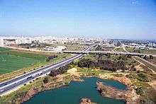
Highway 2 (Hebrew: כביש 2, Kvish 2) is an Israeli highway located on the coastal plain of the Mediterranean Sea. It begins a major arterial road within Tel Aviv, becoming a freeway as it exits the city northward continuing to Haifa. North of Tel Aviv, the highway is also called The Coastal Highway (Hebrew: כביש החוף, Kvish HaHof) or The New Haifa - Tel Aviv Highway (Hebrew: כביש חיפה - תל אביב החדש, Kvish Heifa - Tel Aviv HaHadash).
Highway 2 is one of the busiest highways in the country, and drivers experience frequent traffic congestion between Hadera and Tel Aviv during rush hours. The northern sections are also congested at times, especially during weekends and holidays, when many Israelis travel north for vacation.
History
The first section of the highway between Tel Aviv and Netanya was built in the early 1950s as a two lane road with at-grade intersections. The next section was built later that decade, extending the highway north to Olga Junction in Hadera. This section was also built as a two lane road. In 1965 the highway was widened to four lanes between Tel Aviv and Hadera, however grade separations were not built at this point.
The last section of the highway, between Olga Junction and Haifa, opened in 1969. When this section opened it was the first freeway in Israel. Deteriorating road conditions caused by years of neglect led to this section being downgraded from its original freeway status. Road signs on this section are still blue (as opposed to green on regular highways), however there are a few sings indicating an entrance or exit from a freeway and the maximum speed limit is 90–110 km/h, which makes it an Israeli freeway.
The junctions on the older sections of the highway were gradually grade separated: Netanya Interchange was built in 1974, Poleg Interchange in 1975, Havazelet Interchange in 1989, Yanai Interchange in 1990, Olga Interchange in 1993, Hof HaSharon Interchange in 1994 and Rabin Interchange and HaSira Interchange in 1995. Today the highway is grade separated along its entire route between the Haifa South and West Glilot interchanges.
The Tel Aviv - Netanya section was widened to six lanes in the 1990s.
The West Glilot Interchange opened on February 28, 2007, providing a direct connection to eastbound Highway 5 and the Ayalon Highway.
Coastal roadway corridor
The Carmel Tunnels form a northern extension of Highway 2 which connects directly to Highway 22 in the Krayot area north of Haifa. This northern extension along with the Ayalon Highway and parts of Highway 4 make up a series of controlled-access highways that together form an inter-city highway corridor stretching along most of Israel's Mediterranean coast, from Acre (Akko) in the north to Ashdod in the south. In the future a parallel, but more inland controlled-access corridor will also be provided by Highway 6 when it is fully built.
Plans
There are plans to continue the six lane section north to the Zikhron Ya'akov Interchange. These plans also include upgrading the remaining section between Zikhron Ya'akov and Haifa back to freeway standards.
Interchanges
| Location | km | Name | Type | Meaning | Road(s) crossed |
|---|---|---|---|---|---|
| Ramat Aviv Ramat HaSharon |
0 | מחלף גלילות מערב (Glilot Ma'arav Interchange) |
|
Named after location of former Jewish refugee camp West Glilot |
Namir Road |
| Herzliya | 3 | מחלף הסירה (HaSira Interchange) |
|
The Boat | |
| 5 | מחלף רבין (Rabin Interchange) |
|
Named after Yitzhak Rabin |
Keren Hayesod St. | |
| Under Construction (Completion: 2016)[1] | |||||
| Ga'ash | 6.6 | |
| ||
| Rishpon | 7.5 | צומת רשפון (Rishpon Junction) northbound only |
|
HaKfar St. | |
| Shefayim | 10 | מחלף חוף השרון (Hof HaSharon Interchange) |
|
Sharon Beach | local roads |
| Yakum | 11.2 | מחלף יקום (Yakum Interchange) northbound only |
|
He shall rise | local road |
| Wingate Institute | 11.2 | מחלף וינגייט (Wingate Interchange) southbound only |
|
entrance road | |
| Udim | 11.2 | מחלף אודים (Udim Interchange) northbound only |
|
Firebrands | HaTse'elon St. |
| Netanya | 17 | מחלף פולג (Poleg Interchange) |
|
Named after nearby Poleg Stream |
|
| 19 | מחלף גשר השלום (Gesher HaShalom Interchange) |
|
Peace Bridge | | |
| 23 | מחלף נתניה (Netanya Interchange) |
|
gift of God | | |
| Havatzelet HaSharon | 27 | מחלף חבצלת (Havatzelet Interchange) |
|
Sand Lily | |
| Beit Yanai | 30 | מחלף ינאי (Yanai Interchange) |
|
Rabbi Yannai | |
| Hadera | 33 | |
| ||
| 38 | מחלף אולגה (Olga Interchange) |
|
Named after location ult. Olga Hankin |
Aaron Aaronsohn St. | |
| Caesarea | 41 | מחלף קיסריה (Caesarea Interchange) |
|
Named after location | |
| Or Akiva | 46 | מחלף אור עקיבא (Or Akiva Interchange) |
|
Light of Akiva | Road 6511 |
| Zikhron Ya'akov | 53 | מחלף זכרון יעקב (Zikhron Ya'akov Interchange) |
|
Jacob's Memorial | |
| Atlit | 68 | מחלף עתלית (Atlit Interchange) |
|
Named after location | |
| Haifa | 77 | מחלף חיפה דרום (Haifa Darom Interchange) |
|
Haifa South | |
References
- ↑ "Construction of new route 531". Israel Ministry of Transport, National Infrastructure & Road Safety. Retrieved 2013-01-29.(Hebrew)
| Roads |
| ||||||
|---|---|---|---|---|---|---|---|
| Bus operators | |||||||
| Rail transport |
| ||||||
| Sea ports | |||||||
| Aviation |
| ||||||
| Cable cars | |||||||
| By city | |||||||
| Smart cards | |||||||