High River
| High River | ||
|---|---|---|
| Town | ||
| Town of High River | ||
| ||
 High River Location of High River in Alberta | ||
| Coordinates: 50°34′50.7″N 113°52′28.0″W / 50.580750°N 113.874444°WCoordinates: 50°34′50.7″N 113°52′28.0″W / 50.580750°N 113.874444°W | ||
| Country |
| |
| Province |
| |
| Region | Calgary Region | |
| Census division | 6 | |
| Municipal district | M.D. of Foothills No. 31 | |
| Incorporated[1] | ||
| • Village | December 6, 1901 | |
| • Town | February 12, 1906 | |
| Government[2] | ||
| • Mayor | Craig Snodgrass | |
| • Governing body[3] |
High River Town Council
| |
| • CAO | Tom Maier (interim) | |
| • MLA | Wayne Anderson | |
| Area (2011)[4] | ||
| • Total | 14.27 km2 (5.51 sq mi) | |
| Elevation[5] | 1,040 m (3,410 ft) | |
| Population (2011)[4] | ||
| • Total | 12,920 | |
| • Density | 905.5/km2 (2,345/sq mi) | |
| Time zone | MST (UTC−7) | |
| • Summer (DST) | MDT (UTC−6) | |
| Postal code span | T1V | |
| Area code(s) | -1+403, -1+587 | |
| Highways |
Highway 2 Highway 23 | |
| Waterway | Highwood River | |
| Website | Official website | |
High River is a town within the Calgary Region of Alberta, Canada with a population of 12,920 (2011).[4] It is 67.7 kilometres (42.1 mi) south of the City of Calgary, at the junction of Alberta Highways 2 and 23. High River is located approximately 54 km (34 mi) south of downtown Calgary.
History
The community takes its name from the Highwood River, which flows through the town.[6] The area was originally inhabited largely by the Blackfoot First Nation, who called the site Ispitzee (or the “place of high trees along running water”). By 1870, after the arrival of the North-West Mounted Police and after Treaty Number 7 had been signed in 1877, settlers began arriving into the region.[7][8] High River's development centered on a convenient location for people, horses and cattle to cross the Highwood River - a location known as "The Crossing".[9]
Development of the town was supported by the completion of the Calgary and Edmonton Railway in 1892.[7][9] High River incorporated as a village on December 5, 1901, and was incorporated as a town on February 12, 1906.[1]
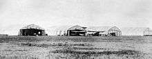
Although growth slowed during the First World War, it continued after the war with the building of brick structures and a number of industries. One of Canada's first air force stations was constructed to the east of the town in 1921[10][11] The establishment of a British Commonwealth Air Training Plan elementary flying training school at the same air station helped boost High River's economy during the Second World War.[7][8]
High River continued to grow throughout the 1950s and 1960s. In the 1970s the downtown saw some major redevelopment, and redevelopment is continuing.
Floods
The Highwood River is subject to frequent flooding. Flood events of exceptional magnitude occurred in 1894, 1899, 1902, 1908, 1912, 1923, 1929, 1932, 1942, 1995, 2005 and 2013.[12] Most recently during the 2013 Alberta floods, thousands of people in Alberta were ordered to evacuate their homes after the rise of the Highwood River, Bow River, Elbow River and numerous others.[13][14] In 2013, three people died as a result of the flooding of the Highwood River.[15]
Geography
Climate
High River experiences a humid continental climate (Köppen climate classification Dfb).
| Climate data for High River | |||||||||||||
|---|---|---|---|---|---|---|---|---|---|---|---|---|---|
| Month | Jan | Feb | Mar | Apr | May | Jun | Jul | Aug | Sep | Oct | Nov | Dec | Year |
| Record high °C (°F) | 20.6 (69.1) |
23.0 (73.4) |
22.2 (72) |
30.0 (86) |
33.3 (91.9) |
35.0 (95) |
37.2 (99) |
35.6 (96.1) |
33.9 (93) |
31.7 (89.1) |
24.4 (75.9) |
20.0 (68) |
37.2 (99) |
| Average high °C (°F) | −0.1 (31.8) |
1.6 (34.9) |
4.8 (40.6) |
10.9 (51.6) |
15.8 (60.4) |
16.3 (61.3) |
23.0 (73.4) |
23.1 (73.6) |
17.7 (63.9) |
11.9 (53.4) |
4.4 (39.9) |
0 (32) |
11.0 (51.8) |
| Daily mean °C (°F) | −6.5 (20.3) |
−4.9 (23.2) |
−1.7 (28.9) |
4.1 (39.4) |
8.8 (47.8) |
12.5 (54.5) |
15.3 (59.5) |
15.0 (59) |
10.2 (50.4) |
5.1 (41.2) |
−1.6 (29.1) |
−6.2 (20.8) |
4.2 (39.6) |
| Average low °C (°F) | −12.9 (8.8) |
−11.3 (11.7) |
−8.1 (17.4) |
−2.8 (27) |
1.7 (35.1) |
5.7 (42.3) |
7.6 (45.7) |
7.0 (44.6) |
2.7 (36.9) |
−1.7 (28.9) |
−7.6 (18.3) |
−12.3 (9.9) |
−2.7 (27.1) |
| Record low °C (°F) | −45 (−49) |
−43.3 (−45.9) |
−40.6 (−41.1) |
−30 (−22) |
−19.4 (−2.9) |
−4.4 (24.1) |
−3.9 (25) |
−16.7 (1.9) |
−16.1 (3) |
−29.4 (−20.9) |
−37 (−35) |
−45 (−49) |
−45 (−49) |
| Average precipitation mm (inches) | 20.4 (0.803) |
19.2 (0.756) |
33.0 (1.299) |
38.7 (1.524) |
72.8 (2.866) |
111.0 (4.37) |
60.2 (2.37) |
59.6 (2.346) |
55.0 (2.165) |
24.8 (0.976) |
26.5 (1.043) |
27.1 (1.067) |
538.6 (21.205) |
| Average rainfall mm (inches) | 0.2 (0.008) |
0.0 (0) |
2.1 (0.083) |
12.1 (0.476) |
58.1 (2.287) |
110.9 (4.366) |
60.2 (2.37) |
59.6 (2.346) |
49.7 (1.957) |
9.5 (0.374) |
1.2 (0.047) |
0.1 (0.004) |
363.7 (14.319) |
| Average snowfall cm (inches) | 20.0 (7.87) |
19.0 (7.48) |
31.0 (12.2) |
27.0 (10.63) |
15.0 (5.91) |
0.0 (0) |
0.0 (0) |
0.0 (0) |
5.0 (1.97) |
15.0 (5.91) |
25.0 (9.84) |
17.0 (6.69) |
175.0 (68.9) |
| Source: Environment Canada[16] | |||||||||||||
Demographics
| Federal census population history | ||
|---|---|---|
| Year | Pop. | ±% |
| 1901 | 153 | — |
| 1906 | 1,018 | +565.4% |
| 1911 | 1,182 | +16.1% |
| 1916 | 1,182 | +0.0% |
| 1921 | 1,198 | +1.4% |
| 1926 | 1,377 | +14.9% |
| 1931 | 1,459 | +6.0% |
| 1936 | 1,359 | −6.9% |
| 1941 | 1,430 | +5.2% |
| 1946 | 1,674 | +17.1% |
| 1951 | 1,888 | +12.8% |
| 1956 | 2,102 | +11.3% |
| 1961 | 2,276 | +8.3% |
| 1966 | 2,239 | −1.6% |
| 1971 | 2,676 | +19.5% |
| 1976 | 3,598 | +34.5% |
| 1981 | 4,792 | +33.2% |
| 1986 | 5,096 | +6.3% |
| 1991 | 6,269 | +23.0% |
| 1996 | 7,359 | +17.4% |
| 2001 | 9,345 | +27.0% |
| 2006 | 10,716 | +14.7% |
| 2011 | 12,920 | +20.6% |
| Source: Statistics Canada [17][18][19][20][21][22][23][24][25][26][27] [4][28][29][30][31][32][33][34][35][36][37] | ||
In the 2011 Census, the Town of High River had a population of 12,920 living in 5,261 of its 5,473 total dwellings, a 20.6% change from its 2006 population of 10,716. With a land area of 14.27 km2 (5.51 sq mi), it had a population density of 905.4/km2 (2,345.0/sq mi) in 2011.[4] Following its 2012 annexation, Statistics Canada adjusted High River's 2011 population by an additional 10 people to 12,930.[38] At its current population, High River is one of the largest towns in the province and is eligible for city status. According to Alberta's Municipal Government Act, a town is eligible for city status when it reaches 10,000 residents.[39]
The population of the Town of High River according to its 2010 municipal census is 11,783,[40][41] a 3.9% increase over its 2009 municipal census population of 11,346.[42]
In 2006, High River had a population of 10,716 living in 4,363 dwellings, a 14.2% increase from 2001. The town has a land area of 14.27 km2 (5.51 sq mi) and a population density of 751.0/km2 (1,945/sq mi).[43]
Arts and culture
As part of High River's tourism and heritage endeavours, a number of murals illustrating High River's history were painted around town.[44]
Attractions
The Museum of the Highwood (c. 1911-2), which sustained smoke, water and fire damage following a fire in the building's attic in July 2010, is on the Canadian Register of Historic Places.[45]
Education
High River is part of the Foothills School Division No. 38, as well as the Christ The Redeemer Catholic Schools Division.
Foothills School Division:
- École Joe Clark School - Grades K-5
- Spitzee Elementary School - Grades K-5
- École Senator Riley Middle School - Grades 6-8
- École Secondaire Highwood High School - Grades 9-12
Christ The Redeemer Catholic Schools:
- Holy Spirit Academy - Grades K-6
- Notre Dame Collegiate - Grades 7-12
Media
- CHRB AM 1140, community radio
- CFXO-FM 99.7, country music
- CKUV-FM 100.9, classic hits
- High River Times
Notable people
- George Canyon, country music singer
- Joe Clark, former Canadian Prime Minister
- John "Pie" McKenzie, former professional hockey player
- W. O. Mitchell, author
- Glen Sather, former hockey player/head coach
Film and television
High River was used as a set for Smallville in Superman III, as well as High River, Montana in Nickelodeon's series Caitlin's Way. Recently, Heartland, a CBC television series has found High River its main filming spot. Also, the movie Carolina Moon based on the book by Nora Roberts was filmed in High River and the movie Moondance Alexander was also filmed in High River.
Parts of the television series Fargo (based on the movie of the same name) were filmed in High River.[46]
See also
- List of communities in Alberta
- List of towns in Alberta
- High River Airport
- RCAF Station High River
- Frank Lake
References
- 1 2 "Location and History Profile: Town of High River" (PDF). Alberta Municipal Affairs. June 17, 2016. p. 323. Retrieved June 19, 2016.
- ↑ "Municipal Officials Search". Alberta Municipal Affairs. November 18, 2016. Retrieved November 21, 2016.
- ↑ Mayor & Council - The Town of High River
- 1 2 3 4 5 "Population and dwelling counts, for Canada, provinces and territories, and census subdivisions (municipalities), 2011 and 2006 censuses (Alberta)". Statistics Canada. 2012-02-08. Retrieved 2012-02-08.
- ↑ "Alberta Private Sewage Systems 2009 Standard of Practice Handbook: Appendix A.3 Alberta Design Data (A.3.A. Alberta Climate Design Data by Town)" (PDF) (PDF). Safety Codes Council. January 2012. pp. 212–215 (PDF pages 226–229). Retrieved October 8, 2013.
- ↑ Karamitsanis, Aphrodite, Ed. Place names of Alberta. Volume II. Southern Alberta. pg. 58. Alberta Culture and Multiculturalism and Friends of Geographical Names of Alberta Society and University of Calgary Press. 1992. ISBN 0-919813-95-X. Retrieved 2015-01-19
- 1 2 3 High River Downtown ARP Final Draft, O2 Planning + Design, page 25, Nov. 2014. Retrieved 2015-01-19
- 1 2 Knupp, Lillian. Life and Legends: A History of the Town of High River. Calgary: Sandstone Publishing Ltd., 1982.
- 1 2 Alberta Culture and Town of High River. A Walking Tour of High River. Edmonton: Alberta Culture. Retrieved 2015-01-19
- ↑ BCATP Station High River and No. 5 Elementary Flying Training School. Bomber Command Air Museum. Retrieved: 2015-01-13.
- ↑ Roberts, Leslie. There Shall Be Wings. Toronto: Clark, Irwin and Co. Ltd., 1959. No ISBN. pg 40.
- ↑ "Little Bow Project/ Highwood Diversion Plan. Application to Construct a Water Management Project to Convey and Store Water Diverted from the Highwood River" Report of the NRCB/CEAA Joint Review Panel. Application #9601 - Alberta Public Works, Supply and Services. May 1998.
- ↑ Calgary neighbourhoods underwater as Bow River's rise continue
- ↑ Alberta floods prompt widespread downtown Calgary evacuations
- ↑ "RCMP confirm three dead in Alberta floods that forced 100,000 to evacuate". National Post. June 22, 2013. Retrieved June 26, 2013.
- ↑ "High River". Canadian Climate Normals 1981–2010 (in English and French). Environment Canada. Retrieved August 22, 2014.
- ↑ "Table IX: Population of cities, towns and incorporated villages in 1906 and 1901 as classed in 1906". Census of the Northwest Provinces, 1906. Sessional Paper No. 17a. Ottawa: Government of Canada. 1907. p. 100.
- ↑ "Table I: Area and Population of Canada by Provinces, Districts and Subdistricts in 1911 and Population in 1901". Census of Canada, 1911. Volume I. Ottawa: Government of Canada. 1912. pp. 2–39.
- ↑ "Table I: Population of Manitoba, Saskatchewan, and Alberta by Districts, Townships, Cities, Towns, and Incorporated Villages in 1916, 1911, 1906, and 1901". Census of Prairie Provinces, 1916. Population and Agriculture. Ottawa: Government of Canada. 1918. pp. 77–140.
- ↑ "Table 8: Population by districts and sub-districts according to the Redistribution Act of 1914 and the amending act of 1915, compared for the census years 1921, 1911 and 1901". Census of Canada, 1921. Ottawa: Government of Canada. 1922. pp. 169–215.
- ↑ "Table 7: Population of cities, towns and villages for the province of Alberta in census years 1901–26, as classed in 1926". Census of Prairie Provinces, 1926. Census of Alberta, 1926. Ottawa: Government of Canada. 1927. pp. 565–567.
- ↑ "Table 12: Population of Canada by provinces, counties or census divisions and subdivisions, 1871–1931". Census of Canada, 1931. Ottawa: Government of Canada. 1932. pp. 98–102.
- ↑ "Table 4: Population in incorporated cities, towns and villages, 1901–1936". Census of the Prairie Provinces, 1936. Volume I: Population and Agriculture. Ottawa: Dominion Bureau of Statistics. 1938. pp. 833–836.
- ↑ "Table 10: Population by census subdivisions, 1871–1941". Eighth Census of Canada, 1941. Volume II: Population by Local Subdivisions. Ottawa: Dominion Bureau of Statistics. 1944. pp. 134–141.
- ↑ "Table 6: Population by census subdivisions, 1926–1946". Census of the Prairie Provinces, 1946. Volume I: Population. Ottawa: Dominion Bureau of Statistics. 1949. pp. 401–414.
- ↑ "Table 6: Population by census subdivisions, 1871–1951". Ninth Census of Canada, 1951. Volume I: Population, General Characteristics. Ottawa: Dominion Bureau of Statistics. 1953. p. 6.73–6.83.
- ↑ "Table 6: Population by sex, for census subdivisions, 1956 and 1951". Census of Canada, 1956. Population, Counties and Subdivisions. Ottawa: Dominion Bureau of Statistics. 1957. p. 6.50–6.53.
- ↑ "Table 6: Population by census subdivisions, 1901–1961". 1961 Census of Canada. Series 1.1: Historical, 1901–1961. Volume I: Population. Ottawa: Dominion Bureau of Statistics. 1963. p. 6.77–6.83.
- ↑ "Population by specified age groups and sex, for census subdivisions, 1966". Census of Canada, 1966. Population, Specified Age Groups and Sex for Counties and Census Subdivisions, 1966. Ottawa: Dominion Bureau of Statistics. 1968. p. 6.50–6.53.
- ↑ "Table 2: Population of Census Subdivisions, 1921–1971". 1971 Census of Canada. Volume I: Population, Census Subdivisions (Historical). Ottawa: Statistics Canada. 1973. p. 2.102–2.111.
- ↑ "Table 3: Population for census divisions and subdivisions, 1971 and 1976". 1976 Census of Canada. Census Divisions and Subdivisions, Western Provinces and the Territories. Volume I: Population, Geographic Distributions. Ottawa: Statistics Canada. 1977. p. 3.40–3.43.
- ↑ "Table 4: Population and Total Occupied Dwellings, for Census Divisions and Subdivisions, 1976 and 1981". 1981 Census of Canada. Volume II: Provincial series, Population, Geographic distributions (Alberta). Ottawa: Statistics Canada. 1982. p. 4.1–4.10. ISBN 0-660-51095-2.
- ↑ "Table 2: Census Divisions and Subdivisions – Population and Occupied Private Dwellings, 1981 and 1986". Census Canada 1986. Population and Dwelling Counts – Provinces and Territories (Alberta). Ottawa: Statistics Canada. 1987. p. 2.1–2.10. ISBN 0-660-53463-0.
- ↑ "Table 2: Population and Dwelling Counts, for Census Divisions and Census Subdivisions, 1986 and 1991 – 100% Data". 91 Census. Population and Dwelling Counts – Census Divisions and Census Subdivisions. Ottawa: Statistics Canada. 1992. pp. 100–108. ISBN 0-660-57115-3.
- ↑ "Table 10: Population and Dwelling Counts, for Census Divisions, Census Subdivisions (Municipalities) and Designated Places, 1991 and 1996 Censuses – 100% Data". 96 Census. A National Overview – Population and Dwelling Counts. Ottawa: Statistics Canada. 1997. pp. 136–146. ISBN 0-660-59283-5.
- ↑ "Population and Dwelling Counts, for Canada, Provinces and Territories, and Census Divisions, 2001 and 1996 Censuses – 100% Data (Alberta)". Statistics Canada. Retrieved 2012-04-02.
- ↑ "Population and dwelling counts, for Canada, provinces and territories, and census subdivisions (municipalities), 2006 and 2001 censuses – 100% data (Alberta)". Statistics Canada. 2010-01-06. Retrieved 2012-04-02.
- ↑ "Interim List of Changes to Municipal Boundaries, Status, and Names From January 2, 2011 to January 1, 2012 (Table 1 – Changes to census subdivisions in alphabetical order by province and territory)" (XLSX). Statistics Canada. November 14, 2012. Retrieved December 3, 2012.
- ↑ "Municipal Government Act". Alberta Queen's Printer. Retrieved 2012-09-05.
- ↑ "High River Census Results 2010" (PDF). Town of High River. Retrieved 2011-01-18.
- ↑ "2010 Official Population List" (PDF). Alberta Municipal Affairs. 2010-09-15. Retrieved 2011-01-19.
- ↑ "2009 Official Population List" (PDF). Alberta Municipal Affairs. 2009-09-15. Retrieved 2010-09-14.
- ↑ Statistics Canada. "Canada 2006 Census: High River – Community Profile". Retrieved 2007-06-12.
- ↑ The Town of High River Historic Murals. Retrieved 2015-01-20
- ↑ Map at the Canadian Register of Historic Places. historicplaces.ca
- ↑ Rushworth, Kevin (11 February 2014). "Fargo continues High River film shoot". High River Times. Retrieved 2 March 2014.
External links
| Wikimedia Commons has media related to High River, Alberta. |
 |
Black Diamond | Okotoks | Arrowwood | |
| Longview | |
Milo | ||
| ||||
| | ||||
| Pekisko | Nanton | Vulcan |