Hersey River
| Hersey River | |
|---|---|
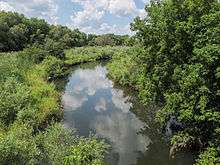 The Hersey River in Reed City | |
| Country | United States |
| Basin | |
| Main source | Lincoln Township, Osceola County, Michigan |
| River mouth |
Muskegon River at Hersey 995 feet (303 m)[1] |
| Features | |
| Tributaries |
|
The Hersey River is a 13.4-mile-long (21.6 km)[2] stream in the Lower Peninsula of the U.S. state of Michigan. It rises in Lincoln Township in northwest Osceola County at the junction of Hersey Creek[3] and the East Branch Hersey Creek[4] at 43°50′55″N 85°25′59″W / 43.84861°N 85.43306°W. For approximately the first two miles, the river flows southward just east of U.S. Route 131. US 131 crosses the river near the northern boundary of Richmond Township. The river continues southward into Lake No Sho Mo,[5] formed by a dam just south of Nartron Field airport. The river continues southward under U.S. Route 10 into Reed City and turns to the east, continuing southeastward into the village of Hersey, where it empties into the Muskegon River at Blodgett's Landing Campground.
Named tributaries
From the mouth:
- (left) Johnson Creek[6]
- (left) Jewitt Creek[9]
- (right) Lawrence Creek[10]
- (right) Lincoln Creek[11]
- (right) East Branch Hersey Creek[4]
- (left) Hersey Creek[3]
Drainage basin
The drainage basin includes all or portions of the following townships and municipalities:
See also
References
- ↑ U.S. Geological Survey Geographic Names Information System: Hersey River
- ↑ U.S. Geological Survey. National Hydrography Dataset high-resolution flowline data. The National Map, accessed November 21, 2011
- 1 2 U.S. Geological Survey Geographic Names Information System: Hersey Creek
- 1 2 U.S. Geological Survey Geographic Names Information System: East Branch Hersey Creek
- ↑ U.S. Geological Survey Geographic Names Information System: Lake No Sho Mo
- ↑ U.S. Geological Survey Geographic Names Information System: Johnson Creek
- ↑ U.S. Geological Survey Geographic Names Information System: Hewitt Creek
- ↑ U.S. Geological Survey Geographic Names Information System: Knuth Creek
- ↑ U.S. Geological Survey Geographic Names Information System: Jewitt Creek
- ↑ U.S. Geological Survey Geographic Names Information System: Lawrence Creek
- ↑ U.S. Geological Survey Geographic Names Information System: Lincoln Creek
- ↑ U.S. Geological Survey Geographic Names Information System: Lincoln Lake
- ↑ U.S. Geological Survey Geographic Names Information System: Todd Lake
- ↑ U.S. Geological Survey Geographic Names Information System: Indian Creek
- ↑ U.S. Geological Survey Geographic Names Information System: Johnson Creek
- ↑ U.S. Geological Survey Geographic Names Information System: Beaver Dam Lake
- ↑ U.S. Geological Survey Geographic Names Information System: Olson Creek
- ↑ U.S. Geological Survey Geographic Names Information System: Sherwood Lake
- ↑ U.S. Geological Survey Geographic Names Information System: Sprague Lake
- ↑ U.S. Geological Survey Geographic Names Information System: Twin Creek
- ↑ U.S. Geological Survey Geographic Names Information System: Twin Lake
- ↑ U.S. Geological Survey Geographic Names Information System: Burt Creek
- ↑ U.S. Geological Survey Geographic Names Information System: Kissinger Creek