Herriman, Utah
| Herriman, Utah | |
|---|---|
| City | |
 Location in Salt Lake County and the state of Utah. | |
| Coordinates: 40°30′24″N 112°1′51″W / 40.50667°N 112.03083°WCoordinates: 40°30′24″N 112°1′51″W / 40.50667°N 112.03083°W | |
| Country | United States |
| State | Utah |
| County | Salt Lake |
| Settled | 1849 |
| Incorporated | 1999 |
| Became a city | April 19, 2001 |
| Founded by | Thomas Butterfield |
| Named for | Henry Harriman |
| Government | |
| • Mayor | Carmen Freeman[1] |
| Area | |
| • Total | 20.3 sq mi (52.5 km2) |
| • Land | 20.3 sq mi (52.5 km2) |
| • Water | 0.0 sq mi (0.0 km2) |
| Elevation | 5,000 ft (1,524 m) |
| Population (2012) | |
| • Total | 24,433 |
| • Density | 1,200/sq mi (470/km2) |
| Time zone | Mountain (UTC-7) |
| • Summer (DST) | Mountain (UTC-6) |
| ZIP code | 84096 |
| Area code(s) | 385, 801 |
| FIPS code | 49-34970[2] |
| GNIS feature ID | 1428675[3] |
| Website | http://www.herriman.org |
Herriman is a city in southwestern Salt Lake County, Utah, United States. The population was 21,785 as of the 2010 census. Although Herriman was a town in 2000,[2] it has since been classified as a fifth-class city by state law.[4] The city has experienced rapid growth since incorporation in 1999, as its population was just 1,523 at the 2000 census.[5] It grew from being the 111th-largest incorporated place in Utah in 2000 to the 32nd-largest in 2010.
History
Founders
Herriman was established in 1849 by Robert Dansie, Henry Harriman, and Thomas Jefferson Butterfield. A monument located in the Herriman City Cemetery lists the original four families of Herriman as the Thomas Jefferson Butterfield, John Jay Stocking, Robert Cowan Petty, and Henry Harriman families.[6]
Land developers
Rosecrest is a land developer who acquired some rights in a large area around Herriman, and started large scale residential development.[7] Rosecrest is owned by parent company Sorenson Companies[8] founded by the late James LeVoy Sorenson and currently managed by his son. In 2007, Rosecrest won a lawsuit with partner land owners/developers that likely will allow about 4,000 acres (16 km2) to be annexed out of neighbor city Bluffdale into Herriman to further expand the Rosecrest/Herriman housing projects.[9] The lawsuit stemmed from a struggle between Bluffdale city officials, strict city building requirements, and Rosecrest.[9]
Camp Williams Fire 2010
On September 19, 2010, the National Guard was performing an exercise at Camp Williams, south of Herriman, when a round likely struck a rock, setting off a 3,500 acres (14 km2) wildfire.[10] Unified Fire Authority members mobilized and were able to arrest the progress of the fire, but not before 3 homes were destroyed and another damaged. Various small structures were also affected. Over 1,200 homes were evacuated in the face of the oncoming danger, with most of them able to return by Tuesday, September 21, 2010.
Geography
According to the United States Census Bureau, the city has a total area of 20.3 square miles (52.5 km²), all of it land.
Herriman shares borders with Riverton to the east, South Jordan to the north, and Bluffdale to the southeast.
Demographics
| Historical population | |||
|---|---|---|---|
| Census | Pop. | %± | |
| 2000 | 1,523 | — | |
| 2010 | 21,785 | 1,330.4% | |
| Est. 2015 | 30,835 | [11] | 41.5% |
As of the census[2] of 2010, there were 21,785 people, 5,542 households, and 5,022 families residing in the town. The population density was 1075.0 people per square mile (64.5/km²). There were 6,022 housing units at an average density of 297.2 per square mile (19.4/km²). The racial makeup of the town was 93.3% White, .3% Native American, 1.3% Asian, 0.5% Pacific Islander, .3% from other races, and 2.3% from two or more races. Hispanic or Latino of any race were 6.2% of the population.
There were 5,542 households out of which 44.1% had children under the age of 18 living with them, 81.3% were married couples living together, 6.1% had a female householder with no husband present, and 9.4% were non-families. 6.5% of all households were made up of individuals and 1.0% had someone living alone who was 65 years of age or older. The average household size was 3.93 and the average family size was 4.13.
In the town the population was spread out with 44.1% under the age of 18, 6.1% from 18 to 24, 29.0% from 25 to 44, 11.7% from 45 to 64, and 2.6% who were 65 years of age or older. The median age was 24.7 years. For every 100 females there were 102.4 males. For every 100 females age 18 and over, there were 100.7 males.
The median income for a household in the town was $56,361, and the median income for a family was $57,404. Males had a median income of $44,135 versus $30,893 for females. The per capita income for the town was $18,991. About 2.9% of families and 3.9% of the population were below the poverty line, including 5.7% of those under age 18 and none of those age 65 or over.
References
- ↑ http://www.herriman.org/elected-officials/
- 1 2 3 "American FactFinder". United States Census Bureau. Retrieved 2008-01-31.
- ↑ "US Board on Geographic Names". United States Geological Survey. 2007-10-25. Retrieved 2008-01-31.
- ↑ of the Utah Code, last amended in 2003. Accessed 2008-06-14.
- ↑ U.S. Census Bureau - Herriman, UT
- ↑ http://www.herriman.org/userfiles/media/Herriman%20Cemetary%20Origal%20Settlers.pdf
- ↑ Anderton, Dave (2006) "Buyers are finding home sweet home in Rosecrest area" Deseret News 13 January 2006
- ↑ "Sorenson Companies"
- 1 2 Felix, Devin and Smeath, Doug (2007) "Herriman in, Bluffdale out in land fight" Deseret News 21 July 2007
- ↑ Reavy, Pat "Herriman fire: National Guard ‘shot in the face of Red Flag’" Deseret News 21 September 2010
- ↑ "Annual Estimates of the Resident Population for Incorporated Places: April 1, 2010 to July 1, 2015". Retrieved July 2, 2016.
- ↑ "Census of Population and Housing". Census.gov. Retrieved June 4, 2015.
External links
Community events in Herriman
 |
Copperton | South Jordan | | |
| Tooele Stockton |
|
Riverton Bluffdale | ||
| ||||
| | ||||
| Ophir, Cedar Fort | Eagle Mountain | |
Municipalities and communities of Salt Lake County, Utah, United States | ||
|---|---|---|
| Cities | 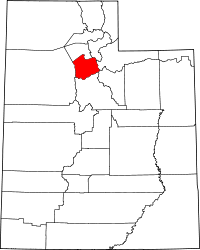 | |
| Town | ||
| Townships | ||
| CDPs | ||
| Unincorporated community | ||
| Ghost towns | ||
| Footnotes | ‡This populated place also has portions in an adjacent county or counties | |