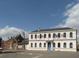
Hergnies
| Hergnies | ||
|---|---|---|
 | ||
| ||
 Hergnies | ||
|
Location within Hauts-de-France region  Hergnies | ||
| Coordinates: 50°28′30″N 3°31′23″E / 50.475°N 3.523°ECoordinates: 50°28′30″N 3°31′23″E / 50.475°N 3.523°E | ||
| Country | France | |
| Region | Hauts-de-France | |
| Department | Nord | |
| Arrondissement | Valenciennes | |
| Canton | Condé-sur-l'Escaut | |
| Intercommunality | Valenciennes Métropole | |
| Government | ||
| • Mayor (2001–2008) | Jacques Schneider | |
| Area1 | 10.75 km2 (4.15 sq mi) | |
| Population (1999)2 | 3,849 | |
| • Density | 360/km2 (930/sq mi) | |
| Time zone | CET (UTC+1) | |
| • Summer (DST) | CEST (UTC+2) | |
| INSEE/Postal code | 59301 / 59199 | |
| Elevation |
14–39 m (46–128 ft) (avg. 20 m or 66 ft) | |
|
1 French Land Register data, which excludes lakes, ponds, glaciers > 1 km² (0.386 sq mi or 247 acres) and river estuaries. 2 Population without double counting: residents of multiple communes (e.g., students and military personnel) only counted once. | ||
Hergnies is a commune in the Nord department of northern France.
Heraldry
_Nord-France.svg.png) |
The arms of Hergniesare blazoned : Gules, 10 lozenges conjoined argent 3,3,3 and 1. (Fressain, Hergnies, Lallaing and Marpent use the same arms.) |
See also
References
| Wikimedia Commons has media related to Hergnies. |
This article is issued from Wikipedia - version of the 11/21/2016. The text is available under the Creative Commons Attribution/Share Alike but additional terms may apply for the media files.