Heiligensee
| Heiligensee | |
|---|---|
| Quarter of Berlin | |
|
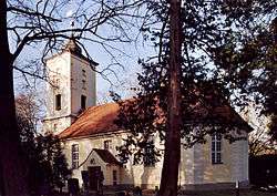
Village church | |
 Heiligensee | |
Location of Heiligensee in Reinickendorf district and Berlin  | |
| Coordinates: 52°37′00″N 13°14′00″E / 52.61667°N 13.23333°ECoordinates: 52°37′00″N 13°14′00″E / 52.61667°N 13.23333°E | |
| Country | Germany |
| State | Berlin |
| City | Berlin |
| Borough | Reinickendorf |
| Founded | 1308 |
| Area | |
| • Total | 10.7 km2 (4.1 sq mi) |
| Population (2008-06-30) | |
| • Total | 17,641 |
| • Density | 1,600/km2 (4,300/sq mi) |
| Time zone | CET/CEST (UTC+1/+2) |
| Postal codes | (nr. 1204) 13503, 13505 |
| Vehicle registration | B |
Heiligensee is a locality within Reinickendorf, a borough of the German capital, Berlin. It has 17,780 inhabitants [1] and an area of 10.7 km2 (4.1 sq mi).
Geography
Overview
Situated at Berlin's north-western border on the shores of the Havel river, Heiligensee shares border with the towns of Hennigsdorf and Hohen Neuendorf in the Oberhavel district of Brandenburg and with the localities Konradshöhe, Tegel and Frohnau. Heiligensee has the westernmost point of Reinickendorf.
Subdivision
Heiligensee counts 1 zone (Ortslage):
- Schulzendorf
History
The village was founded in 1308.[2] Between 1945 and 1990 Heiligensee housed West Berlin's inner German border crossing for inland navigation on the Oder-Havel Canal. The crossing was open for freight vessels navigating between the People's Republic of Poland, or the Soviet Zone of occupation in Germany (till 1949, thereafter the East German Democratic Republic) and West Berlin.
References
- ↑ statistics Berlin.de, Accessed April 27, 2008
- ↑ History of Heiligensee
External links
![]() Media related to Heiligensee at Wikimedia Commons
Media related to Heiligensee at Wikimedia Commons
| |