Hebden Royd
| Hebden Royd | |
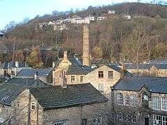 Over the rooftops of Hebden Bridge |
|
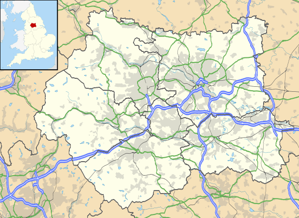 Hebden Royd |
|
| Population | 9,558 (2011 census) |
|---|---|
| OS grid reference | SD993273 |
| – London | 170 mi (270 km) SSE |
| Metropolitan borough | Calderdale |
| Metropolitan county | West Yorkshire |
| Region | Yorkshire and the Humber |
| Country | England |
| Sovereign state | United Kingdom |
| Post town | HEBDEN BRIDGE |
| Postcode district | HX7 |
| Dialling code | 01422 |
| Police | West Yorkshire |
| Fire | West Yorkshire |
| Ambulance | Yorkshire |
| EU Parliament | Yorkshire and the Humber |
| UK Parliament | Calder Valley |
Coordinates: 53°44′31″N 2°00′32″W / 53.742°N 2.009°W
Hebden Royd is a civil parish with a town council in the Metropolitan Borough of Calderdale in West Yorkshire, England. According to the 2001 census it had a population of 9,092,[1] rising to 9,558 at the 2011 census.[2] It includes Hebden Bridge, Mytholmroyd and Cragg Vale. The parish was an urban district before 1974, created in 1937 by the merger of Hebden Bridge and Mytholmroyd urban districts.[3] The area now shares the HX7 postcode area.
Hebden Bridge Town Hall and adjoining fire station is a Grade II listed building, built in 1897. The building was transferred from Calderdale Metropolitan Borough Council to Hebden Bridge Community Association in 2010, along with funds for basic maintenance work. Substantial volunteer time was put into renovation works and fundraising to secure the building’s future.[4] A £4 million project built a small enterprise centre and new community facilities on land adjacent to the Town Hall. More than 450 local people have signed up as "Friends of the Town Hall" and can vote for the trustees.[5]
Hebden Royd lies close to the Pennine Way and Hardcastle Crags and is popular for outdoor pursuits such as walking, climbing and cycling. It lies on the Rochdale Canal – a through route across the Pennines.
The area's location in the valley causes problems with flooding, particularly between Hebden Water and the cinema on New Road, Brearley Fields in Mytholmroyd, and further up the valley at Callis Bridge by the sewage works and the old Aquaspersions factory. Flooding at Callis Bridge is so frequent that the level of the River Calder has been lowered and special perforated kerbstones fitted so that water can drain back into the river. Brearley, on a flood plain, contains the playing fields for Calder High School and local football, rugby league and cricket teams. Hebden Royd suffered two devastating floods in the summer of 2012,[6] and again at Christmas 2015; Todmorden, Mytholmroyd, Sowerby Bridge and York were also affected, with houses, pubs, shops and community centres suffering damage to property. The extent of the Hebden Royd flooding was shown in drone videos of the flooded areas, the most severe flooding occurring in Hebden Bridge town centre.[7] Hebden Royd suffered the worst flooding ever seen in the area on Boxing Day of 2015, the River Calder reached the highest ever recorded levels, flooding buildings never before flooded such as Burnley Road Academy in Mytholmroyd.
The parish is on the route of the Calderdale Way, a circular walk of about 50 miles (80 km) around the hills and valleys of Calderdale.
Transport

Hebden Bridge railway station lies on the Caldervale Line between Manchester Victoria and Leeds City. It is served by frequent Northern services to towns and cities in Lancashire, Greater Manchester, as well as West and North Yorkshire including Leeds, Blackpool North, York, Manchester Victoria and Todmorden. There are also some infrequent services to Dewsbury via Brighouse. The station is still in the original Lancashire and Yorkshire Railway colours, decorated with hanging baskets, original signage and luggage trolleys. Mytholmroyd railway station also serves most of the services into and from Hebden Bridge railway station, with the exception of Blackpool-York services, which only stop at Hebden Bridge. Mytholmroyd also serves disabled passengers from Hebden Royd, with no disabled facilities at Hebden Bridge railway station.
Bus services in the town are primarily operated by First West Yorkshire, and operate to many local towns and villages, most frequently to Halifax (several services at 10-minute intervals), Burnley (592) and Rochdale (590). However, Keighley Bus Company connect Hebden Bridge with Haworth, Oxenhope and Keighley. The "Hebden Bridger" is a local bus operated by West Yorkshire Metro that serves as a town centre service, also operating to local villages including Heptonstall. These services run along the A646 through the rest of Hebden Royd with services direct from Mytholmroyd town centre to Huddersfield, Cragg Vale and Ripponden.
References
- ↑ "Census 2001 : Parish Headcounts : Calderdale". Neighbourhood Statistics. Office for National Statistics. Retrieved 2 September 2009.
- ↑ "Key Figures for 2011 Census: Key Statistics - Area: Hebden Royd (Parish)". Neighbourhood Statistics. Office for National Statistics. Retrieved 6 February 2016.
- ↑ "Hebden Royd Urban District". A Vision of Britain Through Time. Retrieved 2 September 2009.
- ↑ "Hebden Bridge Town Hall". English Heritage. 10 February 2011. Archived from the original on 21 September 2013. Retrieved 19 July 2016.
- ↑ "Community to take over Town Hall". Yorkshire Post. 8 December 2009. Retrieved 15 January 2016.
- ↑ Wainwright, Martin; Quinn, Ben (9 July 2012). "Flash floods hit Hebden Bridge". The Guardian. Retrieved 15 January 2016.
- ↑ "Drone footage of flooding in Hebden Bridge and Mytholmroyd – video". The Guardian. 26 December 2015. Retrieved 15 January 2016.
External links
![]() Media related to Hebden Royd at Wikimedia Commons
Media related to Hebden Royd at Wikimedia Commons