Hazerswoude-Dorp
| Hazerswoude-Dorp | |
|---|---|
| Village | |
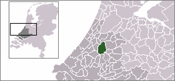 | |
 The town centre (red) and the statistical district (light green) of Hazerswoude-Dorp in the former municipality of Rijnwoude. | |
| Coordinates: 52°5′46″N 4°35′16″E / 52.09611°N 4.58778°ECoordinates: 52°5′46″N 4°35′16″E / 52.09611°N 4.58778°E | |
| Country | Netherlands |
| Province | South Holland |
| Municipality | Alphen aan den Rijn |
| Population (2007) | |
| • Total | 5,767 |
| Time zone | CET (UTC+1) |
| • Summer (DST) | CEST (UTC+2) |
.JPG)
De Rietveldse molen (Windmill of Rietveld) in the rural part of Hazerswoude.
Hazerswoude-Dorp is a town in the west of the Netherlands. It is located in the municipality of Alphen aan den Rijn, South Holland, about 7 km southwest of the town of Alphen aan den Rijn.
In 2001, the town of Hazerswoude-Dorp had 4292 inhabitants. The built-up area of the town was 0.76 km², and contained 1600 residences.[1] The statistical area "Hazerswoude-Dorp", which also can include the peripheral parts of the village, as well as the surrounding countryside, has a population of around 5760.[2]
Famous residents
- Tom Okker, former tennis player and current art dealer
References
- ↑ Statistics Netherlands (CBS), Bevolkingskernen in Nederland 2001 Archived March 19, 2006, at the Wayback Machine.. (Statistics are for the continuous built-up area).
- ↑ Statistics Netherlands (CBS), Statline: Kerncijfers wijken en buurten 2003-2005 Archived 2006-07-24 at WebCite. As of 1 January 2005.
This article is issued from Wikipedia - version of the 11/18/2016. The text is available under the Creative Commons Attribution/Share Alike but additional terms may apply for the media files.