Hayredin
Coordinates: 43°36′N 23°40′E / 43.600°N 23.667°E
| Hayredin Хайредин | |
|---|---|
 Hayredin Location of Hayredin | |
| Coordinates: 43°36′N 23°40′E / 43.600°N 23.667°E | |
| Country |
|
| Province (Oblast) | Vratsa |
| Government | |
| • Mayor | Radoslav Stoykov |
| Elevation | 93 m (305 ft) |
| Population (2008) | |
| • Total | 1,701 |
| Time zone | EET (UTC+2) |
| • Summer (DST) | EEST (UTC+3) |
| Postal Code | 3357 |
| Area code(s) | 09166 |
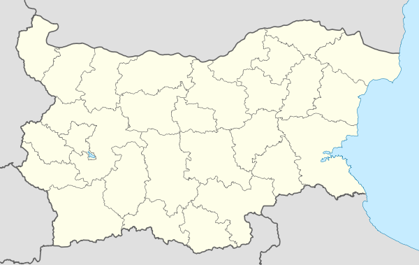
Hayredin (Bulgarian: Хайредин, pronounced [hajrɛˈdin]; also transliterated Hajredin or Hairedin) is a village in northwestern Bulgaria, part of Vratsa Province. It is the administrative centre of Hayredin Municipality, which lies in the northwestern part of Vratsa Province. The village is located along the Ogosta River, 30 kilometres south of Kozloduy, 25 kilometres south of the Danube River, 52 kilometres from the provincial capital Vratsa and 186 kilometres from Sofia.
Hayredin was founded in 1574 by four families who settled on land presented to them by a high-ranking Ottoman official. It may have existed before the Ottoman conquest of the Second Bulgarian Empire, as it was mentioned among the places burnt down by the invaders; the old name of the village was Eredin. The local Bulgarian Orthodox church of Saint Paraskeva was built in 1858-1862, and the Prosveta community centre (chitalishte) was founded in 1909. The village has a mineral spring.
Gallery
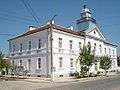 The Neoclassical Hayredin municipal hall
 Inside the church in Hayredin
 The Ogosta River
 Mayor's office in Botevo
External links
- Hayredin at Selo.bg (Bulgarian)
Capital: Hayredin | ||
| Villages |
| |
| Landmarks | ||
| Culture | ||
| Notable people | ||