Hatzic
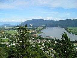
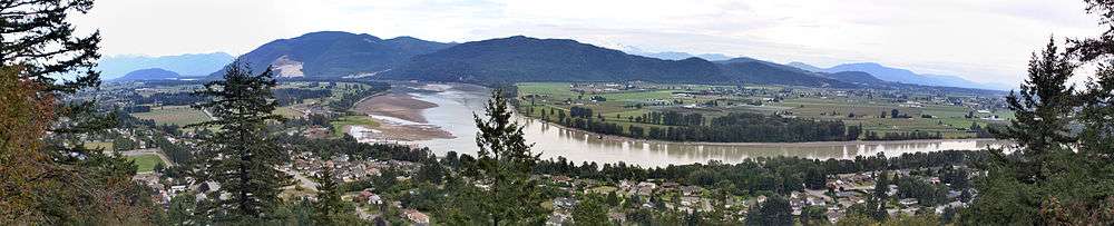
Hatzic is a historic community in the Central Fraser Valley region of the Lower Mainland of British Columbia, Canada, located on the east side of the District of Mission and including areas beyond the municipal boundary to the east and northeast.
Hatzic is the location of two very important historical sites in British Columbia, the mission school of the Oblate Fathers (OMI), St. Mary's Indian Residential School, the name sake of the District of Mission, and Xá:ytem, an archaeological site and museum dating to 9,000 years B.P. Also notable is Ferncliff Gardens, a private floral operation now becoming a heritage site. Hatzic Slough, which is part of the drainage for the oxbow Hatzic Lake, is the site of one of the world's largest dry-sorting yards for raw timber. A former railway station named Hatzic was located between the outlet of Hatzic Lake and the foot of the rise to the benchland where most of residential Hatzic is today.[1]
Mission's Fraser River Heritage Park is to the west and incorporates lands formerly belonging to the Oblate mission, including the foundations of the original school, though it is accessed from Mission proper, not via Hatzic.
Hatzic is one of Mission's older suburban neighbourhoods and is home to Hatzic Secondary School and various elementary schools. Overlooking it from above is Westminster Abbey, a Benedictine monastery established in the 1950s, which is part of the Ferndale neighbourhood of Mission. Across the floodplain from the benchland Hatzic proper overlooks and where Hatzic Valley is located is the community of Dewdney, standing astride the bridge where British Columbia Highway 7 leads onto Nicomen Island. Across the Fraser River from Hatzic is the northeast sector of Matsqui Prairie.
Name origin
"Hatzic" is a Halkomelem word referring to the male anatomy, in reference to a certain root which was gathered in the area, and was the name of a subgroup of the Sto:lo who were wiped out by epidemics in advance of settlement of the Fraser Valley. Because of the sexual innuendo of the term, the archaeological site was renamed Xá:ytem from the original "Hatzic Rock" at the request of native elders.
Related names and local geography
Related names, which more or less are also considered part of Hatzic, are Hatzic Island, which is in the centre of Hatzic Lake, north of which are the farming communities of Hatzic Prairie and Durieu, which together form part of the Hatzic Valley, along with communities to the north of Hatzic Prairie around Allan Lake, McConnell Creek and Miracle Valley. The Hatzic Valley coincides with Electoral District 'F' of the Fraser Valley Regional District and comprises the old course of the Stave River's glacier and its terminal moraine at the north end of the valley, most of which is fertile floodplain. Davis Lake Provincial Park and Cascade Falls Regional Park are at the valley's northeast corner.
"Hatzic Mountain" is a local name commonly used for what is officially Dewdney Peak, which is at the south end of Hatzic Ridge, which forms Hatzic Valley's east flank.
References
Coordinates: 49°09′00″N 122°15′00″W / 49.15000°N 122.25000°W