Hassa, Hatay
| Hassa | |
|---|---|
 Hassa | |
| Coordinates: 36°47′58″N 36°31′04″E / 36.79944°N 36.51778°ECoordinates: 36°47′58″N 36°31′04″E / 36.79944°N 36.51778°E | |
| Country |
|
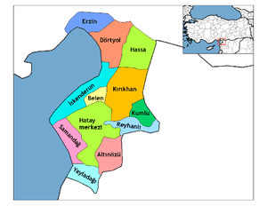
| Province | Hatay |
| Government | |
| • Mayor | Mehmet Karataş (AKP) |
| • Kaymakam | Harun Başıbüyük |
| Area[1] | |
| • District | 514.30 km2 (198.57 sq mi) |
| Elevation | 430 m (1,410 ft) |
| Population (2012)[2] | |
| • Urban | 9,758 |
| • District | 54,104 |
| • District density | 110/km2 (270/sq mi) |
| Post code | 31710 |
| Website |
www |
Hassa is a district of Hatay Province, Turkey on the eastern side of the Nur (Amanos) Mountains, looking towards the city of Gaziantep. It is on the Antakya-Malatya road. In the late 19th and early 20th century, Hassa was part of the Adana Vilayet of the Ottoman Empire. Hassa was a district in Cebel-i Bereket Province from 1923 to 1933 and then a part of Gaziantep Province until 1939.
Hassa is an olive-growing district. The trees were first brought there by Ottoman governor Derviş Paşa in the late 19th century.
Demography
Hassa is a Sunni Turkmen district of Hatay province.
References
- ↑ "Area of regions (including lakes), km²". Regional Statistics Database. Turkish Statistical Institute. 2002. Retrieved 2013-03-05.
- ↑ "Population of province/district centers and towns/villages by districts - 2012". Address Based Population Registration System (ABPRS) Database. Turkish Statistical Institute. Retrieved 2013-02-27.
External links
- Official website (Turkish)
This article is issued from Wikipedia - version of the 11/21/2016. The text is available under the Creative Commons Attribution/Share Alike but additional terms may apply for the media files.