Hartford, Kentucky
| Hartford, Kentucky | |
|---|---|
| City | |
|
Ohio County Courthouse in Hartford | |
 Location of Hartford within Kentucky. | |
| Coordinates: 37°27′1″N 86°54′7″W / 37.45028°N 86.90194°WCoordinates: 37°27′1″N 86°54′7″W / 37.45028°N 86.90194°W | |
| Country | United States |
| State | Kentucky |
| County | Ohio |
| Settled | Fort Hartford, 1790[1] |
| Incorporated | Hartford, 1808 |
| Named for | a deer crossing in the Rough River[2] |
| Government | |
| • Mayor | Dean Minton |
| Area | |
| • Total | 2.6 sq mi (6.7 km2) |
| • Land | 2.6 sq mi (6.7 km2) |
| • Water | 0.0 sq mi (0.0 km2) |
| Elevation | 417 ft (127 m) |
| Population (2000) | |
| • Total | 2,571 |
| Time zone | CST (UTC-6) |
| • Summer (DST) | CDT (UTC-5) |
| ZIP Code | 42347 |
| Area code(s) | 270 & 364 |
| FIPS code | 21-35020 |
| GNIS feature ID | 0493841 |
| Website | http://www.hartfordkentucky.com/ |

Hartford is a home rule-class city[3] in Ohio County, Kentucky, in the United States. It is the seat of its county.[4] The population was 2,571 at the 2000 census.
The former two-year Hartford College existed on East Union Street at the site of the current Ohio County School Board administrative office.
Geography
Hartford is located at 37°27′1″N 86°54′7″W / 37.45028°N 86.90194°W (37.450415, -86.902026).[5]
According to the United States Census Bureau, the city has a total area of 2.6 square miles (6.7 km2), all land.
History
The town was initially part of a 4000-acre grant from Virginia to Gabriel Madison. The area was surveyed in 1782[6] and settled before 1790. Fort Hartford (also known as Hartford Station) grew up around the head of navigation on the Rough River. It initially faced Indian attacks but was named the seat of Ohio County the year after its formation in 1798 in exchange for a grant of land from Mr. Madison. The post office was established as Hartford Court House in 1801[7] and the settlement was formally incorporated by the state assembly in 1808.[2]
The town's second courthouse was burned during the Civil War by Confederate Gen. Hylan B. Lyon on Dec. 20, 1864.[6]
The town was finally connected to the L&N network in 1909.[6]
Demographics
| Historical population | |||
|---|---|---|---|
| Census | Pop. | %± | |
| 1800 | 74 | — | |
| 1810 | 110 | 48.6% | |
| 1830 | 242 | — | |
| 1840 | 309 | 27.7% | |
| 1850 | 495 | 60.2% | |
| 1870 | 511 | — | |
| 1880 | 624 | 22.1% | |
| 1890 | 740 | 18.6% | |
| 1900 | 785 | 6.1% | |
| 1910 | 976 | 24.3% | |
| 1920 | 980 | 0.4% | |
| 1930 | 1,106 | 12.9% | |
| 1940 | 1,385 | 25.2% | |
| 1950 | 1,564 | 12.9% | |
| 1960 | 1,618 | 3.5% | |
| 1970 | 1,868 | 15.5% | |
| 1980 | 2,512 | 34.5% | |
| 1990 | 2,532 | 0.8% | |
| 2000 | 2,571 | 1.5% | |
| 2010 | 2,672 | 3.9% | |
| Est. 2015 | 2,750 | [8] | 2.9% |
As of the census[10] of 2000, there were 2,571 people, 1,079 households, and 684 families residing in the city. The population density was 989.5 people per square mile (381.8/km²). There were 1,165 housing units at an average density of 448.4 per square mile (173.0/km²). The racial makeup of the city was 96.81% White, 1.40% African American, 0.47% Native American, 0.23% Asian, 0.23% from other races, and 0.86% from two or more races. Hispanic or Latino of any race were 0.86% of the population.
There were 1,079 households out of which 28.9% had children under the age of 18 living with them, 47.8% were married couples living together, 11.9% had a female householder with no husband present, and 36.6% were non-families. 33.8% of all households were made up of individuals and 16.6% had someone living alone who was 65 years of age or older. The average household size was 2.24 and the average family size was 2.86.
In the city the population was spread out with 22.1% under the age of 18, 10.0% from 18 to 24, 24.7% from 25 to 44, 22.4% from 45 to 64, and 20.8% who were 65 years of age or older. The median age was 40 years. For every 100 females there were 84.7 males. For every 100 females age 18 and over, there were 79.1 males.
The median income for a household in the city was $24,958, and the median income for a family was $32,083. Males had a median income of $31,020 versus $18,750 for females. The per capita income for the city was $16,542. About 11.8% of families and 15.7% of the population were below the poverty line, including 18.4% of those under age 18 and 23.1% of those age 65 or over.
Notable natives
- Ramsey Carpenter, Miss Kentucky 2014, competitor for the title of Miss America 2015
- James and Virgil Earp - brothers of Old West lawman Wyatt Earp
- William Smeathers - well known frontiersman, Smeathers served on first grand jury of Court of Quarter Sessions at Hartford, 1803; credited as the first settler of Yellow Banks, now present-day Owensboro and cited on Kentucky historical marker #1548 in Hartford.
- Charles Courtney Curran (1861 - 1942), an American painter born in Hartford, particularly known for his depiction of women in various settings. Curran studied at both the Fine Arts Academy of Cincinnati, the New York National Academy of Design, and the Academia Jullian in Paris and died in New York City.
Climate
The climate in this area is characterized by hot, humid summers and generally mild to cool winters. According to the Köppen Climate Classification system, Hartford has a humid subtropical climate, abbreviated "Cfa" on climate maps.[11]
References
- ↑ "Hartford, Kentucky".
- 1 2 Commonwealth of Kentucky. Office of the Secretary of State. Land Office. "Hartford, Kentucky". Accessed 29 Jul 2013.
- ↑ "Summary and Reference Guide to House Bill 331 City Classification Reform" (PDF). Kentucky League of Cities. Retrieved December 30, 2014.
- ↑ "Find a County". National Association of Counties. Retrieved 2011-06-07.
- ↑ "US Gazetteer files: 2010, 2000, and 1990". United States Census Bureau. 2011-02-12. Retrieved 2011-04-23.
- 1 2 3 The Kentucky Encyclopedia, pp. 416–417. "Hartford". University Press of Kentucky (Lexington), 1992. Accessed 30 Jul 2013.
- ↑ Rennick, Robert M. (1987). Kentucky Place Names. University Press of Kentucky. p. 133. Retrieved 28 Apr 2013.
- ↑ "Annual Estimates of the Resident Population for Incorporated Places: April 1, 2010 to July 1, 2015". Retrieved July 2, 2016.
- ↑ "Census of Population and Housing". Census.gov. Retrieved June 4, 2015.
- ↑ "American FactFinder". United States Census Bureau. Retrieved 2008-01-31.
- ↑ "Hartford, Kentucky Köppen Climate Classification (Weatherbase)". Weatherbase.
External links
| Wikivoyage has a travel guide for Hartford (Kentucky). |
Municipalities and communities of Ohio County, Kentucky, United States | ||
|---|---|---|
| Cities | 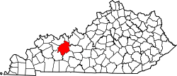 | |
| CDP | ||
| Other unincorporated communities | ||