Hart's Location, New Hampshire
| Hart's Location, New Hampshire | |
|---|---|
| Town | |
|
Frankenstein Cliff c. 1905 | |
 Location in Carroll County, New Hampshire | |
| Coordinates: 44°05′11″N 71°21′07″W / 44.08639°N 71.35194°WCoordinates: 44°05′11″N 71°21′07″W / 44.08639°N 71.35194°W | |
| Country | United States |
| State | New Hampshire |
| County | Carroll |
| Incorporated | 1795 |
| Government | |
| • Board of Selectmen |
Mark R. Dindorf George Holmes Phil St Hilaire |
| Area | |
| • Total | 18.6 sq mi (48.1 km2) |
| • Land | 18.5 sq mi (47.9 km2) |
| • Water | 0.1 sq mi (0.3 km2) 0.56% |
| Elevation | 897 ft (273 m) |
| Population (2010) | |
| • Total | 41 |
| • Density | 2.2/sq mi (0.85/km2) |
| Time zone | Eastern (UTC-5) |
| • Summer (DST) | Eastern (UTC-4) |
| ZIP code | 03812 |
| Area code(s) | 603 |
| FIPS code | 33-34500 |
| GNIS feature ID | 0872015 |
| Website | www.hartslocation.com |

Hart's Location is a town in Carroll County, New Hampshire, United States. Since 1948, the town has been one of the first places to declare its results for the New Hampshire Presidential primary and U.S. Presidential elections.[1]
The population was 41 as of the 2010 census.[2] It was incorporated in 1795.[3] Hart's Location receives services from the nearby town of Bartlett, but otherwise has its own government, selectmen and post office. Home to Crawford Notch State Park, which is noted for a rugged wilderness beauty, the town is crossed by the Appalachian Trail.
History

Hart's Location was named after Colonel John Hart of Portsmouth. In 1772, the land was granted to Thomas Chadbourne, also of Portsmouth.[4] Native Americans used a trail up the Saco River valley through Crawford Notch, and during the French and Indian Wars, many English captives were taken to Canada that way. But the pass through the White Mountains was otherwise unknown until 1771, when Timothy Nash discovered it hunting moose, and told Governor John Wentworth.[5]
The obscure Indian trail transformed into the Coös Road, on which was built a small public house in 1793. It was abandoned, but in 1825 Samuel Willey, Jr. occupied it with his wife, five children, and two hired hands.[6] During a violent storm on August 28, 1826, they all perished in a landslide known as Willey's Slide. They fled their home and took refuge in a shelter, but it was destroyed while the house remained unscathed. A rock outcrop uphill divided the slide, which flowed around the home and reunited below it. The door was found gaping, a bible open on the table. Their tragedy inspired "The Ambitious Guest" (1835) by Nathaniel Hawthorne, and Mount Willey was named in their memory. The house became part of a larger inn, then burned in 1898. Today, the location is a state historic site.[7]
In 1875, the Portland and Ogdensburg Railroad completed its line up through Crawford Notch. Passengers thrilled to traverse the Frankenstein Trestle, 520 feet (158 meters) long and 85 feet (26 meters) above the ravine floor, and then the Willey Brook Bridge, 400 feet (122 meters) long and 94 feet (29 meters) high. Later part of the Mountain Division of the Maine Central Railroad, the route is still traveled by the Conway Scenic Railroad.[8]
Geography
According to the United States Census Bureau, the town has a total area of 18.6 square miles (48.1 km2), of which 18.5 square miles (47.9 km2) is land and 0.12 square miles (0.3 km2), or 0.56%, is water.[2]
The shape of Hart's Location is unusual: about 11 miles (18 km) long and 1.5 miles (2.4 km) wide, with crooked boundaries that echo the confines of Crawford Notch, threaded by the upper Saco River and U.S. Route 302 near the centerline of the town, and pinched from both sides between steep mountains and in some areas sheer cliffs above. This anomaly is heightened on maps that show county lines: Coos County lies immediately to the east and Grafton County to the west, but Hart's Location is part of Carroll County, though barely connected to it.
The highest point in Hart's Location is 3,900 feet (1,200 m) above sea level along the town's western boundary, beneath the summit of 4,285-foot (1,306 m) Mount Willey. Arethusa Falls, New Hampshire's highest waterfall, located in the neighboring township of Livermore, is a popular hiking destination with access from U.S. Route 302 in Hart's Location. The town lies fully within the Saco River watershed.[9]
The town is a popular ice climbing destination in the winter months.
Demographics
| Historical population | |||
|---|---|---|---|
| Census | Pop. | %± | |
| 1870 | 26 | — | |
| 1880 | 70 | 169.2% | |
| 1890 | 187 | 167.1% | |
| 1900 | 38 | −79.7% | |
| 1910 | 85 | 123.7% | |
| 1920 | 35 | −58.8% | |
| 1930 | 29 | −17.1% | |
| 1940 | 17 | −41.4% | |
| 1950 | 11 | −35.3% | |
| 1960 | 7 | −36.4% | |
| 1970 | 7 | 0.0% | |
| 1980 | 27 | 285.7% | |
| 1990 | 36 | 33.3% | |
| 2000 | 37 | 2.8% | |
| 2010 | 41 | 10.8% | |
| Est. 2015 | 41 | [10] | 0.0% |
As of the census[12] of 2000, there were 37 people, 15 households, and 10 families residing in the location. The population density was 2.0 people per square mile (0.8/km²). There were 50 housing units at an average density of 2.7 per square mile (1.0/km²). The racial makeup of the location was 97.30% (36 people) White, with 2.70% (one person) citing themselves as from two or more races.
There were 15 households out of which 33.3% had children under the age of 18 living with them, 66.7% were married couples living together, and 33.3% were non-families. 26.7% of all households were made up of individuals and 6.7% had someone living alone who was 65 years of age or older. The average household size was 2.47 and the average family size was 3.10.
In the location the population was spread out with 24.3% under the age of 18, 5.4% from 18 to 24, 35.1% from 25 to 44, 8.1% from 45 to 64, and 27.0% who were 65 years of age or older. The median age was 39 years. For every 100 females there were 94.7 males. For every 100 females age 18 and over, there were 100.0 males.
The median income for a household in the location was $41,250, and the median income for a family was $70,833. Males had a median income of $26,250 versus $28,750 for females. The per capita income for the town was $19,609. None of the population and none of the families were below the poverty line.
Politics
Federal elections
New Hampshire law allows towns with fewer than 100 residents to open the polls at midnight and close them as soon as all registered voters have cast their ballots.[13] Hart's Location is one of the New Hampshire communities where the first votes are cast in the Democratic and Republican New Hampshire primaries, the first presidential primaries in the United States during each presidential election year. The Hart's Location midnight voting tradition, which began in 1948, actually predates the more widely known Dixville Notch practice; however, Dixville Notch generally receives greater publicity.
The community's voting tradition received a nod in the 2002 third-season episode of US television program The West Wing, in an episode entitled "Hartsfield's Landing", named after a town clearly modeled on either Hart's Location, or its companion, Dixville Notch.
Election results
Boldfaced names indicate the ultimate nationwide winner of each contest:
1996
| Dem. primary: (12 votes) | Rep. primary: (19 votes) | General election: (31 votes) |
|---|---|---|
| Bill Clinton - 12 | Lamar Alexander - 8 | Bob Dole - 13 |
| Bob Dole - 3 | Bill Clinton - 12 | |
| Pat Buchanan - 3 | Ross Perot - 4 | |
| Steve Forbes - 3 | Harry Browne - 2 | |
| Phil Gramm - 1 | ||
| Colin Powell - 1, write-in |
2000
| Dem primary: (12 votes) | Rep primary: (14 votes) | General election: (30 votes) |
|---|---|---|
| Bill Bradley - 9 | John McCain - 9 | George W. Bush - 17 |
| Al Gore - 3 | George W. Bush - 5 | Al Gore - 13 |
2004
| Dem. primary: (16 votes) | Rep. primary: (13 votes) | General election: (31 votes) |
|---|---|---|
| Wesley Clark - 6 | George W. Bush - 13 | George W. Bush - 16 |
| John Kerry - 5 | John Kerry - 14 | |
| Howard Dean - 3 | Ralph Nader - 1 | |
| John Edwards - 2 |
2008
| Dem. primary: (13 votes)[13] | Rep. primary: (16 votes)[13] | General election: (29 votes)[14] |
|---|---|---|
| Barack Obama - 9 | John McCain - 6 | Barack Obama - 17 |
| Hillary Clinton - 3 | Mike Huckabee - 5 | John McCain - 10 |
| John Edwards - 1 | Ron Paul - 4 | Ron Paul - 2, write-in |
| Mitt Romney - 1 |
2012
| Dem. primary: (10 votes)[15] | Rep. primary: (13 votes)[15] | General election: (33 votes)[16] |
|---|---|---|
| Barack Obama - 10 | Mitt Romney - 5 | Barack Obama - 23 |
| Ron Paul - 4 | Mitt Romney - 9 | |
| Jon Huntsman - 2 | Gary Johnson - 1 | |
| Newt Gingrich - 1 | ||
| Rick Perry - 1 |
2016
| Dem. primary: (21 votes) | Rep. primary: (14 votes) | General election: (37 votes)[17] |
|---|---|---|
| Bernie Sanders - 12 | John Kasich - 5 | Hillary Clinton - 17 |
| Hillary Clinton - 7 | Donald Trump - 4 | Donald Trump - 14 |
| Mark Stewart Greenstein - 2 | Chris Christie - 2 | Gary Johnson - 3 |
| Jeb Bush - 1 | Bernie Sanders - 2 | |
| Ben Carson - 1 | John Kasich/Sanders (write-in) - 1 | |
| Marco Rubio - 1 |
Emergency services
Police Services are provided by the Carroll County Sheriff's Office or NH State Police Troop E depending on staffing for the time of day.
See also
References
- ↑ Schworm, Peter (2008-01-07). "N.H. towns vie for late-night voter limelight". The Boston Globe.
- 1 2 "Geographic Identifiers: 2010 Demographic Profile Data (G001): Hart's Location town, Carroll County, New Hampshire". U.S. Census Bureau, American Factfinder. Retrieved April 1, 2013.
- ↑ "Hart's Location Town Services". Hart's Location official website. Retrieved 17 November 2016.
- ↑ New Hampshire Economic and Labor Market Information Bureau Profile
- ↑ Austin J. Coolidge & John B. Mansfield, A History and Description of New England; Boston, Massachusetts 1859
- ↑ The Willey Tragedy
- ↑ New Hampshire Division of Parks & Recreation -- Story of the Willey Family
- ↑ White Mountain History -- Crawford Notch
- ↑ Foster, Debra H.; Batorfalvy, Tatianna N.; Medalie, Laura (1995). Water Use in New Hampshire: An Activities Guide for Teachers. U.S. Department of the Interior and U.S. Geological Survey.
- ↑ "Annual Estimates of the Resident Population for Incorporated Places: April 1, 2010 to July 1, 2015". Retrieved July 2, 2016.
- ↑ "Census of Population and Housing". Census.gov. Retrieved June 4, 2016.
- ↑ "American FactFinder". United States Census Bureau. Retrieved 2008-01-31.
- 1 2 3 Canfield, Clarke (January 8, 2008). "McCain, Obama, get early votes in N.H. villages". The Boston Globe. Associated Press. Archived from the original on November 2, 2008. Retrieved 2008-01-08.
- ↑ http://www.hartslocation.com/ Retrieved Nov 4, 2008
- 1 2 http://www.unionleader.com/article/20120110/NEWS0605/701119999 Retrieved Jan 10, 2012
- ↑ "First Election Day voters, in two tiny N.H. locations, give Obama lead". CBS News. November 6, 2012.
- ↑ "2016 Election Results - Hart's Location". Town of Hart's Location. Retrieved November 8, 2016.
External links
- Town of Hart's Location official website
- New Hampshire Economic and Labor Market Information Bureau Profile
Municipalities and communities of Carroll County, New Hampshire, United States | ||
|---|---|---|
| Towns | 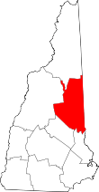 | |
| Township | ||
| CDPs | ||
| Other villages | ||