Hart District
| Hart Hart District | |
|---|---|
| Non-metropolitan district | |
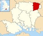 Hart shown within Hampshire | |
| Sovereign state | United Kingdom |
| Constituent country | England |
| Region | South East England |
| Non-metropolitan county | Hampshire |
| Status | Non-metropolitan district |
| Admin HQ | Fleet |
| Incorporated | 1 April 1974 |
| Government | |
| • Type | Non-metropolitan district council |
| • Body | Hart District Council |
| • Leadership | Leader & Cabinet (TBA (council NOC)) |
| • MPs |
Ranil Jayawardena Gerald Howarth |
| Area | |
| • Total | 83.1 sq mi (215.3 km2) |
| Area rank | 161st (of 326) |
| Population (mid-2014 est.) | |
| • Total | 93,325 |
| • Rank | 256th (of 326) |
| • Density | 1,100/sq mi (430/km2) |
| • Ethnicity | 97.7% White |
| Time zone | GMT (UTC0) |
| • Summer (DST) | BST (UTC+1) |
| ONS code |
24UG (ONS) E07000089 (GSS) |
| OS grid reference | SU8047254050 |
| Website |
www |
Hart is a local government district in Hampshire, England, named after the River Hart. Its council is based in Fleet. It was formed on 1 April 1974 under the Local Government Act 1972, as a merger of the urban district of Fleet, and the Hartley Wintney Rural District.
Hart District is one of the richest and least deprived areas in the whole of the United Kingdom. In the Indices of Deprivation 2004, Hart was ranked at 354 out of 354 local authorities in England, where 1 was the most deprived area and 354 the least deprived, meaning Hart is the least deprived area in England. Hart District's population also has one of the highest rates of life expectancy in the UK.
A 2008 census revealed Hart to be the area of England with the best quality of life. It also showed Hart to be the second richest area in England, after Richmond-upon-Thames.[1]
In December 2006, Sport England published a survey which revealed that residents of Hart were the 5th most active in England in sports and other fitness activities. 27.9% of the population participate at least 3 times a week for 30 minutes.[2]
For five years running (2011-2015), an annual study conducted by the Halifax bank named Hart as the UK's most desirable place to live for quality of life. The study took into account jobs, housing, health, crime, weather, traffic and broadband access. It found that in 2014 97% of people in the local authority area were in good health, and in 2011 tended to have incomes 40% above the national average.[3][4]
Population
In mid-2003 Hart had an estimated 85,700 residents. This compares with the 2001 Census figure of 83,505 residents. The 2001 Census also reported that there were 32,470 households, with 77% of residents describing their health as 'good'. In the twenty years between 1982 and 2002 the population of Hart grew by 19 per cent, compared with an increase of 11 per cent for the South East region as a whole.
Politics
Elections to the council are held in three out of every four years, with one third of the 35 seats on the council being elected at each election. From the 2000 election to 2005 the Conservative party had a majority on the council. Until 2010 it was under no overall control. Between 2010 and 2012 the Conservatives again had control of the council, losing power again in the 2012 elections.
Following the 2014 election, the make-up of the Council is as follows:
| Party | Councillors | |
| Conservative Party | 14 | |
| Community Campaign (Hart) | 9 | |
| Liberal Democrats | 9 | |
| Independent | 1 | |
Parishes and Town Councils
- Blackwater and Hawley
- Bramshill
- Church Crookham
- Crondall
- Crookham Village
- Dogmersfield
- Elvetham Heath
- Eversley
- Ewshot
- Fleet Town
- Greywell
- Hartley Wintney
- Heckfield
- Hook
- Long Sutton
- Mattingley
- Odiham
- Rotherwick
- South Warnborough
- Winchfield
- Yateley
References
- ↑ Andy McSmith (13 March 2008). "A wealthy little corner of England where the quality of life comes first". The Independent.
- ↑ "Active People Survey Headline Results: South East Region". Sport England. Retrieved 24 Dec 2011.
- ↑ "Hart in Hampshire named as UK's most desirable place". BBC News. 24 Dec 2011.
- ↑ "Hart in Hampshire remains UK's most desirable place". BBC News. 20 Dec 2014.
External links


Coordinates: 51°16′46″N 0°50′46″W / 51.2794°N 0.8461°W