Harrison, Lincoln County, Wisconsin
| Harrison, Wisconsin | |
|---|---|
| Town | |
 Location of Harrison, Wisconsin | |
| Coordinates: 45°28′49″N 89°30′6″W / 45.48028°N 89.50167°W | |
| Country | United States |
| State | Wisconsin |
| County | Lincoln |
| Area | |
| • Total | 72.4 sq mi (187.4 km2) |
| • Land | 69.5 sq mi (179.9 km2) |
| • Water | 2.9 sq mi (7.5 km2) |
| Elevation[1] | 1,696 ft (517 m) |
| Population (2000) | |
| • Total | 793 |
| • Density | 11.4/sq mi (4.4/km2) |
| Time zone | Central (CST) (UTC-6) |
| • Summer (DST) | CDT (UTC-5) |
| Area code(s) | 715 & 534 |
| FIPS code | 55-32875[2] |
| GNIS feature ID | 1583356[1] |
Harrison is a town in Lincoln County, Wisconsin, United States. The population was 793 at the 2000 census. The unincorporated communities of Bundy, Harrison, and Jeffris are located in the town.
Geography
According to the United States Census Bureau, the town has a total area of 72.4 square miles (187.4 km²), of which, 69.4 square miles (179.9 km²) of it is land and 2.9 square miles (7.5 km²) of it (4.02%) is water.
Demographics
As of the census[2] of 2000, there were 793 people, 314 households, and 243 families residing in the town. The population density was 11.4 people per square mile (4.4/km²). There were 679 housing units at an average density of 9.8 per square mile (3.8/km²). The racial makeup of the town was 98.99% White, 0.50% Asian, and 0.50% from two or more races. Hispanic or Latino of any race were 1.01% of the population.
There were 314 households out of which 31.5% had children under the age of 18 living with them, 71.7% were married couples living together, 2.2% had a female householder with no husband present, and 22.6% were non-families. 18.2% of all households were made up of individuals and 8.0% had someone living alone who was 65 years of age or older. The average household size was 2.53 and the average family size was 2.85.
In the town the population was spread out with 24.8% under the age of 18, 3.9% from 18 to 24, 28.4% from 25 to 44, 27.2% from 45 to 64, and 15.6% who were 65 years of age or older. The median age was 41 years. For every 100 females there were 109.8 males. For every 100 females age 18 and over, there were 104.1 males.
The median income for a household in the town was $42,500, and the median income for a family was $50,625. Males had a median income of $40,250 versus $24,861 for females. The per capita income for the town was $19,463. About 4.6% of families and 7.5% of the population were below the poverty line, including 14.3% of those under age 18 and 8.9% of those age 65 or over.
References
- 1 2 "US Board on Geographic Names". United States Geological Survey. 2007-10-25. Retrieved 2008-01-31.
- 1 2 "American FactFinder". United States Census Bureau. Retrieved 2008-01-31.
Municipalities and communities of Lincoln County, Wisconsin, United States | ||
|---|---|---|
| Cities | 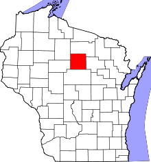 | |
| Towns | ||
| Unincorporated communities | ||
| Footnotes | ‡This populated place also has portions in an adjacent county or counties | |
Coordinates: 45°28′39″N 89°30′24″W / 45.47750°N 89.50667°W