Haripur District
| Haripur | |
|---|---|
| District | |
| Haripur Hazara | |
| Country | Pakistan |
| Province | Khyber Pakhtunkhwa |
| Headquarters | Haripur |
| Government | |
| • MNA | Babar Nawaz Khan |
| • MPA | Akbar Ayub Khan |
| Area | |
| • Total | 1,725 km2 (666 sq mi) |
| Population (2005) | |
| • Total | 803,000 (Estimated) |
| • Density | 466/km2 (1,210/sq mi) |
| Time zone | PST (UTC+5) |
| District Nazim | Adil Islam |
| Number of Tehsils | 2 |
| Website | http://www.Hazara.com.pk/ |
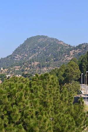
Haripur (Urdu: ہری پور,"The Town of Hari or hari") is a district in the Hazara region of Khyber Pakhtunkhwa province of Pakistan with an altitude of around 610 metres (2,000 ft) above sea level. As of 2005, Haripur District has the third highest Human Development Index of all the districts in Pakistan.
History
Ancient and medieval period
The Haripur district is situated at the heart of the ancient Gandhara civilization. At the time of Alexander, the region including Taxila was known as "Eastern Gandhara", with its boundaries reaching as far as Kashmir. Geographically it lies on either side of the Sindu River, near the Tarbela Reservoir. Most historians believe that the Aryans must have composed a number of Vedic hymns on the banks of Indus. During the kingship of his father Bindusara, the Maharaja Ashoka ruled this region as governor and, according to Tibetan Buddhist traditional stories, he died here.
Turkish rule
In 1399, the Turko-Mongol warrior king Timur, on his return to Kabul, stationed his Turk soldiers in Hazara to protect the important route between Kabul and Kashmir. By 1472, Prince Shahab-ud-Din, a Turk of Central Asian origin and a descendant of Amir Taimur, established his rule over the region. The prince founded the state and named it Pakhli Sarkar (Pakhli), choosing Gulibagh as his capital.
During the period of Mughal rule, local Turkish chiefs acknowledged Mughal authority. In fact, Pakhli provided the main route to Kashmir and was the most commonly used route for Emperor Akbar to travel to Kashmir.
In the 18th century, Turkish rule came to an end.
Durrani rule
When Ahmad Shah Durrani expanded his kingdom to Punjab, Hazara also came under his control. Durrani considered it wise to rule the area through local tribal chiefs, especially the Tareen chiefs who remained the main administrators from around the 1760s to 1818/1819.[1] The Durranis' rule ended abruptly in the beginning of the 19th century, circa 1819 or 1820, with the advent of the Sikhs.
Sikh annexation
The Sikhs annexed Hazara in two stages: first, Lower Hazara was annexed when the Sikhs under Makhan Singh took over the plains, on the invitation of a Turk chieftain, who betrayed his country to save himself .[2] Upper Hazara suffered a similar fate when the Sikhs took Kashmir from the Barakzai Afghans in 1819.[3] The town of Haripur (meaning 'Hari's town') was founded in 1822 by Hari Singh Nalwa, the Commander-in-Chief of Ranjit Singh's army. On the successful completion of his tenure as Governor of Kashmir in 1821, Pakhli and Damtaur were bestowed upon Nalwa as a jagir. As soon as Nalwa received this grant, he built the walled town of Haripur in the heart of the Haripur plain, centered on the fort of Harkishan Garh, which he encircled with a deep trench. The site selected had previously seen some of the fiercest fighting between Sikhs and Afghans.[4] Despite the presence of the fort and a strong Sikh garrison, the Lahore government wasn't finally able to get full control of the Lower Hazara until they had defeated and captured and executed the Tareen chiefs and warriors like Muhammad Khan, Bostan Khan, and some others.[5]
British India
The presence of the fort at Harkishangarh, with its four-yard thick and sixteen yard high wall, eventually brought a feeling of security to the region. In 1835, Baron Heugel, a German traveler found only remnants of that wall remaining.[6]
Haripur was the sole example of a planned town in this region until the British built Abbottabad many years later. It continued to grow, eventually becoming a city and later a district.
Haripur once bore the official name of Haripur Hazara and was the capital of Hazara until 1853, when the new capital Abbottabad was built. In March 1849, the Punjab was annexed by the British Empire. Abbott later painted a noted picture of the town of Haripur and its commanding fort of Harkishangarh.[7]
Sufism in Haripur
The form of Islam called Sufism has remained popular in Haripur area, since ancient times. There have been many Sufis or purported Sufis, in this area, as well as several shrines, some of them counterfeit or pseudo-Sufistic and others which are genuine. Some of the better-known Sufis of the past include:
- Baba Abdul Malik Shah Haqqani Badshah Kazmi Al-Mashadi Qadiri (shrine at Kaag Sharif)
- Baba Sher Shah Ghazi Badshah Kazmi Al-Mashadi Qadiri (shrine at Dari Sharif)
- Shah Jamal Badshah Kazmi Al-Mashadi Qadiri (at Dari Shari)
- Baba Sajawal Badshah
- Khwaja Abdul Rahman Chorwi (at Chohr Sharif)
Administration

The District of Haripur was a Tehsil, or sub-division, of Abbottabad District, until 1992 when it became a district in its own right. The district is presently (2010–2011) represented in the provincial assembly by four elected MPAs. One of those four MPA's is elected to the National/Federal Assembly.
Currently, Haripur District is divided into two tehsils, further subdivided into 44 Union Councils of which 15 are urban Union Councils: 15 Oct.2016 the Chief Minister of KP announced status of Tehsil to Khanpur.''
- Ali Khan
- Bagra
- Baitgali
- Bakka
- Bandi Sher Khan
- Barkot
- Beer
- Behki
- Bherrary
- Breela
- Darwesh
- Dheendah
- Dingi
- Ghazi
- Haripur Central
- Haripur North
- Haripur South
- Hattar
- Jabri
- Jatti Pind
- Kalinjar
- Khalabat Township
- Khanpur
- Kholian Bala
- Kot Najeebullah
- Kotehrra
- Kundi
- Landarmang
- Mankrai
- Maqsood
- Najifpur
- Nara Amaz
- Pandak
- Panian
- Pind Hasham Khan
- Pind Kamal Khan
- Pharhari
- Qazipur
- Rehana
- Sarai Saleh
- Serai Niamat Khan
- Sikandarpur
- Sirikot
- Sirya
- Tarbela
- Tofkian
Notable people
- Khan-sahib Abdul Majid Khan Tarin, OBE, renowned early legal and legislative figure and member of the AIML
- General/Self-appointed Field Marshal Ayub Khan, Military Dictator and President of Pakistan (1958 to 1969)
- Khan Abdus Salim Khan former Pakistani ambassador and senior diplomat
- Mr Sardar Bahadur Khan , Muslim League politician from Haripur area
- Pir Sabir Shah, Ex-Chief Minister North-West Frontier Province (1996 to 1997)
- Air Chief Marshal retd Anwar Shamim, former senior Pakistan Air Force officer
- Gohar Ayub Khan, former Speaker of the Pakistani National Assembly
- Omer Tarin, noted poet, writer, scholar and mystic
- Major (r) Habibullah Khan Tarin former Speaker of NWFP (now KPK) assembly
- Omar Ayub Khan, former federal minister of state for finance
- Raja Sikander Zaman, former Chief Minister of the North-West Frontier Province.
Natural resources
The area is rich in natural resources and contains two important reservoirs, the Tarbela Dam and Khanpur Dam. Geographically, it is the gateway to Hazara, the Hazara Division, and the Pakistani capital Islamabad.
Boundary

Geographically, the district borders Abbottabad District to the north east, Mansehra District in the north-east, the Punjab to the south east, the Buner to the north-west and Swabi to the west. The Federal Capital of Islamabad is also adjacent to the district in the south.
Demographics
As of the 1998 census, Haripur's population was 692,228, and by 2005, it was estimated to have increased to 803,000. 12.0% live in urban districts with the remaining 88.0% residing in rural areas.
The population is spread over an area of 1,725 square kilometres (666 sq mi), resulting in a density of 401.3 persons per km².[8] This compares to an average density of 233 persons per km² in Hazara as a whole. The average household size of the district is 6.6 persons compared to 8 at the provincial level. Agriculture is the predominant livelihood of the population while the total arable area is 77,370 acres (313.1 km²).
Languages
Hindko and Pashto are mainly spoken in the district. Urdu being the National language is widely understood.
Literacy rate
The literacy rate in the Haripur district is 53.7%, substantially higher than the literacy rate in the region of Hazara, which is 35.2%. The female literacy rate is only 37.4% compared to male literacy of 63.6%, and urban literacy rate of 69.7% is significantly higher than the rural rate of 51.4%.
Education
Haripur District has two government funded post graduate colleges, providing higher level education, as well as four degree colleges for girls. Haripur University was established in 2012.
In 2000–2001, Haripur had 907 government primary schools, including 656 for boys and 251 for girls. In addition to government primary schools, 166 mosque schools were also in the district. The primary school population (5–9 years) consisted of 101,670 students, of which 52,240 (51.38%) were boys and 49,430 (48.61%) were girls.
The district had 83 middle schools (56 for boys and 27 for girls), during 2001.
Industries
There are many factories of various sizes on the Hatar Industrial Estate including the most modern SSP Fertilizer unit (Double A Fertilizers), and the presence of these industries means the district plays an important role in national economic development. One of the most prominent industries in the Haripur district is known as Cactus Fertilizer (formerly Pak-China Fertilizers) which is the largest producer of phosphate fertilizer in Pakistan with an enormous production capacity of 500 tons a day.
Haripur's role in the agricultural field is also important. The district provides fruit and vegetables not only to Peshawar but also to Islamabad and the Punjab.
See also
References
- ↑ Dr SB Panni 'Tarikh i Hazara' Peshawar 1969
- ↑ Hazara District Gazeteer 1883-84, Lahore, 1884, pp 23-24
- ↑ Nalwa, V. (2009), Hari Singh Nalwa — Champion of the Khalsaji, New Delhi: Manohar, pp. 77-104, ISBN 81-7304-785-5.
- ↑ Panni, 1969
- ↑ Hazara Gazetteer 1883-84, p. 26
- ↑ Nalwa, V. (2009), Hari Singh Nalwa — Champion of the Khalsaji, New Delhi: Manohar, pp. 224-5, ISBN 81-7304-785-5.
- ↑ 'The Rock Aornos from Huzara' - British Library Online Gallery
- ↑ Information Pakistan - Districts of Pakistan
Further reading
- Waldemar Heckel, Lawrence A. Tritle, ed (2009). Alexander the Great: A New History. Wiley-Blackwell. pp. 47–48. ISBN 978-1-4051-3082-0. https://books.google.com/?id=jbaPwpvt8ZQC&pg=PA46&lpg=PA46&dq=callisthenes+of+olynthus+conspiracy&q=callisthenes%20of%20olynthus%20conspiracy
- Tripathi (1999). History of Ancient India. Motilal Banarsidass Publ.. pp. 118–121. ISBN 978-81-208-0018-2. https://books.google.com/?id=WbrcVcT-GbUC
- Narain, pp. 155–165
- Curtius in McCrindle, Op cit, p 192, J. W. McCrindle; History of Punjab, Vol I, 1997, p 229, Punajbi University, Patiala, (Editors): Fauja Singh, L. M. Joshi; Kambojas Through the Ages, 2005, p 134, Kirpal Singh.
- www.qalamqirtas.org
- www.khalabat.com

Coordinates: 33°44′N 72°35′E / 33.733°N 72.583°E