Hargeisa
| Hargeisa Hargeysa (Somali) هرجيسا (Arabic) | |
|---|---|
| Capital | |
 | |
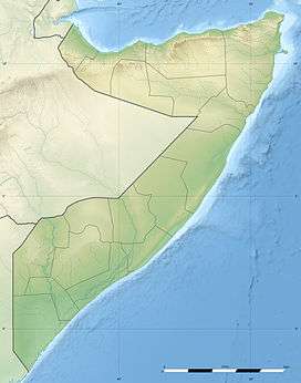 Hargeisa Location in Somaliland with Somalia | |
| Coordinates: 9°33′47″N 44°4′3″E / 9.56306°N 44.06750°ECoordinates: 9°33′47″N 44°4′3″E / 9.56306°N 44.06750°E | |
| Country |
|
| Region | MaroodiJeex |
| Government | |
| • Mayor | Abdirahman Mohamoud Aidid "Soltelco" |
| Area | |
| • Total | 75 km2 (29 sq mi) |
| Population (2015)[1] | |
| • Total | 1,200,000 |
| • Density | 1,600/km2 (5,000/sq mi) |
| Time zone | EAT (UTC+3) |
Hargeisa (Somali: Hargeysa, Arabic: هرجيسا[2][3] is the capital of Somaliland, situated in the Woqooyi Galbeed region in Northwestern Somalia.,[4][5] it is the capital of the Republic of Somaliland, which is internationally recognized as a autonomous region of Somalia.
During the Middle Ages, Hargeisa was part of the Adal Sultanate's domain. The city later succeeded Berbera as the capital of the British Somaliland protectorate in 1941. In 1960, the protectorate gained independence and united as scheduled days later with the Trust Territory of Somaliland (the former Italian Somaliland) to form the Somali Republic (Somalia) on July 1.[6][7]
Hargeisa is situated in a valley in the Galgodon (Ogo) highlands, and sits at an elevation of 1,334 m (4,377 ft). Home to rock art from the Neolithic period, the city is also a commercial hub for precious stone-cutting, construction, retail services and importing/exporting, among other activities.[2]
Etymology
Although little is known about the city's pre-19th century history,[8] Encyclopaedia Aethiopica suggests that the settlement may have evolved in the latter half of the 1800s as a Qadiriyya settlement established by Shaykh Maddar, near a water-stop used by nomadic stock-herders on the way to the town of Harar. It thus proposes that the name "Hargeisa" was possibly derived from the sobriquet Harar as-sagir, meaning "Harar the little"[9] or simply "little Harar'"[10]
History
Prehistory
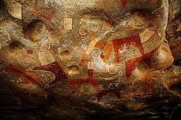
Numerous cave paintings from the Neolithic period are found in the Laas Geel complex, on the outskirts of Hargeisa. During November and December 2002, an archaeological survey was carried out in the area by a French team of researchers. The expedition's objective was to search for rock shelters and caves containing stratified archaeological infills capable of documenting the period when production economy appeared in this part of Somalia (circa 5th and 2nd millennium BCE). During the course of the survey, the French archaeological team discovered the Laas Geel rock art, encompassing an area of ten rock alcoves (caves). In an excellent state of preservation, the paintings show human figures with their hands raised and facing long-horned, humpless cattle.[11]
The rock art had been known to the area's inhabitants for centuries before the French discovery. However, the existence of the site had not been broadcast to the international community. In November 2003, a mission returned to Laas Geel and a team of experts undertook a detailed study of the paintings and their prehistoric context.
Northern Somalia in general is home to numerous such archaeological sites, with similar rock art and/or ancient edifices found at Haylan, Qa’ableh, Qombo'ul and El Ayo. However, many of these old structures have yet to be properly explored, a process which would help shed further light on local history and facilitate their preservation for posterity.[12]
British Somaliland
In 1888, after signing successive treaties with the then ruling Somali Sultans such as Mohamoud Ali Shire of the Warsangali Sultanate, the British established a protectorate in the region referred to as British Somaliland.[13] The British garrisoned the protectorate from Aden in present-day Yemen, and administered it from their British India until 1898. British Somaliland was then administered by the Foreign Office until 1905 and afterwards by the Colonial Office.
Berbera, a major trading harbour on the Red Sea, was the protectorate's first capital due to its strategic importance. However, the capital was moved from Berbera to Hargeisa, and the city was granted capital status in 1941. During the East African Campaign, the protectorate was occupied by Italy in August 1940, but recaptured by the British in March 1941.
The protectorate gained its independence on 26 June 1960 as the State of Somaliland,[14][15] before uniting as planned days later with the Trust Territory of Somaliland (the former Italian Somaliland) to form the Somali Republic.[16]
1960–1980s
In the post-independence period, Hargeisa was administered as the capital of the Woqooyi Galbeed province of Somalia. Numerous new development projects were subsequently launched in the city by the Somali government. Among these initiatives was the creation in 1977 of the Hargeisa Provincial Museum. It was the first museum to be established in Somalia since independence in 1960.[18] The Hargeisa International Airport was also renovated and modernized, with the ultimate aim of equipping the facility to accommodate larger aircraft and offer more flight destinations.[19]
After fallout from the unsuccessful Ogaden campaign of the late 1970s, the ruling socialist government of the Somali Democratic Republic under Major General Mohamed Siad Barre began arresting government and military officials under suspicion of participation in an abortive 1978 coup d'état.[20][21] Most of the people who had allegedly helped plot the putsch were summarily executed.[22] However, several officials managed to escape abroad and started to form the first of various dissident groups dedicated to ousting Barre's administration by force.[23] Among these rebel outfits was the Somali National Movement (SNM), which was supported by Ethiopia's then ruling Derg communist regime. By the late 1980s, the insurgent group had managed to capture Hargeisa, prompting air strikes by government forces. The ensuing bombing raids and crossfire claimed thousands of casualties and destroyed much of the city.[24]
Reconstruction

After the collapse of the Somali central government and the start of the civil war in 1991, SNM secessionists in the northwestern part of the country unilaterally declared independence. A slow process of infrastructural reconstruction subsequently began in Hargeisa and other towns in the region.
Since 1991, Hargeisa has undergone a large-scale facelift. The renovations have been largely financed by local entrepreneurs, as well as Somali expatriates sending remittance funds to relatives in the region through some of the various Somali-owned money transfer operators.[25] Most of the destroyed residential and commercial buildings have since been reconstructed, with many newer structures erected. Single-story buildings downtown are also progressively giving way to multi-story edifices and high-rises.
Geography
Location and habitat
Hargeisa is located in a mountainous area, in an enclosed valley of the northwestern Galgodon (Ogo) highlands. It sits at an elevation of 1,334 meters (4,377 feet) above sea level.

The city used to be surrounded by forest when it was smaller in size, but the countryside around it still has small junipers. Near Hargeisa are the fertile Sheikh and Daallo mountains, which receive large amounts of rain. South of the city is the Haud savannah (Baligubadle), which attracts many different species of wildlife to graze in the area.
Hargeisa is situated near the town of Gabiley, which serves as an agricultural centre in Somaliland. That town's Allay-Baday area produces tons of tomatoes and onions each month during the rainy season. The city of Arabsiyo is also located nearby, and is noted for its lemon production.
Due to its relative fertility and greenery, wild animals come to the Hargeisa area to either breed or graze on the grassland savannah. Fauna that can be found in rural sections of the city include the kudu, wild boars, Somali wild ass, warthogs, antelopes, Somali sheep, goats, camels, and many different types of birds. There are also a number of both public and private menageries. South of Hargeisa is a grassland savannah, which attracts many types of wildlife to the area, including lions and leopards.
Climate
Hargeisa has a semi-arid climate (Köppen: BSh). The city generally features warm winters and hot summers. However, despite its location in the tropics, due to the high altitude Hargeisa seldom experiences either very hot or very cold weather. This is a trait rarely seen in regions with a semi-arid climates. The city receives the bulk of its precipitation between the months of April and September, averaging just under 400 mm of rainfall annually. Average monthly temperatures in Hargeisa range from 18 C in the months of December and January to 24 C in the month of June.
| Climate data for Hargeisa | |||||||||||||
|---|---|---|---|---|---|---|---|---|---|---|---|---|---|
| Month | Jan | Feb | Mar | Apr | May | Jun | Jul | Aug | Sep | Oct | Nov | Dec | Year |
| Record high °C (°F) | 31.1 (88) |
31.7 (89.1) |
32.8 (91) |
32.8 (91) |
35.0 (95) |
33.9 (93) |
33.9 (93) |
33.3 (91.9) |
32.8 (91) |
31.7 (89.1) |
30.6 (87.1) |
28.9 (84) |
35.0 (95) |
| Average high °C (°F) | 24.2 (75.6) |
26.6 (79.9) |
28.7 (83.7) |
29.2 (84.6) |
30.5 (86.9) |
31.0 (87.8) |
29.2 (84.6) |
29.2 (84.6) |
30.5 (86.9) |
28.2 (82.8) |
26.0 (78.8) |
23.7 (74.7) |
28.1 (82.6) |
| Daily mean °C (°F) | 17.7 (63.9) |
18.7 (65.7) |
21.6 (70.9) |
23.0 (73.4) |
24.1 (75.4) |
24.3 (75.7) |
23.6 (74.5) |
23.6 (74.5) |
23.6 (74.5) |
24.1 (75.4) |
18.7 (65.7) |
18.0 (64.4) |
21.7 (71.1) |
| Average low °C (°F) | 11.6 (52.9) |
12.6 (54.7) |
15.0 (59) |
16.6 (61.9) |
17.7 (63.9) |
17.7 (63.9) |
17.1 (62.8) |
17.1 (62.8) |
17.1 (62.8) |
15.0 (59) |
13.1 (55.6) |
12.1 (53.8) |
15.2 (59.4) |
| Record low °C (°F) | 2.8 (37) |
2.8 (37) |
3.9 (39) |
9.4 (48.9) |
11.7 (53.1) |
11.7 (53.1) |
10.5 (50.9) |
11.1 (52) |
11.1 (52) |
7.2 (45) |
4.4 (39.9) |
4.4 (39.9) |
2.8 (37) |
| Average precipitation mm (inches) | 2 (0.08) |
2 (0.08) |
36 (1.42) |
53 (2.09) |
49 (1.93) |
61 (2.4) |
38 (1.5) |
81 (3.19) |
61 (2.4) |
20 (0.79) |
8 (0.31) |
1 (0.04) |
412 (16.22) |
| Average precipitation days (≥ 0.1 mm) | 1 | 1 | 3 | 6 | 7 | 9 | 8 | 10 | 11 | 4 | 1 | 0 | 61 |
| Average relative humidity (%) | 65 | 65 | 58 | 57 | 56 | 55 | 53 | 53 | 55 | 56 | 61 | 64 | 58.2 |
| Percent possible sunshine | 80 | 73 | 80 | 73 | 64 | 73 | 64 | 64 | 73 | 80 | 80 | 80 | 74 |
| Source #1: Food and Agriculture Organization: Somalia Water and Land Management (temperatures, humidity and percent sunshine)[26][27] | |||||||||||||
| Source #2: Deutscher Wetterdienst (extremes and precipitation)[28] | |||||||||||||
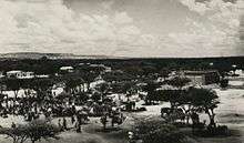
Panorama

Administration
%2C_Hargeisa%2C_House_of_Representatives_2.JPG)
Situated in the Woqooyi Galbeed province of the Somaliland region, Hargeisa is the seat of the regional parliament, the presidential palace and government ministries.[29]
The municipal administration is currently led by Abdurrahman Mahmoud Aidiid (Soltelco). A member of the Peace, Unity, and Development Party (Kulmiye), the ruling political association in the region, he was elected Mayor on 14 April 2013 by a quorum of 24 city councilors.[30]
Demographics
According to The World Factbook, Hargeisa has a population of around 1200,000 residents as of 2015. It is the 700th largest city in the world by population size. The urban area occupies 75 square kilometres (29 sq mi), with a population density of 12,600 inhabitants per square kilometre (33,000/sq mi).[1] It is primarily inhabited by the Ciidagale, Habar Awal, Arap, and Habar Yoonis of the Isaaq Somali clan.
Economy

Hargeisa is the financial hub to many entrepreneurial industries ranging from gem stonecutters, to construction, food processing, retail, and import and export firms.[2]
In June 2012, the Partnership Fund for the private sector in the Somaliland region was launched at Hargeisa's Ambassador Hotel. Part of the larger Partnership for Economic Growth program, the initiative will see $900,000 USD allocated to 13 private local businesses as well as the creation of 250 new full-time jobs, half of which are to be earmarked for youth and one third for women. The Fund is expected to improve job opportunities for 1,300 entrepreneurs through ameliorated product distribution and investment in new technologies and processing facilities. Eligibility is determined through a competitive and transparent selection process overseen by the Partnership program, the Somaliland Chamber of Commerce, and government officials.[31]
Transportation
Buses are the most commonly used form of public transportation in Hargeisa. They travel on a number of routes serving nearly all of the city's districts. Intra-city bus services are also available, which connect Hargeisa to other major northern Somali cities and towns, including Burao, Berbera and Borama.
.jpg)
With the growth of urban development, several new taxi companies have sprung up in Hargeisa. They are the brainchild of local entrepreneurs and Somali expatriates who have returned to invest in their hometown. The firms provide high quality and secure taxi transportation to all parts of the city, and offer long-term employment opportunities. Raho City Taxi was the first of these new cab companies to begin operations in the region. As of 2012, it has a fleet of around 40 vehicles, which include small sedans and vans capable of accommodating up to seven passengers.[32] Hargeisa Taxi is another of the recent taxi firms based in Hargeisa. It has a fleet of four small compact cars and seven passenger minivans, in addition to around 19 other vehicles. GPS devices installed by the Sahal Technology firm allow the cab company's dispatch office to monitor its taxis to ensure that they travel within the speed limit. The office can also disable the vehicles online in the event of theft. Other new taxi firms serving Hargeisa include Dalhis Taxi and Marodi Jeh Taxi. Fares are inexpensive, costing between 15,000 and 18,000 Somaliland shillings ($2–$3 USD) per ride,[32] with the national Somali shilling also widely accepted.[33]
For air transportation, the city is served by the Hargeisa International Airport. The Somali-owned private carriers Daallo Airlines and Jubba Airways offer domestic flights from the facility to various other towns in Somalia, such as Mogadishu, Bosaso and Galkayo. Trips to international destinations are also available, including to Djibouti and Dubai. It has recently gained more airlines such as Ethiopian airlines and fly dubai.
Education
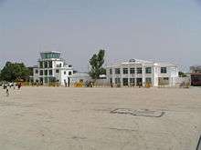
Various primary schools and nurseries are dispersed throughout Hargeisa. There are also several state-run and privately owned secondary and high schools in the city. Among these are the SOS Sheikh Secondary School and Abaarso School of Science and Technology, the latter of which is the pre-eminent secondary institution in the area. Abaarso School is located about 13 km (8 mi) west of Hargeisa.
In terms of post-secondary education, the city is home to a number of colleges and some universities. The main institutions of higher learning include the University of Hargeisa, Admas University College, Somaliland University of Technology, Gollis University New Generation University and Hope University. Additionally, the Edna Adan Maternity Hospital offers nursing programmes to students.
Communication
Hargeisa has a modern telephone system, with most urban residents enjoying mobile or landline access. As online service providers have grown, a number of internet cafés have also sprung up throughout the city.
The main telecommunication services available in Hargeisa are operated by Telesom, Somali Telecom Group - Somtel and NationLink Telecom.
Notable residents
- Hassan Dhuxul Laabsaalax - Founder and Poet of the Xidigaha Geeska.
- Maxamed Axmed Bakaal Cirro - Artist and Vice-manager of Xidigaha Geeska.
- Faysal Ali Warabe – Founder and Chairman of the For Justice and Development party.
- Jamal Ali Hussein – Presidential Candidate For Justice and Development party.
- Mohamed Hassan Saed – Founder of the National Youth Umbrella Organization SONYO, Former Director General Ministry of Foreign Affairs, Co-Founder of the first and Largest Private Security Company in East Africa Physical Risk Solutions PRS.
- Dr. Edna Adan – Founder and Chairman of the Edna Adan University Hospital and Former Minister of Foreign Affairs of Somaliland, The wife of Late President Mohamed Haji Ibrahim Egal.
See also
Notes
- 1 2
- 1 2 3 "Hargeisa". Jubba Airways. Archived from the original on January 22, 2013. Retrieved 18 July 2013.
- ↑ x=1350565654&lng=fr&des=gamelan&geo=-198&srt=pnan&col=abcdefghinoq&msz=1500&men=gcis&lng=en "Somaliland: largest cities and towns and statistics of their population" Check
|url=value (help). world-gazetteer.com. Retrieved October 19, 2012. - ↑ "Somalia". The World Factbook. Langley, Virginia: Central Intelligence Agency. Retrieved 6 December 2013.
- ↑ Regions of Somalia
- ↑ Worldstatesmen – Somalia
- ↑ Encyclopædia Britannica, The New Encyclopædia Britannica, (Encyclopædia Britannica: 2002), p.835
- ↑ Briggs, Philip (2012). Somaliland: With Addis Ababa & Eastern Ethiopia. Bradt Travel Guides. p. 10. ISBN 1841623717.
- ↑ Ficadorey, Gianfranco (2008). "Ha". Basic Reference. NY, USA: Thomson/Gale. 3: 1032.
- ↑ Bennett, Norman (1968). Leadership in Eastern Africa. Boston University Press. p. 70. Retrieved 14 July 2016.
- ↑ The Journal of African Archeology Volume 1.2 (2003) Chapter 3
- ↑ Michael Hodd, East African Handbook, (Trade & Travel Publications: 1994), p.640.
- ↑ Hugh Chisholm (ed.), The encyclopædia britannica: a dictionary of arts, sciences, literature and general information, Volume 25, (At the University press: 1911), p.383.
- ↑ "Somaliland Marks Independence After 73 Years of British Rule" (fee required). The New York Times. 1960-06-26. p. 6. Retrieved 2008-06-20.
- ↑ "How Britain said farewell to its Empire". BBC News. 2010-07-23.
- ↑ Encyclopaedia Britannica, The New Encyclopaedia Britannica, (Encyclopaedia Britannica: 2002), p.835
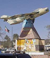
- ↑ "Close Residents of Somaliland sit under a war memorial of a MiG fighter jet in the centre of town in Hargeisa". Reuters. 19 May 2013. Retrieved 11 February 2014.
- ↑ Cobelj, Stefanja (April 24, 2009). "The Provincial Museum of Hargeisa". Museum International. doi:10.1111/j.1468-0033.1986.tb00633.x.
- ↑ Economist Intelligence Unit (Great Britain), Country report: Uganda, Ethiopia, Somalia, Djibouti, (The Unit: 1986), p.43.
- ↑ ARR: Arab report and record, (Economic Features, ltd.: 1978), p.602.
- ↑ Ahmed III, Abdul. "Brothers in Arms Part I" (PDF). WardheerNews. Retrieved February 28, 2012.
- ↑ New People Media Centre, New people, Issues 94–105, (New People Media Centre: Comboni Missionaries, 2005).
- ↑ Nina J. Fitzgerald, Somalia: issues, history, and bibliography, (Nova Publishers: 2002), p.25.
- ↑ Jimcaale, Cabdirahman (2002). Consolidation and decentralization of government institutions. Academy for Peace and Development. p. 19.
- ↑ UK Somali Remittances Survey
- ↑ "Climate of Somalia" (PDF). Food and Agriculture Organization. pp. 69–73. Archived from the original (PDF) on 4 November 2016. Retrieved 4 November 2016.
- ↑ "Long term mean monthly sunshine fraction in Somalia". Food and Agriculture Organization. Retrieved 4 November 2016.
- ↑ "Klimatafel von Hargeisa / Somalia" (PDF). Baseline climate means (1961-1990) from stations all over the world (in German). Deutscher Wetterdienst. Retrieved 4 November 2016.
- ↑ Hargeisa City Hall. Retrieved on 2012-10-17. (2000 est.)
- ↑ Qaran News (14 April 2013). "Kulmiye's Abdirahman Soltelco New Mayor Of Hargeisa". Qaran News. Retrieved 18 July 2013.
- ↑ "USAID launches the first grants program for the private sector in Somaliland". USAID. Archived from the original on February 18, 2013. Retrieved 18 July 2013.
- 1 2 Dahir, Barkhad (20 December 2012). "Taxi companies in Hargeisa create jobs, ease travel". Sabahi. Retrieved 18 July 2013.
- ↑ "Finance Manager – Reporting & Sub Grant Compliance, Hargeisa". Relief Web. Retrieved 19 July 2013.
External links
| Wikimedia Commons has media related to Hargeisa. |
- Hargeisa City Government web Site (Archive)
- Hargeisa, Somalia
-
 Hargeisa travel guide from Wikivoyage