Hanamaki Airport
| Hanamaki Airport 花巻空港 Hanamaki Kūkō | |||||||||||
|---|---|---|---|---|---|---|---|---|---|---|---|
 | |||||||||||
|
IATA: HNA – ICAO: RJSI – WMO: 47549 | |||||||||||
| Summary | |||||||||||
| Airport type | Public (Type-3) | ||||||||||
| Owner | Iwate Prefecture | ||||||||||
| Serves | Hanamaki, Iwate, Japan | ||||||||||
| Elevation AMSL | ft / 91 m | ||||||||||
| Coordinates | 39°25′43″N 141°08′07″E / 39.42861°N 141.13528°ECoordinates: 39°25′43″N 141°08′07″E / 39.42861°N 141.13528°E | ||||||||||
| Map | |||||||||||
 RJSI Location in Japan | |||||||||||
| Runways | |||||||||||
| |||||||||||
| Statistics (2014) | |||||||||||
| |||||||||||
Hanamaki Airport (花巻空港 Hanamaki Kūkō) or Iwate-Hanamaki Airport (IATA: HNA, ICAO: RJSI) is a regional airport located 6 km (3.7 mi) north-northeast[1] of Hanamaki, a city in Iwate Prefecture, Japan.
History
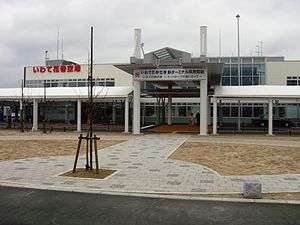
Hanamaki Airport opened in 1954 with a 1200-meter runway. The runway was extended to 2000 meters in 1983. On 4 April 2009, a new terminal building was opened on the opposite side of the runway, replacing the now-defunct old terminal building that is situated next to Route 4. Nitanai Station now replaces Hanamaki Airport Station as the nearest train station to the terminal building.
Airlines and destinations
| Airlines | Destinations |
|---|---|
| All Nippon Airways | Osaka-Itami |
| China Airlines | Seasonal: Taipei-Taoyuan |
| Fuji Dream Airlines | Fukuoka, Nagoya-Komaki, Sapporo-Chitose |
| Japan Airlines operated by J-Air | Osaka-Itami, Sapporo-Chitose |
Several times per year, there are charter flights from Taiwan.
Accidents and incidents
- April 18, 1993, Japan Air System Flight 451: A Douglas DC-9-41 of Japan Air System, flying from Nagoya to Hanamaki, crashed after the aircraft, caught by wind shear, skidded off of the runway while landing at Hanamaki Airport. All of the passengers and crew survived.[3]
References
- 1 2 AIS Japan
- ↑ "Hanamaki Airport Statistics" (PDF) (Press release). Ministry of Land, Infrastructure, Transport and Tourism. Retrieved 8 July 2016.
- ↑ Aviation Safety Network
External links
| Wikimedia Commons has media related to Hanamaki Airport. |
- Hanamaki Airport (Official site) (In Japanese)
- Iwate-Hanamaki Airport Guide from Japan Airlines First 2 floors only (English)
- Iwate-Hanamaki Airport Guide All 3 floors (Japanese)
- Current weather for RJSI at NOAA/NWS
- Accident history for HNA at Aviation Safety Network
1 Joint civil-military use | |||||||||||
| Major hubs | |||||||||||
| International |
| ||||||||||
| Domestic |
| ||||||||||
| General aviation |
| ||||||||||
| Military | |||||||||||
| Heliports |
| ||||||||||
| Defunct | |||||||||||
This article is issued from Wikipedia - version of the 12/4/2016. The text is available under the Creative Commons Attribution/Share Alike but additional terms may apply for the media files.