Hampton Rocks Cutting
| Site of Special Scientific Interest | |
 | |
 Location within Somerset | |
| Area of Search | Avon |
|---|---|
| Grid reference | ST779666 |
| Coordinates | 51°23′53″N 2°19′09″W / 51.39800°N 2.31906°WCoordinates: 51°23′53″N 2°19′09″W / 51.39800°N 2.31906°W |
| Interest | Geological |
| Area | 1.3 hectares (0.013 km2; 0.0050 sq mi) |
| Notification | 1990 |
| Natural England website | |
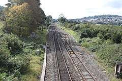
Hampton Rocks Cutting (grid reference ST779666) is a 1.3 hectare geological Site of Special Scientific Interest near the village of Bathampton, Somerset, notified in 1990.
The site is listed in the Geological Conservation Review, for its exposure of Pleistocene rocks made up of coarse fluvial gravels showing scour-and-fill structures and planar bedding. Their sedimentology gives a clear indication that the deposits were laid down under 'cold-stage' conditions, probably during the Devensian glacial period.[1]
References
- ↑ English Nature citation sheet for the site (accessed 19 July 2006)
This article is issued from Wikipedia - version of the 9/25/2011. The text is available under the Creative Commons Attribution/Share Alike but additional terms may apply for the media files.