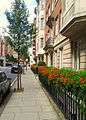
Hallam Street
 Tree lined Hallam Street | |
| Former name(s) |
Charlotte Street Duke Street |
|---|---|
| Length | 0.3 mi (0.5 km) |
| Postal code | W1W |
| Coordinates | 51°31′17″N 0°08′38″W / 51.5213°N 0.1439°W |
| south end |
Broadcasting House Langham Street |
| north end | no junction |

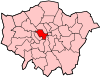
Hallam Street is a road situated in the Parish of St Marylebone and London’s West End. In administrative terms it lies within the City of Westminster's Marylebone High Street Ward as well as the Harley Street Conservation Area.[1] Formerly named both Charlotte Street and Duke Street,[2] it was renamed in the early 1900s after Henry Hallam (1777–1859), a noted historian who had been a local resident, and his son Arthur Henry Hallam (1811–1833), poet and the subject of Tennyson's elegy In Memoriam.[3]
History
Hallam Street is situated within the boundaries of the ancient Manor of St Marylebone. The history of the Manor can be traced back to the Domesday Book in the 11th century, when the area was divided into two manors: Lilestone and Tyburn. Much of the area was covered with forest and marshland and formed part of the great forest of Middlesex.[4]
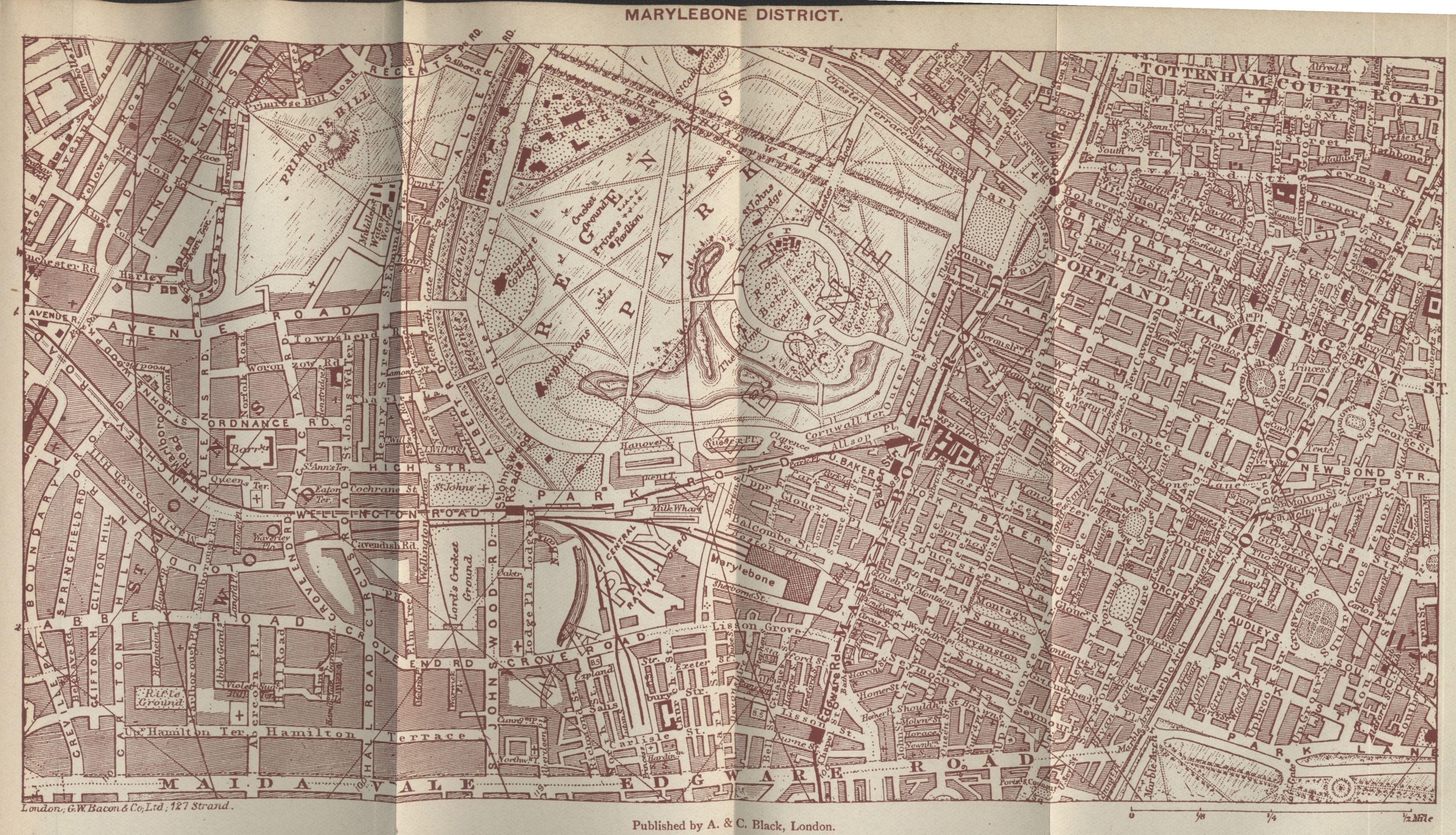
Like the better known Portland Place and Great Portland Street, Hallam Street was originally developed by the Dukes of Portland, who owned most of the eastern half of Marylebone in the 18th and 19th centuries. Richard Horwood’s 1790s map of London shows that Charlotte Street had by then been laid out exactly as Hallam Street is today.[5] Maps from that period show houses lining the entire length of the street by that time. In the late 19th/early 20th century, following the expiration of individual buildings’ 99-year leases, Hallam Street was redeveloped and many of its original Georgian houses were replaced by larger mansion and office blocks.
Buildings and notable residents
The street has buildings of mainly five to eight storeys with a strong residential presence.[6] Notable residents who lived for a time in the street include the Pre-Raphaelite artist and poet Dante Gabriel Rossetti (1828–1882), the painters John Sell Cotman (1782-1842), Cornelius Varley (1781-1873),[7] Sir Peter Francis Bourgeois(1753–1811), dominatrix Theresa Berkley (d.1836), the writer William Gerhardi (1895–1977), the conductor and founder of The Proms Sir Henry Joseph Wood (1869–1944),[8] American journalist and broadcaster Edward R Murrow (1908–1965), World War Two hero Wing Commander Forest Frederick Edward Yeo-Thomas (1901–1964), the radio and television writer Ernest Dudley (1908–2006), and the Austrian writer Stefan Zweig (1881–1942).
Numbers 44 and 50 Hallam Street, originally the offices of the General Medical Council, received Grade II designation in 1954. A large number of the street’s buildings have been characterised as "unlisted buildings of merit" in the Harley Street Conservation Area Audit[9] and are either part of the Howard de Walden Estate[10] (originally the Portland Estate)[11] or the Langham Estate (also once part of the Howard de Walden Estate).[12][13]

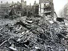
Hallam Street contains a number of institutional buildings (including the BBC’s Broadcasting House) from the Edwardian and inter-war periods. Blitz bomb damage was extensive at the south end of the street, its synagogue was also destroyed while other buildings experienced blast damage.[14]
The redevelopment of Broadcasting House, whose modern rear elevation lies on Hallam Street, is now complete. Its redevelopment is the BBC's single largest capital project ever, and has created a new centre for radio, news and world service in the heart of London.[15] The BBC's facilities, a majority of the street's office buildings and its two hotels lie at the southern end of the street.
Notable buildings
There are a number of notable buildings on this Marylebone Street:
- New Broadcasting House (BBC)
- 44 and 50 Hallam Street (Formerly the offices of the General Medical Council) - Conference venue and residential
- 47 Hallam Street (The Central London Synagogue) - Place of worship
- 49 Hallam Street - Residential mansion block
- 77 Hallam Street - Residential mansion block
- 84-94 Hallam Street (Weymouth House) - Residential mansion block
- 105 Hallam Street (Formerly Cunard White Star Line Lodge) - Residential mansion block
- 110 Hallam Street (Rossetti House) - Residential mansion block
Other buildings with elevations on Hallam Street
- 85 New Cavendish Street – De Walden Court - Residential mansion block & offices
- 1 Weymouth Street (Weymouth Court)- Residential mansion block
- 2 Weymouth Street (formerly YMCA Hostel) - Residential mansion block
- 9 Weymouth Street (Stone House) - Residential mansion block
- 10 Weymouth Street (Warpole House) - Residential mansion block - www.10weymouth.com
- 2 Devonshire Street (formerly YWCA Hostel) - Residential mansion block
- 54-57 Devonshire Street (Goodwood Court) - Residential mansion block
Gallery
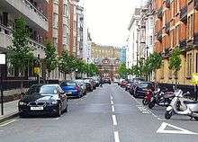
 View of Hallam Street outside Weymouth House in Marylebone London W1
 View South on Hallam St, Marylebone London W1
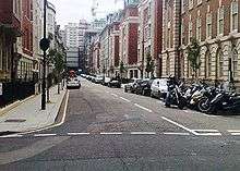
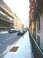 Hallam Street before trees were planted
 Lord Mayor Cllr Alan Bradley launches W1W tree planting campaign Hallam Street W1
 Air Raid Precautions Message regarding bombing incident at 44 Hallam Street on 3 June 1941
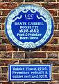 DANTE GABRIEL ROSSETTI 1828-1882 Poet & Painter was born at 110 Hallam Street
Transport
The nearest London Underground stations to Hallam Street are Oxford Circus, Great Portland Street, and Regents Park tube stations. Buses numbered 88, C2, 18, 27, 30, 205, 189, 3, 12, and 55 stop within a close distance (<5 minutes walk) from Hallam Street.[16]
See also
External links
| Wikimedia Commons has media related to Hallam Street. |
- Marylebone Association website
- Hallam Street Facebook Community Page
- Hallam Street drawn into WCC Neighbourhood Forum Discussions
- Westminster City Council Conservation Area Audits
- BBC Broadcasting House Redevelopment Project web site
- The Howard de Walden Estate web site
- The Langham Estate web site
- Portland Village web site
- W1W Street Tree Initiative for Marylebone
- West End at War: Article on damage caused to Hallam Street by the bombing of 10-11 May 1941
References
- ↑ "Harley Street Conservation Area Map September 2007" (PDF). Westminster City Council. Retrieved 2010-05-21.
- ↑ "Marylebone District Map 1902". Gutenberg Project: Charles and Adam Black. Retrieved 2010-05-20.
- ↑ "Henry Hallam entry in Classic Encyclopedia October 2006". www.1911encyclopedia.org. Retrieved 2010-05-21.
- ↑ "Harley Street Conservation Area Audit 2008" (PDF). Westminster City Council. Retrieved 2010-05-21.
- ↑ "Horwood's Plan of the Cities of London and Westminster 1792-1799". Old London Maps Com. Retrieved 2010-05-21.
- ↑ Image catalogue of Hallam St 2011 http://outdoors.webshots.com/album/577048690pTElbR
- ↑ Gordon Mackenzie, Marylebone - Great City North of Oxford Street, Macmillan; 1st Edition (2 Nov 1972)
- ↑ David Brandon and Alan Brook, Marylebone & Tyburn Past - An illustrated history of this wealthy suburb. Historical Publications, 2007
- ↑ "WCC Conservation Area Audit June 2008". Westminster City Council. Retrieved 2010-05-21.
- ↑ "The Howard de Walden Estate from 1086 to present day". Howard de Walden Estate. Retrieved 2010-05-21.
- ↑ "History of Harley Street Area". Harley Street Guide. Retrieved 2010-05-21.
- ↑ "History of Langham Estate". Langham Estate. Retrieved 2010-05-22.
- ↑ Revealed Samuel Tak Lee: the secretive tycoon who controls a huge swathe of the West End, Evening Standard, 13 June 2003, p.19
- ↑ http://www.westendatwar.org.uk/page_id__117_path__0p2p.aspx West End at War web site, Bomb Damage File Nos. 105, 489, 491 & 549 of 1940-41, and Bomb Damage Maps, Westminster City Council Archive Centre, London, England
- ↑ "New Broadcasting House". BBC British Broadcasting Corporation. Retrieved 2010-05-23.
- ↑ "Transport for London - Bus Routes May 2010". Transport for London. Retrieved 2010-05-23.