Hala'ib Triangle
Coordinates: 22°28′9″N 35°31′23″E / 22.46917°N 35.52306°E
| Hala'ib Triangle | |
|---|---|
| Disputed territory | |
 Location of Hala'ib Triangle | |
| Coordinates: 22°28′09″N 35°31′23″E / 22.46917°N 35.52306°E | |
| Country | Administered by Egypt, claimed by Sudan. |
| Area | |
| • Total | 20,580 km2 (7,950 sq mi) |
| • Disputed area | 20,580 km2 (7,950 sq mi) |
| Lowest elevation | 0 m (0 ft) |
The Hala'ib Triangle (also spelled Halayeb ; Arabic: مثلث حلايب Mosallas Ḥalāyeb pronounced [moˈsællæs ħæˈlæːjeb]) is an area of land measuring 20,580 square kilometres (7,950 sq mi) located on the Red Sea's African coast. The area, which takes its name from the town of Hala'ib, is created by the difference in the Egypt–Sudan border between the "political boundary" set in 1899 by the Anglo-Egyptian Condominium, which runs along the 22nd parallel north, and the "administrative boundary" set by the British in 1902,[1] which gave administrative responsibility for an area of land north of the line to Sudan, which was an Anglo-Egyptian client at the time. With the independence of Sudan in 1956, both Egypt and Sudan claimed sovereignty over the area. Since the mid-1990s, Egypt has exercised de facto effective administration of the area as part of the Red Sea Governorate, following the deployment of Egyptian military units there in the 1990s, and has been actively investing in it.[2]
The description of the area as a "triangle" is a rough approximation. Only the southern 290-kilometre (180 mi) demarcation, which follows latitude 22°, is a straight line. While the whole area is north of the 22-degree line, a smaller area south of latitude 22°, referred to as Bir Tawil, joins the Hala'ib Triangle at its westernmost point along the latitude line – neither Sudan nor Egypt claims Bir Tawil.[3]
The area is sometimes referred to in Egypt as the "Sudan Government Administration Area" or SGAA.[4]
History


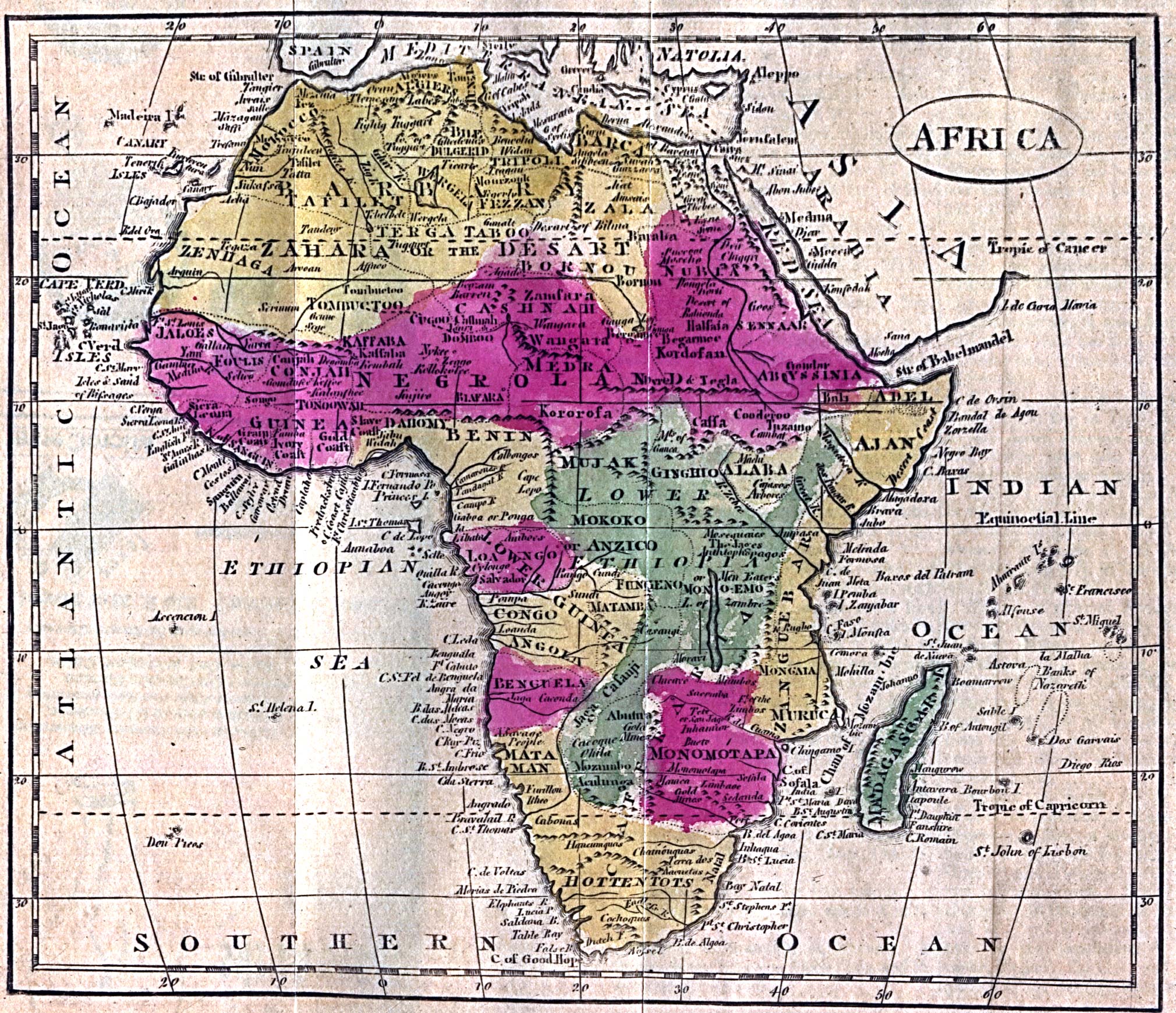
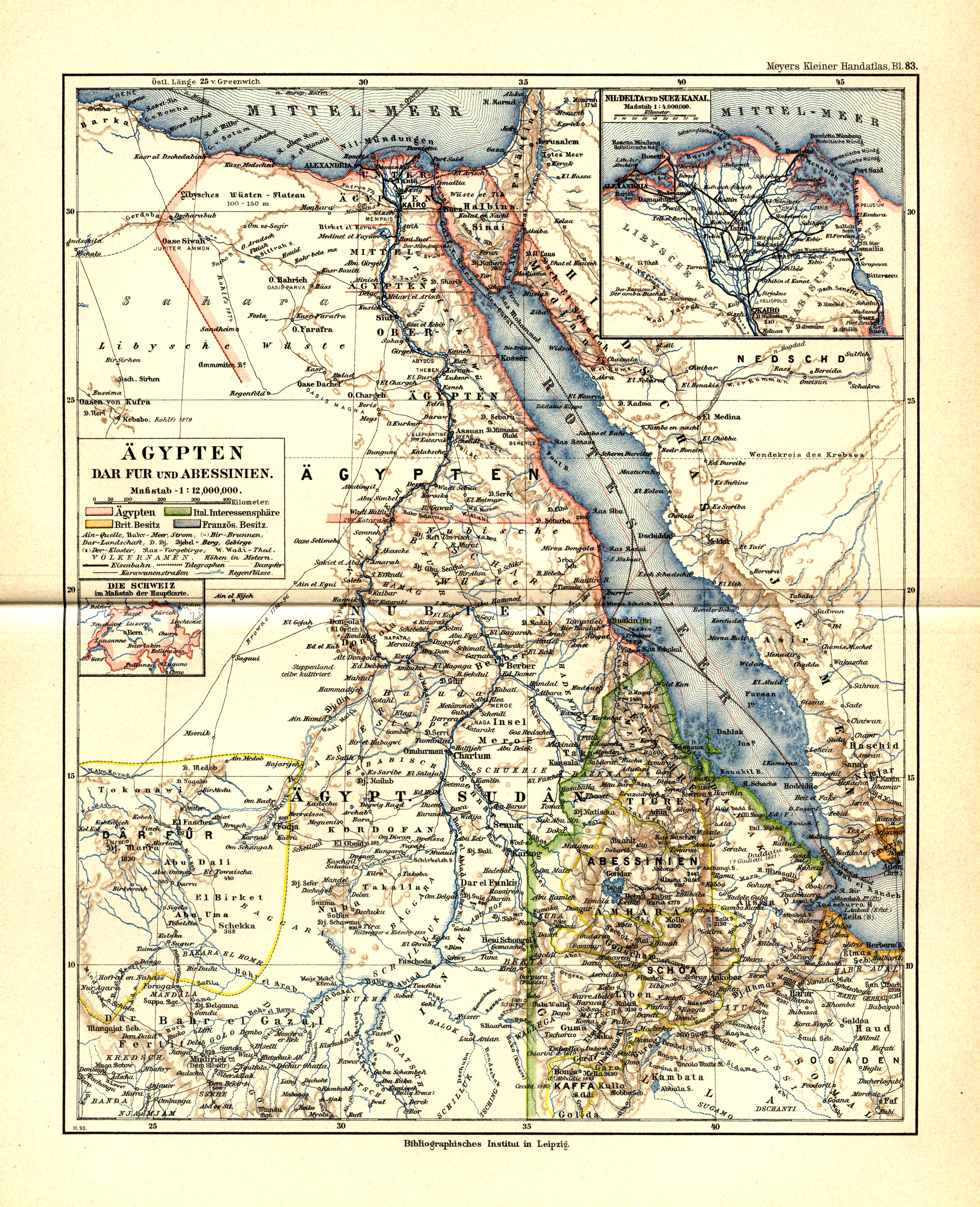
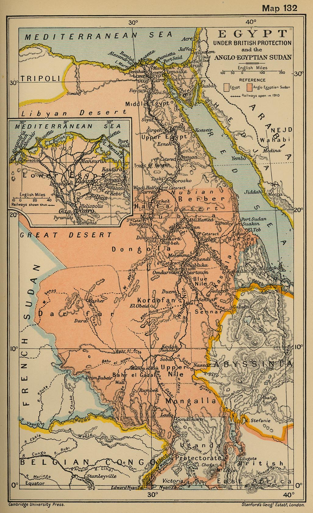
In 1899, when the United Kingdom held hegemony in the area, the Anglo-Egyptian Condominium Agreement for Sudan set the political boundary between the territories at the 22nd parallel. However, in 1902 the British drew a separate "administrative boundary," which assigned administration of the territory of the Ababda tribe south of the 22-degree latitude line to Egypt, and gave to Sudan the grazing land of the Beja tribe north of the line to administer. The Sudan-administered territory comprised about 18,000 km2, including the towns of Hala'ib and Abu Ramad. When Sudan became independent in 1956, Egypt regarded the latitude 22° territorial boundary of 1899 as the border between the two countries, while Sudan held to the claimed 1902 administrative boundary. As a result, both Egypt and Sudan claim sovereignty over the territory.[5][6] Conversely, the area south of the line which had been administered by Egypt, Bir Tawil, is a terra nullius, claimed by neither country.
In February 1958, two years after Sudanese independence, with Sudan planning to hold elections in the Triangle,[5] President Gamal Abdel Nasser of Egypt sent troops into the disputed region for the referendum of the proposed unification between Egypt and Syria in the United Arab Republic,[1][7][8][9][10] but withdrew them the same month.[11]
Although both countries continued to lay claim to the land, joint control of the area remained in effect until 1992, when Egypt objected to Sudan’s granting of exploration rights for the waters off the Triangle to a Canadian oil company. Negotiations began, but the company pulled out of the deal until sovereignty was settled.[12] In July 1994, Sudan sent memoranda to the United Nations Security Council, the Organisation of African Unity (OAU) and the Arab League complaining about what it claimed was more than 39 military and administrative incursions by Egypt into Sudanese territory since Sudan had last filed memoranda in May 1993. In January 1995 Egypt rejected a Sudanese request for the OAU Foreign Ministers' Council to review the dispute at their meeting in Addis Ababa.[13] Then, after an unsuccessful assassination attempt on Egyptian President Hosni Mubarak when he arrived in Addis Ababa to attend the meeting, Egypt accused Sudan of complicity, and, among other responses, strengthened its control of the Hala'ib triangle, expelling Sudanese police and other officials.[5][13]
In 1998, relations between Egypt and Sudan somewhat improved, and the countries announced their intention to work together to resolve the Hala'ib Triangle dispute, with increased cooperation between their security forces. Later that year, though, Sudan accused Egypt of harassing Sudanese citizens in the area, a charge which Egypt denied. Nevertheless, by March 1999, the countries were in diplomatic discussions aimed at improving relations between them.[13] During a visit to Egypt by Sudanese President Omar al-Bashir in December 1999, a joint communique was issued pledging to solve the Hala'ib dispute "in an integrational brotherly context..."[5]
In January 2000, Sudan withdrew its forces from the area, effectively ceding control of the border zone to Egypt, whose forces have occupied and administered the area since.[14]
21st century
In 2004 Sudanese president Omar Al-Bashir claimed that despite his nation's withdrawal in 2000, and Egypt's de facto control of the Triangle, the area still rightfully belonged to Sudan which had "never relinquished" it. "We did not make any concessions.... The proof is that we have recently renewed the complaint to the Security Council," he said, according to the Press.[15] Al-Bashir reiterated the Sudanese claim of sovereignty over Hala'ib in a 2010 speech in Port Sudan, saying "Hala'ib is Sudanese and will always be Sudanese."[16]
The Eastern Front, a Sudanese politico-military coalition comprising the Beja Congress and Free Lions that recently signed a peace agreement with Khartoum, has stated that it considers Hala'ib to be part of Sudan due to its population being ethnically, linguistically and tribally connected to that country.[17] The head of the Eastern Front and Beja Congress, Musa Muhammad Ahmad, has declared that the issue of Hala'ib's sovereignty should be decided by international arbitration in a similar manner to the issue of sovereignty over Abyei between Northern and Southern Sudan.
In October 2009 the Electoral Commission that prepared a comprehensive plan for Sudan's general elections in April 2010 declared that Hala'ib was one of the Red Sea State electoral districts and that its people should exercise their constitutional rights and register in order to participate in the general elections. Voter registration did not take place in the Hala'ib Triangle area because the team from the Sudanese election commission was refused entry by Egyptian authorities. In December 2009, the Sudanese presidential assistant Musa Mohamed Ahmed was barred from entering the border area. Ahmed's visit was intended to "assert [Sudanese] sovereignty over the [Hala'ib] triangle and inspect the situation of the people and provide moral and financial support to the members of the Sudanese army unit trapped inside since the [Egyptian] occupation began." His remarks were the first official recognition that Sudanese Army personnel remained inside the area of de facto Egyptian control. Ahmed also asserted that the Hal'ib Triangle is Sudanese and would not be forsaken "under any circumstances." [18]
The government of Egypt is taking steps to close the Egyptian-Sudanese trade center of Alshalateen and move it to the border control pass point on the 22nd parallel, which has had its facilities enlarged and its administrative manpower increased to handle the Egyptian-Sudanese land trade. By doing this, trucks bringing goods to Egypt from Sudan will not be allowed to unload their goods in Alshalateen, as in the past, but instead at the Hadarba border pass point. Wadi Halfa is another border pass point west of the Nile River at 22 degrees north.
In 2009 the Egyptian electricity authority was building a line to supply the city of Alshalateen with electric power from the main Egyptian grid to replace the generators being used there. This line will extend in the future to Abu Ramad and Hala'ib. Since May 2010 a new paved road has connected the triangle to Port Sudan.
It was reported in the Sudanese daily Al-Ahram Today on 22 April 2010 that Al-Taher Muhammad Hasaay, the former head of the Hala'ib Council and a member of the Bisharin tribe who was campaigning against the Egyptian military presence in the Hala'ib triangle, died in a hospital in Cairo after having been detained by Egyptian security forces without trial for two years. A delegation of the Bisharin tribe stated to the Sudan Media Centre that seven of their members were also in detention: Muhammad Eissa Saeed, who had been in custody for six years, Ali Eissa Abu Eissa and Muhammad Saleem, detained for five years, and Hashim Othman, Muhammad Hussein AbdalHakam, Karrar Muhammad Tahir and Muhammad Tahir Muhammad Saleh each in holding for two years.[19]
In July 2010, it was reported in the Egyptian newspaper Al-Masry Al-Youm that the chiefs of three tribes in the Hala'ib triangle – el-Ababda, el-Basharya and el-Beja – supported the Egyptian claims for the area, stating that they are Egyptian and not Sudanese citizens, and that they have all the rights of Egyptian citizens, including national identity cards, the right to vote in elections and to serve in the Egyptian military.[20]
On November 29, 2010, an open letter was sent to the President of Sudan by Muhammad Al-Hassan Okair (Toyota) who had been the parliamentary member of Hala'ib in 1995, from Hala'ib itself. The letter was written on behalf of the Bisharin, Hamad-Orab and Aliyaab tribes and complained of the forced inclusion of 20 villages that had been administered under indigenous civil society structures into two Egyptian electoral districts. The letter further complained of the siege of Hala'ib, the fact that its inhabitants live within barbed wire and that anything from Sudan is refused entry on the premise that Hala'ib is Egyptian and that the tribes' camels are not allowed to travel and graze for pasture in the ancestral lands of the Bisharin from Hala'ib to the neighbouring state of River Nile in Sudan.[21]
The Egyptian government converted the village of Halayeb to a city, and various civilian projects are under construction. Mamdouh Ali Omara was elected by the local inhabitants as representative for the Halayeb area in the Egyptian parliamentary election of November 2015.
Settlements
The major town in the area is Abu Ramad which lies 30 kilometres (19 mi) north west of Hala'ib on the Red Sea coast. Abu Ramad is the last destination of the buses that connect the area to Cairo and the other cities of Egypt such as Aswan, Marsa Alam and Qena. The only other populated place is the small village of Hadarba, south east of Hala'ib town on the coast.[22] Alshalateen is an Egyptian town just on the northern administrative boundary. The closest Sudanese town south of the disputed area is Osief (Marsa Osief), located 26 kilometres (16 mi) south of latitude 22, the political border line claimed by Egypt based on the 1899 agreement.
Ecology and geography
In the Hala'ib region, Afrotropical elements have their northern limits at Gebel Elba, making it a unique region among Egypt's dominating Mediterranean and North African ecosystems. There is also dense cover of acacias, mangroves and other shrubs, in addition to endemic species of plants such as Biscutella elbensis.
The highest peaks in the area are Mount Elba (1,435 m or 4,708 ft), Mount Shellal (1,409 m or 4,623 ft), Mount Shendib (1,911 m or 6,270 ft) and Mount Shendodai (1,526 m or 5,007 ft). The Gebel Elba mountain area is a nature reserve declared by Egypt in a decree signed by the former prime minister Ahmed Nazif.[4]
Map

See also
- Annexation
- Bir Tawil, an adjoining terra nullius, claimed by neither Egypt nor Sudan
- Wadi Halfa Salient
- Egypt-Sudan relations
- Foreign relations of Egypt
- Foreign relations of Sudan
- Territorial dispute
References
- 1 2 Office of Geography. Sudan - Egypt (United Arab Republic) Boundary International Boundary Study #18, Bureau of Intelligence and Research, United States Department of State. (July 27, 1962).
- ↑ "CIA World Fact Book - Egypt"
- ↑ "Colonial Egypt" 1912 map
- 1 2 Meininger, Peter & Stephen Goodman (1996) From the verge of the Western Palearctic: birds of the Gebel Elba area, Egypt Dutch Birding 18:285-292
- 1 2 3 4 Dzurek, Daniel J. (2001). Parting the Red Sea: boundaries, offshore resources and transit. 3 no.2. University of Durham. International Boundaries Research Unit. p. 4.
- ↑ Rongxing Guo. Territorial disputes and resource management: a global handbook Nova Publishers, 2007. pp. 132-133.
- ↑ "Egypt Sends Troops To Sudan, Claim To Part Of Territory, Khartoum Rejects Demand", The Times, February 18, 1958, page 8
- ↑ "Sudan Rejects Egypt's Ultimatum, Offer To Discuss Border, Legal Rights To Be Defended "Whatever The Cost", The Times, February 19, 1958, page 8
- ↑ "Nasser Moves South", The Times, February 19, 1958, page 9
- ↑ "Sudan Sends Appeal To Security Council, 'Huge Infiltration' By Egyptians", The Times, February 21, 1958, page 8
- ↑ "Egyptians Slip Away, Tension Eases On Sudan Frontier", The Times, February 26, 1958, page 7
- ↑ "Egypt, Algeria and Tunisia Accuse Sudan, as Hala'ib Dispute Flares Up" Washington Report, February 1993, page 33
- 1 2 3 Ofcansky, Thomas. "Sudan: Recent History" in Murison, Katharine, ed. (2002). Africa South of the Sahara. Europa Publications. p. 985. ISBN 1-85743-131-6.
- ↑ "A View of Sudan from Africa: Monthly Briefing", The Machakos Protocol (August 2002)
- ↑ Aljazeera.com. Retrieved June 7, 2010
- ↑ "Sudan’s Bashir reiterates sovereignty over disputed border area of Halayeb" Sudan Tribune (1 July 2010)
- ↑ http://www.sudannewsnet.net/index.php?option=com_content&task=view&id=411&Itemid=58
- ↑ "Egypt bars Sudanese official from entering disputed border region: report" Sudan Tribune (10 December 2009)
- ↑ "Worry Over the Fate of 8 Hala'ib Detainees in Egyptian Prisons after the Death of a Fifth Detainee" Al-Ahram Today (22 April 2010)
- ↑ "Halayeb tribes' chiefs assert belonging to Egypt, not Sudan" Al-Masry Al-Youm (3 July 2010) (translated from the Arabic edition)
- ↑ "Letter from Occupied Halayeb to the Presidential Palace in Khartoum" Sudanese Online (29 November 2010) (translated from the Arabic)
- ↑ "1st Joint Survey Egypt/Sudan border"
External links
| Wikimedia Commons has media related to Halaib Triangle. |
Countries and territories of North Africa | |||||||||||||||||||||||||||||||
|---|---|---|---|---|---|---|---|---|---|---|---|---|---|---|---|---|---|---|---|---|---|---|---|---|---|---|---|---|---|---|---|
| Sovereign states | |||||||||||||||||||||||||||||||
| Partially recognized state | |||||||||||||||||||||||||||||||
| Territories |
| ||||||||||||||||||||||||||||||
1Entirely claimed by both Morocco and the SADR. 2Spanish exclaves claimed by Morocco. 3Portuguese archipelago claimed by Spain. 4Disputed between Sudan and Egypt. 5Terra nullius located between Egypt and Sudan. 6Disputed between Sudan and South Sudan. 7Part of Chad, formerly claimed by Libya. 8Disputed between Morocco and Spain | |||||||||||||||||||||||||||||||