Haibara, Shizuoka
| Haibara 榛原町 | |
|---|---|
| Former municipality | |
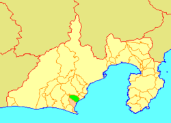 Location of Haibara in Shizuoka Prefecture | |
| Coordinates: 34°45′35″N 138°13′20″E / 34.7596°N 138.2222°ECoordinates: 34°45′35″N 138°13′20″E / 34.7596°N 138.2222°E | |
| Country | Japan |
| Region | Chūbu (Tōkai) |
| Prefecture | Shizuoka Prefecture |
| District | Haibara |
| Merged |
October 11, 2005 (now part of Makinohara) |
| Area | |
| • Total | 53.36 km2 (20.60 sq mi) |
| Population (April 1, 2005) | |
| • Total | 24,989 |
| • Density | 468.3/km2 (1,213/sq mi) |
| Symbols | |
| • Tree | Osmanthus |
| • Flower | Camellia |
| Time zone | Japan Standard Time (UTC+9) |
Haibara (榛原町 Haibara-chō) was a town located in Haibara District, Shizuoka Prefecture, Japan.
As of April 1, 2005, the town had an estimated population of 24,989 and a density of 468.3 persons per km². The total area was 53.36 km².
On October 11, 2005, Haibara, along with town of Sagara (also from Haibara District), was merged to create the city of Makinohara, and thus no longer exists as an independent municipality.
This article is issued from Wikipedia - version of the 11/12/2015. The text is available under the Creative Commons Attribution/Share Alike but additional terms may apply for the media files.