Hagersville, Ontario
Hagersville is a community in Haldimand County, Ontario which gained international notoriety in 1990 for a gigantic uncontrolled tire fire which spewed toxic smoke for seventeen days. The fire itself actually occurred in Townsend, a neighbouring community, but media labelled it as Hagersville due to Townsend's relatively unknown status in the area. The so-called "Hagersville Tire Fire" has nonetheless been reportedly linked to long-term health issues, including some "rare, aggressive cancers," among area firefighters who experienced the event first-hand.[1]
Location and airports
- Hagersville is approximately 45 km southwest of Hamilton, Ontario, and 15 km southwest of Caledonia, Ontario.
- Hagersville's nearest airports are Hamilton/John C. Munro International Airport, CYHM (27 km), formerly Mount Hope Airport, and Toronto Pearson International Airport, YYZ (105 km).
Population, area, and council
- The current population of Hagersville is 2,579 (10 May 2011 census)[2]
- Hagersville comprises an area of 3.142 km/sq.
- The current mayor of Hagersville is Ken Hewitt, mayor of Haldimand County.
Notable people
- Hagersville is the birthplace of Canadian drummer, Neil Peart, of the Canadian rock group, Rush.[3]
- Hagersville is home to the Hagersville Hawks, a junior hockey team that plays in the Niagara & District Junior C Hockey League.
- Hagersville is the birthplace of Becky Kellar, b. 1 January 1975, who is a 3 time Olympian with 2 gold medals and 1 silver in Women's Hockey.
- Hagersville is the birthplace of Paul Gilbert Humber, on July 13, 1942. Rev. Dr. Charles M. Humber was pastor of the Hagersville Baptist Church at the time. Paul is the author of various publications and resides with his wife and a son in Philadelphia.
- Hagersville is the birthplace of Jay Silverheels, b. Harold John Smith, who played Tonto in the 1950s television series, The Lone Ranger.
History
Upon the construction of Highway 6, known formerly as the Plank Road, a small village popped up around 1855 when Charles and David Hager bought most of the land in the center of the area. David Almas owned the land on the east side of the road, while John Porter owned the land in the west end.
The building of the Canada Southern Railroad in 1870, and of the Hamilton and Lake Erie Railway three years later helped to make Hagersville a prosperous village in 1879.
Close by the rail crossing was The Junction Hotel, later becoming The Lawson Hotel after a change in ownership. Perhaps it was best known as Murph's Place when retired NHL player Ron Murphy took ownership. It was also known as the Hagersville Inn, but today it is known as The Old Lawson House. In 1852, Charles Hager built a frame hotel at the corner of the Plank Road and Indian Line. Hagersville's first post office was in this hotel and Joseph Seymour suggested the community be called Hagersville to honour the Hager brothers.
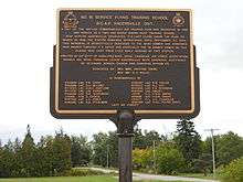
During World War II the Royal Canadian Air Force built and operated No. 16 Service Flying Training School as part of the British Commonwealth Air Training Plan [4] at 274 Concession 11 Walpole 3.5 km southwest of Hagersville. No. 16 SFTS opened on 8 August 1941 and closed on 30 March 1945. After the RCAF finished with the site it was used by the Canadian Army for various purposes and was known as Camp Hagersville. The camp was closed in 1964. [5]
In 2013 the site is an industrial park. Some of the military homes are still there, and the housing area is known as "White Oaks Village". A good view of the site and the old hangars is had from Concession 10 Walpole. The base was located at 42°55′42″N 080°07′33″W / 42.92833°N 80.12583°W .[6]
Climate
| Climate data for Hagersville | |||||||||||||
|---|---|---|---|---|---|---|---|---|---|---|---|---|---|
| Month | Jan | Feb | Mar | Apr | May | Jun | Jul | Aug | Sep | Oct | Nov | Dec | Year |
| Record high °C (°F) | 15 (59) |
18 (64) |
25.5 (77.9) |
30.5 (86.9) |
32.5 (90.5) |
35.5 (95.9) |
38.5 (101.3) |
36.5 (97.7) |
32 (90) |
28.5 (83.3) |
20 (68) |
18 (64) |
38.5 (101.3) |
| Average high °C (°F) | −0.7 (30.7) |
−0.2 (31.6) |
5.1 (41.2) |
12.1 (53.8) |
19.4 (66.9) |
24.5 (76.1) |
26.9 (80.4) |
25.5 (77.9) |
21.1 (70) |
14.4 (57.9) |
7.2 (45) |
1.2 (34.2) |
13.1 (55.6) |
| Daily mean °C (°F) | −4.4 (24.1) |
−4.1 (24.6) |
0.7 (33.3) |
7 (45) |
13.7 (56.7) |
18.8 (65.8) |
21.3 (70.3) |
20.1 (68.2) |
15.9 (60.6) |
9.8 (49.6) |
3.7 (38.7) |
−2.1 (28.2) |
8.4 (47.1) |
| Average low °C (°F) | −8 (18) |
−8 (18) |
−3.8 (25.2) |
1.8 (35.2) |
7.9 (46.2) |
13 (55) |
15.7 (60.3) |
14.6 (58.3) |
10.6 (51.1) |
5 (41) |
0.1 (32.2) |
−5.3 (22.5) |
3.6 (38.5) |
| Record low °C (°F) | −26.5 (−15.7) |
−26 (−15) |
−20 (−4) |
−11 (12) |
−2.5 (27.5) |
2 (36) |
4.5 (40.1) |
4 (39) |
−2 (28) |
−6 (21) |
−14 (7) |
−23 (−9) |
−26.5 (−15.7) |
| Average precipitation mm (inches) | 61.8 (2.433) |
48.2 (1.898) |
75.7 (2.98) |
80.6 (3.173) |
76.9 (3.028) |
84.7 (3.335) |
88.2 (3.472) |
85.8 (3.378) |
94.1 (3.705) |
83.2 (3.276) |
86.9 (3.421) |
73.9 (2.909) |
939.9 (37.004) |
| Source: Environment Canada[7] | |||||||||||||
References
- ↑ Sonnenberg, Monte (4 December 2009). "Hagersville Tire Fire Fallout". Brantford Expositor. Retrieved 1 October 2015.
- ↑ "Census Profile". 2.statcan.gc.ca. Retrieved 2015-03-10.
- ↑ "Official web site: Neil Peart". Retrieved 2007-12-10.
- ↑ Hatch, F. J. (1983). The Aerodrome of Democracy: Canada and the British Commonwealth Air Training Plan, 1939-1945. Ottawa: Directorate of History, Department of National Defence. ISBN 0660114437.
- ↑ Forsyth, Bruce (1998). "A Short History of Abandoned and Downsized Canadian Military Bases". Military Bruce Historical Writings by Bruce Forsyth. Retrieved 24 August 2013.
- ↑ Anon (2009). "Abandoned Aerodromes". Canada Flight Supplement Effective 0901Z 12 MArch 2009 To 0901Z 7 May 2009. Ottawa: Nav Canada. p. A35.
- ↑ Environment Canada Canadian Climate Normals 1971–2000, accessed 30 April 2010
External links
| Wikisource has the text of the 1905 New International Encyclopedia article Hagersville. |
- Hagersville Tire Fire
- CBC Archives: The Hagersville Tire Fire
- The Royal Canadian Legion, #164 Hagersville (website unavailable 18 Dec 2012)
- Haldimand County
Coordinates: 42°57′N 80°03′W / 42.950°N 80.050°W