Killaloe, Hagarty and Richards
| Killaloe, Hagarty and Richards | |
|---|---|
| Township (lower-tier) | |
| Township of Killaloe, Hagarty and Richards | |
|
Welcome sign on Round Lake Road | |
 Killaloe, Hagarty and Richards Location of Killaloe, Hagarty and Richards in southern Ontario | |
| Coordinates: 45°36′N 77°30′W / 45.600°N 77.500°WCoordinates: 45°36′N 77°30′W / 45.600°N 77.500°W[1] | |
| Country |
|
| Province |
|
| County | Renfrew |
| Established | January 1, 2000 |
| Government | |
| • Mayor | Janice Visneskie |
| • Federal riding | Renfrew—Nipissing—Pembroke |
| • Prov. riding | Renfrew—Nipissing—Pembroke |
| Area[2] | |
| • Land | 395.98 km2 (152.89 sq mi) |
| Population (2011)[2] | |
| • Total | 2,402 |
| • Density | 6.1/km2 (16/sq mi) |
| Time zone | EST (UTC−5) |
| • Summer (DST) | EDT (UTC−4) |
| Postal code | K0J 2A0 |
| Area code(s) | 613, 343 |
| Website |
www |


A branch of the township fire department in Round Lake Centre
Killaloe, Hagarty and Richards is an incorporated township in Renfrew County in eastern Ontario, Canada,[1] created on July 1, 2000, as a result of an amalgamation of the Township of Hagarty and Richards with the Village of Killaloe.[3]
Communities
Demographics
| Canada census – Killaloe, Hagarty and Richards community profile | |||
|---|---|---|---|
| 2011 | 2006 | 2001 | |
| Population: | 2402 (-5.8% from 2006) | 2550 (2.3% from 2001) | 2492 (6.2% from 1996) |
| Land area: | 395.98 km2 (152.89 sq mi) | 395.91 km2 (152.86 sq mi) | 395.91 km2 (152.86 sq mi) |
| Population density: | 6.1/km2 (16/sq mi) | 6.4/km2 (17/sq mi) | 6.3/km2 (16/sq mi) |
| Median age: | 45.6 (M: 44.9, F: 46.2) | 42.2 (M: 41.4, F: 43.2) | |
| Total private dwellings: | 1523 | 1574 | 1572 |
| Median household income: | $37,157 | $31,233 | |
| References: 2011[4] 2006[5] 2001[6] | |||
Parks
- Bonnechere Provincial Park
- Bonnechere River Provincial Park
- Erskine Provincial Park
- Foy Provincial Park
- Sheryl Boyle Park, on Round Lake
- Station Park, in Killaloe
- Wilno Heritage Park
Lakes and rivers
- Bonnechere River
- Pine River
- Golden Lake
- Round Lake
Other features
See also
References
- 1 2 "Killaloe, Hagarty and Richards". Geographical Names Data Base. Natural Resources Canada. Retrieved 2011-08-11.
- 1 2 "Killaloe, Hagarty and Richards census profile". 2011 Census of Population. Statistics Canada. Retrieved 2012-02-13.
- ↑ Restructured municipalities - Ontario map #5 (Map). Restructuring Maps of Ontario. Ontario Ministry of Municipal Affairs and Housing. 2006. Retrieved 2011-08-11.
- ↑ "2011 Community Profiles". Canada 2011 Census. Statistics Canada. July 5, 2013. Retrieved 2012-02-13.
- ↑ "2006 Community Profiles". Canada 2006 Census. Statistics Canada. March 30, 2011. Retrieved 2012-02-13.
- ↑ "2001 Community Profiles". Canada 2001 Census. Statistics Canada. February 17, 2012. Retrieved 2012-02-13.
External links
 |
Unorganized Nipissing District (Algonquin Provincial Park) |
| ||
| Madawaska Valley | |
Laurentian Valley North Algona Wilberforce | ||
| ||||
| | ||||
| Brudenell, Lyndoch and Raglan | Bonnechere Valley |
| Cities | 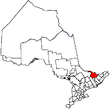 | |
|---|---|---|
| Towns | ||
| Townships | ||
| First Nations | ||
| Indian reserves | ||
| ||
This article is issued from Wikipedia - version of the 5/28/2015. The text is available under the Creative Commons Attribution/Share Alike but additional terms may apply for the media files.