Hafodyrynys
| Hafodyrynys | |
 Hafodyrynys |
|
| OS grid reference | ST2299 |
|---|---|
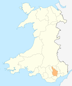
| Principal area | Caerphilly |
| Country | Wales |
| Sovereign state | United Kingdom |
| Post town | NEWPORT |
| Postcode district | NP11 |
| Dialling code | 01495 |
| Police | Gwent |
| Fire | South Wales |
| Ambulance | Welsh |
| EU Parliament | Wales |
| UK Parliament | Islwyn |
|
|
Coordinates: 51°41′02″N 3°07′07″W / 51.68376°N 3.11858°W
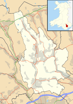
Hafodyrynys is a village on the A472 road between Pontypool and Crumlin in Caerphilly county borough, south-east Wales. It lies within the historic boundaries of Monmouthshire.
The village is served by an inn, a takeaway, a rugby club and car wash/valet service. As of 2008 a new housing estate has been completed on the western periphery of the village.

Hafodyrynys Colliery was located east of the village. The mine was actively worked from 1914 until 1966. It was redeveloped by the NCB in the 1950s, including the creation of new drifts. However, it never fully lived up to production expectations. Today the remains of the washery are a listed building and mark the site of the mine. The mine continued to process coal from other collieries linked underground following its closure.
The mine and village were located on the Taff Vale Extension of the Newport, Abergavenny and Hereford Railway. This ran from Pontypool to Crumlin and beyond. The 280-yard Glyn Tunnel in the village enabled the line to avoid the highest ground as it proceeded towards the Crumlin Viaduct.
External links
- Hafodyrynys Colliery
- Hafodyrynys Colliery
- www.geograph.co.uk : photos of Hafodyrynys and surrounding area
- Hafodyrynys RFC Sports & Welfare
- Hafodyrynys Village
| Wikimedia Commons has media related to Hafodyrynys. |