Haflong
| Haflong হাফলং | |
|---|---|
| Town | |
 Haflong  Haflong | |
| Coordinates: 25°10′08″N 93°00′58″E / 25.169°N 93.016°ECoordinates: 25°10′08″N 93°00′58″E / 25.169°N 93.016°E | |
| Country |
|
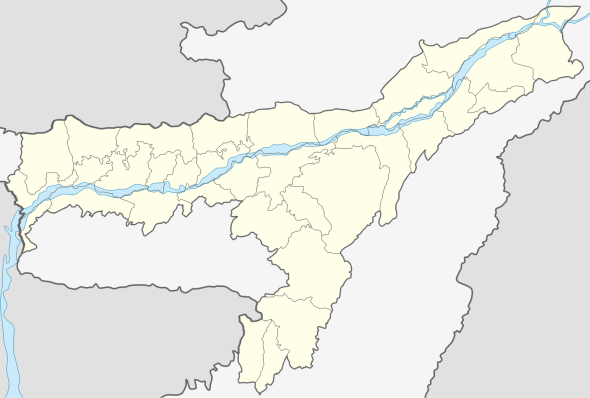
| State | Assam |
| District | Dima Hasao previous N.C.Hills |
| Government | |
| • Body | Haflong Town Committee |
| Area | |
| • Total | 12.79 km2 (4.94 sq mi) |
| Elevation | 966.216 m (3,170.000 ft) |
| Population (2012) | |
| • Total | 43,756 |
| • Density | 3,400/km2 (8,900/sq mi) |
| Languages | |
| • Official | Haflong Hindi language |
| Time zone | IST (UTC+5:30) |
| PIN | 788819 |
| Telephone code | 03673 |
| ISO 3166 code | IN-AS |
| Vehicle registration | AS |
Haflong (Bengali: হাফলং) is a town and headquarters of Dima Hasao in India in the state of Assam. It is the only hill station in Assam.[1]
Geography
Haflong is located at Coord |25.18|N|9E. It has an average elevation of 966.216 metres (3170 feet).
Climate
Haflong has a humid subtropical climate (Köppen climate classification Cwa), falling just short of a tropical savanna climate (Köppen climate classification Aw).
| Climate data for Haflong | |||||||||||||
|---|---|---|---|---|---|---|---|---|---|---|---|---|---|
| Month | Jan | Feb | Mar | Apr | May | Jun | Jul | Aug | Sep | Oct | Nov | Dec | Year |
| Record high °C (°F) | 28.8 (83.8) |
25.2 (77.4) |
28.4 (83.1) |
29.0 (84.2) |
20.0 (68) |
28.3 (82.9) |
26.5 (79.7) |
28.2 (82.8) |
25.8 (78.4) |
24.3 (75.7) |
26.0 (78.8) |
18.1 (64.6) |
29 (84.2) |
| Average high °C (°F) | 19.6 (67.3) |
20.2 (68.4) |
21.0 (69.8) |
22.2 (72) |
22.2 (72) |
25.7 (78.3) |
24.9 (76.8) |
23.2 (73.8) |
22.7 (72.9) |
22.3 (72.1) |
21.6 (70.9) |
20.7 (69.3) |
22.19 (71.97) |
| Average low °C (°F) | 8.3 (46.9) |
12.0 (53.6) |
15.9 (60.6) |
20.0 (68) |
22.7 (72.9) |
20.9 (69.6) |
20.6 (69.1) |
20.6 (69.1) |
21.7 (71.1) |
21.9 (71.4) |
16.7 (62.1) |
11.8 (53.2) |
17.76 (63.97) |
| Record low °C (°F) | 3.7 (38.7) |
4.1 (39.4) |
6.3 (43.3) |
12.0 (53.6) |
13.2 (55.8) |
15.4 (59.7) |
18.4 (65.1) |
18.1 (64.6) |
15.7 (60.3) |
10.6 (51.1) |
8.3 (46.9) |
5.0 (41) |
3.7 (38.7) |
| Average rainfall mm (inches) | 11.9 (0.469) |
18.3 (0.72) |
55.8 (2.197) |
147.9 (5.823) |
244.2 (9.614) |
316.4 (12.457) |
345.4 (13.598) |
264.3 (10.406) |
185.9 (7.319) |
91.2 (3.591) |
18.7 (0.736) |
7.1 (0.28) |
0 (0) |
| Average rainy days | 1.8 | 2.9 | 5.8 | 13.1 | 17.0 | 19.6 | 22.3 | 18.5 | 15.2 | 7.4 | 2.8 | 1.3 | 127.7 |
| Average relative humidity (%) | 69 | 55 | 47 | 48 | 55 | 51 | 53 | 52 | 53 | 52 | 52 | 52 | 53.3 |
| Mean monthly sunshine hours | 106.3 | 174.7 | 180.1 | 181.0 | 152.2 | 102.0 | 104.0 | 121.2 | 98.0 | 104.6 | 131.0 | 132.5 | 1,587.6 |
| Source #1: World Meteorological Organization.[2] NOAA (extremes & humidity, 1971–1990)[3] | |||||||||||||
| Source #2: Hong Kong Observatory.[4] | |||||||||||||
The lowest temperature ever recorded was 2.4°C on January 7, 1980.
Demographics
Population
As of 2012 the India census, Haflong had a population of 43,756. Males constitute 45% of the population and females 55%. Haflong has an average literacy rate of 92%, higher than the national average of 59.5%: male literacy is 85%, and female literacy is 75%. In Haflong, 12% of the population is under 6 years of age. The population of the Town comprises various tribes & races who maintain their own dialect, culture, customs & usages. Apart from various tribes (Oriental Indians), non-tribals also account for a sizable amount of the population. They are mostly government employees, traders living in urban & semi-urban area. The small and serene Town shelter the lovely people – warm and fascinating – and as colourful as the land itself. It is also the home of various tribes: Dimasa, Nagas, Hmar, Kukis, Mizo, Bengali, Assamese, Gorkha, Biate and Hrangkhol.
Languages
Commonly spoken languages are Haflong Hindi, Dimasa, Hmar, Zeme Naga, Kuki, Khasi, Biate, Bengali, Assamese, Nepali and Hrankhol.
Transportation
Though there is no direct Air connection to Haflong, one can fly to Guwahati or Silchar or Dimapur from where easy road or rail options are available. New Haflong railway station of Lumding-Badarpur section provides the rail connectivity in Haflong with Guwahati and Silchar.
Education
Some prominent educational institutions of Haflong are:
Schools
- Haflong Government Boys Higher Secondary School
- Government Girls Higher Secondary School
- Jawahar navodaya vidyalaya,haflong
- Kendriya Vidyalaya, Haflong
- Saraswati Vidya Mandir, Bodo Haflong
- Vivekananda Vidyalaya (VHP)
- Don Bosco High School, Haflong
- Narzareth High School
- PMS High School
- Covenant High School
- Sengya Sambudhan High School
- St. Agnes' Convent High School
- CHT Synod Higher Secondary School
Colleges
- Haflong Government College
Tourism Attractions
Haflong is a hilly town surrounded by lots of natural beauties like fluent water streams, lush green hills and bounty waterfalls. Main attractions are:
- Ethnic Villages
- Statue of Rani Maa Gaidinliue
- Fiangpui Garden
- Haflong Lake
- Hill view from circuit house,etc.
- Hill view from Moulpong
- Jatinga Bird Observatory
- Jorai
- Haflong Gallery view of Muolhoi Ville
Politics
Haflong is part of Autonomous District (Lok Sabha constituency). It is the headquarters of Dima Hasao Autonomous District.
References
- ↑ Haflong - Assam's Hill Station, India-north-east.com
- ↑ World Weather Information Service-Guwahati, World Meteorological Organization. Retrieved 24 July 2012.
- ↑ "Haflong Climate Normals 1971-1990". National Oceanic and Atmospheric Administration. Retrieved December 22, 2012.
- ↑ Climatological Information for Haflong, India, Hong Kong Observatory. Retrieved 24 July 2013.
External links
| Wikivoyage has a travel guide for Dima Hasao. |