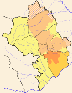
Hadrut Region
| Hadrut Հադրութ | |
|---|---|
| Province | |
 | |
| Capital | Hadrut |
| Government | |
| • Governor | Valery Gevorkian |
| Area | |
| • Total | 1,877 km2 (725 sq mi) |
| Area rank | Ranked 2nd |
| Population (2013)[1] | |
| • Total | 13,163 |
| • Rank | Ranked 5th |
| • Density | 7.0/km2 (18/sq mi) |
| Website | Hadrut Province |

Hadrut (Հադրութ in Armenian) is a province of Nagorno-Karabakh Republic. It forms the southern border of Nagorno-Karabakh, and one of the most mountainous parts. Villages are primarily found along two river valleys and scattered in lower elevations on the very southern fringe. Excavations of the Azokh Cave show that humans have inhabited this area for tens of thousands of years, and the region has a rich history.
Hadrut province has 30 communities of which 1 is considered urban and 29 are rural. The most important problems are drinking and irrigation water, and internal communication roads. Some villages are lacking a telephone network and some have difficulties with watching Armenian TV channels. More than 340 people of Hadrut Region fell victims during the Nagorno-Karabakh war. Nearly 30% of its area has been ruined and burnt several times.[2]
Sites of interest
- Town of Hadrut
- Monastery of Spitak Khatch (Սպիտակ Խաչ; White Cross), 14th century
- The G'Tichavank monastery (Գտիչի վանք), 1241–1248
- Anapat church (Անապատ եկեղեցի), 13th century, near the village of Togh (Տող)
- Khodaafarin Bridges
See also
References
External links
| Capital city | ||
|---|---|---|
| Regions | ||
| Provincial capitals | ||
| Other urban communities | ||
1 Claimed by the Nagorno-Karabakh Republic but partly under Azerbaijani control. | ||
Coordinates: 39°31′00″N 47°01′48″E / 39.5167°N 47.0300°E