Haddow, Edmonton
| Haddow | |
|---|---|
| Neighbourhood | |
|
Haddow Location of Haddow in Edmonton | |
| Coordinates: 53°27′18″N 113°35′53″W / 53.455°N 113.598°W | |
| Country |
|
| Province |
|
| City | Edmonton |
| Quadrant[1] | NW |
| Ward[1] | 9 |
| Sector[2] | Southwest |
| Area[3][4] | Terwillegar Heights |
| Government[5] | |
| • Administrative body | Edmonton City Council |
| • Councillor | Bryan Anderson |
| Area[6] | |
| • Total | 1.28 km2 (0.49 sq mi) |
| Elevation | 684 m (2,244 ft) |
| Population (2012)[7] | |
| • Total | 4,342 |
| • Density | 3,392.2/km2 (8,786/sq mi) |
| • Change (2009–12) |
|
| • Dwellings | 1,590 |
Haddow is a triangle shaped residential neighbourhood in south west Edmonton, Alberta, Canada. It is bounded on the south west by Anthony Henday Drive and on the south east by Terwillegar Drive. The northern boundary is an undeveloped strip of land about 29 Avenue.
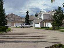
The neighbourhood is a newer neighbourhood with all residential construction being completed after 1995.[8] The most common type of housing is the single family home (78%), followed by apartment style condominiums in high rise buildings with five or more stories (11%). Duplexes[9] make up 6% of the residences and row houses the remaining 4%.[10] All residences are owner occupied.[11]
Demographics
In the City of Edmonton's 2012 municipal census, Haddow had a population of 4,342 living in 1,590 dwellings,[7] a 1.9% change from its 2009 population of 4,261.[12] With a land area of 1.28 km2 (0.49 sq mi), it had a population density of 3,392.2 people/km2 in 2012.[6][7]
Recreation
Haddow Park is located near the centre of the neighbourhood. The parke features perimeter and bisecting asphalt walking trails, a playground, sports fields, toboggan hill, and (in the winter months) an ice rink. Haddow Park is a designated on-leash area for dogs.[13]
Trails located at the north-western boundary of Haddow provide access to the North Saskatchewan River valley and Terwillegar Park.
Surrounding neighbourhoods
Surrounding neighbourhoods are Henderson Estates and Falconer Heights to the north, Carter Crest to the north east, Leger and Terwillegar Towne to the east, and Terwillegar South to the south east. Beyond Anthony Henday Drive are the neighbourhoods of Ambleside and Windermere Estates
 |
Henderson Estates | Falconer Heights | Carter Crest | |
| North Saskatchewan River | |
Terwillegar Towne | ||
| ||||
| | ||||
| Anthony Henday Drive | Anthony Henday Drive, Windermere Estates | Anthony Henday Drive, Ambleside |
References
- 1 2 "City of Edmonton Wards & Standard Neighbourhoods" (PDF). City of Edmonton. Retrieved February 13, 2013.
- ↑ "Edmonton Developing and Planned Neighbourhoods, 2011" (PDF). City of Edmonton. Retrieved February 13, 2013.
- ↑ "The Way We Grow: Municipal Development Plan Bylaw 15100" (PDF). City of Edmonton. 2010-05-26. Retrieved February 13, 2013.
- ↑ "City of Edmonton Plans in Effect" (PDF). City of Edmonton. November 2011. Retrieved February 13, 2013.
- ↑ "City Councillors". City of Edmonton. Retrieved February 13, 2013.
- 1 2 "Neighbourhoods (data plus kml file)". City of Edmonton. Retrieved February 13, 2013.
- 1 2 3 "Municipal Census Results – Edmonton 2012 Census". City of Edmonton. Retrieved February 22, 2013.
- ↑ http://censusdocs.edmonton.ca/DD23/FEDERAL%202001/Neighbourhood/HADDOW.pdf
- ↑ Includes triplexes and quadruplexes
- ↑ http://censusdocs.edmonton.ca/C05002/MUNICIPAL%202005/Neighbourhood/HADDOW.pdf
- ↑ http://censusdocs.edmonton.ca/DD22/FEDERAL%202001/Neighbourhood/HADDOW.pdf
- ↑ "2009 Municipal Census Results". City of Edmonton. Retrieved February 22, 2013.
- ↑ City of Edmonton - City of Edmonton