Haddon Heights, New Jersey
| Haddon Heights, New Jersey | |
|---|---|
| Borough | |
| Borough of Haddon Heights | |
|
Hinchman-Lippincott House | |
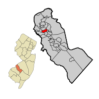 Haddon Heights highlighted in Camden County. Inset: Location of Camden County in the State of New Jersey. | |
 Census Bureau map of Haddon Heights, New Jersey | |
| Coordinates: 39°52′45″N 75°03′57″W / 39.879127°N 75.065918°WCoordinates: 39°52′45″N 75°03′57″W / 39.879127°N 75.065918°W[1][2] | |
| Country |
|
| State |
|
| County | Camden |
| Founded | 1699 |
| Incorporated | March 2, 1904 |
| Named for | Elizabeth Haddon |
| Government[3] | |
| • Type | Borough |
| • Body | Borough Council |
| • Mayor | Jack D. Merryfield Jr. (R, term ends December 31, 2019)[4][5] |
| • Clerk | Kelly Santosusso[6] |
| Area[1] | |
| • Total | 1.574 sq mi (4.076 km2) |
| • Land | 1.569 sq mi (4.063 km2) |
| • Water | 0.005 sq mi (0.014 km2) 0.33% |
| Area rank |
444th of 566 in state 22nd of 37 in county[1] |
| Elevation[7] | 59 ft (18 m) |
| Population (2010 Census)[8][9][10] | |
| • Total | 7,473 |
| • Estimate (2015)[11] | 7,514 |
| • Rank |
306th of 566 in state 18th of 37 in county[12] |
| • Density | 4,764.1/sq mi (1,839.4/km2) |
| • Density rank |
116th of 566 in state 11th of 37 in county[12] |
| Time zone | Eastern (EST) (UTC-5) |
| • Summer (DST) | Eastern (EDT) (UTC-4) |
| ZIP code | 08035[13][14] |
| Area code(s) | 856[15] |
| FIPS code | 3400728800[1][16][17] |
| GNIS feature ID | 0885239[1][18] |
| Website |
www |

Haddon Heights is a borough in Camden County, New Jersey, United States. As of the 2010 United States Census, the borough's population was 7,473,[8][9][10] reflecting a decline of 74 (-1.0%) from the 7,547 counted in the 2000 Census, which had in turn declined by 313 (-4.0%) from the 7,860 counted in the 1990 Census.[19]
Haddon Heights was incorporated as a borough by an act of the New Jersey Legislature on March 2, 1904, from portions of the now-defunct Centre Township and parts of Haddon Township.[20] Haddon Heights is a dry town where alcohol cannot be sold.[21][22] The borough was named for Elizabeth Haddon, an early settler of the area.[23]
New Jersey Monthly magazine ranked Haddon Heights as the 98th best place to live in New Jersey in its 2008 rankings of the "Best Places To Live" in New Jersey,[24] and the borough has also been listed among its "Classic Towns of Greater Philadelphia" by the Delaware Valley Regional Planning Commission.[25] In 2011, New Jersey Monthly named Haddon Heights the second best town to live in Southern New Jersey, after Moorestown Township.[26]
History
The land that was to become Haddon Heights was settled in 1699 by John Hinchman. In 1713, John Siddon built a farmhouse near Hinchman's property. John Thorn Glover dammed King's Run and constructed a mill race and fulling mill on this property before 1776. Jacob Hinchman built a frame dwelling no later than 1720 that was later enlarged by American Revolutionary War hero Col. Joseph Ellis. New Jersey governor Joseph Bloomfield later purchased this property.
In 1890, Benjamin A. Lippincott constructed a passenger station in the center of his land for the Atlantic City Railroad. Then Lippincott, with Charles Hillman, filed a grid street plan with Camden County to develop a community. They named it Haddon Heights because of its proximity to Haddonfield and its high elevation. Large houses were constructed that appealed to prosperous middle-class families moving from the cities. In 1904, Haddon Heights was incorporated as a borough and Lippincott was elected mayor. A small downtown grew near the railroad and the White Horse Pike and eight churches and a synagogue were built. An area of old Centre Township, known as Fairfield Estates, voted in 1926 to become part of Haddon Heights. This land was developed for more single-family housing through the 1940s and 1950s. Even though rail passenger service ceased in July 1965, Haddon Heights remains a typical turn-of-the-twentieth-century railroad suburb with tree-shaded streets and comfortable homes.
Geography
According to the United States Census Bureau, the borough had a total area of 1.574 square miles (4.076 km2), including 1.569 square miles (4.063 km2) of land and 0.005 square miles (0.014 km2) of water (0.33%).[1][2]
The borough borders Audubon, Mount Ephraim, Barrington, Bellmawr, and Haddonfield.
Demographics
| Historical population | |||
|---|---|---|---|
| Census | Pop. | %± | |
| 1910 | 1,452 | — | |
| 1920 | 2,950 | 103.2% | |
| 1930 | 5,394 | 82.8% | |
| 1940 | 5,555 | 3.0% | |
| 1950 | 7,287 | 31.2% | |
| 1960 | 9,260 | 27.1% | |
| 1970 | 9,365 | 1.1% | |
| 1980 | 8,361 | −10.7% | |
| 1990 | 7,860 | −6.0% | |
| 2000 | 7,547 | −4.0% | |
| 2010 | 7,473 | −1.0% | |
| Est. 2015 | 7,514 | [11][27] | 0.5% |
| Population sources: 1910-2000[28] 1910-1920[29] 1910[30] 1910-1930[31] 1930-1990[32] 2000[33][34] 2010[8][9][10] | |||
2010 Census
At the 2010 United States Census, there were 7,473 people, 2,997 households, and 2,023 families residing in the borough. The population density was 4,764.1 per square mile (1,839.4/km2). There were 3,159 housing units at an average density of 2,013.9 per square mile (777.6/km2). The racial makeup of the borough was 95.45% (7,133) White, 1.12% (84) Black or African American, 0.16% (12) Native American, 1.31% (98) Asian, 0.07% (5) Pacific Islander, 0.54% (40) from other races, and 1.35% (101) from two or more races. Hispanics or Latinos of any race were 2.65% (198) of the population.[8]
There were 2,997 households, of which 29.4% had children under the age of 18 living with them, 55.6% were married couples living together, 8.8% had a female householder with no husband present, and 32.5% were non-families. 28.4% of all households were made up of individuals, and 13.0% had someone living alone who was 65 years of age or older. The average household size was 2.49 and the average family size was 3.10.[8]
In the borough, 22.9% of the population were under the age of 18, 6.5% from 18 to 24, 23.9% from 25 to 44, 30.7% from 45 to 64, and 16.0% who were 65 years of age or older. The median age was 42.6 years. For every 100 females there were 91.5 males. For every 100 females age 18 and over, there were 87.9 males.[8]
The Census Bureau's 2006-2010 American Community Survey showed that (in 2010 inflation-adjusted dollars) median household income was $82,663 (with a margin of error of +/- $9,335) and the median family income was $101,943 (+/- $5,362). Males had a median income of $75,785 (+/- $5,098) versus $58,912 (+/- $4,731) for females. The per capita income for the borough was $40,913 (+/- $3,618). About 0.0% of families and 1.0% of the population were below the poverty line, including 0.0% of those under age 18 and 3.3% of those age 65 or over.[35]
2000 Census
As of the 2000 United States Census[16] there were 7,547 people, 3,039 households, and 2,039 families residing in the borough. The population density was 4,855.5 people per square mile (1,879.9/km2). There were 3,136 housing units at an average density of 2,017.6 per square mile (781.2/km2). The racial makeup of the borough was 97.97% White, 0.40% African American, 0.11% Native American, 0.65% Asian, 0.04% Pacific Islander, 0.27% from other races, and 0.57% from two or more races. Hispanic or Latino of any race were 1.05% of the population.[33][34]
There were 3,039 households out of which 30.6% had children under the age of 18 living with them, 56.4% were married couples living together, 8.2% had a female householder with no husband present, and 32.9% were non-families. 28.5% of all households were made up of individuals and 14.7% had someone living alone who was 65 years of age or older. The average household size was 2.48 and the average family size was 3.09.[33][34]
In the borough the population was spread out with 24.1% under the age of 18, 5.3% from 18 to 24, 28.2% from 25 to 44, 24.2% from 45 to 64, and 18.2% who were 65 years of age or older. The median age was 41 years. For every 100 females there were 89.0 males. For every 100 females age 18 and over, there were 86.3 males.[33][34]
The median income for a household in the borough was $58,424, and the median income for a family was $73,460. Males had a median income of $51,572 versus $35,208 for females. The per capita income for the borough was $28,198. About 1.0% of families and 2.8% of the population were below the poverty line, including 1.9% of those under age 18 and 5.3% of those age 65 or over.[33][34]
Government
Local government
Haddon Heights is governed under the borough form of New Jersey municipal government. The governing body consists of a mayor and a borough council comprising six council members, with all positions elected at-large on a partisan basis as part of the November general election. A mayor is elected directly by the voters to a four-year term of office. The borough council consists of six members elected to serve three-year terms on a staggered basis, with two seats coming up for election each year in a three-year cycle.[3] The borough form of government used by Haddon Heights, the most common system used in the state, is a "weak mayor / strong council" government in which council members act as the legislative body, with the mayor presiding at meetings and voting only in the event of a tie. The mayor can veto ordinances subject to an override by a two-thirds majority vote of the council. The mayor makes committee and liaison assignments for council members, and most appointments are made by the mayor with the advice and consent of the council.[36][37]
The reorganization meeting of the governing body is held on the first Saturday in January. At this meeting, the newly elected council members take the oath of office and a council president, who serves as acting mayor when the mayor is absent, is elected by the council. Appointments for the coming year are announced by the mayor and confirmed by the council when required by law.[38]
As of 2016, the mayor of Haddon Heights is Republican Jack D. Merryfield Jr., whose term of office ends December 31, 2019. Members of the borough council are Council President Kathryn Lange (R, 2017), Stephen D. Berryhill (D, 2018), Vincent M. Ceroli (R, 2016; appointed to serve an unexpired term), Richard DiRenzo (R, 2017), Susan R. Griffith (R, 2016) and Jacquelyn E. Valvardi (R, 2018).[4][39][40][41][42]
In March 2016, the Borough Council selected Vincent Ceroli from three canddiates nominated by the Republican municipal committee to fill the seat expiring in December 2016 that had been held by Earl R. Miller Jr. until he resigned from office.[43][44]
Federal, state and county representation
Haddon Heights is located in the 1st Congressional District[45] and is part of New Jersey's 5th state legislative district.[9][46][47]
New Jersey's First Congressional District is represented by Donald Norcross (D, Camden).[48] New Jersey is represented in the United States Senate by Cory Booker (D, Newark, term ends 2021)[49] and Bob Menendez (D, Paramus, 2019).[50][51]
For the 2016–2017 session (Senate, General Assembly), the 5th Legislative District of the New Jersey Legislature is represented in the State Senate by Nilsa Cruz-Perez (D, Barrington) and in the General Assembly by Arthur Barclay (D, Camden) and Patricia Egan Jones (D, Barrington).[52] The Governor of New Jersey is Chris Christie (R, Mendham Township).[53] The Lieutenant Governor of New Jersey is Kim Guadagno (R, Monmouth Beach).[54]
Camden County is governed by a Board of Chosen Freeholders, whose seven members chosen at-large in partisan elections to three-year terms office on a staggered basis, with either two or three seats coming up for election each year.[55] As of 2015, Camden County's Freeholders are Freeholder Director Louis Cappelli, Jr. (Collingswood, term as freeholder ends December 31, 2017; term as director ends 2015),[56] Freeholder Deputy Director Edward T. McDonnell (Pennsauken Township, term as freeholder ends 2016; term as deputy director ends 2015),[57] Michelle Gentek (Gloucester Township, 2015),[58] Ian K. Leonard (Camden, 2015),[59] Jeffrey L. Nash (Cherry Hill, 2015),[60] Carmen Rodriguez (Merchantville, 2016)[61] and Jonathan L. Young, Sr. (Berlin Township, November 2015; serving the unexpired term of Scot McCray ending in 2017)[62][63][64]
Camden County's constitutional officers, all elected directly by voters, are County clerk Joseph Ripa,[65] Sheriff Charles H. Billingham,[66] and Surrogate Patricia Egan Jones.[64][67] The Camden County Prosecutor Mary Eva Colalillo was appointed by the Governor of New Jersey with the advice and consent of the New Jersey Senate (the upper house of the New Jersey Legislature).[68]
Politics
As of March 23, 2011, there were a total of 5,754 registered voters in Haddon Heights, of which 2,137 (37.1%) were registered as Democrats, 1,310 (22.8%) were registered as Republicans and 2,300 (40.0%) were registered as Unaffiliated. There were 7 voters registered to other parties.[69]
In the 2012 presidential election, Democrat Barack Obama received 54.8% of the vote (2,352 cast), ahead of Republican Mitt Romney with 44.0% (1,891 votes), and other candidates with 1.2% (51 votes), among the 4,326 ballots cast by the borough's 6,019 registered voters (32 ballots were spoiled), for a turnout of 71.9%.[70][71] In the 2008 presidential election, Democrat Barack Obama received 55.8% of the vote (2,548 cast), ahead of Republican John McCain, who received around 41.4% (1,893 votes), with 4,568 ballots cast among the borough's 5,586 registered voters, for a turnout of 81.8%.[72] In the 2004 presidential election, Democrat John Kerry received 53.2% of the vote (2,411 ballots cast), outpolling Republican George W. Bush, who received around 45.1% (2,045 votes), with 4,534 ballots cast among the borough's 5,562 registered voters, for a turnout percentage of 81.5.[73]
In the 2013 gubernatorial election, Republican Chris Christie received 65.2% of the vote (1,821 cast), ahead of Democrat Barbara Buono with 33.2% (928 votes), and other candidates with 1.5% (43 votes), among the 2,859 ballots cast by the borough's 6,010 registered voters (67 ballots were spoiled), for a turnout of 47.6%.[74][75] In the 2009 gubernatorial election, Republican Chris Christie received 47.4% of the vote (1,450 ballots cast), ahead of both Democrat Jon Corzine with 43.7% (1,338 votes) and Independent Chris Daggett with 6.4% (195 votes), with 3,059 ballots cast among the borough's 5,680 registered voters, yielding a 53.9% turnout.[76]
Education
The Haddon Heights School District serves public school students in Kindergarten through twelfth grade. As of the 2011-12 school year, the district's four schools had an enrollment of 1,334 students and 117.0 classroom teachers (on an FTE basis), for a student–teacher ratio of 11.40:1.[77] Schools in the district (with 2011-12 enrollment data from the National Center for Education Statistics[78]) are three elementary schools — Atlantic Avenue Elementary School[79] (166 students; grades K-6), Glenview Elementary School[80] (211; PreK-6) and Seventh Avenue Elementary School[81] (133; K-6) — and Haddon Heights High School[82] for grades 7-12 (824).[83] The districts' high school also serves students from the neighboring communities of Barrington and Lawnside who attend the high school as part of sending/receiving relationships.[84][85]
St. Rose of Lima School, founded in 1921, is a K-8 elementary school that operates under the auspices of the Roman Catholic Diocese of Camden.[86][87]
Baptist Regional School is a private, co-educational K-12 college-preparatory school governed by a board of directors in association with Haddon Heights Baptist Church (GARBC). The school offers an integrated curriculum with a conservative Christian worldview.[88]
Transportation
Roads and highways
As of May 2010, the borough had a total of 30.82 miles (49.60 km) of roadways, of which 22.06 miles (35.50 km) were maintained by the municipality, 6.52 miles (10.49 km) by Camden County and 2.24 miles (3.60 km) by the New Jersey Department of Transportation.[89]
Interstate 295 follows the southern border of the borough, while Route 168 straddles the western border and Route 41 follows the eastern border.
Public transportation
NJ Transit local bus service between the borough and Philadelphia is provided on the 400 and 403 routes, with local service available on the 455 and 457 routes.[90][91]
Commuter train service to Philadelphia is available using the PATCO Speedline. The closest stops are Westmont and Haddonfield.
Notable people
People who were born in, residents of, or otherwise closely associated with Haddon Heights include:
- Camille Andrews (born 1959), politician.[92]
- Rob Andrews (born 1957), Congressman.[93]
- Andrew Bailey (born 1984), Major League Baseball player, two time MLB All-Star, and 2009 AL Rookie of the Year for the Oakland Athletics.[94]
- Edward Clyde Benfold (1931-1952), United States Navy Hospital Corpsman Third Class who was killed in action and posthumously awarded the Medal of Honor.[95]
- Matt Brady (born 1965), Division I college basketball head coach at James Madison University.[96]
- DyAnne DiSalvo, illustrator.[97]
- Erin Donohue (born 1983), middle distance runner who competed at the 2008 Summer Olympics.[98]
- Patrick T. Harker (born 1958),President of the Philadelphia Federal Reserve, former President of the University of Delaware.[99]
- Steve Israel (born 1969), former NFL cornerback who played for the Los Angeles Rams, San Francisco 49ers, New England Patriots, New Orleans Saints and the Carolina Panthers.[100]
- Herb Kelleher (born 1931), founder/Chairman and former CEO of Southwest Airlines.[101]
- Billy Lange (born 1972), head men's basketball coach at the United States Naval Academy started his coaching career at Bishop Eustace Preparatory School in 1995-96.[102]
- Willie Mosconi (1913–1993), billiards world champion.[103]
- Blaine Neal (born 1978), Major League Baseball player and Olympic bronze medalist 2008.[104]
- Steven Spielberg (born 1946), film director and producer.[105]
- Eric Stokes (1930–1999), composer at the University of Minnesota.[106]
References
- 1 2 3 4 5 6 2010 Census Gazetteer Files: New Jersey County Subdivisions, United States Census Bureau. Accessed May 21, 2015.
- 1 2 US Gazetteer files: 2010, 2000, and 1990, United States Census Bureau. Accessed September 4, 2014.
- 1 2 2012 New Jersey Legislative District Data Book, Rutgers University Edward J. Bloustein School of Planning and Public Policy, March 2013, p. 28.
- 1 2 Mayor and Council, Borough of Haddon Heights. Accessed June 26, 2016.
- ↑ 2016 New Jersey Mayors Directory, New Jersey Department of Community Affairs. Accessed June 14, 2016.
- ↑ Borough Clerk, Borough of Haddon heights. Accessed June 25, 2016.
- ↑ U.S. Geological Survey Geographic Names Information System: Borough of Haddon Heights, Geographic Names Information System. Accessed March 5, 2013.
- 1 2 3 4 5 6 DP-1 - Profile of General Population and Housing Characteristics: 2010 for Haddon Heights borough, Camden County, New Jersey, United States Census Bureau. Accessed October 5, 2012.
- 1 2 3 4 Municipalities Grouped by 2011-2020 Legislative Districts, New Jersey Department of State, p. 3. Accessed January 6, 2013.
- 1 2 3 Profile of General Demographic Characteristics: 2010 for Haddon Heights borough, New Jersey Department of Labor and Workforce Development. Accessed October 5, 2012.
- 1 2 PEPANNRES - Annual Estimates of the Resident Population: April 1, 2010 to July 1, 2015 - 2015 Population Estimates for New Jersey municipalities, United States Census Bureau. Accessed May 22, 2016.
- 1 2 GCT-PH1 Population, Housing Units, Area, and Density: 2010 - State -- County Subdivision from the 2010 Census Summary File 1 for New Jersey, United States Census Bureau. Accessed October 5, 2012.
- ↑ Look Up a ZIP Code for Haddon Heights, NJ, United States Postal Service. Accessed January 2, 2012.
- ↑ Zip Codes, State of New Jersey. Accessed August 28, 2013.
- ↑ Area Code Lookup - NPA NXX for Haddon Heights, NJ, Area-Codes.com. Accessed October 14, 2013.
- 1 2 American FactFinder, United States Census Bureau. Accessed September 4, 2014.
- ↑ A Cure for the Common Codes: New Jersey, Missouri Census Data Center. Accessed July 30, 2012.
- ↑ US Board on Geographic Names, United States Geological Survey. Accessed September 4, 2014.
- ↑ Table 7. Population for the Counties and Municipalities in New Jersey: 1990, 2000 and 2010, New Jersey Department of Labor and Workforce Development, February 2011. Accessed July 30, 2012.
- ↑ Snyder, John P. The Story of New Jersey's Civil Boundaries: 1606-1968, Bureau of Geology and Topography; Trenton, New Jersey; 1969. p. 107. Accessed July 30, 2012.
- ↑ New Jersey Division of Alcoholic Beverage Control. New Jersey ABC list of dry towns (May 1, 2013)
- ↑ Giordano, Rita. "More towns catching liquor-license buzz; Moorestown considers ending its dry spell", The Philadelphia Inquirer, June 24, 2007. Accessed February 16, 2014.
- ↑ Hutchinson, Viola L. The Origin of New Jersey Place Names, New Jersey Public Library Commission, May 1945. Accessed August 31, 2015.
- ↑ Staff. "Best Places To Live - The Complete Top Towns List 1-100", New Jersey Monthly, February 21, 2008. Accessed May 11, 2009.
- ↑ Haddon Heights has it all., Delaware Valley Regional Planning Commission. Accessed July 30, 2012.
- ↑ Staff. "Top Towns by Region; A list of the top towns by region. Ho-Ho-Kus, Peapack-Gladstone, and Chesterfield lead the way in the north, central, and south parts of the state.", New Jersey Monthly, August 15, 2011. Accessed July 30, 2012. "South: Overall Rank / Municipality - 68 Moorestown; 99 Haddon Heights"
- ↑ Census Estimates for New Jersey April 1, 2010 to July 1, 2015, United States Census Bureau. Accessed May 22, 2016.
- ↑ Barnett, Bob. Population Data for Camden County Municipalities, 1850 - 2000, WestJersey.org, January 6, 2011. Accessed October 5, 2012.
- ↑ Compendium of censuses 1726-1905: together with the tabulated returns of 1905, New Jersey Department of State, 1906. Accessed October 14, 2013.
- ↑ Thirteenth Census of the United States, 1910: Population by Counties and Minor Civil Divisions, 1910, 1900, 1890, United States Census Bureau, p. 336. Accessed October 5, 2012.
- ↑ Fifteenth Census of the United States : 1930 - Population Volume I, United States Census Bureau, p. 714. Accessed January 2, 2012.
- ↑ New Jersey Resident Population by Municipality: 1930 - 1990, Workforce New Jersey Public Information Network. Accessed June 28, 2015.
- 1 2 3 4 5 Census 2000 Profiles of Demographic / Social / Economic / Housing Characteristics for Haddon Heights borough, New Jersey, United States Census Bureau. Accessed October 5, 2012.
- 1 2 3 4 5 DP-1: Profile of General Demographic Characteristics: 2000 - Census 2000 Summary File 1 (SF 1) 100-Percent Data for Haddon Heights borough, Camden County, New Jersey, United States Census Bureau. Accessed October 5, 2012.
- ↑ DP03: Selected Economic Characteristics from the 2006-2010 American Community Survey 5-Year Estimates for Haddon Heights borough, Camden County, New Jersey, United States Census Bureau. Accessed January 2, 2012.
- ↑ Cerra, Michael F. "Forms of Government: Everything You've Always Wanted to Know, But Were Afraid to Ask", New Jersey State League of Municipalities. Accessed November 30, 2014.
- ↑ "Forms of Municipal Government in New Jersey", p. 6. Rutgers University Center for Government Studies. Accessed June 3, 2015.
- ↑ Haddon Heights Borough Government, Borough of Haddon Heights. Accessed April 4, 2006.
- ↑ 2016 Municipal Data Sheet, Borough of Haddon Heights. Accessed June 26, 2016.
- ↑ Official Election Results 2015 General Election November 3, 2015, Camden County, New Jersey, November 19, 2015. Accessed June 23, 2016.
- ↑ Official Election Results 2014 General Election November 4, 2014, Camden County, New Jersey, November 13, 2015. Accessed February 11, 2015.
- ↑ Official Election Results 2013 General Election November 5, 2013, Camden County, New Jersey, November 14, 2013. Accessed June 23, 2016.
- ↑ Tuesday, March 1, 2016 Governing Body Meeting Minutes, Haddon Heights. Accessed June 26, 2016. "Resolution 2016:73 – Resolution Filling Vacancy on Council: Councilwoman Griffith made a motion to nominate Vincent Ceroli to fill the vacancy on Council, Councilwoman Valvardi seconded the motion. A motion to adopt Resolution 2016:73 was made by Councilwoman Griffith, seconded by Councilwoman Valvardi. Under a roll call vote, all members voted in favor with the exception of Councilman DiRenzo who abstained."
- ↑ Tuesday, February 16, 2016 Governing Body Meeting Minutes, Haddon Heights. Accessed June 26, 2016. "Albert Olizi said that the Republican Municipal Committee is required to submit three names for Council's consideration to fill the vacancy on Council created with the resignation of Councilman Miller."
- ↑ Plan Components Report, New Jersey Redistricting Commission, December 23, 2011. Accessed January 6, 2013.
- ↑ 2016 New Jersey Citizen's Guide to Government, p. 58, New Jersey League of Women Voters. Accessed July 20, 2016.
- ↑ Districts by Number for 2011-2020, New Jersey Legislature. Accessed January 6, 2013.
- ↑ Directory of Representatives: New Jersey, United States House of Representatives. Accessed January 5, 2012.
- ↑ About Cory Booker, United States Senate. Accessed January 26, 2015. "He now owns a home and lives in Newark's Central Ward community."
- ↑ Biography of Bob Menendez, United States Senate, January 26, 2015. "He currently lives in Paramus and has two children, Alicia and Robert."
- ↑ Senators of the 114th Congress from New Jersey. United States Senate. Accessed January 26, 2015. "Booker, Cory A. - (D - NJ) Class II; Menendez, Robert - (D - NJ) Class I"
- ↑ Legislative Roster 2016-2017 Session, New Jersey Legislature. Accessed January 17, 2016.
- ↑ "About the Governor". State of New Jersey. Retrieved 2010-01-21.
- ↑ "About the Lieutenant Governor". State of New Jersey. Retrieved 2010-01-21.
- ↑ What is a Freeholder?, Camden County, New Jersey. Accessed May 12, 2015.
- ↑ Freeholder Louis Cappelli, Jr., Camden County, New Jersey. Accessed May 12, 2015.
- ↑ Freeholder Edward T. McDonnell, Camden County, New Jersey. Accessed May 12, 2015.
- ↑ Freeholder Michelle Gentek, Camden County, New Jersey. Accessed May 12, 2015.
- ↑ Freeholder Ian K. Leonard, Camden County, New Jersey. Accessed May 12, 2015.
- ↑ Freeholder Jeffrey L. Nash, Camden County, New Jersey. Accessed May 12, 2015.
- ↑ Freeholder Carmen Rodriguez, Camden County, New Jersey. Accessed May 12, 2015.
- ↑ Jonathan L. Young, Sr., Camden County, New Jersey. Accessed May 12, 2015.
- ↑ Daniels, Mark. "Carpenters union official tapped for Camden County Freeholder seat", South Jersey Times, January 22, 2015. Accessed May 12, 2015. "Democratic leaders in Camden County have nominated a construction union official from Berlin Township to fill an open seat on the board of chosen freeholders. Jonathan L. Young Sr., 45, has been nominated to replace Scot McCray, who resigned from the board in late December, citing a desire to spend more time with his family."
- 1 2 Board of Freeholders, Camden County, New Jersey. Accessed May 12, 2015.
- ↑ County Clerk, Camden County, New Jersey. Accessed May 12, 2015.
- ↑ Sheriff, Camden County, New Jersey. Accessed May 12, 2015.
- ↑ Surrogate's Office, Camden County, New Jersey. Accessed May 12, 2015.
- ↑ Prosecutor's Office, Camden County, New Jersey. Accessed May 12, 2015.
- ↑ Voter Registration Summary - Camden, New Jersey Department of State Division of Elections, March 23, 2011. Accessed October 15, 2012.
- ↑ "Presidential General Election Results - November 6, 2012 - Camden County" (PDF). New Jersey Department of Elections. March 15, 2013. Retrieved December 24, 2014.
- ↑ "Number of Registered Voters and Ballots Cast - November 6, 2012 - General Election Results - Camden County" (PDF). New Jersey Department of Elections. March 15, 2013. Retrieved December 24, 2014.
- ↑ 2008 Presidential General Election Results: Camden County, New Jersey Department of State Division of Elections, December 23, 2008. Accessed October 15, 2012.
- ↑ 2004 Presidential Election: Camden County, New Jersey Department of State Division of Elections, December 13, 2004. Accessed October 15, 2012.
- ↑ "Governor - Camden County" (PDF). New Jersey Department of Elections. January 29, 2014. Retrieved December 24, 2014.
- ↑ "Number of Registered Voters and Ballots Cast - November 5, 2013 - General Election Results - Camden County" (PDF). New Jersey Department of Elections. January 29, 2014. Retrieved December 24, 2014.
- ↑ 2009 Governor: Camden County, New Jersey Department of State Division of Elections, December 31, 2009. Accessed October 15, 2012.
- ↑ District information for Haddon Heights School District, National Center for Education Statistics. Accessed August 5, 2014.
- ↑ School Data for the Haddon Heights School District, National Center for Education Statistics. Accessed August 5, 2014.
- ↑ Atlantic Avenue Elementary School, Haddon Heights School District. Accessed October 14, 2013.
- ↑ Glenview Elementary School, Haddon Heights School District. Accessed October 14, 2013.
- ↑ Seventh Avenue Elementary School, Haddon Heights School District. Accessed October 14, 2013.
- ↑ Haddon Heights High School, Haddon Heights School District. Accessed October 14, 2013.
- ↑ New Jersey School Directory for the Haddon Heights School District, New Jersey Department of Education. Accessed October 14, 2013.
- ↑ About Our School, Haddon Heights High School. Accessed January 2, 2011. "Haddon Heights High School serves over eight hundred students from three local towns: Haddon Heights, Barrington, and Lawnside."
- ↑ Haddon Heights Public Schools 2013 Report Card Narrative. New Jersey Department of Education. Accessed June 26, 2016. "Professional development with our two sending districts, Barrington and Lawnside, continues to increase so that our students enter high school with the same educational background."
- ↑ History, Saint Rose of Lima School. Accessed October 14, 2013.
- ↑ Catholic Schools Directory, Roman Catholic Diocese of Camden. Accessed October 20, 2016.
- ↑ About, Baptist Regional School. Accessed October 14, 2013.
- ↑ Camden County Mileage by Municipality and Jurisdiction, New Jersey Department of Transportation, May 2010. Accessed July 18, 2014.
- ↑ Camden County Bus / Rail Connections, NJ Transit, backed up by the Internet Archive as of May 22, 2009. Accessed January 2, 2012.
- ↑ South Jersey Transit Guide, Cross County Connection, as of April 1, 2010. Accessed August 5, 2014.
- ↑ Margolin, Josh. "Camille Andrews: I'm running for real", NJ.com, April 8, 2008. Accessed December 13, 2014. "Andrews and her husband have two teenaged daughters and live in Haddon Heights."
- ↑ Biography of Robert E. Andrews, accessed April 29, 2007. "The Andrews family lives in Haddon Heights. He does not keep an apartment in Washington, D.C. but instead commutes each day by train to be closer to his family and constituents."
- ↑ Lawrence, Ryan. "Oakland ace Cahill silences Phillies", Daily Local News, June 25, 2011. Accessed January 2, 2011. "Oakland All-Star closer Andrew Bailey, who grew up just over the bridge in Haddon Heights, N.J., finished what Cahill started."
- ↑ PO3 Edward Clyde Benfold, Military Hall of Honor. Accessed December 13, 2014. "He grew up in Haddon Heights, NJ, and graduated from Audubon High School in Audubon, NJ."
- ↑ Staff. "Longtime Hawks aide Brady to be named Marist coach", Philadelphia Daily News, April 26, 2004. Accessed January 2, 2012. "Brady, 38, grew up in Haddon Heights, NJ, and went to Paul VI High."
- ↑ Adelson, Fred B. "ART; Children's Page Turners to Linger Over", The New York Times, January 9, 2000. Accessed November 18, 2013. "DyAnne DiSalvo-Ryan of Haddon Heights wants children to see themselves in her illustrations, which include a diverse group of ethnic types."
- ↑ Erin Donohue, USA Track & Field. Accessed December 13, 2014.
- ↑ Meet the Dean, Wharton Alumni Magazine, Spring 2000. "Harker is a resident of Haddon Heights, N.J., where he lives with his wife, Emily - a Wharton alumna whom he met at Penn - and their three children."
- ↑ Narducci, Marc. "William & Mary Football Stocks Up On Local Linemen", The Philadelphia Inquirer, September 28, 1990. Accessed December 13, 2014. "Steve Israel of Haddon Heights is a backup cornerback at the University of Pittsburgh. Israel, who has been slowed by a knee injury, has returned one punt for 27 yards and two kickoffs for 56 yards."
- ↑ Herb Kelleher on the Record, Part 1, Business Week by Mark Morrison, December 22, 2003. "In Part 1 of this edited interview, Kelleher retraces his steps from his childhood in Haddon Heights, N.J., to his move with his wife to Texas, where he gained entrepreneur Rollin King as a client, and the two drew up a plan on the proverbial napkin for an airline connecting Dallas, San Antonio, and Houston."
- ↑ Billy Lange profile, CSTV. Accessed July 17, 2007. "A native of Haddon Heights, N.J., Lange played basketball at Bishop Eustace Preparatory School for his father, Bill Lange Sr., and at Rowan College before moving into the coaching ranks in 1995."
- ↑ via Associated Press. "Willie Mosconi, 80; Was Champion Billiards Player", The Seattle Times, September 18, 1993. Accessed January 2, 2011. "HADDON HEIGHTS, N.J. - Willie Mosconi, a world champion billiards player over nearly two decades, died at his home here. He was 80. Mr. Mosconi, who lived in Haddon Heights for nearly 40 years, died Sept. 17 of a heart attack."
- ↑ Staff. "Pitching for the home team, South Philly's Mike Koplove out to make the Phils.", The Philadelphia Inquirer, February 20, 2009. Accessed January 2, 2011. "Blaine Neal, who hails from Bishop Eustace Prep and Haddon Heights, was also on that team.
- ↑ Breznican, Anthony. Spielberg's family values, USA Today, June 23, 2005. "I first became aware of the sky when my father pointed out the Perseid meteor shower to me when I was about 6 years old, living in Haddon Heights, N.J.,"
- ↑ Biography, Composers Bureau / Stokes, Eric
External links
Municipalities and communities of Camden County, New Jersey, United States | ||
|---|---|---|
| Cities | 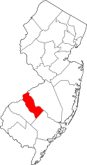 | |
| Boroughs | ||
| Townships | ||
| CDPs | ||
| Other unincorporated communities | ||