HaBesor Stream

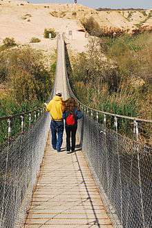
Besor (Hebrew: נחל הבשור, Nahal HaBesor) is a wadi in southern Israel. The stream begins at Mount Boker (near Sde Boker), and spills into the Mediterranean Sea near Al-Zahra in the Gaza Strip, where it is called Wadi Ghazzeh, also spelled Wadi Gaza. Further upstream it is marked as Wadi esh-Shallaleh on the 1878 Survey of Western Palestine map. There are several important archaeological sites located in this area.
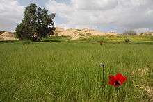
The stream is the largest in the northern Negev, and together with its largest tributaries, the Nahal Gerar, and the Beersheba stream, reaches as far east into the desert as Sde Boker, Yeruham, Dimona and Arad/Tel Arad.[1] The Gaza section of the Coastal Aquifer is the only significant source of water in the Gaza Strip.[2] The Wadi Gaza runs through a wetland, the Gaza Valley, and as of 2012 it is used as a wastewater dump.[3]
History
In the Old Testament Besor was a ravine or brook in the extreme south-west of Judah, where 200 of David's men stayed behind because they were faint, while the other 400 pursued the Amalekites (1 Samuel 30:9-10, 30:21).[1]
Between 1951 and 1954, the Yeruham Dam was built on one of the tributaries of the HaBesor Stream.
Geography
The geographical region referred to as HaBesor stretches from the Israeli border with the Gaza Strip to kibbutz Urim in the south. It is a plain at an elevation of about 70–80 m above sea level.[1]
Tributaries from south to north: HaRo'e Stream, Boker Stream, Mesora Stream, Zalzal Stream, Revivim Stream, Atadim Stream, Beersheba Stream, Grar Stream, Assaf Stream, Amar Stream, Sahaf Stream and Wadi Abu Katrun.
Archaeology
Nahal Besor has shown evidence of epipaleolithic sites above paleolithic sediments.[4] Several archaeological sites were excavated by Eann Macdonald in 1929 to 1930 along the Wadi Ghazzeh in lower Nahal Besor that show signs of specialist flint production. Some of these sites were re-excavated in 1969 by Jean Perrot.[5][6]
Finds of pottery and flints were studied by Ann Roshwalb who found evidence of both Egyptian and late Neolithic occupations.[7]
There are several important Bronze age archaeological sites in this area. Among them are fr:Tel Gamma, and Tell el-Farah (South). A smaller site of Qubur al-Walaydah is located between them.[8]
Tel Gamma
Tel Gamma (תל גמה), also known as Tell Jemmeh, is located on the west side of Nahal Besor, near Re'im. The huge site (close to 50,000 m2 in size) shows a continuous occupation from the Late Bronze Age ("Canaanite period") until the Byzantine era. The first archaeological excavations mistakenly identified it as biblical Gerar.
The site was continuously settled only between the Middle Bronze IIB (c. 1700–1550 BC) and the Persian period (c. 530–330 BC). During the Iron I (c. 1200–1000 BC) the site was part of the Philistine territory.[9]
Tel Gamma has been identified by researchers as the Canaanite city of Yurzah (ירזה), that was cited on the lists of Pharaoh Thutmose III (XV century BC), as well as in Amarna letters.[9]
Yurzah is again mentioned in an inscription of the Assyrian king Esarhaddon (seventh century) as one of the cities that rose up against the Assyrian domination and whose queen was deported to Nineveh.
The site also features Assyrian style buildings, ancient iron furnaces, a Persian period grain storage shed, and several tombs from the Byzantine period.
Tell el-Farah (South)
Tell el-Farah (South) is located on the west side of Nahal Besor, near Ein HaBesor. It was first excavated by Flinders Petrie in 1928 to 1929 and again recently excavated in 1999 and 2000 under direction of Gunnar Lehmann of Ben-Gurion University of the Negev and Tammi J. Schneider of Claremont Graduate University.[10] As of 2013, it is under excavation again.[11]
Petrie first identified the site as Beth-Pelet (Joshua 15:27) and published the excavation reports under the names Beth-Pelet I - II. It has been linked by William Foxwell Albright to the ancient settlement of Sharuhen, although Tell el-Ajjul near the estuary of Nahal Besor, and Tel Haror to the north, are also being suggested.[12]
The tell is 37 hectares (4,000,000 sq ft) in size 15 metres (49 ft) high and was an important fortified site in the Middle bronze age. The earliest major settlement that has been uncovered to date is from the Middle Bronze Age II, lasting from ca. 1650 to 1550 b.c.e.
It was controlled by Egypt in the later bronze age and inhabited by philistines into the iron age. A hematite seal in the shape of the head of a bull was found and identified by Flinders Petrie to originate from Syria, it showed a bull attacking a lion beneath a scorpion.[13]
Nahal Besor has been suggested to be the Brook of Egypt.[14][15]
Various ostracons have been recovered from around the site with Aramaic inscriptions analysed and translated by Joseph Naveh.[16]
Flooding
HaBesor Stream is subject to annual flooding following heavy rains. Some Palestinians have claimed that Israel is at fault for the flooding, due to the opening of one or more dams opened upstream,[17] and in 2015, AFP posted a video showing flooding, entitled "Gaza village floods after Israel opens dam gates."[18] Several days later, AFP published a story acknowledging that "no such dam exists in Israel that could control the flow of water into Gaza, according to a team of AFP reporters on the ground as well as interviews with Israeli and international experts."[17]
See also
References
- 1 2 3 Vilnai, Ze'ev (1976). "Besor (Stream)". Ariel Encyclopedia (in Hebrew). Volume 1. Tel Aviv, Israel: Am Oved. pp. 1065–1066.
- ↑ Integrated Water Resources Management and Security in the Middle East, p. 109. Clive Lipchin; Springer, 2007
- ↑ "Gaza's Valley of Slow Death | إعلاميون من أجل صحافة استقصائية عربية (أريج)" (in Arabic). Arij.net. Archived from the original on July 14, 2014. Retrieved 2014-07-12.
- ↑ Thomas E. Levy (1 November 1998). The archaeology of society in the Holy Land. Continuum International Publishing Group. pp. 46–. ISBN 978-0-8264-6996-0. Retrieved 2 May 2011.
- ↑
- Peregrine, Peter Neal; Ember, Melvin, eds. (2002). Encyclopedia of Prehistory. 8 : South and Southwest Asia. Springer. p. 61. ISBN 978-0-306-46262-7. Retrieved 2 May 2011.
- ↑ British School of Archaeology in Jerusalem; British Institute at Amman for Archaeology and History (1990). Levant. British School of Archaeology in Jerusalem [and] British Institute at Amman for Archaeology and History. Retrieved 2 May 2011.
- ↑ Thomas Evan Levy; David Alon (1987). Shiqmim I: Text. B.A.R. ISBN 978-0-86054-460-9. Retrieved 2 May 2011.
- ↑ Gunnar Lehmann, Steven A. Rosen, Angelika Berlejung,Bat-Ami Neumeier and Hermann M. Niemann, Excavations at Qubur al-Walaydah, 2007–2009 academia.edu
- 1 2 David Ben-Shlomo, Tell Jemmeh, Philistia and the Neo-Assyrian Empire during the Late Iron Age. Levant 2014; 46(1), 58-88 doi:10.1179/0075891413Z.00000000031
- ↑ Manfried Dietrich; Oswald Loretz (2000). Ugarit-Forschungen: Internationales Jahrbuch für die Altertumskunde Syrien-Palästinas, p. 251. Ugarit-Verlag. ISBN 978-3-927120-88-4. Retrieved 2 May 2011.
- ↑ "Tell el-Far'ah, South -- Israel Excavation Project Website". Farahsouth.cgu.edu. Retrieved 12 Jan 2016.
- ↑ Eerdmans Dictionary of the Bible. Amsterdam University Press. 31 December 2000. p. 1197. ISBN 978-90-5356-503-2. Retrieved 2 May 2011.
- ↑ Othmar Keel; Christoph Uehlinger (1998). Gods, goddesses, and images of God in ancient Israel. Continuum International Publishing Group. pp. 144–. ISBN 978-0-567-08591-7. Retrieved 2 May 2011.
- ↑ Nadav Na'aman, The Brook of Egypt and Assyrian Policy on the Egyptian Border. Tel Aviv 6 (1979), pp. 68-90
- ↑ Mario Liverani (1995). Neo-Assyrian geography, p. 111. Università di Roma, Dipartimento di scienze storiche, archeologiche e antropologiche dell'Antichità. Retrieved 2 May 2011.
- 1 2 Ward, Hazel (2015-02-27). "Gaza floods: dispelling the myth about Israeli 'dams'". Yahoo! News. AFP. Retrieved 2016-08-09.
- ↑ Berman, Lazar (2015-02-25). "False 'Israel drowns Gaza' claims sweep internet". Times of Israel. Retrieved 2016-08-09.
External links
| Wikimedia Commons has media related to Besor Stream. |
Coordinates: 31°17′13.28″N 34°29′7.12″E / 31.2870222°N 34.4853111°E