Høyanger
| Høyanger kommune | |||
|---|---|---|---|
| Municipality | |||
 | |||
| |||
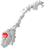
 Høyanger within Sogn og Fjordane | |||
| Coordinates: 61°11′17″N 05°53′44″E / 61.18806°N 5.89556°ECoordinates: 61°11′17″N 05°53′44″E / 61.18806°N 5.89556°E | |||
| Country | Norway | ||
| County | Sogn og Fjordane | ||
| District | Sogn | ||
| Administrative centre | Høyanger | ||
| Government | |||
| • Mayor (2011) | Petter Sortland (Ap) | ||
| Area | |||
| • Total | 907.94 km2 (350.56 sq mi) | ||
| • Land | 838.42 km2 (323.72 sq mi) | ||
| • Water | 69.52 km2 (26.84 sq mi) | ||
| Area rank | 121 in Norway | ||
| Population (2013) | |||
| • Total | 4,222 | ||
| • Rank | 229 in Norway | ||
| • Density | 5.0/km2 (13/sq mi) | ||
| • Change (10 years) | -7.8 % | ||
| Demonym(s) | Høyangring[1] | ||
| Time zone | CET (UTC+1) | ||
| • Summer (DST) | CEST (UTC+2) | ||
| ISO 3166 code | NO-1416 | ||
| Official language form | Nynorsk | ||
| Website |
www | ||
|
| |||

![]() Høyanger is a municipality in Sogn og Fjordane county, Norway. It is located in the traditional district of Sogn. The administrative center is the village of Høyanger, which has 2152 inhabitants (2012). Other villages in Høyanger municipality include Austreim, Bjordal, Kyrkjebø, Lavik, Ortnevik, and Vadheim.
Høyanger is a municipality in Sogn og Fjordane county, Norway. It is located in the traditional district of Sogn. The administrative center is the village of Høyanger, which has 2152 inhabitants (2012). Other villages in Høyanger municipality include Austreim, Bjordal, Kyrkjebø, Lavik, Ortnevik, and Vadheim.
Høyanger is known for having one of the first industrial towns in Norway to use its steep mountains surrounding the town giving excellent conditions for producing hydroelectricity needed for electrolysis. The main product being produced in the village of Høyanger was aluminium.
General information


The municipality of Høyanger was created on 1 January 1964 when the municipalities of Kyrkjebø and Lavik were merged.
Ladvig (later spelled Lavik) was established as a municipality on 1 January 1838 (see formannskapsdistrikt). The municipality was created to be identical to the Ladvig parish (prestegjeld). In 1858, the eastern district of Klævold (population: 1,645) was separated from Ladvig to constitute a municipality of its own. This left Ladvig with a population of 2,042. (The name Klævold was changed to Kirkebø on 1 July 1890, and then later changed to Kyrkjebø in 1917).
In 1861, Lavik (population: 926) was merged with Brekke municipality (population: 898), located across the Sognefjorden, to form the new municipality of Lavik og Brekke. In 1862 the sub-parish (sokn) of Bø in the western part of the municipality was removed from Lavik og Brekke and merged with the Øn and Hyllestad sub-parishes (sokn) from Askvoll Municipality to form a new municipality which was named Hyllestad. On 1 January 1875, a part of Klævold with 90 inhabitants was moved to Lavik og Brekke.
On 1 January 1905, the municipality was split into two separate municipalities (again): Lavik (population: 1,182) and Brekke (population: 982). Then on 1 January 1964, a new municipality named Høyanger was created. It consisted of the former municipalities of Lavik (population: 894) and Kyrkjebø (population: 4,742) along with the Nybø and Nygjerdet farms in Vik.[2]
Name
The name originally belonged to an arm of Sognefjorden (now called the Høyangsfjorden). The first element is høy which means "hay" and the last element is angr which means "fjord". The word høy is probably referring to the green hillsides along the fjord.[3]
Coat-of-arms
The coat of arms is from modern times—they were granted on 15 May 1987. The arms shows three silver flames on a blue background. The flames were chosen as a symbol for the local aluminium industry. Aluminium is melted and purified in the village of Høyanger, due to the cheap hydroelectric energy that is locally available. The colors represent waterpower (blue) and aluminium (silver).[4]
Churches
The Church of Norway has four parishes(sokn) within the municipality of Høyanger. It is part of the Sunnfjord deanery in the Diocese of Bjørgvin.
| Parish (Sokn) | Church Name | Location of the Church | Year Built |
|---|---|---|---|
| Bjordal og Ortnevik | Bjordal Church | Bjordal | 1906 |
| Ortnevik Church | Ortnevik | 1925 | |
| Høyanger | Høyanger Church | Høyanger | 1960 |
| Kyrkjebø | Kyrkjebø Church | Kyrkjebø | 1869 |
| Vadheim Chapel | Vadheim | 1916 | |
| Lavik | Lavik Church | Lavik | 1865 |
Government


All municipalities in Norway, including Høyanger, are responsible for primary education (through 10th grade), outpatient health services, senior citizen services, unemployment and other social services, zoning, economic development, and municipal roads. The municipality is governed by a municipal council of elected representatives, which in turn elect a mayor.
Municipal council
The municipal council (Kommunestyre) of Høyanger is made up of 21 representatives that are elected to every four years. For 2011–2015, the party breakdown is as follows:[5]
| Party Name | Name in Norwegian | Number of representatives | |
|---|---|---|---|
| Labour Party | Arbeiderpartiet | 10 | |
| Conservative Party | Høgre | 4 | |
| Christian Democratic Party | Kristelig Folkeparti | 1 | |
| Red Party | Raudt | 2 | |
| Centre Party | Senterpartiet | 4 | |
| Total number of members: | 21 | ||
Mayor
The mayor (ordførar) of a municipality in Norway is a representative of the majority party of the municipal council who is elected to lead the council. The mayor for the 2011-2015 term is Petter Sortland of the Labour Party.
Geography


Høyanger forms part of the southern border of Sogn og Fjordane county. The Sognefjorden (the largest fjord in Norway) runs through the center of the municipality. Høyanger is bordered to the north by the municipalities of Fjaler and Gaular, to the east by Balestrand and Vik, to the south by Modalen and Masfjorden (in Hordaland county), and to the west by Gulen and Hyllestad.
Høyanger municipality covers an area of about 910 square kilometres (350 sq mi). Stølsheimen Nature Reserve was created in 1990 in Høyanger. Its 367 square kilometres (142 sq mi) area stretches from high mountaintops through fertile valleys and sweeps over steep meadows down to the fjord. Høyanger is perhaps best known for its mountain farms and lakes. From the village of Ortnevik there are marked footpaths up to Stølsheimen Park and from the village of Bjordal you may drive up the Stordal road to the summit at 730 metres (2,400 ft) above sea level.
Economy
Høyanger is a modern industrial community which has grown in pace with the principal employers being Hydro Aluminium and Høyanger Metallverk. Hydroelectricity has played a major role in the development of the area. In addition to manufacturing aluminium, Høyanger supports a varied range of light industry that is backed by retail and service trades. In the rural areas bordering the fjord, farming is the main source of livelihood.[6] There are currently 115 traditional farms gårds in the municipality. Each traditional farms originally had one owner, but most of them have been divided up and sold off over the years, and so there are more than 115 farms in use today.
Transportation
There are good connections with Oslo and Bergen by bus, as well as air and fast boat services. The nearest airport is in Førde, about 50 kilometres (31 mi) away. The village of Lavik is an important junction for traffic to and from Bergen as it is a ferry port that is part of the European route E39 highway. Høyanger is reached from the neighboring municipality of Balestrand to the east by the Høyangertunnelen which is 7.5 kilometres (4.7 mi) in length. It is part of the Norwegian County Road 55. It is one of the longest tunnels in Europe. Good ferry services across the Sognefjorden link the northern and southern sides of the municipality.[6]
Attractions
In 1986, in Høyanger, Norsk Hydro Aluminium/Høyanger Metallverk opened a museum designed to show what water power has meant both locally and to Norway as a whole. Visitors will get to learn about how the aluminium industry has grown and prospered in the area thanks to the vast energy produced by water.
Near Vadheim is an 18th-century stone bridge called the Ytredal Bridge. It is a popular tourist attraction.
There is also a 600 mm (1 ft 11 5⁄8 in) narrow gauge funicular railway in the area, first opened in 1953.[7]
References
- ↑ "Navn på steder og personer: Innbyggjarnamn" (in Norwegian). Språkrådet. Retrieved 2015-12-01.
- ↑ Jukvam, Dag (1999). "Historisk oversikt over endringer i kommune- og fylkesinndelingen" (PDF) (in Norwegian). Statistics Norway.
- ↑ Rygh, Oluf (1919). Norske gaardnavne: Nordre Bergenhus amt (in Norwegian) (12 ed.). Kristiania, Norge: W. C. Fabritius & sønners bogtrikkeri. p. 180.
- ↑ "Civic heraldry of Norway - Norske Kommunevåpen". Heraldry of the World. Retrieved 2014-01-19.
- ↑ "Members of the local councils, by party/electoral lists and municipality" (in Norwegian). Statistics Norway. 2011. Retrieved 2014-01-19.
- 1 2 Høyanger Kommune (2008). "Høyanger is a modern industrial community". Retrieved 11 June 2008.
- ↑ Funiculars.net - Høyanger
| Wikimedia Commons has media related to Høyanger. |
External links
- Official website: Høyanger Kommune (Norwegian)
- NRK: Fylkesleksikon - Høyanger Kommune (Norwegian)