Gyokutō, Kumamoto
| Gyokutō 玉東町 | |
|---|---|
| Town | |
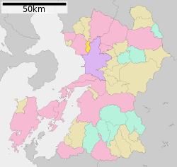 Location of Gyokutō in Kumamoto Prefecture | |
 Gyokutō Location in Japan | |
| Coordinates: 32°54′N 130°37′E / 32.900°N 130.617°ECoordinates: 32°54′N 130°37′E / 32.900°N 130.617°E | |
| Country | Japan |
| Region | Kyushu |
| Prefecture | Kumamoto Prefecture |
| District | Tamana |
| Area | |
| • Total | 24.40 km2 (9.42 sq mi) |
| Population (2003) | |
| • Total | 5,601 |
| • Density | 230/km2 (590/sq mi) |
| Time zone | Japan Standard Time (UTC+9) |
| Website |
www |
Gyokutō (玉東町 Gyokutō-machi) is a town located in Tamana District, Kumamoto Prefecture, Japan.
As of 2003, the town has an estimated population of 5,601 and the density of 229.55 persons per km². The total area is 24.40 km².
External links
 Media related to Gyokutō, Kumamoto at Wikimedia Commons
- Gyokutō official website (Japanese)
This article is issued from Wikipedia - version of the 11/6/2015. The text is available under the Creative Commons Attribution/Share Alike but additional terms may apply for the media files.