Gurung Hill
| Gurung Hill | |
|---|---|
 Gurung Hill  Gurung Hill | |
| Highest point | |
| Elevation | 5100m |
| Coordinates | 33°36′42″N 78°45′11″E / 33.611617°N 78.753090°ECoordinates: 33°36′42″N 78°45′11″E / 33.611617°N 78.753090°E |
| Geography | |
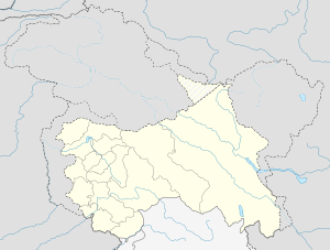
| Location | Aksai Chin |
Gurung Hill is a mountain near the Line of Actual Control in the region of Aksai Chin that is controlled by China but claimed by India. A battle was fought at Gurung Hill during the Sino-Indian War.[1]
Battle of Gurung Hill
Gurung Hill was at the center of a network of Indian posts at Black Top, Table Top, Camel's Back, Yula, Spanggur Gap and Magar Hill. Neighbouring it to the east is Black Top, which is a continuation of Gurung Hill,[2] and which got its name from its black rocks.[3] The portion of Gurung Hill adjoining Black Top is flat and is called Table Top or Plateau. The rest of the hill is called Camel's Back. To the east of Black Top is the Yula pass, where the India had three posts.[1] By 22 October, the Chinese were firing on Yula, and troops were withdrawn from Yula. To the south of Gurung Hill is the Spanggur Gap, and across it, Magar Hill, both of which were held by India.[1] Chinese troops attacked Gurung Hill and Magar Hill, and conquered Plateau on 18 November 1962 and Camel's Back the next day. The forces at Magar Hill were withdrawn on the night of 19 November.[1]
References
- 1 2 3 4 Thapliyal. "Battle of Eastern Ladakh : 1962 Sino-Indian Conflict".
- ↑ Malhotra. Trishul.
- ↑ Singh, Jagjit. While Memory is Fresh.