Gundlupet
| Gundlupet ಗುಂಡ್ಲುಪೇಟೆ | |
|---|---|
| town | |
|
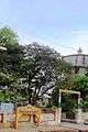
Gundulpet Bus Station | |
 Gundlupet Location in Karnataka, India | |
| Coordinates: 11°48′N 76°41′E / 11.8°N 76.68°ECoordinates: 11°48′N 76°41′E / 11.8°N 76.68°E | |
| Country |
|
| State | Karnataka |
| District | Chamarajanagar |
| Area | |
| • Total | 4.22 km2 (1.63 sq mi) |
| Elevation | 816 m (2,677 ft) |
| Population (2001) | |
| • Total | 26,368 |
| • Density | 6,248.34/km2 (16,183.1/sq mi) |
| Languages | |
| • Official | Kannada |
| Time zone | IST (UTC+5:30) |
| PIN | 571 111 |
| Telephone code | 08229 |
| Vehicle registration | KA-10 |
| Website |
www |

Gundlupet or Gundlupete in Kannada is a town in the Chamarajanagar district of the Indian state of Karnataka. This small town is about 56 km from the Mysore-Ooty / Mysore-Calicut NH 212 highway and about 200 km from Bangalore, the state capital. Gundlupet is the last town in Karnataka en route to Ooty, Wayanad, Kozhikode, situated very close to Tamil Nadu and Kerala state borders. National Highway -67 ( NH-67 ) starts from Gundlupete and ends in Nagapattinam in Tamil Nadu via Ooty and Coimbatore.
One of the famous village in gundlupet is Nenekatte (A must visit place)
The Bandipur National Park Forest Office is 16 km from Gundlupet. Previously this town was known as "Vijayapura" which got its name due presence of historical Vijayanarayana temple.
Geography
Gundlupet is located at 11°48′N 76°41′E / 11.8°N 76.68°E.[1] It has an average elevation of 816 metres (2677 feet).
Demographics
As of 2001 India census,[2] Gundlupet had a population of 26,368. Males constitute 51% of the population and females 49%. Gundlupet has an average literacy rate of 63%, higher than the national average of 59.5%: male literacy is 71%, and female literacy is 56%. In Gundlupet, 11% of the population is under 6 years of age.
As per 2011 census, Gundlupet had a population of 28,157. Males 14,014 and females 14,143.
Agriculture
Main crops are jowar, ragi, sugar cane, turmeric, onion and banana. It is a fairly dry region on the rain-shadow side of the Western Ghats with an average annual rainfall of about 600 mm (almost all of it falling during the monsoon months of July through October. The natural vegetation of the area is Dry Thorn Forest, as can be seen in the nearby reserve forests on the boundary of Bandipur National Park.
Irrigation
There are no rivers or canals that pass through this town.
Tourist places near by
1. Himavad Gopalswamy hills (18 km from Gundlupet)
2. Bandipur National Park (16 km from Gundlupet)
3, Huluganamuradi Venkataramana betta (26 km from Gundlupet)
4. Paarvati Betta (10 km from Gundlupet)
5. Terakanabi and Triyambakpura temples 12 km from gundlupet.
6. Narasamangala shiva temple 7 km from terkanambi.
7. Manchalli cave temple 12km from gundlupet
8. Padaguru lingayth math. 11 km from gundlupet.
9. kodasoge shiva temple.14 km from gundlupete
Image gallery
-
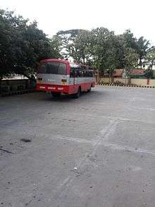
Gundulpet town
-
Begur, Gundlupet
See also
References
- ↑ Falling Rain Genomics, Inc - Gundlupet
- ↑ "Census of India 2001: Data from the 2001 Census, including cities, villages and towns (Provisional)". Census Commission of India. Archived from the original on 2004-06-16. Retrieved 2008-11-01.
External links
| Wikimedia Commons has media related to Gundlupet. |
| Wikivoyage has a travel guide for Gundlupet. |