Gudvangen
| Gudvangen | |
|---|---|
| Village | |
|
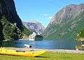
Looking towards Gudvangen from the fjord | |
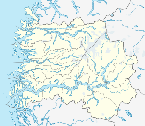 Gudvangen  Gudvangen Location in Sogn og Fjordane county | |
| Coordinates: 60°52′43″N 06°50′19″E / 60.87861°N 6.83861°ECoordinates: 60°52′43″N 06°50′19″E / 60.87861°N 6.83861°E | |
| Country | Norway |
| Region | Western Norway |
| County | Sogn og Fjordane |
| District | Sogn |
| Municipality | Aurland |
| Elevation[1] | 40 m (130 ft) |
| Time zone | CET (UTC+01:00) |
| • Summer (DST) | CEST (UTC+02:00) |
| Post Code | 5747 Gundvangen |

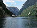
Gudvangen is a village in the municipality of Aurland in Sogn og Fjordane county, Norway. It is a popular tourist destination and is located at the end of the Nærøyfjord where the Nærøydalselvi river empties into the fjord. The European route E16 highway passes by the village. Heading southwest on the highway leads to Voss municipality while heading northeast the E16 enters the Gudvanga Tunnel on its way to the villages of Flåm, Undredal, and Aurlandsvangen. The nearby village of Bakka lies about 5 kilometres (3.1 mi) to the north. The Kjelfossen waterfall is located just to the southeast of the village.[2]
Name
The name Gudvangen (Old Norse: Guðvangir) comes from the old farm name. The first element is gud meaning a "heathen god". The vang(en) word is still in use referring the open space in front of a place of worship like Aurlandsvangen and Vossevangen. In Gudvangen, there have been several places of worship since pre-Christian times.[3][4]
Media gallery
-

Gudvangen
-
Cruise ship in Gudvangen
-

Looking to Gudvangen from the fjord
-
Ferry arriving at Gudvangen
References
- ↑ "Gudvangen" (in Norwegian). yr.no. Retrieved 2010-09-05.
- ↑ Store norske leksikon. "Gudvangen" (in Norwegian). Retrieved 2010-09-05.
- ↑ Brekke, Arne. "Farms in Nærøy". Retrieved 29 June 2008.
- ↑ Rygh, Oluf (1919). Norske gaardnavne: Nordre Bergenhus amt (in Norwegian) (12 ed.). Kristiania, Norge: W. C. Fabritius & sønners bogtrikkeri. p. 121.