Gudalur, Nilgiris
| Gudalur கூடலூர் | |
|---|---|
| Municipality | |
|
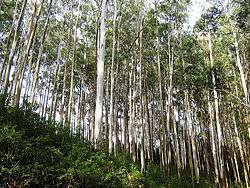
Upper Gudalur | |
 Gudalur Location in Tamil Nadu, India | |
| Coordinates: 11°30′N 76°30′E / 11.50°N 76.50°ECoordinates: 11°30′N 76°30′E / 11.50°N 76.50°E | |
| Country |
|
| State | Tamil Nadu |
| District | Nilgiris |
| Government | |
| • Type | Second Grade Municipality |
| • Body | Gudalur Municipality |
| • Chairperson | Rama Mani [1] |
| Elevation | 1,072 m (3,517 ft) |
| Population (2011) | |
| • Total | 49,535 |
| • Density | 200/km2 (500/sq mi) |
| Languages | |
| • Official | Tamil |
| Time zone | IST (UTC+5:30) |
| PIN | 643212 |
| Telephone code | 04262 |
| Vehicle registration | TN-43Z, TN43Y |
| Sex ratio | 900/1000 ♂/♀ |
Gudalur is a municipality and taluk in Nilgiris district in the Indian state of Tamil Nadu. As of 2011, the town had a population of 49,535. The economy is dependent majorly on the tea industry.
Demographics
According to 2011 census, Gudalur had a population of 49,535 with a sex-ratio of 1,032 females for every 1,000 males, much above the national average of 929.[2] A total of 5,359 were under the age of six, constituting 2,719 males and 2,640 females. Scheduled Castes and Scheduled Tribes accounted for 27.66% and 3.65% of the population respectively. The average literacy of the town was 79.48%, compared to the national average of 72.99%.[2] The town had a total of 12101 households. There were a total of 18,807 workers, comprising 551 cultivators, 1,759 main agricultural labourers, 206 in house hold industries, 14,488 other workers, 1,803 marginal workers, 90 marginal cultivators, 278 marginal agricultural labourers, 119 marginal workers in household industries and 1,316 other marginal workers.[3] As per the religious census of 2011, Gudalur had 59.83% Hindus, 26.01% Muslims, 14.1% Christians, 0.01% Sikhs, 0.05% following other religions and 0.01% following no religion or did not indicate any religious preference.[4]
Climate
Gudalur gets about 120 inches (3,000 mm) of rainfall in a year from South West and North East monsoons. It is situated at a height of approximately 3,500 feet (1,100 m) above sea level.
Transport
Gudalur is linked to Ooty by NH 67, one of the Nilgiri Ghat Roads. In the other direction, the same road continues on towards Gundlupet in Karnataka State. Another road links it to Malappuram and Sulthan Bathery in Kerala State
Politics
Gudalur assembly constituency is one of the three constituencies in the Nilgiris district and The Gudalur assembly constituency is part of Nilgiris (Lok Sabha constituency).[5]
Places of Interest
Places of interest include Needle Rock View Point, Frog Hill View Point, Mudumalai Wildlife Sanctuary, Mango Orange, Nelliyalam, Moyar, Cherambady mines, Nellakotta fort, Hanging bridges, Genepool Garden, Devala mines, Cherangode Swami Malai, Kusumagiri Murugan Temple, Sandanamalai Temple and Masinagudi.
See also
References
- ↑ "Gudalur Municipality". Retrieved 6 May 2016.
- 1 2 "Census Info 2011 Final population totals". Office of The Registrar General and Census Commissioner, Ministry of Home Affairs, Government of India. 2013. Retrieved 26 January 2014.
- ↑ "Census Info 2011 Final population totals - Gudalur". Office of The Registrar General and Census Commissioner, Ministry of Home Affairs, Government of India. 2013. Retrieved 26 January 2014.
- ↑ "Population By Religious Community - Tamil Nadu" (XLS). Office of The Registrar General and Census Commissioner, Ministry of Home Affairs, Government of India. 2011. Retrieved 13 September 2015.
- ↑ "List of Parliamentary and Assembly Constituencies" (PDF). Tamil Nadu. Election Commission of India. Retrieved 2008-10-10.
External links
| Wikimedia Commons has media related to Gudalur, Nilgiris. |
| State symbols |
|
|---|---|
| Governance |
|
| Topics | |
| Districts |
|
| Major cities | |