Gucheng County, Hubei
| Gucheng County 谷城县 | |
|---|---|
| County | |
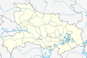 Gucheng County Location in Hubei | |
| Coordinates: 32°14′N 111°31′E / 32.233°N 111.517°ECoordinates: 32°14′N 111°31′E / 32.233°N 111.517°E | |
| Country | People's Republic of China |
| Province | Hubei |
| Prefecture-level city | Xiangfan |
| Area | |
| • Total | 2,553 km2 (986 sq mi) |
| Elevation | 86 m (283 ft) |
| Population (2004) | |
| • Total | 540,000 |
| • Density | 210/km2 (550/sq mi) |
| Time zone | China Standard (UTC+8) |
Gucheng County (simplified Chinese: 谷城县; traditional Chinese: 穀城縣; pinyin: Gǔchéng Xiàn) is a county of northwestern Hubei province, People's Republic of China, located in the eastern foothills of the Daba Mountains. It is under the administration of Xiangyang City, and is served by G70 Fuzhou–Yinchuan Expressway. As of 2004, it had a total population of 540,000 residing in an area of 2,552 square kilometres (985 sq mi).
External links
This article is issued from Wikipedia - version of the 2/26/2013. The text is available under the Creative Commons Attribution/Share Alike but additional terms may apply for the media files.