Guatemala City
| Guatemala City Ciudad de Guatemala | |||
|---|---|---|---|
| City | |||
| Nueva Guatemala de la Asunción[1] | |||
|
Collage of several city's landmarks | |||
| |||
| Motto: "Todos somos la ciudad" (We are all the city), "Tú eres la ciudad" (You are the city) | |||
 Guatemala City Location within Guatemala | |||
| Coordinates: 14°36′48″N 90°32′7″W / 14.61333°N 90.53528°WCoordinates: 14°36′48″N 90°32′7″W / 14.61333°N 90.53528°W | |||
| Country |
| ||
| Department | Guatemala | ||
| Established | 1776 | ||
| Government | |||
| • Type | Municipality | ||
| • Mayor | Álvaro Arzú (PU. Partido Unionista) | ||
| Area | |||
| • City | 692 km2 (267 sq mi) | ||
| • Land | 1,905 km2 (736 sq mi) | ||
| • Water | 0 km2 (0 sq mi) | ||
| Elevation | 1,500 m (4,900 ft) | ||
| Population (2012 Estimate) | |||
| • City | 2,110,100[2] | ||
| • Metro | 4,500,000[2] | ||
| Time zone | Central America (UTC-6) | ||
| Climate | Cwb | ||
| Website |
www | ||


Guatemala City (Spanish: Ciudad de Guatemala), locally known as Guatemala or Guate, is the capital and largest city of the Republic of Guatemala, and the most populous in Central America. The city is located in the south-central part of the country, nestled in a mountain valley called Valle de la Ermita (English: Hermitage Valley). In 2009, it had a population of 1,075,000.[3][4] Guatemala City is also the capital of the local Municipality of Guatemala and of the Guatemala Department.
History

Pre-Columbian Period
Humans have long inhabited and settled in the areas in and around modern-day Guatemala City. Upon the advent of agriculture, some of these early Neolithic settlements grew to become large, stratified cities. Testimony of this can be seen in the western suburbs of Guatemala City, where the ruins of the central ceremonial center of the Preclassic Maya city of Kaminaljuyu are located. Archeological evidence demonstrates that Kaminaljuyu was first occupied by the Maya around 1500 BC, with the site being continuously inhabited until around 1200 AD.[5] The footprint of the archeological site is extensive, proof of the size and sophistication of Kaminaljuyu at its Preclassic peak. As a result, in the late 20th century, the unregulated suburbs of modern-day Guatemala City grew above and around the ruins. Many of the outlying ruins, along with several hundred temple mounds, were covered over with freeways, shopping centers, businesses, luxury hotels and residential areas. However, the central ceremonial center of Kaminaljuyu came under the protection of the Guatemalan government and is now a park.
The Spanish Conquest
In Spanish colonial times, Guatemala City was a small town. It had a monastery called El Carmen, founded in 1628. The capital of the Spanish Captaincy General of Guatemala, covering most of modern Central America, was moved here after a series of earthquakes—the Santa Marta earthquakes that started on July 29, 1773—destroyed the old capital, Antigua.[6] On September 27, 1775, King Charles III of Spain officiated at the moving of the capital. This move to a location at a significant distance from the volcanoes believed to have caused the earthquake dramatically increased the potential for expansion of the city. The new city was given the name Nueva Guatemala (New Guatemala).[7]
Central Square
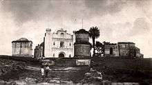
Central Square was the civic and political center of Guatemala city from it foundation in 1776 until the beginning of democratic rule in 1985. Around the square were the main religious and political buildings of the country. The cathedral, on the east side, was built between 1782 and 1815, with the towers being completed in 1867. Its massive structure incorporates baroque and classical elements and has withstood numerous earthquakes. On the west side, the Royal Palace was the Executive branch headquarters for the Capitanía of Guatemala from the time the city was established in 1776 until the earthquakes of 1917 and 1918.
Guatemala City was the scene of the declaration of independence of Central America from Spain, and became the capital of the United Provinces of Central America in 1821.
15 September 1821


Carrera Theater


An enthusiastic fan of opera, and following the advice of his mistress Josefa Silva,[lower-alpha 1] president for life of Guatemala Rafael Carrera started the construction of a massive National Theater that was called "Carrera Theater" in his honor, and was located in the old Central Square.[9] The Old Central Square was located in the northeast part of Guatemala City, then not larger than a village, and in 1776 was the site of the placement of the first block of Nueva Guatemala de la Asunción after the 1773 earthquakes destroyed Santiago de los Caballeros de Guatemala.[10] The place was chosen as the new city Central Square, saving the surroundings for the new Cathedral, Palace, and houses for the richest family of the time, the Aycinena family, since the family leader, Fermín de Aycinena, had contributed considerably to the move of the city from its old place.[11] However, the design approved by the Spanish crown had the Central Square in a different location, and this one became the Old Central Square.[10]
Years later it became a commercial site, and on August 6, 1832, then State of Guatemala Governor Dr. Mariano Galvez issued a decree to build a theater in the Old Central Square site. However, at that time the political climate was very tense in the country and when the civil war between liberal and conservative parties escalated, Galvez was overthrown and the theater was not built.[10]
The project was revisited in 1852 when Juan Matheu and Manuel Francisco Pavón Aycinena presented Rafael Carrera with a new plan. Once approved, Carrera commissioned Matheu and Miguel Ruiz de Santisteban to build the theater. Initially, construction was to be supervised by engineer Miguel Rivera Maestre, but he quit after a few months and was replaced by German expert José Beckers, who built the Greek façades and added a lobby. This was the first monumental building ever built in the Republican era of Guatemala;[10] it was built in the 1850s, a period when the country finally was enjoying some peace and prosperity.[12]
Appleton's Guide to México and Guatemala of 1884 describes the theater as follows: "In the middle of the square is the Theater, similar in size and elegance to any of the rest of Spanish America. Lines of orange trees and other nice trees of brilliant flowers and delicious fragances surround the building while the statues and fountains placed at certain intervals enhance even more the beauty of the place."[13]
After the Liberal reform of 1871, the theater was called the National Theater. In 1892, it was refurbished, removing the conservative Coat of Arms from its façade and substituting it with a sculpture and inscriptions. The orange trees, fountains and sculptures were removed, and in their place modern gardens were planted and a bust of José Batres Montúfar was erected.[14]
During the government of General Manuel Lisandro Barillas Bercián, the theater was remodeled to celebrate the Discovery of America fourth centennial anniversary; the Italian community in Guatemala donated a statue of Christopher Columbus—Cristóbal Colón, in Spanish—which was placed next to the theater. Since then, the place has been called "Colón Theater".[10]
Liberal regimes

General José María Reyna Barrios built several monuments to embellish the Capital City. Among them are the "30 de Junio" Boulevard to celebrate the Liberal Reform of 1871 and the Presidential Palace. In 1895, Reyna Barrios hired architect José de Bustamante, who came to Guatemala from Spain to build the Presidential Palace and residence. The contract was approved on February 8, 1895. It was built in a garden that was on the southwest corner of the colonial Royal Palace on 8th Street at a cost around 4,000 Guatemalan pesos. Construction began on January 1, 1895, and it was finished on December 24, 1896.[15]
Unfortunately, most of the infrastructure from those years was lost due to the earthquakes of 1917–1918.


20th century
"30 de junio" Boulevard


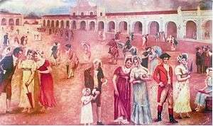
Conservative elite members from the time of Rafael Carrera and the new coffee elite that was formed during the presidency of Justo Rufino Barrios moved their homes to the area around "30 de junio" Boulevard, on the south side of the city; also, certain native settlements were forcibly moved from Santiago de los Caballeros de Guatemala and relocated on the southeast section of the city, forming the "San Pedrito", "Ciudad Vieja" and "Villa de Guadalupe" neighborhoods. Guatemala City also expanded a little bit to the north, especially along "Simeón Cañas" Avenue, at the end of which was the Temple of Minerva, where president Manuel Estrada Cabrera celebrated the student parades in honor of the Greek goddess Minerva,[16] and the Guatemala Relief Map was built in 1905. President Estrada Cabrera moved his residence to "La Palma", located where in 1955 the "Teodoro Palacios Flores" national gym had been built. Toward the end of Estrada Cabrera presidency in 1920, the population of Guatemala City was around 120,000.
1917–1918 earthquakes


During the government of Manuel Estrada Cabrera -1898-1920- several important government buildings were constructed along "30 de Junio" Boulevard, like the maternity house "Joaquina"[lower-alpha 2][18]
The earthquakes marked the beginning of the end for Estrada Cabrera's long regime. From 17 November 1917 to 24 January 1918, a series of quakes destroyed a number of public and religious structures, and particular homes both in Guatemala City and Antigua Guatemala. Among the destroyed public buildings were the Palace of La Reforma built by Reyna Barrios and the maternity house "Joaquina"; because of this, the historical infrastructure that existed during this time has been forgotten by new generations of Guatemalans.
.jpg)


Jorge Ubico regime
The "Hipódromo del Sur" (English: "Southern Horse Track") was officially inaugurated in 1923 by then president general José María Orellana, and it was a very popular recreation place in "La Aurora" National Park. the track was 1,600 metres (5,200 feet) long and 30 metres (98 feet) wide and the bleachers could seat 1500 spectators. Back in those days one could enjoy horse manoeuvers, rodeos and horse races. In 1926, president general Lázaro Chacón ordered to build new facilities and improve the horse track to increase event diversity, fairs and other shows, keeping the site under constant improvement and expansion.[20]
In the early days of general Jorge Ubico term in office (1931-1934) the news facilities were completed; a presidential suite, and field referee quarters were added. In 1935 an outdoor concert hall was added near the track and an yearly international fair was established. For such fair, the government rented mechanical attractions such as roller coasters and there were cultural and social events; the fair was in honor of general Ubico's birthday -November 10-.
On the next years of Ubico's regime, the city expand towards the South, with the construction of "La Aurora" International Airport and exposition halls for the "November Fair" The seventh avenue was extended and the "Torre del Reformador" and the "Charles the Fifth fountain" was moved from the Main Square to the "Spain Plazuela". Ubico also built several palaces: National Palace, Police headquarters, Post Office headquarters, Central Custom office, and the Supreme Court.[21] The elite homes were placed along "Avenida Reforma" -Reform Avenue-, and were built of wood, American style, to resist earthquakes; there were a lot of empty spaces along that area, as well which contributed to the peace and quiet of the zone.[22]
In those days, Ubico designated the city major whom was in charge of modernizing the utilities of downtown and the south area, since the elite has started relocating there; besides, the palace buildings took 35% of the cement production of the country.[23] On the other hand, peripheral poor neighborhoods that formed after the 1917-18 earthquakes lacked attention; these neighborhoods were "La Parroquia", "Ermita", "Candelaria", "La Reformita", "El Gallito", "Gerona" and "Palmita", among others. The population in these areas was formed by extremely poor families who lived in precarious conditions.[lower-alpha 3]
Civil war in the city
"Beheaded corpses hanging from their legs in between what is left from blown up cars, shapeless bodies among glass shards and tree branches all over the place is what a terrorist attack caused yesterday at 9:35 am. El Gráfico reporters were able to get to exact place where the bomb went off, only seconds after the horrific explosion, and found a truly infernal scene in the corner of the 6th avenue and 6th street -where the Presidential Office is located- which had turned into a huge oven -but the solid building where the president worked was safe-. The reporters witnessed the dramatic rescue of the wounded, some of them critical, like the man that completely lost a leg and had only stripes of skin instead."
El Gráfico, 6 September 1980[25]
On 31 January 1980, Guatemala got worldwide attention when the Spanish Embassy in Guatemala City was burnt down, resulting in 37 deaths, including embassy personnel and high ranked Guatemalan former government officials.[26] A group of native people from El Quiché occupied the embassy in a desperate attempt to bring attention to the issues they were having with the Army in that region of the country, which was rich in oil and had been recently populated as part of the "Franja Transversal del Norte" agricultural program.[27] In the end, thirty seven people died after a fire started within the embassy after the police force tried to occupy the building; after that, Spain broke its diplomatic relationships with Guatemala.[26]
On 5 September 1980 a terror attack by Ejército Guerrillero de los Pobres (EGP) took place right in front of the Guatemalan National Palace, the headquarters of the Guatemalan government at the time. The intention was to prevent the Guatemalan people from supporting a huge demonstration that the government of general Lucas Garcia had prepared for on Sunday 7 September 1980. In the attack, six adults and a little boy died after two bombs inside a vehicle went off.[28]
There was an undetermined number of wounded and heavy material losses, not only from art pieces from the National Palace, but from all the surrounding buildings, particularly in the Lucky Building, which was right across the Presidential Office.[29][lower-alpha 4]
The attacks against private financial, commercial, and agricultural targets increased in the Lucas Garcia years, as the leftist Marxist groups saw those institutions as "reactionaries" and "millionaire exploiters" that were collaborating with the "genocidal government".[30] The following is a non-exhaustive list of the terrorist attacks that occurred in Guatemala city and are presented in the UN Commission report:
| Date | Perpetrator | Target | Result |
|---|---|---|---|
| 15 September 1981 | Rebel Army Forces | Corporación Financiera Nacional (CORFINA) | Car bomb damaged the building and neighbor Guatemalan and international financial institutions; there were more than Q300k in losses.[31] |
| 19 October 1981 | EGP Urban guerilla | Industrial Bank Financial Center | Building sabotage.[32] |
| 21 December 1981 | EGP "Otto René Castillo" commando | Bombs against newly built structures: Chamber of Industry, Torre Panamericana (Bank of Coffee headquarters) and Industrial Bank Financial Center | Car bombs completely destroyed the buildings windows.[32] |
| 28 December 1981 | EGP "Otto René Castillo" commando | Industrial Bank Financial Center | Car bomb against the building which virtually destroyed one of the bank towers. In a sign of defiance, the bank did not repair the windows immediately and continued operating as normally as it could. |
Overpass constructions
Guatemala City started growing uncontrollably after the 1976 earthquake, which led to serious transit problems, especially at rush hour. To help with this situation, City Hall started building overpasses; the first during this modernization period was the Tecún Umán overpass, that connects zones 8, 9 and 13. The structure has four concrete bridges and a freeway exchange transit system. The overpass was built in three phases, beginning in October 1991 and completing on 31 August 1993.[33]
21st century
Tropical storm Agatha
In 2010 Guatemala City was impacted by Tropical Storm Agatha, which caused an extreme amount of rain over a very short period. The sewage system collapsed, creating a large sinkhole that practically swallowed a complete house, killing its three occupants.[34] The piping feature, of larger dimensions than a street intersection, engulfed a three story building and a house (14°39′7.50″N 90°30′21.5″W / 14.6520833°N 90.505972°W).[35] This 2010 piping feature was at least 18 metres (59 feet) wide and 60 metres (200 feet) deep.[36] The distance between the 2010 piping feature and the 2007 piping feature is about 2 kilometres (1.2 mi). Geologists Sam Bonis and T. Waltham argue that the recurring piping features in Guatemala City are caused by sewer leaks eroding the soft volcanic deposits that form the floor of the Valle de la Ermita.[37][38]
Pacaya volcano eruption of 2010
Four volcanoes are visible from Guatemala City, and two of them are active. The closest and most active is Pacaya, which often expels large amounts of ash and rocks, the others are Volcán de Fuego, Volcán Acatenango and Volcán de Agua. On the night of 27 May 2010, Pacaya volcano erupted; the ash column reached 1,500 metres (4,900 feet) above the crater and severely impact the city and three adjacent regions. The International Airport had to remain closed for five days due to the falling ash, rain and poor visibility conditions.[39] The Guatemalan Emergency and Disaster response team declared a red alert for those communities near the volcano and urged them to evacuate.[39]
The eruption caused two deaths, [40] Guatemalan news channel Noti-7 reporter Aníbal Archila being one of them; Archila was one of the first reporters to arrive to the scene. President Álvaro Colom declared State of Emergency and the Secretary of Education suspended classes in the affected regions: Guatemala, Escuintla and Sacatepéquez. The Congress ratified the State Emergency on 1 June 2010.[40]
Contemporary times
.jpg)
Guatemala City serves as the economic, governmental, and cultural epicenter of the nation of Guatemala. The city also functions as Guatemala's main transportation hub, hosting an international airport, La Aurora International Airport, and serving as the origination or end points for most of Guatemala's major highways. The city, with its robust economy, attracts hundreds of thousands of rural migrants from Guatemala's interior hinterlands and serves as the main entry point for most foreign immigrants seeking to settle in Guatemala.
In addition to a wide variety of restaurants, hotels, shops, and a modern BRT transport system (Transmetro), the city is home to many art galleries, theaters, sports venues and museums (including some fine collections of Pre-Columbian art) and provides a growing number of cultural offerings. Guatemala City not only possesses a history and culture unique to the Central American region, it also furnishes all the modern amenities of a world class city, ranging from an IMAX Theater to the Ícaro film festival (Festival Ícaro), where independent films produced in Guatemala and Central America are debuted.
Structure and growth


Guatemala City is subdivided into 22 zones designed by the urban engineering of Raúl Aguilar Batres, each one with its own streets and avenues, making it pretty easy to find addresses in the city. Zones are numbered 1-25 with Zones 20, 22 and 23 not existing as they would have fallen in two other municipalities territory.[41] Addresses are assigned according to the street or avenue number, followed by a dash and the number of metres it is away from the intersection further simplifying address location. The zones are assigned in a spiral form starting in downtown Guatemala city.
The city's metro area has recently grown very rapidly and has absorbed most of the neighboring municipalities of Villa Nueva, San Miguel Petapa, Mixco, San Juan Sacatepequez, San José Pinula, Santa Catarina Pinula, Fraijanes, San Pedro Ayampuc, Amatitlán, Villa Canales, Palencia and Chinautla forming what is now known as the Guatemala City Metropolitan Area.
Zone One is the Historic Center, (Centro Histórico), lying in the very heart of the city, the location of many important historic buildings including the Palacio Nacional de la Cultura (National Palace of Culture), the Metropolitan Cathedral, the National Congress, the Casa Presidencial (Presidential House), the National Library and Plaza de la Constitución (Constitution Plaza, old Central Park). Efforts to revitalize this important part of the city have been undertaken by the municipal government and have been very successful thus far.
In an attempt to control rapid growth of the city, the municipal government (Municipalidad de Guatemala) headed by longtime Mayor Álvaro Arzú, has implemented a plan to control its growth based on transects along its important arterial roads and exhibitting Transit-oriented development (TOD) characteristics. This plan denominated POT (Plan de Ordenamiento Territorial) aims to allow taller building structures of mixed uses to be built next to large arterial roads and gradually decline in height and density as you move away from such. It is also worth mentioning, that due to the Airport being in the city, to the south, many Aeronautic Height Limits have been applied to the construction code. This limits the maximum height for a building, at 60 metres (200 feet) in Zone 10, up to 95 metres (312 feet) in Zone 1.[41]
The city is located in the South-Central area of the country and has a lot of green areas.[1] Besides the parks, the city offers a portfolio of entertainment in the region, focused on the so-called Zona Viva and the Calzada Roosevelt as well as four degrees North. The activity of Casinos is considerable and possesses several located in different parts of the Zona Viva, although East market is still in the stage of initiation, although the date has been restructuring this area and is becoming more modern.
One of the most outstanding mayors was the engineer Martin Prado Vélez, who took over in 1949, and ruled the city during the reformist Presidents Juan José Arévalo and Jacobo Arbenz Guzman, although he was not a member of the ruling party at the time and was elected due his well known capabilities. Of cobanero origin, married with Marta Cobos, he studied at the University of San Carlos; under his tenure, among other modernist works of the city, it was planned the El Incienso bridge, the construction of the Roosevelt Avenue, the main road axis from East to West of the city, the town hall building, and numerous road works which meant the widening of the colonial city, its order in the cardinal points and the generation of a ring road with the first Shamrock in the main city of Central America.[16]
In the financial district are the tallest buildings in the country including: Club Premier, Tinttorento, Atlantis building, Atrium, Tikal Futura, Building of Finances, Towers Building Batteries, Torres Botticelli, Tadeus, building of the INTECAP, Royal Towers, Towers Geminis, Industrial Bank towers, Holiday Inn Hotel, Premier of the Americas, among many others to be used for offices, apartments etc. Also include projects such as Zona Pradera and Interamerica´s World Financial Center http://www.interamericaswfc.com. The location of the La Aurora international airport within the city limits the construction of skyscrapers, changing the limits permitted directly by its location within the urban area.
Population

According to the 2002 census, the Guatemala City metropolitan area had a population of 2.3 million, making it the most populous urban agglomeration in Central America.[42] The growth of the city's population has been robust since then, abetted by the mass migration of Guatemalans from the rural hinterlands to the largest and most vibrant regional economy in Guatemala.[3] The inhabitants of Guatemala City are incredibly diverse given the size of the city, with those of Spanish and Mestizo descent being the most numerous.[3] Guatemala City also has sizable indigenous populations, divided among the 23 distinct Mayan groups present in Guatemala. The numerous Mayan languages are now spoken in certain quarters of Guatemala City, making the city a linguistically rich area. Foreigners and foreign immigrants comprise the final distinct group of Guatemala City inhabitants, representing a very small minority among the city's citizens.[3]
Due to mass migration from impoverished rural districts wracked with political instability, Guatemala City's population has exploded since the 1970s, severely straining the existing bureaucratic and physical infrastructure of the city. As a result, chronic traffic congestion, shortages of safe potable water in some areas of the city, and a sudden and prolonged surge in crime have become perennial problems. The infrastructure, although continuing to grow and improve in some areas,[43] it is lagging in relation to the increasing population of those less fortunate.[44] Guatemala City is not unique in facing and tackling problems all too common among rapidly expanding cities around the world.
Communications
Guatemala City is headquarters to many communications and telecom companies, among them Tigo, Claro-Telgua, and Movistar-Telefónica. These companies also offer cable television, internet services and telephone access. Due to Guatemala City's large and concentrated consumer base in comparison to the rest of the country, these telecom and communications companies provide most of their services and offerings within the confines of the city. There are also seven local television channels, in addition to numerous international channels. The international channels range from children's programming channels, like Nickelodeon and the Disney Channel, to more adult offerings, such as E! and HBO. While most international programming is dominated by televised entertainment from the United States, most domestic programming is dominated by televised entertainment from Mexico. Due to its small and relatively income-restricted domestic market, Guatemala City produces very little in the way of its own programming outside of local news and sports.
Economy and Finance
Guatemala City, as the capital, is home to Guatemala's central bank, from which Guatemala's monetary and fiscal policies are formulated and promulgated. Guatemala City is also headquarters to numerous regional private banks, among them CitiBank, Banco Agromercantil, Banco Promerica, Banco Industrial, Banco GyT Continental, Banco de Antigua, Banco Reformador, Banrural, Grupo Financiero de Occidente, BAC Credomatic, and Banco Internacional. By far the richest and most powerful regional economy within Guatemala, Guatemala City is the largest market for goods and services, which provides the greatest number of investment opportunities for public and private investors in all of Guatemala. Financing for these investments is provided by the regional private banks, as well as by foreign direct and capital investment, mostly from the United States. Guatemala City's ample consumer base and sophisticated service sector is represented by the large department store chains present in the city, among them Siman, Hiper Paiz & Paiz (Walmart), Price Smart, ClubCo, Cemaco, Sears and Office Depot.
 Bank of Guatemala.
 Banrural Bank.
 Pradera Zone.
 Agromercantil Bank.
 G&T Continental Bank.
 CHN Bank.
Places of interest by zones
Guatemala City is divided into 22 zones in accordance with the urban layout plan designed by Raúl Aguilar Batres. Each zone has its own streets and avenues, facilitating navigation within the city. Zones are numbered 1 through 25. However, numbers 20, 22 and 23 have not been designated to zones, thus these zones do not exist within the city proper.[41]
| Zone | Main places | Pictures |
|---|---|---|
| Zone 1 |
|
 Guatemala National Theater. |
| Zone 2 |
|
 Relief Map of Guatemala. |
| Zone 3 | ||
| Zone 4 |
|
|
| Zone 5 |
|
|
| Zone 6 | ||
| Zone 7 |
|
|
| Zone 9 |
|
|
| Zone 10 |
|
|
| Zone 11 |
|
 Hotel Tikal Futura, zone 11. |
| Zone 12 |  University of San Carlos Central Campus. | |
| Zone 13 |
|
 La Aurora International Airport |
| Zone 14 |
|
|
| Zone 15 |
|
 Latter Day Saints Guatemala City Temple |
| Zone 16 |
|
 Universidad Rafael Landívar |


Transportation
- Renovated and expanded, La Aurora International Airport lies to the south of the city center. La Aurora serves as Guatemala's principal air hub.
- Public transport is provided by buses and supplemented by a BRT system. The three main highways that bisect and serve Guatemala start in the city. (CA9 Transoceanic Highway - Puerto San Jose to Puerto Santo Tomas de Castilla-, CA1 Panamerican Highway - from the Mexican border to Salvadorian border - and to Peten.) Construction of freeways and underpasses by the municipal government, the implementation of reversible lanes during peak rush-hour traffic, as well as the establishment of the Department of Metropolitan Transit Police (PMT), has helped improve traffic flow in the city. Despite these municipal efforts, the Guatemala City metropolitan area still faces growing traffic congestion.
- A BRT (Bus Rapid Transit) system called Transmetro, consisting of special-purpose lanes for high-capacity buses, began operating in 2007, and aimed to improve traffic flow in the city through the implementation of an efficient mass transit system. The system currently consists of five lines. In the future, it is expected to be made up of around 10 lines, with some over-capacity expected lines considered to be made Light Metro or Heavy Metro.
Traditional buses are now required to discharge passengers at central stations at the city's edge to board the Transmetro. This is being implemented as new Transmetro lines become established. In conjunction with the new mass transit implementation in the city, there is also a prepaid bus card system called Transurbano that is being implemented in the metro area to limit cash handling for the transportation system. A new fleet of buses tailored for this system has been purchased from a Brazilian firm.
Universities and schools
Guatemala City is home to ten universities, among them the oldest institution of higher education in Central America, the University of San Carlos of Guatemala. Founded in 1676, the Universidad de San Carlos is older than all North American universities except for Harvard University.
The other nine institutions of higher education to be found in Guatemala City include the Universidad Mariano Gálvez, the Universidad Panamericana, the Universidad Mesoamericana, the Universidad Rafael Landivar, the Universidad Francisco Marroquín, the Universidad del Valle, the Universidad del Istmo, Universidad Galileo, Universidad da Vinci and the Universidad Rural. Whereas these nine named universities are private, the Universidad de San Carlos remains the only public institution of higher learning.
Sports
Guatemala City possesses several sportsgrounds and is home to many sports clubs. Association football is the most popular sport, with CSD Municipal, Aurora FC and Comunicaciones being the main clubs. The Estadio Mateo Flores, located in the Zone 5 of the city, is the largest stadium in the country, followed in capacity by the Estadio Cementos Progreso, Estadio del Ejército & Estadio El Trébol . An important multi-functional hall is the Domo Polideportivo de la CDAG.
The city has hosted several promotional functions and some international sports events: in 1950 it hosted the VI Central American and Caribbean Games, and in 2000 the FIFA Futsal World Championship. On July 4, 2007 the International Olympic Committee gathered in Guatemala City and voted Sochi to become the host for the 2014 Winter Olympics and Paralympics.[50] In April 2010, it hosted the XIVth Pan-American Mountain Bike Championships.[51]
Guatemala City hosted the 2008 edition of the CONCACAF Futsal Championship, played at the Domo Polideportivo from June 2 to June 8, 2008.[52]
Panoramic views of Guatemala City
1875

2008


International relations
International organizations with headquarters in Guatemala City
Twin towns — sister cities
Guatemala City is twinned with:
| City | Jurisdiction | Country | Year |
|---|---|---|---|
| Caracas | Capital District | 1969 | |
| San Salvador | San Salvador | 1979 | |
| Madrid | Madrid | 1983[53] | |
| Lima | Lima | 1987 | |
| Santiago de Chile | Metropolitan Santiago | 1991 | |
| Washington DC | District of Columbia | 1991 | |
| Saltillo | Coahuila | 1993 | |
| La Habana | La Habana | 1997 | |
| Bogotá | Distrito Capital | 1997 | |
| San Pedro Sula | Cortés | 1999 | |
| Santa Cruz de Tenerife | Santa Cruz de Tenerife | 2002 | |
| San José | San José | 2005 | |
| Ciudad de Panamá | Panamá | 2005 | |
| Taipei | 2007[54] | ||
| Managua | Managua | 2008 | |
| Beijing | Beijing | 2009 | |
Notable residents
- Raúl Aguilar Batres, Engineer, creator of Guatemala City's system of avenue/street notation
- Miguel Ángel Asturias, Writer and diplomat, Nobel Prize Laureate
- Ricardo Arjona, Singer /songwriter
- Manuel Colom Argueta, Former mayor of Guatemala City and politician
- Toti Fernández, triathlete and ultramarathon runner
- Juan José Gutiérrez, CEO of Pollo Campero and on the board of directors of Corporación Multi Inversiones. Has been featured on the cover of Newsweek as Super CEO and named one of the Ten Big Thinkers for Big Business.[55]
- Ted Hendricks, Oakland Raiders NFL Hall Of Fame Linebacker. 5-Time Super Bowl Champion
- Jorge de León, performance artist[56]
- Carlos Mérida, painter
- Gaby Moreno, Singer/ Songwriter
- Carlos Peña, Singer, Winner of Latin American Idol 2007
- Georgina Pontaza, actress and artistic director of the Teatro Abril and Teatro Fantasía
- Fernando Quevedo, Theoretical Physicist, currently a professor of High Energy Physics at the university of Cambridge
- Rodolfo Robles, Physician, discovered onchocercosis "Robles' Disease"
- Fabiola Rodas, Winner of The Third TV Azteca's Desafio de Estrellas 2nd Place in The Last Generation of La Academia
- Carlos Ruíz, football/soccer player
- Alida Boer, designer/Guatemalan designer clothing
- Alvaro Arzu, Mayor/businessman
- Shery, singer / songwriter
- Jaime Viñals, Mountaineer (Scaled seven highest peaks in the world)
- Luis von Ahn, Computer Scientist, CAPTCHA's creator and Researcher at Carnegie Mellon University
Climate
Despite its location in the tropics, Guatemala City’s relatively high altitude moderates average temperatures. The city has a tropical savanna climate (Köppen Aw) bordering on a subtropical highland climate (Cwb). Guatemala City is generally warm, almost springlike, throughout the course of the year. It occasionally gets hot during the dry season, but not as hot and humid as in the cities located at sea level. The hottest month is April. The rainy season extends from May to October, coinciding with the tropical storm and hurricane season in the western Atlantic Ocean and Caribbean Sea, while the dry season extends from November to April. The city can at times be windy, which also leads to lower ambient temperatures.
The average annual temperature ranges from 22 to 28 °C (72 to 82 °F) during the day, and 12 to 17 °C (54 to 63 °F) at night.
Average morning relative humidity: 82%, evening relative humidity: 58%. Average dew point is 16 °C (61 °F).[57]
| Climate data for Guatemala City (1990–2011) | |||||||||||||
|---|---|---|---|---|---|---|---|---|---|---|---|---|---|
| Month | Jan | Feb | Mar | Apr | May | Jun | Jul | Aug | Sep | Oct | Nov | Dec | Year |
| Record high °C (°F) | 30.0 (86) |
32.1 (89.8) |
32.0 (89.6) |
33.9 (93) |
33.9 (93) |
31.2 (88.2) |
29.1 (84.4) |
30.2 (86.4) |
29.8 (85.6) |
28.6 (83.5) |
29.9 (85.8) |
28.8 (83.8) |
33.9 (93) |
| Average high °C (°F) | 24.3 (75.7) |
25.8 (78.4) |
26.8 (80.2) |
27.8 (82) |
27.1 (80.8) |
25.8 (78.4) |
25.4 (77.7) |
25.5 (77.9) |
25.1 (77.2) |
24.7 (76.5) |
24.2 (75.6) |
23.9 (75) |
25.5 (77.9) |
| Average low °C (°F) | 13.2 (55.8) |
13.6 (56.5) |
14.6 (58.3) |
16.0 (60.8) |
16.8 (62.2) |
16.8 (62.2) |
16.3 (61.3) |
16.5 (61.7) |
16.4 (61.5) |
16.0 (60.8) |
14.7 (58.5) |
13.7 (56.7) |
15.4 (59.7) |
| Record low °C (°F) | 6.0 (42.8) |
7.8 (46) |
8.4 (47.1) |
8.6 (47.5) |
12.3 (54.1) |
11.2 (52.2) |
12.1 (53.8) |
13.5 (56.3) |
13.0 (55.4) |
11.4 (52.5) |
9.4 (48.9) |
7.6 (45.7) |
6.0 (42.8) |
| Average rainfall mm (inches) | 2.8 (0.11) |
5.4 (0.213) |
6.0 (0.236) |
31.0 (1.22) |
128.9 (5.075) |
271.8 (10.701) |
202.6 (7.976) |
202.7 (7.98) |
236.6 (9.315) |
131.6 (5.181) |
48.8 (1.921) |
6.6 (0.26) |
1,274.8 (50.188) |
| Average rainy days | 1.68 | 1.45 | 2.00 | 4.73 | 12.36 | 21.14 | 18.59 | 19.04 | 20.82 | 14.59 | 6.18 | 2.64 | 125.22 |
| Average relative humidity (%) | 74.3 | 73.4 | 73.2 | 74.3 | 77.3 | 82.4 | 80.8 | 80.9 | 84.5 | 82.0 | 79.2 | 76.0 | 77.8 |
| Mean monthly sunshine hours | 248.4 | 236.2 | 245.6 | 237.9 | 184.4 | 155.3 | 183.4 | 191.8 | 159.0 | 178.0 | 211.7 | 209.2 | 2,440.9 |
| Source: Instituto Nacional de Sismologia, Vulcanologia, Meteorologia, e Hidrologia[58] | |||||||||||||
Volcanic activity
Four stratovolcanoes are visible from the city, two of them active. The nearest and most active is Pacaya, which at times erupts a considerable amount of ash.[59] These volcanoes lie to the south of the Valle de la Ermita, providing a natural barrier between Guatemala City and the Pacific lowlands that define the southern regions of Guatemala. Agua, Fuego, Pacaya and Acatenango comprise a line of 33 stratovolcanoes that stretches across the breadth of Guatemala, from the Salvadorian border to the Mexican border.
Earthquakes
Lying on the Ring of Fire, the Guatemalan highlands and the Valle de la Ermita are frequently shaken by large earthquakes. The last large tremor to hit the Guatemala City region occurred in the 1976, on the Motagua Fault, a left-lateral strike-slip fault that forms the boundary between the Caribbean Plate and the North American Plate. The 1976 event registered 7.5 on the moment magnitude scale. Smaller, less severe tremors are frequently felt in Guatemala City and environs.
Mudslides
Torrential downpours, similar to the more famous monsoons, occur frequently in the Valle de la Ermita during the rainy season, leading to flash floods that sometimes inundate the city. Due to these heavy rainfalls, some of the slums perched on the steep edges of the canyons that criss-cross the Valle de la Ermita are washed away and buried under mudslides, as in October 2005.[60] Tropical waves, tropical storms and hurricanes sometimes strike the Guatemalan highlands, which also bring torrential rains to the Guatemala City region and trigger these deadly mudslides.
Piping pseudokarst


In February 2007, a very large, deep circular hole with vertical walls opened in northeastern Guatemala City (14°39′1.40″N 90°29′25″W / 14.6503889°N 90.49028°W), killing five people. This sinkhole, which is classified by geologists as either a "piping feature" or "piping pseudokarst", was 100 metres (330 ft) deep, and apparently was created by fluid from a sewer eroding the loose volcanic ash, limestone, and other pyroclastic deposits that underlie Guatemala City.[37][61] As a result, one thousand people were evacuated from the area.[62] This piping feature has since been mitigated by City Hall by providing proper maintenance to the sewerage collection system[1] and plans to develop the site have been proposed. However, critics believe municipal authorities have neglected needed maintenance on the city's aging sewerage system, and have speculated that more dangerous piping features are likely to develop unless action is taken.[63]
3 years later the 2010 Guatemala City sinkhole arose.
Geographic location
The city is completely surrounded by Guatemala Department municipalities:[64]
 |
Mixco, Chinautla, San Pedro Ayampuc y Palencia | Palencia | | |
| Mixco and Villa Nueva | |
Palencia[64] | ||
| ||||
| | ||||
| Santa Catarina Pinula, Villa Canales and Petapa[64] | San José Pinula |
See also
-
 Guatemala portal
 -
 Geography portal
 - 2007 Guatemala earthquake
- La Aurora International Airport
- List of places in Guatemala
Notes and references
- ↑ Ms. Silva was a professional actreess and singer who had taught Rafael Carrera how to behave, write, read and sing.[9]
- ↑ Named after Joaquina Cabrera, the late President's mother.
- ↑ 75% of the houses were made out of wood, and 67% of them had no floor; 97.8% had deficient zinc roofing while 90.6% had no running water, 21.5% lacked a sanitary system and 71.1% lacked any kind of underground sewage.[24]
- ↑ Among the deceased was Domingo Sánchez, Secretary of Agriculture drive; Joaquín Díaz y Díaz, car washer; and Amilcar de Paz, security guard.
References
- 1 2 3 Municipalidad de Guatemala 2014.
- 1 2 INE 2013.
- 1 2 3 4 INE 2013, p. 13.
- ↑ Population data 2013.
- ↑ Moncada Maya n.d.
- ↑ Baily 1850, p. 72.
- ↑ Rosales Flores 2015.
- 1 2 González Davison 2008.
- 1 2 3 4 5 Guateantaño 17 October 2011.
- ↑ González Davison 2008, p. 430.
- ↑ González Davison 2008, p. 432.
- ↑ Conkling 1884, p. 343.
- ↑ Guateantaño & 17 October.
- ↑ Álvarez Arévalo 2015.
- 1 2 Morán Mérida 1994, p. 9.
- ↑ Bascome Jones, Scoullar & Soto Hall 1915.
- ↑ Almengor 1994, p. 3.
- ↑ Barrios Vital 2006, p. 38.
- ↑ Mundo Chapín 2013.
- ↑ Morán Mérida 1994, p. 11.
- ↑ Dary Fuentes 1994.
- ↑ Morán Mérida 1994, p. 10.
- ↑ Meza, César (1944). Guatemala y el seguro social obligatorio (Estudio Médicosocial) (in Spanish). Guatemala: Tesis de la Facultad de Ciencias Médicas de la Universidad Nacional.
- ↑ Figueroa 2011.
- 1 2 El Periódico 2012.
- ↑ La Hora 2013.
- ↑ La otra memoria histórica 2011.
- ↑ Prensa Libre 1980.
- ↑ Comisión para el Esclarecimiento Histórico: Vol. IV 1999, p. Sección 256.
- ↑ Comisión para el Esclarecimiento Histórico: Vol. IV 1999, p. Sección 253.
- 1 2 Comisión para el Esclarecimiento Histórico: Vol. IV 1999, p. Sección 252.
- ↑ Municipalidad de Guatemala August 2008.
- ↑ El País 2010.
- ↑ Walker 2010.
- ↑ Sydney Morning Herald 2010.
- 1 2 Waltham 2008, p. 291-300.
- ↑ Reilly 2 June 2010.
- 1 2 Assardo 2010.
- 1 2 3 Municipalidad de Guatemala 2008.
- ↑ "Guatemala: metropolitan areas". World Gazeteer. Archived from the original on 5 Jan 2013. Retrieved 2010-02-24.
- ↑ Morán Mérida 1994, p. 14.
- ↑ Morán Mérida 1994, p. 14-17.
- ↑ FUNTEC n.d.
- ↑ Museo Ixchel 2008.
- ↑ Nature Reserse 2005.
- ↑ De Guate n.d.
- ↑ Zoológico La Aurora n.d.
- ↑ rga-online, Remscheid, Germany. "Topnews - Sport - Remscheid: Remscheider General-Anzeiger / rga-online ...weil wir hier zu Hause sind!". Rga-online.de. Retrieved 2009-07-08.
- ↑ http://www.guatepanamericanomtb2010.com/ XIVth Pan-American Mountain Bike Championships
- ↑ "Futsal Championship 2008 Recap". CONCACAF.
- ↑ "Mapa Mundi de las ciudades hermanadas". Ayuntamiento de Madrid. Retrieved 2009-07-25.
- ↑ "Taipei - International Sister Cities". Taipei City Council. Archived from the original on 2012-11-02. Retrieved 2013-08-23.
- ↑ Newsweek 2005, p. 4.
- ↑ Estey, Myles. "A generation of young artists is gaining recognition for their gritty depictions of the modern realities of the Central American nation." Global Post. 15 Aug 2011. Retrieved 11 Feb 2012.
- ↑ "Guatemala City, Guatemala Travel Weather Averages (Weatherbase)". Weatherbase.
- ↑ "Ministerio de comunicaciones Infraestructura y Vivienda". Retrieved 25 December 2012.
- ↑ "MTU-VP Pacaya Volcano, Guatemala". Geo.mtu.edu. 1995-06-01. Retrieved 2009-07-08.
- ↑ Carlos, Juan (2005-10-07). "Mudslide in Guatemala kills dozens | The San Diego Union-Tribune". Signonsandiego.com. Retrieved 2009-07-08.
- ↑ Halliday 2007, p. 103-113.
- ↑ David L Miller (2009-07-04). "Massive Guatemala Sinkhole Kills 2 Teens". CBS News. Retrieved 2009-07-08.
- ↑ Constantino Diaz-Duran (2010-06-01). "Sinkhole in Guatemala City Might Not Be the Last". The Daily Beast. Retrieved 2010-06-03.
- 1 2 3 "Municipios del departamento de Guatemala". SEGEPLAN (in Spanish). Guatemala. Archived from the original on 7 July 2015. Retrieved 22 July 2015.
Bibliography
- Almengor, Oscar Guillermo (1994). "La Nueva Guatemala de la Asunción y los terremotos de 1917-18". Ciudad de Guatemala (in Spanish). Guatemala: Centro de estudios urbanos y regionales-USAC.
- Assardo, Luis (2010). "Llueve ceniza y piedras del Volcán de Pacaya". El Periódico. Guatemala. Archived from the original on 4 July 2014. Retrieved 28 May 2010.
- Baily, John (1850). Central America; Describing Each of the States of Guatemala, Honduras, Salvador, Nicaragua, and Costa Rica. London: Trelawney Saunders. p. 72.
- Barrios Vital, Jenny Ivette (2006). "Restauración y revitalización del complejo arquitectónico de la Recolección" (PDF) (in Spanish). Guatemala: University of San Carlos of Guatemala thesis. Retrieved 2 September 2013.
- Bascome Jones, J.; Scoullar, William T.; Soto Hall, Máximo (1915). El Libro azul de Guatemala (in Spanish). Searcy & Pfaff.
relato é historia sobre la vida de las personas más prominentes; historia condensada de la república; artículos especiales sobre el comercio, agricultura y riqueza mineral, basado sobre las estadísticas oficiales
- Comisión para el Esclarecimiento Histórico: Vol. IV,2 (1999). "Atentados contra la libertad". Programa de Ciencia y Derechos Humanos, Asociación Americana del Avance de la Ciencia (in Spanish). Guatemala: memoria del silencio. Archived from the original (Online edition) on 26 May 2013. Retrieved 20 September 2014.
- Comisión para el Esclarecimiento Histórico: Vol. IV (1999). "Atentados contra sedes municipales". Programa de Ciencia y Derechos Humanos, Asociación Americana del Avance de la Ciencia (in Spanish). Guatemala: memoria del silencio. Archived from the original (Online edition) on 26 May 2013. Retrieved 20 September 2014.
- Conkling, Alfred R. (1884). Appleton's guide to Mexico, including a chapter on Guatemala, and a complete English-Spanish vocabulary. Nueva York: D. Appleton and Company.
- Dary Fuentes, Claudia (1994). "Una ciudad que empezaba a crecer". Revista Crónica, suplemento Revolución (in Spanish). Guatemala: Editorial Anahté.
- Diario de Navarra (2010). "El volcán Pacaya continúa activo y obliga a seguir con evacuaciones". Diario de Navarra (in Spanish). Archived from the original on 31 July 2014. Retrieved 5 June 2010.
- El País (2010). "Socavón causado por la tormenta Agatha". El País (in Spanish). Madrid, Spain. Archived from the original on 18 February 2012.
- El Periódico (31 January 2012). "Quema de embajada española". elPeriódico (in Spanish). Archived from the original on 30 October 2013. Retrieved 8 October 2013.
- Figueroa, Luis (2011). "Bombazo en el Palacio Nacional". Luis Figueroa Blog (in Spanish). Archived from the original on 26 June 2014. Retrieved 25 October 2014.
- Funtec (n.d.). "Mapa en Relieve de Guatemala". Funtec-Guatemala (in Spanish). Guatemala. Archived from the original on 9 February 2008. Retrieved 25 July 2009.
- González Davison, Fernando (2008). La montaña infinita;Carrera, caudillo de Guatemala (in Spanish). Guatemala: Artemis y Edinter. ISBN 84-89452-81-4.
- Guateantaño (17 October 2011). "Parques y plazas antiguas de Guatemala". Guatepalabras Blogspot. Guatemala. Archived from the original on 27 January 2015.
- Halliday, W.R. (2007). "Pseudokarst in the 21st century". Journal of Cave and Karst Studies. 69 (1): 103–113.
- Ine (2013). "Caracterización Departamental, Guatemala 2012" (PDF). Instituto Nacional de Estadística (in Spanish). Guatemala: Gobierno de Guatemala. Archived from the original (PDF) on 25 June 2014.
- Hernández de León, Federico (1959). "El capítulo de las efemérides". Diario La Hora (in Spanish). Guatemala.
- Hernández de León, Federico (1930). El libro de las efemérides (in Spanish). Tomo III. Guatemala: Tipografía Sánchez y de Guise.
- La Hora (2013). "Una crónica impactante en el aniversario de la quema de la Embajada de España tras 33 años de impunidad". Diario La Hora (in Spanish). Archived from the original on 7 December 2013. Retrieved 8 October 2013.
- La otra memoria histórica (5 December 2011). "Guatemala, viudas y huérfanos que dejó el comunismo". La otra memoria histórica (in Spanish). Guatemala. Archived from the original on 7 December 2013. Retrieved 10 October 2013.
- Milla y Vidaurre, José (1980). Cuadros de Costumbres. Textos Modernos (in Spanish). Guatemala: Escolar Piedra Santa.
- Moncada Maya, José Omar (n.d.). "En torno a la destrucción de la ciudad de Guatemala, 1773. Una carta del ingeniero militar Antonio Marín". Ub.es (in Spanish). Retrieved 8 July 2009.
- Morán Mérida, Amanda (1994). "Movimientos de pobladores en la Ciudad de Guatemala (1944-1954)" (PDF). Boletín del CEUR-USAC (in Spanish). Guatemala: Centro de estudios urbanos y regionales-USAC (23). Archived from the original (PDF) on 18 October 2014. Retrieved 27 September 2014.
- Mundo Chapín (2013). "La Aurora y el Hipódromo del Sur". Mundo Chapín. Guatemala. Archived from the original on 30 March 2014. Retrieved 23 September 2014.
- Municipalidad de Guatemala (August 2008). "Paso a desnivel de Tecún Umán". Segmento cultural de la Municipalidad de Guatemala (in Spanish). Archived from the original on 24 February 2011. Retrieved 27 September 2014.
- Municipalidad de Guatemala (2014). "Mi barrio querido, Ciudad de Guatemala" (in Spanish). Guatemala City.
- Municipalidad de Guatemala (2007). "Conmemoración de los doscientos treinta años de fundación de la Ciudad de Guatemala". Boletín de la Municipalidad de Guatemala. Archived from the original on 20 March 2013. Retrieved 18 August 2009.
- Municipalidad de Guatemala (2008). "Plan de Ordenamiento Territorial, Ciudad de Guatemala" (in Spanish). Archived from the original on 18 September 2009.
- Museo Ixchel (2008). "Museo Ixchel". Museo Ixchel del traje indígena (in Spanish). Archived from the original on 2 February 2008. Retrieved 25 July 2009.
- Natural Reserve (2005). "Jardin Botanico". Natureserve.org (in Spanish). Retrieved 25 July 2009.
- Newskeek (2005). "10 Big Thinkers for Big Business - The Daily Beast". Newsweek.com. Retrieved 15 September 2011.
- Population data (2012). "Guatemala population". Population data. Archived from the original on 26 December 2013. Retrieved 12 December 2012.
- Prensa Libre (6 September 1980). "Avalancha terrorista en contra de la manifestación de mañana; poder público y transporte extraurbano blancos de ataque". Prensa Libre (in Spanish). Guatemala.
- Reilly, Michael (2 June 2010). "Don't Call the Guatemala Sinkhole a Sinkhole". Discovery News. Retrieved 9 June 2010.
- Sharer, Robert J.; Traxler, Loa P. (2006). The Ancient Maya (6th (fully revised) ed.). Stanford, CA: Stanford University Press. ISBN 0-8047-4817-9. OCLC 57577446.
- Sydney Morning Herald (2010). "Hole that swallowed a three-story building". Sydney Morning Herald. Archived from the original on 3 July 2014.
- Walker, Peter (2010). "Tropical Storm Agatha blows a hole in Guatemala City". The Guardian. London, UK. Archived from the original on 19 March 2013.
- Waltham, T. (2008). "Sinkhole hazard case histories in karst terrains". Quarterly Journal of Engineering Geology and Hydrogeology. 41 (3).
- Woodward, Ralph Lee, Jr. (2002). "Rafael Carrera y la creación de la República de Guatemala, 1821–1871". Serie monográfica (in Spanish). CIRMA y Plumsock Mesoamerican Studies (12). ISBN 0-910443-19-X.
- Woodward, Ralph Lee, Jr. (1993). Rafael Carrera and the Emergence of the Republic of Guatemala, 1821-1871 (Online edition). Athens, Georgia EE.UU.: University of Georgia Press. Retrieved 28 December 2014.
External links
-
 Media related to Guatemala City at Wikimedia Commons
 -
 Guatemala City travel guide from Wikivoyage
 - Official Website of the Municipalidad de Guatemala
Capital: Guatemala City | ||
| Municipalities |  | |