Grong
| Grong kommune | |||
|---|---|---|---|
| Municipality | |||
|
Grong in early-August 2007 | |||
| |||
 Grong within Nord-Trøndelag | |||
| Coordinates: 64°31′53″N 12°37′12″E / 64.53139°N 12.62000°ECoordinates: 64°31′53″N 12°37′12″E / 64.53139°N 12.62000°E | |||
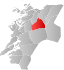
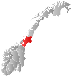
| Country | Norway | ||
| County | Nord-Trøndelag | ||
| District | Namdalen | ||
| Administrative centre | Mediå | ||
| Government | |||
| • Mayor (2003) | Erik Seem (Sp) | ||
| Area | |||
| • Total | 1,136.17 km2 (438.68 sq mi) | ||
| • Land | 1,097.65 km2 (423.81 sq mi) | ||
| • Water | 38.52 km2 (14.87 sq mi) | ||
| Area rank | 87 in Norway | ||
| Population (2011) | |||
| • Total | 2,357 | ||
| • Rank | 301 in Norway | ||
| • Density | 2.1/km2 (5/sq mi) | ||
| • Change (10 years) | -8.4 % | ||
| Time zone | CET (UTC+1) | ||
| • Summer (DST) | CEST (UTC+2) | ||
| ISO 3166 code | NO-1742 | ||
| Official language form | Neutral | ||
| Website |
www | ||
|
| |||

![]() Grong (Southern Sami: Kråangke) is a municipality in Nord-Trøndelag county, Norway. It is part of the Namdalen region. The administrative centre of the municipality is the village of Medjå. Other villages in the municipality include Bergsmoen, Formofoss, Gartland, and Harran.
Grong (Southern Sami: Kråangke) is a municipality in Nord-Trøndelag county, Norway. It is part of the Namdalen region. The administrative centre of the municipality is the village of Medjå. Other villages in the municipality include Bergsmoen, Formofoss, Gartland, and Harran.
General information
Grong was established as a municipality on 1 January 1838 (see formannskapsdistrikt). On 1 January 1901, the northwestern district of Høylandet (population: 1,046) was separated from Grong to form its own municipality. On 1 January 1923, the northeastern district of Røyrvik (population: 392), the northwestern district of Namsskogan (population: 469), and the central district of Harran (population: 630) were all split from Grong to form separate municipalities. This left a vastly smaller municipality of Grong with only 1,272 residents. On 1 January 1964, the municipality of Harran (population: 1,085) was merged back into Grong.[1]
Name
The municipality (originally the parish) is named after the old Grong farm (Old Norse: Granungar), since the first church was built there. The first element is grǫn which means "spruce" and the last element is the plural form of the suffix -ungr.[2]
Coat-of-arms
The coat-of-arms is from modern times; they were granted on 6 February 1987. The arms show three green triangles on a silver/gray background. The green triangles represent spruce trees (gran), making them canting arms. The name is supposedly derived from Granungar. The number three symbolizes the three main villages in the municipality: Harran, Bergsmoen, and Medjå.[3]
Churches
The Church of Norway has two parishes (sokn) within the municipality of Grong. It is part of the Namdal deanery in the Diocese of Nidaros.
| Parish (Sokn) | Church Name | Location of the Church | Year Built |
|---|---|---|---|
| Grong | Grong Church | Grong | 1877 |
| Harran | Harran Church | Harran | 1874 |
| Gløshaug Church | Gartland | 1689 |
Geography
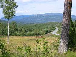
Grong is located along the river Namsen in the Namdalen valley. Two major tributaries of the Namsen flow through Grong too: the river Sanddøla and the river Neselva. The Bangsjøene lakes lie at the extreme southern border with Snåsa and Overhalla. The Blåfjella–Skjækerfjella National Park covers a small part of the southeastern part of Grong.
Government
All municipalities in Norway, including Grong, are responsible for primary education (through 10th grade), outpatient health services, senior citizen services, unemployment and other social services, zoning, economic development, and municipal roads. The municipality is governed by a municipal council of elected representatives, which in turn elect a mayor.
Municipal council
The municipal council (Kommunestyre) of Grong is made up of 17 representatives that are elected to every four years. Currently, the party breakdown is as follows:[4]
| Party Name | Name in Norwegian | Number of representatives | |
|---|---|---|---|
| Labour Party | Arbeiderpartiet | 9 | |
| Conservative Party | Høyre | 1 | |
| Centre Party | Senterpartiet | 5 | |
| Socialist Left Party | Sosialistisk Venstreparti | 2 | |
| Total number of members: | 17 | ||
Transportation
The European route E6 highway follows the river Namsen across the municipality, as does the Nordlandsbanen railway line. The two main stations on the Nordlandsbanen are Grong Station in Medjå and Harran Station in Harran. The old Namsos Line railway used to run from Grong to Namsos, but that is now closed.
Media gallery
 The high school in Grong
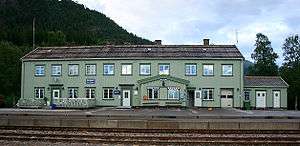 Train station in Grong
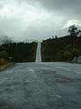 County road from Grong to Sweden
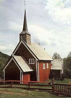 The old Gløshaug church in Gartland
References
- ↑ Jukvam, Dag (1999). "Historisk oversikt over endringer i kommune- og fylkesinndelingen" (PDF) (in Norwegian). Statistisk sentralbyrå.
- ↑ Rygh, Oluf (1903). Norske gaardnavne: Nordre Trondhjems amt (dokpro.uio.no) (in Norwegian) (15 ed.). Kristiania, Norge: W. C. Fabritius & sønners bogtrikkeri. p. 295.
- ↑ Norske Kommunevåpen (1990). "Nye kommunevåbener i Norden". Retrieved 29 October 2008.
- ↑ "Table: 04813: Members of the local councils, by party/electoral list at the Municipal Council election (M)" (in Norwegian). Statistics Norway. 2015.
External links
| Wikimedia Commons has media related to Grong. |
 Nord-Trøndelag travel guide from Wikivoyage
- Municipal fact sheet from Statistics Norway