Grinde, Rogaland
| Grinde | |
|---|---|
| Village | |
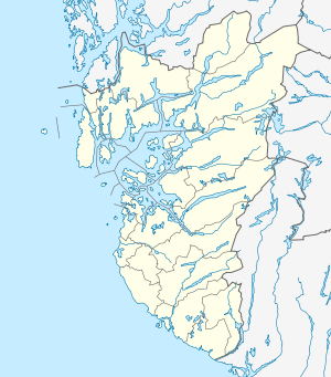 Grinde  Grinde Location in Rogaland county | |
| Coordinates: 59°25′49″N 05°27′54″E / 59.43028°N 5.46500°ECoordinates: 59°25′49″N 05°27′54″E / 59.43028°N 5.46500°E | |
| Country | Norway |
| Region | Western Norway |
| County | Rogaland |
| District | Haugaland |
| Municipality | Tysvær |
| Area[1] | |
| • Total | 0.59 km2 (0.23 sq mi) |
| Elevation[2] | 5 m (16 ft) |
| Population (2014)[1] | |
| • Total | 859 |
| • Density | 1,456/km2 (3,770/sq mi) |
| Time zone | CET (UTC+01:00) |
| • Summer (DST) | CEST (UTC+02:00) |
| Post Code | 5570 Aksdal |
Grinde is a village in Tysvær municipality in Rogaland county, Norway. The village is located at the western end of the Grindafjorden, a couple of kilometers east of the villages of Aksdal and Førre. Grinde lies along the European route E39-European route E134 highway.
The 0.59-square-kilometre (150-acre) village has a population (2014) of 859, giving the village a population density of 1,456 inhabitants per square kilometre (3,770/sq mi).[1]
History
Grinde was historically located in Skjold municipality. On 1 January 1965, Skjold municipality was dissolved and its territory dispersed between three municipalities. The districts Grinde, Dueland, and Yrkje with 1,133 inhabitants in total were merged into Tysvær.[3]
References
- 1 2 3 Statistisk sentralbyrå (1 January 2014). "Urban settlements. Population and area, by municipality.".
- ↑ "Grinde, Tysvær (Rogaland)" (in Norwegian). yr.no. Retrieved 2015-09-10.
- ↑ Jukvam, Dag (1999). "Historisk oversikt over endringer i kommune- og fylkesinndelingen" (PDF) (in Norwegian). Statistisk sentralbyrå.
This article is issued from Wikipedia - version of the 8/4/2016. The text is available under the Creative Commons Attribution/Share Alike but additional terms may apply for the media files.