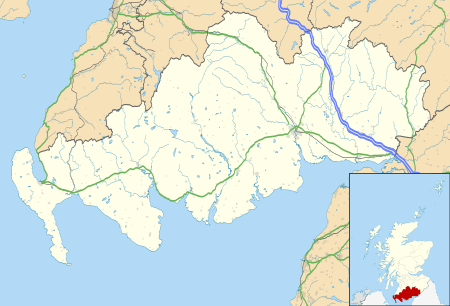
Gretna, Dumfries and Galloway
Coordinates: 54°59′38″N 3°03′43″W / 54.994°N 3.062°W
Gretna (Scottish Gaelic: Greatna) is a town in Dumfries and Galloway, Scotland. Because they are near the Anglo-Scottish border, nearby Gretna Green and, to a lesser extent, Gretna, are historically linked to weddings because of the more liberal marriage provisions in Scots law. "Gretna" has become a term for a place for quick, easy marriages.[1]
Gretna was historically a civil parish in Dumfriesshire.[2]
History
Etymology
Gretna means "(place at the) gravelly hill", from Old English greot "grit" (in the dative form greoten (which is where the -n comes from) and hoh "hill-spur".
The Lochmaben Stone is a megalith standing in a field, nearly 1 mile (1.6 kilometres) west of the Sark mouth on the Solway Firth, three hundred yards or so above high water mark on the farm of Old Graitney. It was one of the traditionally recognised meeting places on the England / Scotland border.
17th century
Prior to the Acts of Union 1707 of the Parliaments of England and Scotland, Gretna was a customs post for collecting taxes on cattle crossing the border between the two kingdoms. The Gretna customs post was established in 1612.[3] A Drove road was constructed between Gretna and Annan in 1619, possibly to facilitate the transportation of cattle from Wigtownshire, Kirkcudbrightshire and Dumfriesshire to markets in England.[4]
18th century
Gretna's principal claim to fame arose in 1753 when an Act of Parliament, Lord Hardwicke's Marriage Act, was passed in England, which provided, among other things, that if both parties to a marriage were not at least 21 years old, consent to the marriage had to be given by the parents. This Act did not apply in Scotland, which allowed boys to marry at 14 and girls at 12, with or without parental consent. In addition, the Act required procedures that gave notice of an impending marriage to the community. As a result, many elopers fled England, and the first Scottish village they reached was often Gretna. With the construction of a new highway, Gretna Green became easier to reach, and Gretna's appeal as an elopement destination waned.
World War I
The village was notable for HM Factory, Gretna, codenamed Moorside, a huge cordite munitions factory built nearby on the shore of Solway Firth to supply ammunition to British forces during World War I. The factory, the biggest munitions factory ever built, stretched for 9 mi (14 km) from Eastriggs along the Solway coast as far as Longtown in England and 2 mi (3 km) across. The factory took 10,000 navvies to build it, and employed 30,000 workers, mostly women. The workers mixed by hand a devil’s porridge of nitro-glycerine and guncotton into cordite paste, and loaded the extruded cordite strands into shell cases.
Gretna and Eastriggs were built to house the workforce, and many were accommodated nearby in Carlisle. When 5,000 workers arrived back by train to Carlisle, one publican had 1,000 whiskies lined up. The labourers and workers had such a reputation for drunkenness, which was seen by Government as such a threat to the national interest, that Gretna and the surrounding area became a historical curiosity for a considerable period. Under the Defence of the Realm Act 1914 a State Management Scheme was set up in 1916 to bring the liquor industry, including public houses (pubs) and the local breweries, under Government control over a wide area stretching as far as Carlisle and Maryport. There were Spiritless Saturdays, and buying anyone else a drink (shouting), and heaters and coolers (drinking beer and spirits in the same pub) were banned. The pub landlords, became civil servants, were instructed to follow a disinterested management policy and not allow people to get drunk in the pubs. The State Management Scheme persisted for many years after the First World War was long over and the munitions factories dismantled. It was not until the early 1970s, when the low prices and unadulterated beer in the Gretna area began to become conspicuous, that the government enterprise was sold off by the Heath government.
Geography and administration
Gretna is in Dumfries and Galloway, in the south of Scotland, on the A74(M) near the border to England, and near the mouth of the River Esk.[5] The township is distinct from the smaller nearby village of Gretna Green, famous for marriages, which borders but is a separate area from Gretna proper. To the west in Scotland are Eastriggs (about 5 mi [8 km] to the west) and Annan (about 8 mi [13 km] to the west), both situated on the B721 and linked to the nearby A75.[5]
Transport
A military road was built in 1763 by General Wade linking Gretna to Portpatrick, then the main ferry port to Northern Ireland.[6] This was later to become the route of much of the A75 road to Stranraer. However, the A75 is a modern road, post-dating World War I. The original route between Gretna and Annan is now the B721 road, and the A75 diverges significantly from it; similarly, the B724 was the original route between Annan and Dumfries.[7]
In the 1840s, there were three main railway companies building lines around Gretna and this resulted in three railway stations named "Gretna". The first station called "Gretna" was opened by the Glasgow, Dumfries and Carlisle Railway on 23 August 1843, this station was renamed Gretna Green railway station in April 1852.[8] It closed on 6 December 1965, but a new station was opened by British Rail nearby on 20 September 1993, the station is served by Glasgow South Western Line.[8] This station had a new platform added in 2009,to coincide with the redoubling of this section of track. The other two stations were located a short distance to the east of Gretna, over the border in England. Gretna (Caledonian) railway station was opened on 9 September 1847 by the Caledonian Railway on its main line between Carlisle and Glasgow and Edinburgh.[8] The station closed on 10 September 1951.[8] The North British Railway built Gretna (Border Union) railway station next to the Caledonian station, at Gretna junction, on its short link to the Border Union Railway. The station opened on 1 November 1861 and closed during World War One on 9 August 1915.[8]
The main Anglo-Scottish trunk road running north–south through Gretna was the A74 road. With the opening of the M6 motorway to the south of Carlisle in December 1970,[9] much of the A74 in Scotland was upgraded to motorway standard in the 1970s, 1980s and 1990s, and the upgraded sections of road were renamed the A74(M). The, so called, Cumberland Gap was the remaining 6 miles (9.7 km) of non-upgraded dual-carriageway A74 between the northern terminus of the M6 at Carlisle, and the southern end of the A74(M) at the Scottish border.
The A75 is a major trunk road heading west along the south coast of Scotland from Gretna. Its eastern terminus at Gretna was originally the A74, but this was changed to a junction with the A74(M). The A75 runs past Eastriggs, Annan, Dumfries, Castle Douglas, Gatehouse of Fleet, Newton Stewart and Glenluce before ending in the west at Stranraer.
Present day
Much of the local economy is driven by the marriage industry, where by some accounts, as many as one of every six Scottish weddings takes place in Gretna / Gretna Green. Most marriages take place in Gretna itself, at the Register office, the Anvil Hall, or in the numerous Hotels in the centre of the township. Gretna is also the location of the Gretna Gateway Outlet Village, a development of discount factory shops.
Thousands of starlings occasionally fly in flocks above Gretna. The birds gather in flocks called murmurations, having migrated in the millions from Russia and Scandinavia to escape the harsher winters there.
A nearby sculpture has been approved called the Star of Caledonia.
Sport
Gretna was also the official home of Gretna Football Club, who played in the Scottish Premier League during the 2007–2008 season, the club playing 'home' games at Fir Park, Motherwell. The club also reached the 2006 Scottish Cup Final. Mounting financial problems saw the club relegated from the SPL at the end of the season, then demoted to Division 3 of the Scottish Football League. After attempts to find a buyer for the club proved fruitless, Gretna finally resigned from the SFL on 3 June 2008. A new club, Gretna FC 2008 has been founded in its place. Rugby league also has a large following in the area.
References
Notes
- ↑ E.g., State v. Clay, 182 Md. 639, 642, 35 A.2d 821, 822-23 (1944).
- ↑ Thomson Atlas of Scotland, 1832
- ↑ Haldane, pages 161 & 167.
- ↑ Haldane, pages 31 & 161.
- 1 2 1:50,000 OS map 85
- ↑ Taylor, Christopher (1979). The Roads & Tracks of Britain. London, Toronto and Melbourne: J. M. Dent & sons ltd. ISBN 0-460-04329-3, Page 171.
- ↑ See for instance the re-scaled 1:50,000 Cassini Historical Maps, number 85, for Carlisle & Solway Firth, Revised New Series 1901–1904 (ISBN 978-1-84736-369-5) and Popular Edition 1925 (ISBN 978-1-84736-210-0).
- 1 2 3 4 5 Butt, page 110
- ↑ Chatsworth, Table 7.3, pages 100 - 123.
Sources
- Butt, R. V. J. (1995). The Directory of Railway Stations: details every public and private passenger station, halt, platform and stopping place, past and present (1st ed.). Sparkford: Patrick Stephens Ltd. ISBN 1-8526-0508-1. OCLC 60251199.
- Chatsworth, George (1984). A history of British motorways. London: Thomas Telford Limited. ISBN 978-0-7277-0159-6.
- Haldane, A.R.B. (1997). The Drove Roads of Scotland. Edinburgh: Berlinn. ISBN 1-874744-76-9.
- Routledge, Gordon L. (1999).Gretna’s Secret War.
- Ordnance Survey Landranger Map (number 85) - 1:50,000 scale (1.25 inches to 1 mile). ISBN 0-319-22685-9.
- Ordnance Survey Explorer Map (number 323) - 1:25,000 scale (2.5 inches to 1 mile)
External links
 Gretna travel guide from Wikivoyage
![]() Media related to Gretna, Dumfries and Galloway at Wikimedia Commons
Media related to Gretna, Dumfries and Galloway at Wikimedia Commons
- Gretna Registration Office
- Civil Parish Historical Tax Rolls for the Civil Parish of Gretna, Dumfriesshire, (Volumes 1-5)