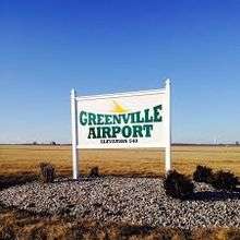
Greenville Airport
| Greenville Airport | |||||||||||||||
|---|---|---|---|---|---|---|---|---|---|---|---|---|---|---|---|
| IATA: GRE – ICAO: KGRE – FAA LID: GRE | |||||||||||||||
| Summary | |||||||||||||||
| Airport type | Public | ||||||||||||||
| Owner | Greenville Airport Authority | ||||||||||||||
| Serves | Greenville, Illinois | ||||||||||||||
| Elevation AMSL | 541 ft / 165 m | ||||||||||||||
| Coordinates | 38°50′10″N 89°22′45″W / 38.83611°N 89.37917°WCoordinates: 38°50′10″N 89°22′45″W / 38.83611°N 89.37917°W | ||||||||||||||
| Map | |||||||||||||||
 GRE  GRE Location of airport in Illinois/United States | |||||||||||||||
| Runways | |||||||||||||||
| |||||||||||||||
| Statistics (2007) | |||||||||||||||
| |||||||||||||||
Greenville Airport (IATA: GRE, ICAO: KGRE, FAA LID: GRE) is a public airport located three miles (5 km) south of the central business district of Greenville, a city in Bond County, Illinois, United States. It is owned by the Greenville Airport Authority.[1]
Facilities and aircraft
Greenville Airport covers an area of 492 acres (199 ha) which contains two runways: 18/36 with a 4,002 x 75 ft (1,220 x 23 m) asphalt pavement and 9/27 with a 3,200 x 250 ft (975 x 76 m) turf surface.[1] The airport is capable of handling most aircraft up through the Citation and Lear Jet class. The airport provides a lighted runway, rental hangars, mechanic service, and pilot service. [2]
For the 12-month period ending August 31, 2007, the airport had 25,000 aircraft operations, an average of 68 per day: 88% general aviation, 8% air taxi and 4% military. At that time there were 43 aircraft based at this airport: 77% single-engine, 5% multi-engine and 19% ultralight.[1]
References
- 1 2 3 4 FAA Airport Master Record for GRE (Form 5010 PDF), effective 2008-04-10
- ↑ "Greenville Municipal Airport - City of Greenville, Illinois ". greenvilleillinois.com. Retrieved 8 April 2015.
External links
- FAA Terminal Procedures for GRE, effective November 10, 2016
- Resources for this airport:
- FAA airport information for GRE
- AirNav airport information for GRE
- ASN accident history for GRE
- FlightAware airport information and live flight tracker
- SkyVector aeronautical chart for GRE