Greenleaf, Idaho
| Greenleaf, Idaho | |
|---|---|
| City | |
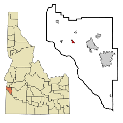 Location in Canyon County and the state of Idaho | |
| Coordinates: 43°40′16″N 116°48′59″W / 43.67111°N 116.81639°WCoordinates: 43°40′16″N 116°48′59″W / 43.67111°N 116.81639°W | |
| Country | United States |
| State | Idaho |
| County | Canyon |
| Area[1] | |
| • Total | 0.73 sq mi (1.89 km2) |
| • Land | 0.73 sq mi (1.89 km2) |
| • Water | 0 sq mi (0 km2) |
| Elevation | 2,411 ft (735 m) |
| Population (2010)[2] | |
| • Total | 846 |
| • Estimate (2012[3]) | 861 |
| • Density | 1,158.9/sq mi (447.5/km2) |
| Time zone | Mountain (MST) (UTC-7) |
| • Summer (DST) | MDT (UTC-6) |
| ZIP code | 83626 |
| Area code(s) | 208 |
| FIPS code | 16-33490 |
| GNIS feature ID | 0396590 |
| Historical population | |||
|---|---|---|---|
| Census | Pop. | %± | |
| 1980 | 663 | — | |
| 1990 | 648 | −2.3% | |
| 2000 | 862 | 33.0% | |
| 2010 | 846 | −1.9% | |
| Est. 2015 | 882 | [4] | 4.3% |
Greenleaf is a city in Canyon County, Idaho, United States. The population was 846 at the 2010 census. Named after Quaker poet and abolitionist John Greenleaf Whittier.
West of Caldwell, Greenleaf is part of the Boise City–Nampa, Idaho Metropolitan Statistical Area.
Geography
Greenleaf is located at 43°40′16″N 116°48′59″W / 43.67111°N 116.81639°W (43.671142, -116.816480).[6]
According to the United States Census Bureau, the city has a total area of 0.73 square miles (1.89 km2), all of it land.[1]
Demographics
2010 census
As of the census[2] of 2010, there were 846 people, 299 households, and 226 families residing in the city. The population density was 1,158.9 inhabitants per square mile (447.5/km2). There were 316 housing units at an average density of 432.9 per square mile (167.1/km2). The racial makeup of the city was 87.1% White, 0.4% African American, 0.5% Native American, 0.4% Asian, 9.6% from other races, and 2.1% from two or more races. Hispanic or Latino of any race were 19.4% of the population.
There were 299 households of which 37.8% had children under the age of 18 living with them, 61.2% were married couples living together, 10.7% had a female householder with no husband present, 3.7% had a male householder with no wife present, and 24.4% were non-families. 19.7% of all households were made up of individuals and 8.1% had someone living alone who was 65 years of age or older. The average household size was 2.83 and the average family size was 3.26.
The median age in the city was 39.6 years. 28.4% of residents were under the age of 18; 8.2% were between the ages of 18 and 24; 20.5% were from 25 to 44; 30.7% were from 45 to 64; and 12.2% were 65 years of age or older. The gender makeup of the city was 46.9% male and 53.1% female.
2000 census
As of the census[7] of 2000, there were 862 people, 277 households, and 219 families residing in the city. The population density was 1,190.1 people per square mile (462.3/km²). There were 284 housing units at an average density of 392.1 per square mile (152.3/km²). The racial makeup of the city was 74.59% White, 0.46% African American, 0.81% Native American, 0.81% Asian, 0.23% Pacific Islander, 22.39% from other races, and 0.70% from two or more races. Hispanic or Latino of any race were 23.32% of the population.
There were 277 households out of which 46.9% had children under the age of 18 living with them, 63.9% were married couples living together, 10.8% had a female householder with no husband present, and 20.6% were non-families. 19.1% of all households were made up of individuals and 10.5% had someone living alone who was 65 years of age or older. The average household size was 3.11 and the average family size was 3.57.
In the city the population was spread out with 35.7% under the age of 18, 7.9% from 18 to 24, 27.5% from 25 to 44, 20.8% from 45 to 64, and 8.1% who were 65 years of age or older. The median age was 31 years. For every 100 females there were 94.1 males. For every 100 females age 18 and over, there were 85.9 males.
The median income for a household in the city was $37,375, and the median income for a family was $45,313. Males had a median income of $26,538 versus $22,115 for females. The per capita income for the city was $15,406. About 9.3% of families and 13.3% of the population were below the poverty line, including 17.8% of those under age 18 and 14.0% of those age 65 or over.
References

- 1 2 "US Gazetteer files 2010". United States Census Bureau. Retrieved 2012-12-18.
- 1 2 "American FactFinder". United States Census Bureau. Retrieved 2012-12-18.
- ↑ "Population Estimates". United States Census Bureau. Retrieved 2013-06-03.
- ↑ "Annual Estimates of the Resident Population for Incorporated Places: April 1, 2010 to July 1, 2015". Retrieved July 2, 2016.
- ↑ "Census of Population and Housing". Census.gov. Retrieved June 4, 2015.
- ↑ "US Gazetteer files: 2010, 2000, and 1990". United States Census Bureau. 2011-02-12. Retrieved 2011-04-23.
- ↑ "American FactFinder". United States Census Bureau. Retrieved 2008-01-31.
Municipalities and communities of Canyon County, Idaho, United States | ||
|---|---|---|
| Cities | ||
| Unincorporated communities | ||