Greenhow

Coordinates: 54°04′N 1°50′W / 54.07°N 1.83°W
Greenhow is a village in North Yorkshire, England, often referred to as Greenhow Hill. The term how derives from the Old Norse word haugr meaning a hill and a mound.[1]
It is situated about 3 miles (4.8 km) west of Pateley Bridge on the road heading towards Grassington, and is mainly in the civil parish of Bewerley.[2] However, the western end of the village lying to the west of Kell Dyke, commonly known as Craven Cross, lies within the civil parish of Appletreewick in Craven.[3] It is one of the highest villages in Yorkshire, at an altitude of between 400 and 420 metres (1,310 and 1,380 ft), and one of the few villages in the United Kingdom lying at over 400 metres (1,300 ft).[4]
Greenhow is an old mining village that was a major supplier of lead. Sir Stephen Proctor bought the Manor of Bewerley, including the mineral rights in 1597. He was also responsible, as part of a settlement with John Armitage over disputed land, for the founding of the actual village of Greenhow.[5] Prior to this date the only settlement recorded on the Hill itself was Kell House, where monks of Fountains Abbey lived while guarding the abbey's lead interests.[6]
In 1613, an agreement sought to protect the Greenhow miners' rights: "…there may be cottages erected for the miners and mineral workmen upon the said waste … and also for the keeping of draught oxen and horses for the maintenance of the mines, always leaving the tenants sufficient common".[6]
Joseph Kipling,[7] the grandfather of Rudyard Kipling was the minister at the Methodist Chapel at Greenhow and Rudyard himself is known to have visited the village.[8] There is a 'Kiplings Cottage' next door to the 'Miners Arms', but it is not known whether his grandfather actually lived there.
To the east of the village is Coldstones Quarry, operated by Hanson. A large public artwork, The Coldstones Cut, has been created by the artist Andrew Sabin, and was opened in 2010.[9]
References
- ↑ "Standard English words which have a Scandinavian Etymology". Retrieved 2012-07-02.
- ↑ "2001 Census: Key Statistics: Parish Headcounts: Area: Bewerley CP (Parish)". Office for National Statistics. 2008-07-17. Retrieved 2012-07-02.
- ↑ "2001 Census: Key Statistics: Parish Headcounts: Area: Craven CP (Parish)". Office for National Statistics. 2008-07-17. Retrieved 2012-07-02.
- ↑ "Welcome to Greenhow". Retrieved 2012-07-02.
- ↑ Jennings, Ed Bernard (1983) [1967]. A History of Nidderdale. p. 152.
- 1 2 Jennings, Ed Bernard (1983) [1967]. A History of Nidderdale. p. 153.
- ↑ "Family of Joseph Kipling". Retrieved 2012-07-02.
- ↑ Kipling, Rudyard. "On Greenhow Hill". Life's Handicap.
- ↑ "The Coldstones Cut". Retrieved 2012-07-02.
Bibliography
- Blackah, Thomas, Songs & Poems written in the Nidderdale Dialect (1867)
- Blackah, Thomas, Dialect Poems & Prose (compiled by Harald Bruff) (1937)
- Bruff, Harald J.L. T'ill an' T'oade uns upuv Greenho (1920)
- Bruff, Harald J.L. T' Miners. Character sketches of old Yorkshire Lead Miners (1924)
- Dunham, Sir Kingsley & Wilson, Albert A, Geology of the Northern Pennine Orefield, Vol 2 Stainmore to Craven (1980)
- Gill, M.C. The Greenhow Mines. 1998: Northern Mine Research Society.
- Grainge, William, Nidderdale (1862)
- Greenhow Local History Club. Life on the Hill. 2005: Greenhow Local History Club.
- Jennings, Bernard (Ed), A History of Nidderdale (1983)
- Weatherhead, W. History of Netherdale (1839)
External links
| Wikimedia Commons has media related to Greenhow. |
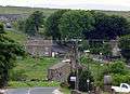 Greenhow Village 2003
 Greenhow Hill summit
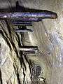 Lead Workings on Sun Vein