Greenfield (Pittsburgh)
| Greenfield | |
|---|---|
| Neighborhood of Pittsburgh | |
 | |
| Coordinates: 40°25′19″N 79°56′31″W / 40.422°N 79.942°W | |
| Country | United States |
| State | Pennsylvania |
| County | Allegheny County |
| City | Pittsburgh |
| Area[1] | |
| • Total | 0.773 sq mi (2.00 km2) |
| Population (2010)[1] | |
| • Total | 7,294 |
| • Density | 9,400/sq mi (3,600/km2) |
Greenfield is a neighborhood in Pittsburgh, Pennsylvania, United States. It is represented on Pittsburgh City Council by Corey O'Connor.
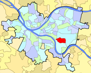
Greenfield is a member of Pittsburgh's 15th Ward, which includes the neighborhoods of Greenfield and Four Mile Run. Greenfield is adjacent to the Pittsburgh neighborhoods of Hazelwood to the south, Oakland and Schenley Park to the north, and Squirrel Hill to the east.[2] Pittsburgh Fire Station #12 is located on Winterburn Avenue in the neighborhood.
History
In 1758, a large tract of woodland was purchased for $10,000 under the Treaty of Fort Stanwix made with the Native-Americans. This area included what became Greenfield and neighboring Hazelwood, which today are both part of the city's 15th ward. By the late 1800s, many of Greenfield's residents were of Irish, Polish, Slovak, Italian, Hungarian, and Carpatho-Rusyn descent. They resided in Greenfield and traveled to Hazelwood, Homestead and Duquesne to work in the steel mills.[2]
During the Civil War, Greenfield (part of Squirrel Hill at the time)[3] was the site of a small redoubt, Fort Black on Bigelow Street between Parade and Shields Streets, also known as Fort Chess or Fort Squirrel Hill.[4]
Points of interest
Greenfield contains two small business districts along Greenfield Avenue and Murray Avenue. A major travel route is along Beechwood Boulevard, connecting I-376 to the Waterfront shopping district in Homestead. As a predominantly residential neighborhood, Greenfield boasts three baseball fields, four basketball courts, two hockey rinks, two soccer fields, and a swimming pool. It is also home to seven churches and one synagogue; the largest is St. Rosalia, a Roman Catholic church. Greenfield is known among locals for very steep hills, a chaotic street grid off the main roads, and a preponderance of single lane 2-way streets, which does not usually lead to congestion as the neighborhood is not heavily traveled (excluding Murray and Greenfield Avenues and Beechwood Boulevard, which are all multi-lane streets).
Similar to other Pittsburgh neighborhoods, Greenfield hosts a holiday parade and fireworks every December. The fireworks, which are usually sponsored by Zambelli Fireworks, are shot off from Magee Field.
Spanning I-376 and connecting Greenfield to Oakland was the Beechwood Boulevard Bridge, known more popularly as the Greenfield Bridge. It was built in the 1920s and was demolished on December 28, 2015. It will be replaced by a new bridge, due in 2017.
Notable residents
- Bryan Bassett, American guitarist
- Richard Caliguiri, mayor of Pittsburgh, 1978–88[5]
- George Otto Gey, propagated the HeLa cell line, credited with creating the roller drum, pioneer in filming cell division.
- Gary Green (MLB player San Diego Padres first round pick, current manager of Lynchburg Hillcats)
- Larry Lucchino (MLB team president, Boston Red Sox)
- Mike McCarthy, head coach, Green Bay Packers[6]
- Regis Monahan, professional football player, Detroit Lions, Chicago Cardinals, Ohio State All-American
- Bob O'Connor, mayor of Pittsburgh, January 2006 – September 2006[5]
- Steve Sandor - actor who grew up in "The Run" in lower Greenfield
- Don Schaffer (NFL player, All-American, Notre Dame)
- Jimmy Smith ("Greenfield Jimmy"), professional baseball player
- Pittsburgh Slim, rapper
See also
References
- 1 2 "PGHSNAP 2010 Raw Census Data by Neighborhood". Pittsburgh Department of City Planning PGHSNAP Utility. 2012. Retrieved 24 June 2013. External link in
|publisher=(help) - 1 2 Toker, Franklin (1994) [1986]. Pittsburgh: An Urban Portrait. Pittsburgh: University of Pittsburgh Press. ISBN 0-8229-5434-6.
- ↑ http://brandtstreetpress.com/Ebook-Renegades.pdf
- ↑ http://www.northamericanforts.com/East/pa-pitt.html
- 1 2 O'Connor tribute to be reminiscent of Caliguiri's. Pittsburgh Post Gazette, September 7, 2006.
- ↑ Packers.com » Team » Coaches » Mike McCarthy
External links
| Wikimedia Commons has media related to Greenfield (Pittsburgh). |
- City of Pittsburgh's Greenfield page
- Interactive Pittsburgh Neighborhoods Map
- Four Mile Run Bridges
- Newspaper's Profile of Greenfield
- Community Organizations
- Historic Pittsburgh Map Collections
- 1872 - Atlas of the Cities of Pittsburgh, Allegheny and Adjoining Boroughs: Plate 12
- 1872 - Atlas of the Cities of Pittsburgh, Allegheny, and the Adjoining Boroughs: Plate 10
- 1876 - Atlas of the Cities of Pittsburgh, Allegheny, and the Adjoining Boroughs: Plate 76
- 1904 - Volume 1 - East End of Pittsburgh (South): Wards 13, 14, 22, and 23
- 1923 - Volume 2 - East End (South): Wards 7 and 14-15
- 1939 - Volume 2 - East End (South): Wards 7, 14 and 15