Greenbelt, Maryland
| Greenbelt, Maryland | |||
|---|---|---|---|
| City | |||
|
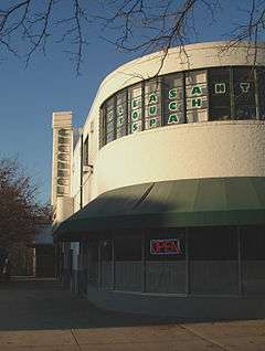
Roosevelt Center in November 2006. The building typifies the Art Deco style used during the original construction of Greenbelt. | |||
| |||
 Location in Maryland | |||
| Coordinates: 39°0′2″N 76°53′18″W / 39.00056°N 76.88833°WCoordinates: 39°0′2″N 76°53′18″W / 39.00056°N 76.88833°W | |||
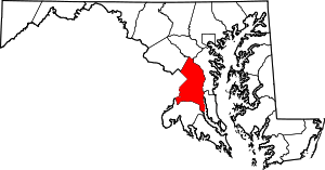
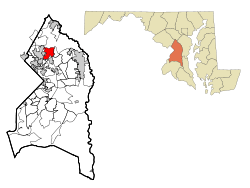
| Country |
| ||
| State |
| ||
| County |
| ||
| Incorporated | 1937 | ||
| Government | |||
| • Mayor | Emmett V. Jordan (D) | ||
| Area[1] | |||
| • Total | 16.42 km2 (6.34 sq mi) | ||
| • Land | 16.27 km2 (6.28 sq mi) | ||
| • Water | 0.16 km2 (0.06 sq mi) 0.95% | ||
| Elevation | 48 m (157 ft) | ||
| Population (2010)[2] | |||
| • Total | 23,068 | ||
| • Estimate (2012[3]) | 23,541 | ||
| • Density | 1,418.2/km2 (3,673.2/sq mi) | ||
| Time zone | Eastern (UTC-5) | ||
| • Summer (DST) | Eastern (UTC-4) | ||
| ZIP codes | 20768, 20770, 20771 | ||
| Area code(s) | 301 and 240 | ||
| FIPS code | 24-34775 | ||
| GNIS feature ID | 0597493 | ||
| Website | www.greenbeltmd.gov | ||

Greenbelt is a city in Prince George's County, Maryland, United States.[4] Contained within today's City of Greenbelt is the historic planned community now known locally as "Old Greenbelt" and designated as the Greenbelt Historic District. Greenbelt's population was 23,068 at the 2010 U.S. Census.
Greenbelt is known widely as a public cooperative community founded in the New Deal Era. Greenbelt was one of three "green" towns planned in 1935 under the United States Resettlement Administration, along with Greendale, Wisconsin (near Milwaukee) and Greenhills, Ohio (near Cincinnati).[5][6]
Geography


Greenbelt is located at 39°0′2″N 76°53′18″W / 39.00056°N 76.88833°W (39.000460, -76.888325).[7]
According to the United States Census Bureau, the city has a total area of 6.34 square miles (16.42 km2), of which, 6.28 square miles (16.27 km2) is land and 0.06 square miles (0.16 km2) is water.[1] Greenbelt's ZIP codes are 20768, 20770, and 20771.
The National Aeronautics and Space Administration's Goddard Space Flight Center is located in Greenbelt, as is Greenbelt Park, a unit of the National Park System.
Transportation
Two major highways pass through and have interchanges in Greenbelt: the Capital Beltway (I-95/I-495) and the National Park Service's Baltimore-Washington Parkway (Route 295). Greenbelt Road is a portion of State Highway 193, which connects several suburban towns. Kenilworth Avenue (Route 201) traverses Greenbelt in a North-South direction.
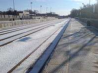
Washington Metro rapid transit rail service from Washington, D.C., serves Greenbelt Metro Station, the northern terminus of the system's Green Line. Commuter rail service to the same station is provided by MARC's Camden Line between Washington's Union Station and Camden Station in Baltimore, Maryland, using the original 1835 Baltimore and Ohio Railroad (B&O) track route between Washington and Baltimore, now part of the CSX System.
Bordering areas
- Beltsville Agricultural Research Center
- Berwyn Heights
- College Park
- Goddard
- Lanham
- New Carrollton
- Glenn Dale
History
Old Greenbelt was settled in 1937 as a public cooperative community in the New Deal Era. The concept was at the same time both eminently practical and idealistically utopian: the federal government would foster an "ideal" self-sufficient cooperative community that would also ease the pressing housing shortage near the nation's capital. Construction of the new town would also create jobs and thus help stimulate the national economic recovery following the Great Depression.
Greenbelt, which provided affordable housing for federal government workers, was one of three "green" towns planned in 1935 by Rexford Guy Tugwell, head of the United States Resettlement Administration, under authority of the Emergency Relief Appropriation Act. Working alongside Tugwell was Charles W. Yost. The two other green towns are Greendale, Wisconsin (near Milwaukee) and Greenhills, Ohio (near Cincinnati). A fourth green town, Roosevelt, New Jersey (originally called Homestead), was planned but was not fully developed on the same large scale as Greenbelt.
Eleanor Roosevelt, wife of President Franklin D. Roosevelt, helped Tugwell lay out the Maryland town on a site that had formerly consisted largely of tobacco fields. She was also heavily involved in the first cooperative community designed by the federal government in the New Deal Era, Arthurdale, West Virginia, which sought to improve the lives of impoverished laborers by enabling them to create a self-sufficient, and relatively prosperous, cooperative community. Cooperatives in Greenbelt include the Greenbelt News Review, Greenbelt Consumers Coop grocery store, the New Deal Cafe, and the cooperative forming the downtown core of original housing, Greenbelt Homes Incorporated (GHI).[5]
The architectural planning of Greenbelt was innovative, but no less so than the social engineering involved in this federal government project.[8] Applicants for residency were interviewed and screened based on income and occupation, and willingness to become involved in community activities.[9] African-Americans were initially excluded,[10] but were later included by the Greenbelt Committee for Fair Housing founded in 1963,[11] and came to number 41% of residents according to the 2000 census.[12] The same census data also indicates that African-Americans are isolated in certain parts within the town and the percentage of African-Americans within the historic area is often between 0% and 5% on most blocks.[13]
Much of the community is now located within the Greenbelt Historic District; listed on the National Register of Historic Places in 1980.[14]
Greenbelt was the subject of the 1939 documentary film The City.
Demographics
| Historical population | |||
|---|---|---|---|
| Census | Pop. | %± | |
| 1940 | 2,831 | — | |
| 1950 | 7,074 | 149.9% | |
| 1960 | 7,479 | 5.7% | |
| 1970 | 18,199 | 143.3% | |
| 1980 | 17,332 | −4.8% | |
| 1990 | 21,096 | 21.7% | |
| 2000 | 21,456 | 1.7% | |
| 2010 | 23,068 | 7.5% | |
| Est. 2015 | 24,272 | [15] | 5.2% |
2010 census
As of the census[2] of 2010, there were 23,068 people, 9,747 households, and 5,367 families residing in the city. The population density was 3,673.2 inhabitants per square mile (1,418.2/km2). There were 10,433 housing units at an average density of 1,661.3 per square mile (641.4/km2). The racial makeup of the city was 30.1% White, 47.8% African American, 0.3% Native American, 9.7% Asian, 0.1% Pacific Islander, 8.6% from other races, and 3.3% from two or more races. Hispanic or Latino of any race were 14.3% of the population.
There were 9,747 households of which 31.0% had children under the age of 18 living with them, 30.7% were married couples living together, 18.3% had a female householder with no husband present, 6.0% had a male householder with no wife present, and 44.9% were non-families. 36.1% of all households were made up of individuals and 7.3% had someone living alone who was 65 years of age or older. The average household size was 2.37 and the average family size was 3.12.
The median age in the city was 33.7 years. 22.8% of residents were under the age of 18; 10.1% were between the ages of 18 and 24; 34.4% were from 25 to 44; 25.3% were from 45 to 64; and 7.5% were 65 years of age or older. The gender makeup of the city was 46.7% male and 53.3% female.
2000 census
As of the census[12] of 2000, there were 21,456 people, 9,368 households, and 4,965 families residing in the city. The population density was 3,586.6 people per square mile (1,385.3/km²). There were 10,180 housing units at an average density of 1,701.7 per square mile (657.3/km²). The racial makeup of the city was 39.74% White, 41.35% African American, 0.23% Native American, 12.05% Asian, 0.05% Pacific Islander, 3.11% from other races, and 3.47% from two or more races. Hispanic or Latino of any race were 6.45% of the population.
There were 1,1202 households out of which 26.9% had children under the age of 18 living with them, 33.1% were married couples living together, 15.0% had a female householder with no husband present, and 47.0% were non-families. 35.0% of all households were made up of individuals and 5.8% had someone living alone who was 65 years of age or older. The average household size was 2.29 and the average family size was 3.00.
In the city the population was spread out with 21.9% under the age of 18, 12.5% from 18 to 24, 39.1% from 25 to 44, 19.8% from 45 to 64, and 6.7% who were 65 years of age or older. The median age was 32 years. For every 100 females there were 91.8 males. For every 100 females age 18 and over, there were 88.2 males.
The median income for a household in the city was $46,328, and the median income for a family was $55,671. Males had a median income of $39,133 versus $35,885 for females. The per capita income for the city was $25,236. About 6.0% of families and 10.2% of the population were below the poverty line, including 12.7% of those under age 18 and 7.2% of those age 65 or over.
Government
The City of Greenbelt operates under a council-manager government as established by the city charter, the first such arrangement in Maryland.[8] The Council consists of seven members elected by plurality-at-large voting. From their members, the Council selects the Mayor and the Mayor Pro Tem (who assumes the duties of the Mayor when the Mayor is unavailable). The Council has traditionally chosen the member with the highest vote count to be Mayor, and the member with the second-highest vote count as Mayor Pro Tem. Elections are held every two years, in odd-numbered years, in part to diminish the influence of political parties. Political party affiliations are not an official part of the city election process, and are seldom part of candidate campaigns. Regular council meetings are held on Mondays, twice per month except during July, August, and December, when meetings are held once per month.[17]
The City Council is supported by 14 advisory boards and committees of citizen volunteers. The council appoints a professional city manager responsible for supervising government operations and implementing the policies adopted by the council.
The 2013 election selected the current city council:[18]
- Mayor: Emmett Jordan
- Mayor Pro Tem: Judith "J" Davis
- Council Members: Konrad Herling, Leta Mach, Silke Pope, Edward Putens, and Rodney Roberts.
The council selects the City Manager:
- City Manager: Michael McLaughlin.
2009 election reform
Of the ten incorporated cities in Prince George's County, Greenbelt is one of three with at-large elections for council and mayor. (The others are District Heights and New Carrollton.) The remaining seven use combinations of districts and at-large voting. On 2008-02-28, the Maryland American Civil Liberties Union and Prince George's County NAACP sent a letter to the Greenbelt City Council claiming that Greenbelt's at-large system may violate section 2 of the Voting Rights Act of 1965.[19] According to the letter, the 2000 Census indicated that African-Americans constituted 38% of Greenbelt's voting-age population, Asians 13%, and Latinos 6%. At the time, however, all members of the city council were white. The letter proposed that the city switch to single-winner district-based voting, cumulative voting, or choice voting, and indicated a lawsuit would follow if no reform were implemented.[20] While the city population is racially diverse, only two African Americans had run for Council in the 30 years preceding the 2009 election,[21] one of whom had withdrawn before the election.[22] In June 2008, the United States Department of Justice opened an investigation into the city's election system.[23]
In 2008, the city government hosted three public community meetings regarding election reform, in concert with the ACLU, NAACP, and FairVote.[24] Over 100 residents attended the forums, including one of the unsuccessful African American candidates, Jeanette Gordy, who said, "My concern is that people don’t get off their royal behinds. By going to meetings I got what I wanted and found out I had power as a citizen."[25]
In 2009, the city implemented several election reforms with the goal of increasing diversity: increasing the city council from five to seven members, adding another precinct in Greenbelt East to shorten voter lines, and amending the city charter to allow early voting.[26]
In the election held November 3, 2009, Emmett Jordan, an African American, was chosen by 75% of voters,[27] electing him to the Council as Mayor Pro Tem, the second-highest city official.[28] Voter turnout increased from 1,898 to 2,399 voters (a 26% increase in ballots cast) from 2007 to 2009.[29]
In the election held November 5, 2013, Emmett Jordan was chosen by 77% of voters,[30] and receiving highest vote count was then elected Mayor by the council.[18]
Greenbelt Historic District
Designated as a National Historic Landmark in 1997, the Greenbelt Historic District contains Roosevelt Center and many buildings in the Art Deco style. The Historic District has retained several of the original businesses in Roosevelt Center including the Greenbelt Co-Op Supermarket and Pharmacy and the Old Greenbelt Theatre, while also adding new businesses such as the New Deal Cafe.
Education
Greenbelt is served by Prince George's County Public Schools.
There are three public elementary schools:
- Greenbelt Elementary School (Greenbelt),
- Magnolia Elementary School (unincorporated Prince George's County, Lanham address), and
- Springhill Lake Elementary School (Greenbelt).
All of Greenbelt is served by Greenbelt Middle School (Greenbelt), which includes a Talented and Gifted magnet program.
All of Greenbelt is served by Eleanor Roosevelt High School (Greenbelt), a highly rated school which includes a Science and Technology magnet program.
There is a public magnet school within the City:
- Dora Kennedy French Immersion School (Greenbelt), which serves K through 8th grade students. The school uses language immersion with instruction in the French language.
There is a public charter school within the City:
- Turning Point Academy (located within Greenbelt but using a Lanham mailing address), which serves K through 8th grade students using the Hyde process of character development.
There are no private schools within the City of Greenbelt.
Notable people
- Abraham Chasanow
- Erin Harpe, lead singer of Erin Harpe & the Delta Swingers
- Phyllis Richman, restaurant critic for the Washington Post from 1976 to 2000
- Dorothy Sucher, author
- Steve Rochinski, jazz guitarist, recording artist, composer/arranger, educator/ author - childhood home from 1955 to 1960.
- Rosa Salazar, actor
Economy
Top employers
According to Greenbelt's 2011 Comprehensive Annual Financial Report,[31] the top employers in the city were:
| # | Employer | # of Employees |
|---|---|---|
| 1 | City of Greenbelt | 440 |
| 2 | ManTech International | 267 |
| 3 | Target | 208 |
| 4 | Bozzuto Group | 206 |
| 5 | Eleanor Roosevelt High School | 202 |
| 6 | Martin's Caterers | 192 |
| 7 | Arctic Slope Regional Corporation | 151 |
| 8 | Giant | 147 |
| 9 | Safeway | 131 |
| 10 | Atlanta Restaurant Partners (TGI Friday's) | 122 |
Gallery
-
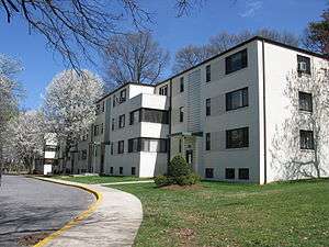
Apartments in Greenbelt
-

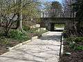
Extensive pedestrian paths connect residences, in this case feeding into a tunnel beneath the primary collector roadway
-
A grade-separated pedestrian path / roadway crossing, inspired by such configurations in Radburn, New Jersey
-

Albert S. Buddy Attick Lake Park. The artificial lake replaces the open parkland of the Radburn plan
-
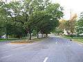
Southway, a road on the southern portion of Old Greenbelt
-
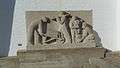
One of several panels by sculptor Lenore Thomas Straus, installed at the Greenbelt Community Center
See also
- Greenbelt News Review
- Greenbelt Police Department
- Greenbelt 15K
- New Deal Cafe
- Arthurdale, West Virginia
References
- 1 2 "US Gazetteer files 2010". United States Census Bureau. Archived from the original on 2012-01-24. Retrieved 2013-01-25.
- 1 2 "American FactFinder". United States Census Bureau. Retrieved 2013-01-25.
- ↑ "Population Estimates". United States Census Bureau. Archived from the original on 2013-06-17. Retrieved 2013-06-26.
- ↑ U.S. Geological Survey Geographic Names Information System: Greenbelt, Maryland
- 1 2 Halpern, Sue (May–June 2002), "New Deal City", Mother Jones, retrieved 2007-07-07
- ↑ "Greendale Originals - The shops, history and events in the Village of Greendale, Wisconsin.".
- ↑ "US Gazetteer files: 2010, 2000, and 1990". United States Census Bureau. 2011-02-12. Retrieved 2011-04-23.
- 1 2 "HOUSING: Greenbelt". Time. 1937-09-13. Retrieved 2010-07-23.
- ↑ "Images and Voices of Greenbelt: Oral Histories". Virtual Greenbelt. University of Maryland. 2000. Retrieved 2010-07-23.
- ↑ Vick, Karl (1997-04-20), "In FDR Years, 'Sleepy Southern Town' Woke Up", The Washington Post, retrieved 2009-11-03
- ↑ "Images and Voices of Greenbelt: Oral Histories". Virtual Greenbelt. University of Maryland. 2000. Retrieved 2010-07-23.
- 1 2 "American FactFinder". United States Census Bureau. Archived from the original on 2013-09-11. Retrieved 2008-01-31.
- ↑ "20770 Zip Code (Greenbelt, Maryland) Profile - homes, apartments, schools, population, income, averages, housing, demographics, location, statistics, sex offenders, residents and real estate info". City-data.com. Retrieved 2016-03-11.
- ↑ "Greenbelt Historic District". Maryland Historical Trust. Retrieved 2008-10-29.
- ↑ "Annual Estimates of the Resident Population for Incorporated Places: April 1, 2010 to July 1, 2015". Retrieved July 2, 2016.
- ↑ "Census of Population and Housing". Census.gov. Archived from the original on May 11, 2015. Retrieved June 4, 2015.
- ↑ "Greenbelt City Government". Greenbelt CityLink. City of Greenbelt, Maryland. Retrieved 2008-08-24.
- 1 2 Oberg, Diane (2013-11-14), "Full House Sees Emmett Jordan Elected and Inducted as Mayor" (PDF), Greenbelt News Review, pp. 1, 6, retrieved 2013-11-16
- ↑ "ACLU Contacts City re: Reform for Fairness of Election System" (PDF), Greenbelt News Review, pp. 1, 6, 2008-03-27, retrieved 2008-08-24
- ↑ Jeon, Deborah A. (Legal Director, American Civil Liberties Union of Maryland) (2008-02-28). "Letter to the Greenbelt City Council" (PDF). Retrieved 2008-08-24.
- ↑ McLaughlin, Michael (City Manager of Greenbelt) (2008-06-03). "Response to Gazette editorial" (PDF). Retrieved 2010-09-27.
- ↑ Attebury, Jordan; Lyles, Jeffrey K. (December 3, 2009), "A change in complexion for Greenbelt", Washington Post, retrieved 2010-01-12
- ↑ McGill, Natalie (June 5, 2008), "Probe of election system begins", Maryland Gazette, retrieved 2008-07-17
- ↑ Woods, Bay (2008-10-09), "NAACP and ACLU Hold Their Third Meeting in Greenbelt West" (PDF), Greenbelt News Review, pp. 1, 6, retrieved 2009-11-07
- ↑ White, Thomas X. (2008-08-28), "County Groups Seek to Change Manner of Voting in Greenbelt" (PDF), Greenbelt News Review, pp. 1, 12, retrieved 2008-09-11
- ↑ Attebury, Jordan (September 24, 2009), "Nine candidates vie for city office", Maryland Gazette, retrieved 2009-11-04
- ↑ Giese, James (2009-11-05), "Jordan, Davis, City Are the Big Winners in City Council Election" (PDF), Greenbelt News Review, pp. 1, 8, retrieved 2009-11-07
- ↑ Attebury, Jordan (November 3, 2009), "Greenbelt elects first black city councilman", Maryland Gazette, retrieved 2009-11-04
- ↑ City of Greenbelt 2009 Election Results, November 4, 2009, retrieved 2009-11-04
- ↑ Giese, James (2013-11-07), "Emmett Jordan Gets Top Vote All Incumbents Are Re-elected" (PDF), Greenbelt News Review, pp. 1, 7, retrieved 2013-11-16
- ↑
Further reading
- Cathy D. Knepper (2001), Greenbelt, Maryland: A Living Legacy of the New Deal (Creating the North American Landscape), The Johns Hopkins University Press, ISBN 0-8018-6490-9
- Mary Lou Williamson (editor) (1987), Greenbelt: History of a New Town, 1937-1987, The Donning Company, ISBN 0-89865-607-9
External links
| Wikimedia Commons has media related to Greenbelt, Maryland. |
| Wikivoyage has a travel guide for Greenbelt. |
- Greenbelt city government website
- Greenbelt community website
- Greenbelt Arts Center
- Greenbelt Museum
- Virtual Greenbelt at the University of Maryland, College Park
- Greenbelt Volunteer Fire Department
- Kojo Namdi Show: Kojo In Your Community: Greenbelt