Greater Moncton
| Greater Moncton | |
|---|---|
|
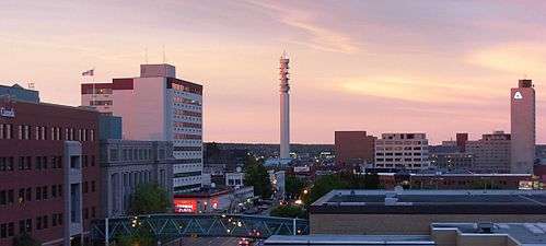
Downtown Moncton skyline | |
| Country |
|
| Province |
|
| Area (2011)[1] | |
| • Total | 2,406.31 km2 (929.08 sq mi) |
| Population (2011)[1] | |
| • CMA | 138,644 |
| • CMA density | 57.6/km2 (149/sq mi) |
| Time zone | AST (UTC-4) |
| • Summer (DST) | ADT (UTC-3) |
Greater Moncton[2] (French: Grand Moncton) is the name given to the area encompassing Metro Moncton (Moncton, Riverview, and Dieppe). Greater Moncton is also known as Greater Moncton Census Metropolitan Area, Moncton Metropolitan Area or Moncton CMA, and is located in New Brunswick, Canada. Greater Moncton has a population of 138,644 (2011).
Metro Moncton Government Services
- Metro Moncton Water and Sewer System - The Water system used comes from The Turtle Creek Reservoir.
- Codiac Transpo - Bussing System used.
Tourist Attractions
Main article: List of tourist attractions in Greater Moncton
List of towns, communities and cities[2]
See also
Neighbouring regions
References
- 1 2 "Population and dwelling counts, for census metropolitan areas, 2011 and 2006 censuses". Statistics Canada. 2012-02-08. Retrieved 2012-02-13.
- 1 2 Greater Moncton, Information on Metro Moncton and surrounding communities.
Coordinates: 46°6′42.2″N 64°39′13.2″W / 46.111722°N 64.653667°W
This article is issued from Wikipedia - version of the 8/26/2016. The text is available under the Creative Commons Attribution/Share Alike but additional terms may apply for the media files.