Great Falls, Montana
| Great Falls, Montana | ||
|---|---|---|
| City | ||
|
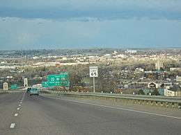
Great Falls, Montana as viewed from Interstate 15, looking due north | ||
| ||
| Nickname(s): The Electric City | ||
 Location of Great Falls, Montana | ||
| Coordinates: 47°30′13″N 111°17′11″W / 47.50361°N 111.28639°WCoordinates: 47°30′13″N 111°17′11″W / 47.50361°N 111.28639°W | ||
| Country | United States | |
| State | Montana | |
| County | Cascade | |
| Government | ||
| • Mayor | Bob Kelly | |
| Area[1] | ||
| • City | 22.26 sq mi (57.65 km2) | |
| • Land | 21.79 sq mi (56.44 km2) | |
| • Water | 0.47 sq mi (1.22 km2) | |
| Elevation | 3,330 ft (1,015 m) | |
| Population (2010)[2] | ||
| • City | 58,505 | |
| • Estimate (2015)[3] | 59,638 | |
| • Rank | US: 617th | |
| • Density | 2,684.9/sq mi (1,036.6/km2) | |
| • Metro | 82,278 (US: 374th) | |
| Time zone | Mountain (MST) (UTC-7) | |
| • Summer (DST) | MDT (UTC-6) | |
| ZIP codes | 59401-59406 | |
| Area code | 406 | |
| FIPS code | 30-32800 | |
| GNIS feature ID | 0802113 | |
| Website | http://www.greatfallsmt.net/ | |


Great Falls is a city in and the county seat of Cascade County, Montana, United States.[4] The 2015 census estimate put the population at 59,638.[3] The population was 58,505 at the 2010 census. It is the principal city of the Great Falls, Montana Metropolitan Statistical Area, which encompasses all of Cascade County and has a population of 82,278.[5] Great Falls was the largest city in Montana from 1950 to 1970, when Billings surpassed it. Great Falls remained the second largest city in Montana until 2000, when it was passed by Missoula.[6] Since then Great Falls has been the third largest city in the state.[7]
Great Falls takes its name from the series of five waterfalls in close proximity along the upper Missouri River basin that the Lewis and Clark Expedition had to portage around over a ten-mile stretch; the effort required 31 days of arduous labor during the westward leg of their 1805-06 exploration of the Louisiana Purchase and to the Pacific Northwest Coast of the Oregon Country. Each falls sports a hydroelectric dam today, hence Great Falls is nicknamed "the Electric City". Currently there are two undeveloped parts of their portage route; these are included within the Great Falls Portage, a National Historic Landmark.
The city is home to the C. M. Russell Museum Complex, the University of Great Falls, Great Falls College Montana State University, Giant Springs, the Roe River (claimed to be the world's shortest river), the Montana School for the Deaf and the Blind, the Great Falls Voyagers minor league baseball (formerly known as the Great Falls White Sox and before that as the Dodgers and Giants respectively) team, and Malmstrom Air Force Base. The local newspaper is the Great Falls Tribune. A Coldwell Banker Home Price Comparison Index listed Great Falls as the most affordable area of 348 markets in the US, Canada, and Puerto Rico.
History
The first human beings to live in the Great Falls area were Paleo-Indians who migrated into the region between 9,500 BCE and 8,270 BCE.[8][9] The earliest inhabitants of North America entered Montana east of the Continental Divide between the mountains and the Laurentide ice sheet.[10] The area remained only sparsely inhabited, however.[11] Salish Indians would often hunt bison in the region on a seasonal basis, but no permanent settlements existed at or near Great Falls for much of prehistory.[11] Around 1600, Piegan Blackfeet Indians, migrating west, entered the area, pushing the Salish back into the Rocky Mountains and claiming the site now known as Great Falls as their own.[11] The Great Falls location remained the tribal territory of the Blackfeet until long after the United States claimed the region in 1803.[12][13]
Meriwether Lewis was the first white person to visit the area, which he did on June 13, 1805, as part of the Lewis and Clark Expedition.[14][15] York, an African American slave owned by William Clark and who had participated in the Expedition, was the first black American to visit the site of the future city.[16]


Following the return passage of Lewis and Clark in 1806,[17] there is no record of any white person visiting the site of the city of Great Falls until explorer and trapper Jim Bridger reached the area in 1822.[12] Bridger and Major Andrew Henry led a fur-trading expedition to the future city location in April 1823 (and were attacked by Blackfeet Indians while camping at the site).[18] British explorer Alexander Ross trapped around Great Falls in 1824.[19] In 1838, a mapping expedition sent by the U.S. federal government and guided by Bridger spent four years in the area.[12] Margaret Harkness Woodman became the first white woman to visit the Great Falls area in 1862.[20]
The Great Falls of the Missouri River marked the limit of the navigable section of the Missouri River for non-portagable watercraft,[21] and the non-navigability of the falls was noted by the U.S. Supreme Court in its 2012 ruling against the State of Montana on the question of streambed ownership beneath several dams situated at the site of the falls.[22] The first steamboat arrived at future site of the city in 1859.[23]
Politically, the future site of Great Falls passed through numerous hands in the 19th century. It was part of the unincorporated frontier until May 30, 1854, when Congress established the Nebraska Territory.[24] Indian attacks on white explorers and settlers dropped significantly after Isaac Stevens negotiated the Treaty of Hellgate in 1855, and white settlement in the area began to occur.[12] On March 2, 1861, the site became part of the Dakota Territory.[25] The Great Falls area was incorporated into the Idaho Territory on March 4, 1863,[26] and then into the Montana Territory on May 28, 1864.[11] It became part of the state of Montana upon that territory's admission to statehood on November 8, 1889.[11]
Great Falls was founded in 1883. Businessman Paris Gibson visited the Great Falls of the Missouri River in 1880, and was deeply impressed by the possibilities for building a major industrial city near the falls with power provided by hydroelectricity.[27][28][29][30] He returned in 1883 with friend Robert Vaughn and some surveyors and platted a permanent settlement the south side of the river.[12][27][28] The city's first citizen, Silas Beachley, arrived later that year.[12] With investments from railroad owner James J. Hill and Helena businessman Charles Arthur Broadwater, houses, a store, and a flour mill were established in 1884.[12][27][28][29][30] The Great Falls post office was established on July 10, 1884, and Paris Gibson was named the first postmaster.[31] A planing mill, lumber yard, bank, school, and newspaper were established in 1885.[27][30] By 1887 the town had 1,200 citizens, and in October of that year the Great Northern Railway arrived in the city.[27][29][30] Great Falls was incorporated on November 28, 1888.
Black Eagle Dam was built in 1890, and by 1912 Rainbow Dam and Volta Dam (now Ryan Dam) were all operating.[12][27][30]
Great Falls quickly became a thriving industrial and supply center and, by the early 1900s, was en route to becoming one of Montana's largest cities. The rustic studio of famed Western artist Charles Marion Russell was a popular attraction, as were the famed "Great Falls of the Missouri", after which the city was named. A structure billed as the "world's tallest smokestack" was completed in 1908 by the city's largest employer, the Anaconda Copper Mining Company's smelter, measuring 508 feet (155 m) tall. The Big Stack immediately became a landmark for the community. The Big Stack's 'sister' stack in Anaconda was suffering from cracking and it was decided to remove the support bands from the upper half of the Big Stack and send them to Anaconda. This action proved to be the Big Stack's ultimate demise since the cracks it suffered from rapidly worsened. Citing public safety concerns due to the stack's continual deterioration of its structural integrity it was slated for demolition on September 18, 1982. In an interesting twist of fate the demolition crew failed to accomplish the task on the first try; the two worst cracks in the stack ran from just above ground level to nearly 300 feet up. As the 600 lbs of explosives were set off (which was to create a wedge in the base so it would fall almost vertically into a large trench for the rubble) the cracks 'completed themselves' all the way to the ground—effectively severing the stack into two-thirds and one-third pieces. Much to the delight of the spectating community, the smaller of the two pieces remained standing, but the failed demolition only solidified the safety issue whereas the community cited the event as the stack's defiance. The demolition team who had planted the charges was recalled and several hours later they returned and finished the demolition, after packing another 400 lbs of explosives into the smaller wedge.
During World War II the Northwest Staging Route passed through the city on which planes were delivered to the USSR according to the Lend-Lease program. Great Falls prospered further with the opening of a nearby military base in the 1940s, but as rail transportation and freight slowed in the later part of the century, outlying farming areas lost population, and with the closure of the smelter and cutbacks at Malmstrom Air Force Base in the 1980s, its population growth slowed.
The economy of Great Falls has suffered from the decline of heartland industry in recent years much like other cities in the Great Plains and Midwest.
Geography and climate

Great Falls is located near several waterfalls on the Missouri River. It lies near the center of Montana on the northern Great Plains. It lies next to the Rocky Mountain Front and is about 100 miles (160 km) south of the Canada–US border.
The city of Great Falls lies atop the Great Falls Tectonic Zone, an intracontinental shear zone between two geologic provinces of basement rock of the Archean period which form part of the North American continent.[32] The city lies at the southern reach of the Laurentide ice sheet, a vast glacial sheet of ice which covered much of North America during the last glacial period. Approximately 1.5 million years ago, the Missouri River flowed northward into a terminal lake.[33][34] The Laurentide ice sheet pushed the river southward.[33][35] Between 15,000 BCE and 11,000 BCE, the Laurentide ice sheet blocked the Missouri River and created Glacial Lake Great Falls.[8][35][36] About 13,000 BCE, as the glacier retreated, Glacial Lake Great Falls emptied catastrophically in a glacial lake outburst flood.[8] The current course of the Missouri River essentially marks the southern boundary of the Laurentide ice sheet.[37] The Missouri River flowed eastward around the glacial mass, settling into its present course.[33] As the ice retreated, meltwater from Glacial Lake Great Falls poured through the Highwood Mountains and eroded the mile-long, 500-foot-deep (150 m) Shonkin Sag—one of the most famous prehistoric meltwater channels in the world.[38]
Great Falls is also situated on a fall line unconformity in the Great Falls Tectonic Zone,[39] as well as atop the Kootenai Formation, a mostly nonmarine sandstone laid down by rivers, glaciers, and lakes in the past.[40][41]

According to the United States Census Bureau, the city has a total area of 22.26 square miles (57.65 km2), of which, 21.79 square miles (56.44 km2) is land and 0.47 square miles (1.22 km2) is water.[1]
Great Falls has a cold semi-arid climate Köppen climate classification (BSk), with a notable amount of summer precipitation occurring in the form of thunderstorms. Winters are very cold, long and often snowy, though periods of chinook winds do cause warm spells and raise the maximum temperature above 50 °F (10 °C) on an average of twelve days during three months of 2015-2016[42] In the absence of such winds, shallow cold snaps are common; there is an average of 20.8 nights with a low of 0 °F (−17.8 °C) or colder and 44 days failing to top freezing. The wettest part of the year is the spring. Summers are hot and dry, with highs reaching 90 °F (32.2 °C) on nineteen days per year, though the diurnal temperature variation is large and easily exceeds 30 °F (16.7 °C).[43] Freak early and late summer snowfalls such as a two-day total of 8.3 in (21.1 cm) in August 1992 can occur, although the median snowfall from June to September is zero and on average the window for accumulating (0.1 in or 0.25 cm) snowfall is October 2 thru May 13.[43] The average first and last freeze dates are September 21 and May 21, respectively, allowing a growing season of 122 days, although, excepting for July, a freeze has occurred in every month of the year. Extreme temperatures range from −49 °F (−45.0 °C) on February 15, 1936 to 107 °F (41.7 °C) on July 25, 1933.
| Climate data for Great Falls, Montana (Great Falls Int'l), 1981–2010 normals, extremes 1891–present | |||||||||||||
|---|---|---|---|---|---|---|---|---|---|---|---|---|---|
| Month | Jan | Feb | Mar | Apr | May | Jun | Jul | Aug | Sep | Oct | Nov | Dec | Year |
| Record high °F (°C) | 67 (19) |
70 (21) |
78 (26) |
89 (32) |
100 (38) |
102 (39) |
107 (42) |
106 (41) |
98 (37) |
91 (33) |
76 (24) |
69 (21) |
107 (42) |
| Average high °F (°C) | 35.5 (1.9) |
38.3 (3.5) |
45.9 (7.7) |
55.6 (13.1) |
64.8 (18.2) |
73.3 (22.9) |
83.4 (28.6) |
82.3 (27.9) |
70.3 (21.3) |
57.7 (14.3) |
43.3 (6.3) |
34.6 (1.4) |
57.08 (13.93) |
| Average low °F (°C) | 14.9 (−9.5) |
16.4 (−8.7) |
22.6 (−5.2) |
30.5 (−0.8) |
38.6 (3.7) |
46.1 (7.8) |
51.4 (10.8) |
50.4 (10.2) |
42.0 (5.6) |
32.8 (0.4) |
23.4 (−4.8) |
14.9 (−9.5) |
32.00 (0) |
| Record low °F (°C) | −44 (−42) |
−49 (−45) |
−32 (−36) |
−10 (−23) |
12 (−11) |
31 (−1) |
35 (2) |
30 (−1) |
10 (−12) |
−11 (−24) |
−25 (−32) |
−43 (−42) |
−49 (−45) |
| Average precipitation inches (mm) | 0.51 (13) |
0.47 (11.9) |
0.91 (23.1) |
1.42 (36.1) |
2.42 (61.5) |
2.53 (64.3) |
1.50 (38.1) |
1.57 (39.9) |
1.42 (36.1) |
0.86 (21.8) |
0.59 (15) |
0.55 (14) |
14.75 (374.8) |
| Average snowfall inches (cm) | 8.6 (21.8) |
8.2 (20.8) |
11.9 (30.2) |
8.6 (21.8) |
2.7 (6.9) |
0.3 (0.8) |
0 (0) |
0.3 (0.8) |
1.2 (3) |
4.1 (10.4) |
8.1 (20.6) |
9.5 (24.1) |
63.5 (161.2) |
| Average precipitation days (≥ 0.01 in) | 6.8 | 7.0 | 9.3 | 9.4 | 11.7 | 11.7 | 7.5 | 7.9 | 7.8 | 6.6 | 6.7 | 7.5 | 99.9 |
| Average snowy days (≥ 0.1 in) | 7.2 | 6.8 | 7.8 | 4.5 | 1.6 | 0.2 | 0 | 0.1 | 0.8 | 3.1 | 5.7 | 7.5 | 45.3 |
| Mean monthly sunshine hours | 125.1 | 151.7 | 237.5 | 245.7 | 286.6 | 316.5 | 377.4 | 330.8 | 254.4 | 200.4 | 124.8 | 105.4 | 2,756.3 |
| Source #1: NOAA (sun 1961–1990)[44][45] | |||||||||||||
| Source #2: Weather.com (extremes) [46] | |||||||||||||
Demographics
| Historical population | |||
|---|---|---|---|
| Census | Pop. | %± | |
| 1890 | 3,979 | — | |
| 1900 | 14,930 | 275.2% | |
| 1910 | 13,948 | −6.6% | |
| 1920 | 24,121 | 72.9% | |
| 1930 | 28,822 | 19.5% | |
| 1940 | 29,928 | 3.8% | |
| 1950 | 39,214 | 31.0% | |
| 1960 | 55,244 | 40.9% | |
| 1970 | 60,091 | 8.8% | |
| 1980 | 56,725 | −5.6% | |
| 1990 | 55,097 | −2.9% | |
| 2000 | 56,690 | 2.9% | |
| 2010 | 58,505 | 3.2% | |
| Est. 2015 | 59,638 | [47] | 1.9% |
| source:[48] U.S. Decennial Census[49] 2015 Estimate[3] | |||
2010 census
As of the census[2] of 2010, there were 58,505 people, 25,301 households, and 15,135 families residing in the city. The population density was 2,684.9 inhabitants per square mile (1,036.6/km2). There were 26,854 housing units at an average density of 1,232.4 per square mile (475.8/km2). The racial makeup of the city was 88.5% caucasian, 1.1% African American, 5.0% Native American, 0.9% Asian, 0.1% Pacific Islander, 0.6% from other races, and 3.8% from two or more races. Hispanic or Latino of any race were 3.4% of the population.
There were 25,301 households of which 28.6% had children under the age of 18 living with them, 43.6% were married couples living together, 11.5% had a female householder with no husband present, 4.8% had a male householder with no wife present, and 40.2% were non-families. 33.5% of all households were made up of individuals and 12.7% had someone living alone who was 65 years of age or older. The average household size was 2.26 and the average family size was 2.88.
The median age in the city was 39 years. 22.5% of residents were under the age of 18; 9.9% were between the ages of 18 and 24; 24.5% were from 25 to 44; 26.5% were from 45 to 64; and 16.6% were 65 years of age or older. The gender makeup of the city was 48.9% male and 51.1% female.
2000 census
As of the 2000 census, there were 56,690 people, 23,834 households, and 14,848 families residing in the city. The population density was 2,909.1 people per square mile (1,123.0/km²). There were 25,250 housing units at an average density of 1,295.7 per square mile (500.2/km²). The racial makeup of the city was 89.96% caucasian, 0.95% African American, 5.09% Native American, 0.86% Asian, 0.09% Pacific Islander, 0.60% from other races, and 2.45% from two or more races. Hispanic or Latino of any race were 2.39% of the population.
There were 23,834 households out of which 30.1% had children under the age of 18 living with them, 47.4% were married couples living together, 11.1% had a female householder with no husband present, and 37.7% were non-families. 31.9% of all households were made up of individuals and 12.4% had someone living alone who was 65 years of age or older. The average household size was 2.31 and the average family size was 2.92.
In the city the age distribution of the population shows 24.9% under the age of 18, 9.0% from 18 to 24, 27.7% from 25 to 44, 22.7% from 45 to 64, and 15.7% who were 65 years of age or older. The median age was 38 years. For every 100 females there were 94.2 males. For every 100 females age 18 and over, there were 91.4 males.
The median income for a household in the city was $32,436, and the median income for a family was $40,107. Males had a median income of $29,353 versus $20,859 for females. The per capita income for the city was $18,059. About 11.1% of families and 14.5% of the population were below the poverty line, including 20.3% of those under the age of 18 and 9.2% of those 65 and older.
Communities of the Great Falls Metro area
Military
Great Falls is home to Malmstrom Air Force Base and the 341st Missile Wing. The 341st Operations Group provides the forces to launch, monitor and secure the wing's Intercontinental ballistic missile (ICBM) and missile alert facilities (MAF).
These ICBMs and MAFs are dispersed over the largest missile complex in the Western Hemisphere, an area encompassing some 23,000 sq mi (60,000 km2) (approximately the size of the state of West Virginia).
The group manages a variety of equipment, facilities, and vehicles worth more than $5 billion.
Great Falls International Airport is home to the Montana Air National Guard's 120th Airlift Wing. The 120AW is composed of C-130 Hercules (C-130H) cargo aircraft and associated support personnel.
Great Falls is also home to the 889th Army Reserve Unit.
The 819th Red Horse rapid deployment unit is also located on Malmstrom AFB
Arts and culture


Great Falls has a symphony orchestra, founded in 1959, which generally offers multiple concert series throughout the year, also sponsoring a Youth Orchestra, the Cascade String Quartet, the Chinnook Winds Quartet, other Chamber ensembles and an educational outreach program. Well-known performers brought in to perform with Great Falls Symphony have included Yo-Yo Ma, Itzhak Perlman, Midori, Joshua Bell, James Galway, Christopher Parkening and Evelyn Glennie.[50]
The community also is notable for the unique Sip 'n Dip Lounge, a tiki bar located downtown in the O'Haire Motor Inn. Built in 1962, it features an indoor swimming pool visible through a window in the bar where women dressed as "mermaids" swim underwater. In 2003, GQ Magazine rated the lounge as one of the top 10 bars in the world,[51] and the #1 bar in the world "worth flying for".[52] With the added feature of an octogenarian piano player named "Piano Pat," noted for her "unusual covers" of songs by Frank Sinatra and other performers of the 1960s, Frommer's travel guide calls it "one of the kitschiest, wackiest, and flat-out coolest nightspots, not just in Montana, but in the entire West."[53]
Four Seasons Arena
The Four Seasons Arena is a multi-purpose indoor sports and exhibition arena located in the city of Great Falls, Montana, in the United States. Constructed in 1979, it served primarily as an ice rink until 2005. The failure of the practice rink's refrigeration system in 2003 and the management's decision to close the main rink in 2006 led to the facility's reconfiguration as an indoor sports and exhibition space. As of May 2011 it is the largest exhibition, music, and sports venue in the city.
Sports and recreation
| Club | Sport | League | Stadium (or Arena) |
|---|---|---|---|
| Great Falls Voyagers | Baseball | Pioneer League | Centene Stadium |
| Great Falls Gladiators | Football | Rocky Mountain Football League | Memorial Stadium |
| Great Falls Americans | Ice Hockey | North American 3 Hockey League | Great Falls Ice Plex |
For the 1979–80 WHL season, Great Falls and the Four Seasons Arena was the home of the Great Falls Americans hockey team (see below). The team was 2-25 before folding. Great Falls has a rich baseball history with the Voyagers. Formerly called the White Sox, Dodgers and Giants, baseball players such as Pedro Martínez, José Offerman, and Raúl Mondesí have spent time in Great Falls with the team. Since 1988, the team has won the Pioneer League championship six times (1988, 1989, 1990, 2002, 2008, and 2011). In 2007, the Great Falls Explorers basketball team were the CBA National Conference Runner-Up.
Great Falls has been home to the Great Falls Americans Junior A ice hockey team since the 2011–2012 season.
Great Falls is home to the Great Falls Gladiators semi-professional football team. The Gladiators are currently the defending Rocky Mountain Football League champions, recording an 11-0 record and winning the AA division championship at home in Memorial Stadium.
Local media
- AM radio
- FM radio
- KGPR 89.9
- KLFM 92.9
- KTZZ 93.7
- KMON-FM 94.5
- KVVR 97.9
- KAAK 98.9
- KLSK 100.3
- KMXM 101.9
- KINX 102.7
- KIKF 104.9
- KQDI-FM 106.1
- KIMO 107.3
- Television
- Newspapers
The Great Falls Tribune is published in Great Falls. Great Falls is the second largest media market in the state of Montana.
Fire and police
Great Falls Fire Rescue consists of 65 uniformed Firefighters and 3 civilian personnel. All suppression Firefighters are certified EMT's, with 20 of them certified as Paramedics. One uniformed Firefighter is an Inspector to the Fire Prevention Bureau, and assists the Fire Marshal. The department has four stations, manned 24 hours a day by four platoons (shifts). They also maintain a Training Facility, a 10-acre site that offers a wide variety of training opportunities. The facility has live fire training, search and rescue, multi story operations, HazMat training, and an obstacle course.
The Great Falls Police Department is the municipal law enforcement agency. The GFPD has 82 sworn men and women and 37 civilian supportive staff. The patrol division consists of 49 officers. There are four shifts. In 2005 the officers responded to 32,823 calls. There are three patrol teams, and each consist of a Lieutenant, two sergeants, and ten officers.[54] There are two canines on the GFPD force, K-9 Oakley and K-9 Rhingo. Officers Cunningham and Green are the dogs' owners. The dogs specialize in drug detection and suspect apprehension.[55] Bike patrol consists of four officers and they mainly patrol the downtown section of the city. They volunteer to patrol on mountain bikes.[56] HRU is a SWAT team which is trained to handle dangerous situations. The candidates take on rigorous tasks.[56]
The GFPD was established in 1888. George E. Huy was the first police chief. At that time the department had two officers. The officers did not wear uniforms so they used plain clothes. The department got automobiles in 1914, and two-way radios in 1940, then computers in 1970. Now the department has 82 officers and 65 cars.[57] The current police chief is David Bowen.[58] The current Sheriff is Bob Edwards.
Education
There are 20 schools within the Great Falls Public Schools system. These include two public high schools, an alternative high school, two middle schools, and 15 elementary schools.[59] The two public high schools are Great Falls High School and Charles M. Russell High School. The alternative high school is Paris Gibson Education Center, located in the former Paris Gibson Junior High School building. The two middle schools are North Middle School and East Middle School.
Great Falls also is home to many private schools, all of them sponsored by religious organizations. The Catholic Church sponsors several schools in the city, including Great Falls Montessori (grades Pre-K to K), Our Lady of Lourdes Catholic School (Pre-K to grade 8), Holy Spirit Catholic School (Pre-K to grade 8), and Great Falls Central Catholic High School (grades 9 to 12). The Conservative Baptist Association of America sponsors two schools in the city: Heritage Baptist School (K to grade 9) and Treasure State Academy (Pre-K to grade 12). The Seventh-day Adventist Church also sponsors two schools: Adventist Christian (grades 1 to 8) and Five Falls Christian Church (grades 1 to 8). There is also a nondenominational Christian school, Foothills Community Christian School (Pre-K to grade 12).
Great Falls is home to two institutions of higher education. Great Falls College Montana State University is a two-year public institution of higher learning. It was founded as the Great Falls Vocational-Technical Center in 1969, and received its current name after the state restructured the two-year comprehensive colleges in the state in 2012. Although a public institution since its creation, it became part of the Montana University System in 1994. The University of Great Falls a private, four-year Catholic university founded in 1932 by the Sisters of Providence and the Ursuline Sisters.
Infrastructure
Transportation infrastructures
Great Falls is served by Great Falls International Airport, with 4 passenger and 5 cargo airlines. Of those, only Allegiant Air and Fed Ex Express provide service to the city with mainline (large) jet aircraft.
Notable people
- Valeen Tippetts Avery, biographer and historian
- Walter Breuning (1896–2011), once the oldest man in the world
- Mal Bross, National Football League player
- James R. Browning, judge and former Chief Judge on United States Court of Appeals for the Ninth Circuit and former clerk of United States Supreme Court
- Dorothy Coburn, silent-movie actress
- Walter Coy, actor
- Brian Coyle, Minnesota community leader and gay activist
- Scott Davis, two-time U.S. Figure Skating Championships gold medalist
- Dave Dickenson, Canadian Football League quarterback
- Patrick Dwyer, National Hockey League player
- Cory Fong, North Dakota State Tax Commissioner
- Todd Foster, Olympic boxer
- Norman A. Fox, Western author
- Ted Geoghegan, horror filmmaker
- John Gibbons, Major League Baseball manager
- Paris Gibson, U.S. Senator, city founder[60]
- Missy Gold, child actress on Benson
- Tyler Graham, professional baseball player
- Melony G. Griffith, member of Maryland House of Delegates
- A. B. Guthrie, Jr., Pulitzer Prize-winning author of The Way West
- Malcolm Hancock, magazine cartoonist
- Hannah Rose, Christian musician
- Charles S. Hartman, United States Representative from Montana[61]
- Paul G. Hatfield, Federal District Court Judge (1979 to 2000), former U.S. Senator, former Chief Justice of the Montana Supreme Court, former Montana state District Court Judge[62]
- Lester Hogan, pioneer in microwave & semiconductor technology
- George Horse-Capture, Native American activist and museum curator
- Joseph Kinsey Howard, author and historian
- Josh Huestis, NBA player
- Patrick M. Hughes, Lieutenant General, United States Army, Director of the Defense Intelligence Agency, February 1996–July 1999[63]
- Alma Smith Jacobs, director, Great Falls Public Library; first African American Montana State Librarian
- Jay L. Johnson, U.S. Navy admiral, Chief of Naval Operations
- Raymond A. Johnson, aviation pioneer, worked at Great Falls airport in 1940s[64]
- Edward McKnight Kauffer, early 20th Century graphic designer and poster artist
- Pert Kelton, actress, the original Alice Kramden on The Honeymooners
- Ryan Leaf, NFL quarterback
- Barbara Luddy, actress
- Howard Lyman, vegetarian activist
- Einar Axel Malmstrom, U.S. Air Force colonel
- Mike Mansfield, U.S. Representative, Senator, longest-serving Senate majority leader, U.S. Ambassador to Japan[65]
- Linda McDonald, drummer in all-girl metal band Phantom Blue
- Leonard McEwan, former member of the Wyoming Supreme Court, born in Great Falls
- Cyra McFadden, writer
- Hugh Mitchell, served in United States Senate from 1945–46 and House of Representatives from 1949-53 for state of Washington.[66]
- Gerald R. Molen, Academy Award–winning film producer
- George Montgomery, actor, painter, sculptor and stuntman, born in nearby Brady
- Matt Morrison, Fox Sports Net sportscaster
- John Misha Petkevich, U.S. Figure Skating Championships gold medalist
- Andrew Nelson, Japanese-language lexicographer
- Tom Neville, NFL player
- Victoria Paris, adult film actress
- Tera Patrick, adult film actress
- Charles Nelson Pray, former U.S. Representative from Montana[67]
- Charley Pride, country singer
- Traver Rains, half of the New York fashion design duo Heatherette
- Merle Greene Robertson, artist, art historian, archaeologist & Mayan researcher
- William V. Roth, Jr., U.S. Representative and Senator from Delaware[68]
- Charles Marion Russell, western artist
- Brian Salonen, tight end for the Dallas Cowboys
- Jaymee Sire, ESPN sportscaster
- Jon Steele, American expat author
- Wallace Stegner, Pulitzer Prize-winning author of Angle of Repose
- Haila Stoddard, actor, writer, producer and director
- Anton D. Strouf, Montana and Wisconsin state legislator, lawyer
- Edward L. Thrasher, Los Angeles, California, City Council member between 1931 and 1942, born in Great Falls
- Al Ullman, United States Congressman from Oregon[69]
- Reggie Watts, comedian, musician, performance artist
- John Warner, justice of the Montana Supreme Court
- Irving Weissman, scientist
- Bill Zadick, wrestler
- Mike Zadick, wrestler
- Ryan Lance, CEO ConocoPhillips
Motion pictures filmed in Great Falls
Numerous motion pictures have been filmed in and around Great Falls, Montana. These movies include:
- Thunderbolt and Lightfoot (1974)
- Telefon (1977)
- The Stone Boy (1984)
- The Untouchables (1987)
- Amazing Grace and Chuck (1987)
- A River Runs Through It (1992)
- Freedom (1994)
- Holy Matrimony (1994)
- "Striptease" (1996)
- The Slaughter Rule (2002)
- Northfork (2003)
- Iron Ridge (2008)
- " REBORN " (2009)
- The Vessel (2009) (Post-Production)
- " Tomorrow Will Be... " (2010)
- " Gerald Bickel's Who's in the Mirror" (2013)
The Mariana UFO Incident
The Mariana UFO Incident occurred in August 1950 in Great Falls. Nicholas "Nick" Mariana, the general manager of the Great Falls "Electrics" minor-league baseball team, and his secretary observed two "bright, silvery spheres" move rapidly over the city's empty baseball stadium. Mariana used his camera to film the objects; the film was one of the first ever taken of a suspected UFO. The incident received widespread national publicity and is regarded as one of the first great UFO incidents in the United States. In 2007, the Great Falls White Sox were renamed as the Great Falls Voyagers to commemorate this event. The team logo features a green alien in a flying saucer.
Sister city
Great Falls has one sister city, as designated by Sister Cities International (SCI):
-
 Sharya, Russia
References
- 1 2 "US Gazetteer files 2010". United States Census Bureau. Retrieved 2012-12-18.
- 1 2 "American FactFinder". United States Census Bureau. Retrieved 2012-12-18.
- 1 2 3 "Population Estimates". United States Census Bureau. Retrieved June 18, 2016.
- ↑ "Find a County". National Association of Counties. Retrieved 2011-06-07.
- ↑ "Metropolitan and Micropolitan Statistical Areas". Retrieved June 18, 2016.
- ↑ US Census Bureau, Public Information Office. "Census 2000 data for Montana". census.gov. Retrieved 4 March 2015.
- ↑ http://2010.census.gov/news/releases/operations/cb11-cn85.html
- 1 2 3 Feathers, James K. and Hill, Christopher L. "Luminescence Dating of Glacial Lake Great Falls, Montana, U.S.A." XVI International Quaternary Association Congress. Stratigraphy and Geochronology Session. International Quaternary Association, Reno, 2003.
- ↑ Davis, L.B., Hill, Christopher L.; and Fisher, Jr., Jack W. "Radiocarbon Dates for Paleoindian Components (Folsom, Scottsbluff) at the MacHaffie Site, West-Central Montana Rockies." Current Research in the Pleistocene. 19 (2002); Hill, Christopher L. "Middle and Late Wisconsin (Late Pleistocene) Paleoenvironmental Records from the Rocky Mountains: Lithostratigraphy and Geochronology of Blacktail Cave, Montana, U.S.A." Current Research in the Pleistocene. 18 (2001); Marsters, B.; Spiker, E.; and Rubin, M. "U.S. Geological Survey Radiocarbon Dates X." Radiocarbon. 11 (1969); Harrington, C.R. Annotated Bibliography of Quaternary Vertebrates of Northern North America: With Radiocarbon Dates. Toronto: University of Toronto Press, 2003. ISBN 0-8020-4817-X
- ↑ Strohmaier, David Jon. Drift Smoke: Loss and Renewal in a Land of Fire. Las Vegas, Nev.: University of Nevada Press, 2005. ISBN 0-87417-621-2
- 1 2 3 4 5 Malone, Michael P.; Roeder, Richard B.; and Lang, William L. Montana: A History of Two Centuries. 2d rev. ed. Seattle: University of Washington Press, 2003. ISBN 0-295-97129-0
- 1 2 3 4 5 6 7 8 Federal Writers' Project. Montana: A State Guide Book. Washington, D.C.: Federal Works Agency, Work Projects Administration, 1939. ISBN 1-60354-025-3
- ↑ Fleming, Thomas J. The Louisiana Purchase. Hoboken, N.J.: John Wiley and Sons, 2003. ISBN 0-471-26738-4
- ↑ Ambrose, Stephen. Undaunted Courage: Meriwether Lewis, Thomas Jefferson, and the Opening of the American West. New York: Simon & Schuster, 1996. ISBN 0-684-82697-6; Gilman, Carolyn. Lewis and Clark: Across the Divide. Washington, D.C.: Smithsonian Books, 2003. ISBN 1-58834-099-6; Lavender, David. The Way to the Western Sea: Lewis and Clark Across the Continent. New York: Harpercollins, 1988. ISBN 0-06-015982-0
- ↑ Pritchett, Michael. The Melancholy Fate of Capt. Lewis. Columbia, Mo.: Unbridled Books, 2007. ISBN 1-932961-41-0
- ↑ Betts, Robert B. In Search of York: The Slave Who Went to the Pacific With Lewis and Clark. Boulder, Colo.: Colorado Associated University Press, 1985. ISBN 978-0-87081-714-4; Hancock, Sibyl. Famous Firsts of Black Americans. Gretna, La.: Pelican Publishing Company, 1983. ISBN 0-88289-240-1; Doig, Ivan. English Creek. New York: Atheneum, 1984. ISBN 0-689-11478-8
- ↑ Saindon, Robert A. Explorations Into the World of Lewis and Clark. Vol. 3. Scituate, Mass.: Digital Scanning Inc, 2003. ISBN 1-58218-766-5
- ↑ O'Neal, Bill. Fighting Men of the Indian Wars: A Biographical Encyclopedia of the Mountain Men, Soldiers, Cowboys, and Pioneers Who Took Up Arms During America's Westward Expansion. Stillwater, Okla.: Barbed Wire Press, 1991. ISBN 0-935269-07-X
- ↑ Allen, John Logan. North American Exploration: A Continent Comprehended. Vol. 3. Lincoln, Neb.: University of Nebraska Press, 1997. ISBN 0-8032-1043-4
- ↑ McManus, Sheila. The Line Which Separates: Race, Gender, and the Making of the Alberta-Montana Borderlands. Calgary: University of Alberta, 2005. ISBN 0-88864-434-5; Evans, Sterling. The Borderlands of the American and Canadian Wests: Essays on Regional History of the Forty-Ninth Parallel. Lincoln, Neb.: University of Nebraska Press, 2006. ISBN 0-8032-1826-5
- ↑ Tubbs, Stephenie Ambrose and Jenkinson, Clay. The Lewis and Clark Companion: An Encyclopedic Guide to the Voyage of Discovery. New York: Macmillan, 2003. ISBN 0-8050-6726-4; Miller, James Knox Polk. The Road to Virginia City: The Diary of James Knox Polk Miller. Stillwater, Okla.: University of Oklahoma, 1960.
- ↑ "Opinion analysis: Montana dunked on riverbeds". SCOTUSblog. Retrieved 4 March 2015.
- ↑ Cutright, Paul Russell and Brodhead, Michael J. Elliott Coues: Naturalist and Frontier Historian. Reprint ed. Urbana, Ill.: University of Illinois Press, 2001. ISBN 0-252-06987-0
- ↑ Luebke, Frederick C. Nebraska: An Illustrated History. 2d ed. Lincoln, Neb.: University of Nebraska Press, 2005. ISBN 0-8032-8042-4
- ↑ Lamar, Howard Roberts. Dakota Territory, 1861-1889: A Study of Frontier Politics. New Haven, Conn.: Yale University Press, 1956; History of Southeastern Dakota. Sioux City, Iowa: Western Publishing Company, 1881.
- ↑ Rees, John E. Idaho Chronology, Nomenclature, Bibliography. Chicago: W.B. Conkey Co., 1918.
- 1 2 3 4 5 6 Roeder, Richard B. "Paris Gibson and the Building of Great Falls." Montana: Magazine of Western History. 42:4 (Autumn 1992).
- 1 2 3 "Great Falls, Montana." In Encyclopedia of the Great Plains. David J. Wishart, ed. Lincoln, Neb.: University of Nebraska Press, 2004. ISBN 0-8032-4787-7
- 1 2 3 Malone, Michael P. James J. Hill: Empire Builder of the Northwest. Reprint ed. Stillwater, Okla.: University of Oklahoma Press, 1996. ISBN 0-8061-2860-7
- 1 2 3 4 5 Myers, Rex C. and Fritz, Harry W. Montana and the West: Essays in Honor of K. Ross Toole. Boulder, Colo.: Pruett Publishing Co., 1984. ISBN 0-87108-229-2; Martin, Albro. James J. Hill and the Opening of the Northwest. St. Paul, Minn.: Minnesota Historical Society Press, 1991. ISBN 0-87351-261-8
- ↑ Lutz, Dennis J. Montana Post Offices & Postmasters, p 24, p. 200. (1986) Minot, ND: published by the author & Montana Chapter No. 1, National Association of Postmasters of the United States.
- ↑ Boerner, D.E.; Craven, J.A.; Kurtz, R.D.; Ross, G.M.; and Jones, F.W. "The Great Falls Tectonic Zone: Suture or Intracontinental Shear Zone?" Canadian Journal of Earth Sciences. 35:2 (1998); O'Neill, J. Michael and Lo, David A. "Character and Regional Significance of Great Falls Tectonic Zone, East-Central Idaho and West-Central Montana." AAPG Bulletin. 69 (1985); Mueller, Paul A.; Heatherington, Ann L.; Kelly, Dawn M.; Wooden, Joseph L.; and Mogk, David W. "Paleoproterozoic Crust Within the Great Falls Tectonic Zone: Implications for the Assembly of Southern Laurentia." Geology. 30:2 (February 2002); Harms, Tekla A.; Brady, John B.; Burger, H. Robert; and Cheney, John T. ‘Advances in the Geology of the Tobacco Root Mountains, Montana, and Their Implications for the History of the Northern Wyoming Province.’ Precambrian geology of the Tobacco Root Mountains, Montana. Special Papers, Volume 377. John B. Brady, H. Robert Burger, John T. Cheney, and Tekla A. Harms, eds. Boulder, Colo.: Geological Society of America, 2004. ISBN 0-8137-2377-9
- 1 2 3 Clawson, Roger and Shandera, Katherine A. Billings: The City and the People. Helena, Mont.: Farcountry Press, 1998. ISBN 1-56037-037-8
- ↑ McRae, W.C. and Jewell, Judy. Moon Montana. 7th ed. Cambridge, Massachusetts: PublicAffairs, 2009. ISBN 1-59880-014-0
- 1 2 Montagne J.L. ‘Quaternary System, Wisconsin Glaciation.’ Geologic Atlas of the Rocky Mountain Region. Denver: Rocky Mountain Association of Geologists, 1972.
- ↑ Hill, Christopher L. and Valppu, Seppo H. "Geomorphic Relationships and Paleoenvironmental Context of Glaciers, Fluvial Deposits, and Glacial Lake Great Falls, Montana." Current Research in the Pleistocene. 14 (1997); Hill, Christopher L. "Pleistocene Lakes Along the Southwest Margin of the Laurentide Ice Sheet." Current Research in the Pleistocene. 17 (2000); Hill, Christopher L. and Feathers, James K. "Glacial Lake Great Falls and the Late-Wisconsin-Episode Laurentide Ice Margin." Current Research in the Pleistocene. 19 (2002); Reynolds, Mitchell W. and Brandt, Theodore R. Geologic Map of the Canyon Ferry Dam 30' x 60' Quadrangle, West-Central Montana: U.S. Geological Survey Scientific Investigations Map 2860, scale 1:100,000. Scientific Investigations Map 2860. Washington, D.C.: U.S. Geologic Survey, 2005.
- ↑ "Agriculture." In Encyclopedia of the Great Plains. David J. Wishart, ed. Lincoln, Neb.: University of Nebraska Press, 2004. ISBN 0-8032-4787-7
- ↑ Axline, Jon and Bradshaw, Glenda Clay. Montana's Historical Highway Markers. Rev. ed. Helena, Mont.: Montana Historical Society, 2008. ISBN 0-9759196-4-4; Bowman, Isaiah. "Forest Physiography: Physiography of the United States and Principles of Soils in Relation to Forestry." American Environmental Studies. Reprint ed. Charles Gregg, ed. New York: Arno Press, 1970. ISBN 0-405-02659-5
- ↑ Botkin, Daniel B. Beyond the Stony Mountains: Nature in the American West from Lewis and Clark to Today. New York: Oxford University Press, 2004. ISBN 0-19-516243-9
- ↑ Fisher, Cassius A. "Geology of the Great Falls Coal Field, Montana." Bulletin - United States Geological Survey. Issue 356. Washington, D.C.: U.S. Geological Survey, 1909.
- ↑ DeCelles, Peter G. "Sedimentation in a Tectonically Partitioned, Nonmarine Foreland Basin: The Lower Cretaceous Kootenai Formation, Southwestern Montana." Geological Society of America Bulletin. 97:8 (August 1986).
- ↑ NOW; NOAA Online Weather Data, Great Falls, Montana
- 1 2 "Climatography of the United States No. 20 1971−2000: GREAT FALLS INTL AP, MT" (PDF). National Oceanic and Atmospheric Administration. Retrieved 2011-01-26.
- ↑ "NowData - NOAA Online Weather Data". National Oceanic and Atmospheric Administration. Retrieved 2012-02-17.
- ↑ "NOAA". NOAA.
- ↑ "Monthly Averages for Great Falls, MT". The Weather Channel. Retrieved 2011-01-26.
- ↑ "Annual Estimates of the Resident Population for Incorporated Places: April 1, 2010 to July 1, 2015". Retrieved July 2, 2016.
- ↑ Moffatt, Riley. Population History of Western U.S. Cities & Towns, 1850–1990. Lanham: Scarecrow, 1996, 131.
- ↑ United States Census Bureau. "Census of Population and Housing". Retrieved May 31, 2014.
- ↑ "The Great Falls Symphony » About Us". gfsymphony.org. Retrieved 4 March 2015.
- ↑ "MATR News: Quirky Sip-N-Dip (Great Falls) makes splash on GQ magazine's top 10 bars in the world". Matr.net. 2003-03-31. Retrieved 2014-04-02.
- ↑ "Official State of Montana Vacation, Recreation, Accommodations and Travel Information Website". visitmt.com. Retrieved 4 March 2015.
- ↑ "Nightlife in Great Falls". Frommers.com. Retrieved 2014-04-02.
- ↑ Patrol Services | Police Department | Great Falls, Montana
- ↑ K-9 Dog Unit | Police Department | Great Falls, Montana
- 1 2 http://greatfallsmt.net/people_offices/police/specialu.php
- ↑ History | Police Department | Great Falls, Montana
- ↑ Administration | Police Department | Great Falls, Montana
- ↑ Great Falls Public Schools website Great Falls Public School System.
- ↑ "Paris Gibson". Biographical Directory of the United States Congress. Retrieved 14 October 2012.
- ↑ "Charles S. Hartman". Biographical Directory of the United States Congress. Retrieved 14 October 2012.
- ↑ "Paul G. Hatfield". Biographical Directory of the United States Congress. Retrieved 14 October 2012.
- ↑ "MSU Graduates More Than 2,000 Students." Associated Press. May 9, 1999.
- ↑ "Raymond Johnson named to Wyoming Aviation Hall of Fame, September 23, 2013". Retrieved September 26, 2013.
- ↑ "MANSFIELD, Michael Joseph (Mike), (1903 - 2001)". Biographical Directory of the United States Congress. Retrieved October 14, 2012.
- ↑ "Hugh Mitchell". Biographical Directory of the United States Congress. Retrieved 14 October 2012.
- ↑ "Charles Nelson Pray". Biographical Directory of the United States Congress. Retrieved 14 October 2012.
- ↑ "William V. Roth, Jr.". Biographical Directory of the United States Congress. Retrieved 14 October 2012.
- ↑ "Al Ullman". Biographical Directory of the United States Congress. Retrieved 14 October 2012.
Further reading
- MacGibbon, Elma (1904). Leaves of knowledge. Shaw & Borden Co.Available online through the Washington State Library's Classics in Washington History collection Elma MacGibbon's reminiscences of her travels in the United States starting in 1898, which were mainly in Oregon and Washington. Includes chapter "Great Falls, Montana".
External links
| Wikimedia Commons has media related to Great Falls, Montana. |
- City website
- Great Falls History
- The History Museum
- Great Falls Convention Visitors Bureau (CVB)
- Great Falls Visitor Information Center
- Great Falls Tourism, Events and Business Directory
![]() Great Falls travel guide from Wikivoyage
Great Falls travel guide from Wikivoyage
| Communities of the Great Falls Metro area | |||||||||||
|---|---|---|---|---|---|---|---|---|---|---|---|
| Geography | |||||||||||
| History | |||||||||||
| Education |
| ||||||||||
| Media |
| ||||||||||
| Services |
| ||||||||||
| Sports |
| ||||||||||
| Breweries | |||||||||||
| Notable people | |||||||||||
| |||||||||||
Municipalities and communities of Cascade County, Montana, United States | ||
|---|---|---|
| City | 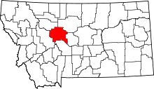 | |
| Towns | ||
| CDPs | ||
| Unincorporated community | ||