Grand Canyon Village, Arizona
| Grand Canyon Village, Arizona | |
|---|---|
| CDP | |
 Location in Coconino County and the state of Arizona | |
 Grand Canyon Village, Arizona Location in the United States | |
| Coordinates: 36°02′57″N 112°09′24″W / 36.04917°N 112.15667°WCoordinates: 36°02′57″N 112°09′24″W / 36.04917°N 112.15667°W | |
| State | Arizona |
| County | Coconino County |
| Area | |
| • Total | 34.7 km2 (13.4 sq mi) |
| • Land | 34.8 km2 (13.4 sq mi) |
| • Water | 0.0 km2 (0.0 sq mi) |
| Elevation[1] | 2,074 m (6,804 ft) |
| Population (2010) | |
| • Total | 2,004 |
| • Density | 58/km2 (150/sq mi) |
| Time zone | MST (UTC-7) |
| Area code(s) | 928 |
| FIPS code | 04-2408314 |
| GNIS feature ID | 28981 |
Grand Canyon Village is a census-designated place (CDP) located on the South Rim of the Grand Canyon, in Coconino County, Arizona, in the United States. Its population was 2,004 at the 2010 Census.[2] Located in Grand Canyon National Park, it is wholly focused on accommodating tourists visiting the canyon. Its origins trace back to the railroad completed from Williams, Arizona, to the canyon's South Rim by the Santa Fe Railroad in 1901. Many of the structures in use today date from that period. The village contains numerous landmark buildings, and its historic core is a National Historic Landmark District, designated for its outstanding implementation of town design.
Geography
Grand Canyon Village is located at 36°02′57″N 112°09′24″W / 36.04917°N 112.15667°W (36.049228, -112.156629).[1] According to the United States Census Bureau, the CDP has a total area of 13.4 square miles (35 km2), all of it land.[3]
Demographics
As of the census[4] of 2000, there were 1,460 people, 651 households, and 345 families residing in the CDP. The population density was 108.6 people per square mile (41.9/km²). There were 791 housing units at an average density of 58.8 per square mile (22.7/km²). The racial makeup of the CDP was 73.70% White, 1.58% Black or African American, 18.84% Native American, 0.89% Asian, 0.27% Pacific Islander, 1.85% from other races, and 2.88% from two or more races. 10.21% of the population were Hispanic or Latino of any race.
There were 651 households out of which 24.9% had children under the age of 18 living with them, 42.1% were married couples living together, 6.0% had a female householder with no husband present, and 46.9% were non-families. 31.6% of all households were made up of individuals and 0.9% had someone living alone who was 65 years of age or older. The average household size was 2.18 and the average family size was 2.84.
In the CDP the population was spread out with 20.5% under the age of 18, 8.4% from 18 to 24, 41.2% from 25 to 44, 27.7% from 45 to 64, and 2.2% who were 65 years of age or older. The median age was 37 years. For every 100 females there were 114.7 males. For every 100 females age 18 and over, there were 110.1 males.
The median income for a household in the CDP was $42,083, and the median income for a family was $53,676. Males had a median income of $28,750 versus $23,565 for females. The per capita income for the CDP was $19,923. About 1.7% of families and 4.8% of the population were below the poverty line, including 4.9% of those under age 18 and none of those age 65 or over.
Education
The area is served by the Grand Canyon Unified School District.
Transportation
The Grand Canyon Railway connects the Grand Canyon Depot in Grand Canyon Village with the Williams Depot in Williams, Arizona. Connections are offered to Amtrak's Williams Junction station.
The National Park Service operates free shuttle buses on the South Rim.[5]
References
- 1 2 "Feature Detail Report for: Grand Canyon Village Census Designated Place". Geographic Names Information System. United States Geological Survey.
- ↑ "Profile of General Population and Housing Characteristics: 2010 Demographic Profile Data (DP-1): Grand Canyon Village CDP, Arizona". U.S. Census Bureau, American Factfinder. Retrieved December 8, 2011.
- ↑ "Grand Canyon Village CDP, Arizona - Basic Facts". AZ Hometown Locator. Retrieved November 22, 2016.
- ↑ "American FactFinder". United States Census Bureau. Retrieved 2008-01-31.
- ↑ http://www.nps.gov/grca/planyourvisit/shuttle-buses.htm South Rim Shuttle Bus Routes]
External links
Municipalities and communities of Coconino County, Arizona, United States | ||
|---|---|---|
| Cities | 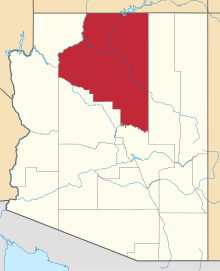 | |
| Towns | ||
| CDPs | ||
| Unincorporated communities |
| |
| Indian reservations | ||
| Ghost town | ||
| Footnotes | ‡This populated place also has portions in an adjacent county or counties | |