Grade I listed buildings in the City of London

There are over 9,000 Grade I listed buildings in England. This page is a list of these buildings in the City of London.
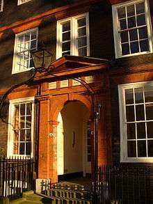
Buildings

Name Location Type Completed [note 1]Date designated Grid ref.[note 2]
Geo-coordinates
Entry number [note 3]Image
Apothecaries' Hall Farringdon Within Livery Hall 1670 4 January 1950 TQ3171981037
51°30′46″N 0°06′12″W / 51.512912°N 0.103214°W / 51.512912; -0.103214 (Apothecaries' Hall)
1359133
Bank of England Walbrook Bank Late 18th century to early 19th century 4 January 1950 TQ3273081211
51°30′51″N 0°05′19″W / 51.514239°N 0.088588°W / 51.514239; -0.088588 (Bank of England)
1079134
St Paul's Cathedral Castle Baynard Cathedral The previous building Medieval

The present building 1711[1]

4 January 1950 TQ3204281141
51°30′50″N 0°05′55″W / 51.513771°N 0.098523°W / 51.513771; -0.098523 (St Paul's Cathedral)
1079157
Christ Church Greyfriars Farringdon Within Church 1677–91 4 January 1950 TQ3198181372
51°30′57″N 0°05′58″W / 51.515861°N 0.099315°W / 51.515861; -0.099315 (Christ Church Greyfriars)
1359217
Church of All Hallows-on-the-Wall Broad Street Church 1765-7 4 January 1950 TQ3302281485
51°31′00″N 0°05′03″W / 51.516633°N 0.084279°W / 51.516633; -0.084279 (Church of All Hallows-on-the-Wall)
1064632
Church of All Hallows by the Tower Tower Church 15th century 4 January 1950 TQ3338580687
51°30′34″N 0°04′46″W / 51.509376°N 0.079352°W / 51.509376; -0.079352 (Church of All Hallows by the Tower)
1064671
Church of St Andrew Farringdon Without Church 15th century 4 January 1950 TQ3147081518
51°31′02″N 0°06′24″W / 51.517293°N 0.106621°W / 51.517293; -0.106621 (Church of St Andrew)
1064643
Church of St Andrew by the Wardrobe Castle Baynard Church 1685–95 4 January 1950 TQ3185580980
51°30′45″N 0°06′05″W / 51.512368°N 0.101277°W / 51.512368; -0.101277 (Church of St Andrew by the Wardrobe)
1079148
Church of St Andrew Undershaft Aldgate Church 15th century 4 January 1950 TQ3325281173
51°30′50″N 0°04′52″W / 51.513775°N 0.081084°W / 51.513775; -0.081084 (Church of St Andrew Undershaft)
1079155
Church of St Anne and St Agnes Aldersgate Church Medieval 4 January 1950 TQ3218781449
51°30′59″N 0°05′47″W / 51.516505°N 0.09632°W / 51.516505; -0.09632 (Church of St Anne and St Agnes)
1286384
Church of St Bartholomew the Great Farringdon Within Church 12th century 4 January 1950 TQ3195681711
51°31′08″N 0°05′58″W / 51.518914°N 0.099549°W / 51.518914; -0.099549 (Church of St Bartholomew the Great)
1180873
Church of St Benet, Paul's Wharf Queenhithe Church 1677–85 4 January 1950 TQ3200080907
51°30′42″N 0°05′57″W / 51.511678°N 0.099216°W / 51.511678; -0.099216 (Church of St Benet, Paul's Wharf)
1180700
Church of St Botolph Aldersgate Church Medieval 4 January 1950 TQ3212381501
51°31′01″N 0°05′50″W / 51.516988°N 0.097222°W / 51.516988; -0.097222 (Church of St Botolph)
1064732
Church of St Botolph Portsoken Church 1741-4 4 January 1950 TQ3357581215
51°30′51″N 0°04′35″W / 51.514076°N 0.076416°W / 51.514076; -0.076416 (Church of St Botolph)
1359143
Church of St Bride City and County of the City of London Church 1670–1684 4 January 1950 TQ3155681128
51°30′50″N 0°06′20″W / 51.513768°N 0.105528°W / 51.513768; -0.105528 (Church of St Bride)
1064657
Church of St Clement City and County of the City of London Church 1683-7 4 January 1950 TQ3286480895
51°30′41″N 0°05′12″W / 51.511368°N 0.086777°W / 51.511368; -0.086777 (Church of St Clement)
1064699
Church of St Dunstan in the East City and County of the City of London Gate 1698 4 January 1950 TQ3314980718
51°30′35″N 0°04′58″W / 51.509711°N 0.082739°W / 51.509711; -0.082739 (Church of St Dunstan in the East)
1359173
Church of St Dunstan-in-the-West (including attached Sunday School) City and County of the City of London Statue 1586 4 January 1950 TQ3122981172
51°30′51″N 0°06′37″W / 51.514239°N 0.110221°W / 51.514239; -0.110221 (Church of St Dunstan-in-the-West (including attached Sunday School))
1064663
Church of St Edmund City and County of the City of London Church 1670-9 4 January 1950 TQ3289581020
51°30′45″N 0°05′11″W / 51.512484°N 0.086284°W / 51.512484; -0.086284 (Church of St Edmund)
1064631
Church of St Giles City and County of the City of London Church Mid 16th century 4 January 1950 TQ3235181699
51°31′07″N 0°05′38″W / 51.518714°N 0.093864°W / 51.518714; -0.093864 (Church of St Giles)
1359183
Church of St Helen City and County of the City of London Church 13th century 4 January 1950 TQ3320481285
51°30′53″N 0°04′54″W / 51.514793°N 0.081733°W / 51.514793; -0.081733 (Church of St Helen)
1286458
Church of St James Garlickhithe City and County of the City of London Church 1674–87 4 January 1950 TQ3238480854
51°30′40″N 0°05′37″W / 51.511112°N 0.093705°W / 51.511112; -0.093705 (Church of St James Garlickhithe)
1064669
Church of St Katherine Cree City and County of the City of London Church Late 18th – Early 19th century 4 January 1950 TQ3339781140
51°30′48″N 0°04′44″W / 51.513444°N 0.079008°W / 51.513444; -0.079008 (Church of St Katherine Cree)
1064627
Church of St Lawrence Jewry City and County of the City of London Church 1670–86 4 January 1950 TQ3245881325
51°30′55″N 0°05′33″W / 51.515328°N 0.092463°W / 51.515328; -0.092463 (Church of St Lawrence Jewry)
1064673
Church of St Magnus the Martyr City and County of the City of London Church 1671–87 4 January 1950 TQ3291080671
51°30′34″N 0°05′10″W / 51.509344°N 0.086199°W / 51.509344; -0.086199 (Church of St Magnus the Martyr)
1064601
Church of St Margaret City and County of the City of London Church 1686–95 4 January 1950 TQ3271281280
51°30′54″N 0°05′20″W / 51.514864°N 0.088821°W / 51.514864; -0.088821 (Church of St Margaret)
1064634
Church of St Margaret Pattens City and County of the City of London Church 1684-9 4 January 1950 TQ3313080840
51°30′39″N 0°04′59″W / 51.510811°N 0.082967°W / 51.510811; -0.082967 (Church of St Margaret Pattens)
1286593
Church of St Martin City and County of the City of London Church 1677–87 4 January 1950 TQ3180281172
51°30′51″N 0°06′07″W / 51.514106°N 0.101968°W / 51.514106; -0.101968 (Church of St Martin)
1359194
Church of St Mary City and County of the City of London Church 1681–87 4 January 1950 TQ3275580927
51°30′42″N 0°05′18″W / 51.511681°N 0.088335°W / 51.511681; -0.088335 (Church of St Mary)
1359119
Church of St Mary-at-Hill City and County of the City of London Church 1670-6 4 January 1950 TQ3308080760
51°30′36″N 0°05′01″W / 51.510104°N 0.083717°W / 51.510104; -0.083717 (Church of St Mary-at-Hill)
1064600
Church of St Mary Aldermary City and County of the City of London Church Early 16th century 4 January 1950 TQ3240981035
51°30′46″N 0°05′36″W / 51.512733°N 0.093277°W / 51.512733; -0.093277 (Church of St Mary Aldermary)
1079145
Church of St Mary Le Bow City and County of the City of London Church 1670–1683 4 January 1950 TQ3238681143
51°30′49″N 0°05′37″W / 51.513709°N 0.093568°W / 51.513709; -0.093568 (Church of St Mary Le Bow)
1064696
Church of St Mary Woolnoth City and County of the City of London Church 1716–27 4 January 1950 TQ3277181047
51°30′46″N 0°05′17″W / 51.512756°N 0.088059°W / 51.512756; -0.088059 (Church of St Mary Woolnoth)
1064620
Church of St Michael City and County of the City of London Church 1670-7 4 January 1950 TQ3295181101
51°30′48″N 0°05′08″W / 51.513199°N 0.085447°W / 51.513199; -0.085447 (Church of St Michael)
1286688
Church of St Michael Paternoster Royal City and County of the City of London Church 1686–94 4 January 1950 TQ3249380866
51°30′40″N 0°05′32″W / 51.511195°N 0.092131°W / 51.511195; -0.092131 (Church of St Michael Paternoster Royal)
1286707
Church of St Nicholas Cole Abbey Bread Street Church 1671–81 4 January 1950 TQ3216180959
51°30′44″N 0°05′49″W / 51.512108°N 0.096878°W / 51.512108; -0.096878 (Church of St Nicholas Cole Abbey)
1079146
Church of St Olave Tower Church Late 13th century 4 January 1950 TQ3337280859
51°30′39″N 0°04′46″W / 51.510925°N 0.079475°W / 51.510925; -0.079475 (Church of St Olave)
1064676
Church of St Peter Cornhill Church Medieval 4 January 1950 TQ3301081108
51°30′48″N 0°05′05″W / 51.513248°N 0.084594°W / 51.513248; -0.084594 (Church of St Peter)
1192245
Church of St Sepulchre Farringdon Without Church Mid 15th century 4 January 1950 TQ3177581459
51°31′00″N 0°06′08″W / 51.516691°N 0.10225°W / 51.516691; -0.10225 (Church of St Sepulchre)
1064640
Church of St Stephen Walbrook Church 1672–87 4 January 1950 TQ3264681030
51°30′45″N 0°05′24″W / 51.512632°N 0.089866°W / 51.512632; -0.089866 (Church of St Stephen)
1285320
Church of St Vedast City and County of the City of London Church 1670-3 4 January 1950 TQ3220281272
51°30′54″N 0°05′46″W / 51.514911°N 0.09617°W / 51.514911; -0.09617 (Church of St Vedast)
1064666
College of Arms City and County of the City of London House and gate 1956 4 January 1950 TQ3203380971
51°30′44″N 0°05′55″W / 51.512246°N 0.098717°W / 51.512246; -0.098717 (College of Arms)
1079147
Custom House City and County of the City of London Custom House 1813–17 5 June 1972 TQ3317280611
51°30′31″N 0°04′57″W / 51.508744°N 0.082449°W / 51.508744; -0.082449 (Custom House)
1359193
Dr. Johnson's House City and County of the City of London House Late 17th century 4 January 1950 TQ3136781267
51°30′54″N 0°06′30″W / 51.515061°N 0.108198°W / 51.515061; -0.108198 (Dr. Johnson's House)
1192738
Gateway from Devereux Court Middle Temple, City and County of the City of London Gate Late 17th century 4 January 1950 TQ3108481009
51°30′46″N 0°06′45″W / 51.512808°N 0.11237°W / 51.512808; -0.11237 (Gateway from Devereux Court)
1193846
Goldsmiths' Hall City and County of the City of London Livery Hall 1829–35 4 January 1950 TQ3221981357
51°30′56″N 0°05′45″W / 51.515671°N 0.095893°W / 51.515671; -0.095893 (Goldsmiths' Hall)
1286469
Guild Church of St Ethelburga the Virgin City and County of the City of London Fountain 1923 4 January 1950 TQ3318581361
51°30′56″N 0°04′55″W / 51.51548°N 0.081978°W / 51.51548; -0.081978 (Guild Church of St Ethelburga the Virgin)
1191603
Guildhall City and County of the City of London Guildhall Early 15th century 4 January 1950 TQ3248581384
51°30′57″N 0°05′31″W / 51.515851°N 0.092052°W / 51.515851; -0.092052 (Guildhall)
1064675
Lloyd's Building City and County of the City of London Commercial Office 1978–86 19 December 2011 TQ3315981082
51°30′47″N 0°04′57″W / 51.512979°N 0.082458°W / 51.512979; -0.082458 (Lloyd's Building)
1405493
Main North Block, East Block, West Block, St Bartholomew's Hospital City and County of the City of London Courtyard 1750-9 4 January 1950 TQ3189281574
51°31′04″N 0°06′02″W / 51.517697°N 0.100522°W / 51.517697; -0.100522 (Main North Block, East Block, West Block, St Bartholomew's Hospital)
1079116
Mansion House City and County of the City of London Courtyard 1739–53 4 January 1950 TQ3266981070
51°30′47″N 0°05′22″W / 51.512987°N 0.08952°W / 51.512987; -0.08952 (Mansion House)
1064604
Middle Temple Gatehouse Middle Temple, City and County of the City of London Inns of Court 1684 4 January 1950 TQ3114081104
51°30′49″N 0°06′42″W / 51.513649°N 0.111528°W / 51.513649; -0.111528 (Middle Temple Gatehouse)
1064612
Middle Temple Hall Middle Temple, City and County of the City of London Inns of Court 1562–73 4 January 1950 TQ3114880961
51°30′45″N 0°06′41″W / 51.512362°N 0.111466°W / 51.512362; -0.111466 (Middle Temple Hall)
1064609
Midland Bank City and County of the City of London Commercial Office 1924 5 June 1972 TQ3262281144
51°30′49″N 0°05′25″W / 51.513663°N 0.090169°W / 51.513663; -0.090169 (Midland Bank)
1064598
Number 4 5 and 6 and Attached Pump City and County of the City of London Inns of Chancery c.1586 24 October 1951 TQ3115781585
51°31′05″N 0°06′40″W / 51.517967°N 0.111105°W / 51.517967; -0.111105 (Number 4 5 and 6 and Attached Pump)
1246100
Railings to Churchyard of Cathedral Church of St Paul City and County of the City of London Gate 1714 5 June 1972 TQ3197881099
51°30′48″N 0°05′58″W / 51.513409°N 0.099461°W / 51.513409; -0.099461 (Railings to Churchyard of Cathedral Church of St Paul)
1194622
Royal Exchange City and County of the City of London Exchange 1841-4 4 January 1950 TQ3282581144
51°30′49″N 0°05′14″W / 51.513615°N 0.087245°W / 51.513615; -0.087245 (Royal Exchange)
1064713
Screen Wall and Gateways to Forecourt of St Paul's Deanery City and County of the City of London Gate 5 June 1972 TQ3192181080
51°30′48″N 0°06′01″W / 51.513251°N 0.100289°W / 51.513251; -0.100289 (Screen Wall and Gateways to Forecourt of St Paul's Deanery)
1359191
Skinners' Hall City and County of the City of London Livery Hall Late 17th century 4 January 1950 TQ3255880861
51°30′40″N 0°05′28″W / 51.511134°N 0.091197°W / 51.511134; -0.091197 (Skinners' Hall)
1064686
St Paul's Deanery City and County of the City of London Deanery 1670 4 January 1950 TQ3190081082
51°30′48″N 0°06′02″W / 51.513274°N 0.100591°W / 51.513274; -0.100591 (St Paul's Deanery)
1064683
Stationers' Hall City and County of the City of London Livery Hall c.1670 4 January 1950 TQ3183181201
51°30′52″N 0°06′06″W / 51.51436°N 0.10154°W / 51.51436; -0.10154 (Stationers' Hall)
1064742
Bevis Marks Synagogue City and County of the City of London Synagogue 1701 4 January 1950 TQ3339581257
51°30′52″N 0°04′44″W / 51.514496°N 0.078993°W / 51.514496; -0.078993 (Bevis Marks Synagogue)
1064745
Temple Bar Gate City and County of the City of London Gate 1806 15 June 2010 TQ3196981195
51°30′51″N 0°05′58″W / 51.514274°N 0.099554°W / 51.514274; -0.099554 (Temple Bar Gate)
1393844
Temple Church (St Mary's) Inner Temple, City and County of the City of London Church 1185 4 January 1950 TQ3123581062
51°30′48″N 0°06′37″W / 51.513249°N 0.110176°W / 51.513249; -0.110176 (Temple Church (St Mary's))
1064646
The Gatehouse, St Bartholomew's Hospital City and County of the City of London Gate 1702 4 January 1950 TQ3186381599
51°31′05″N 0°06′03″W / 51.517929°N 0.10093°W / 51.517929; -0.10093 (The Gatehouse, St Bartholomew's Hospital)
1079115
The Monument City and County of the City of London Column 1671-7 4 January 1950 TQ3292380760
51°30′37″N 0°05′10″W / 51.510141°N 0.085978°W / 51.510141; -0.085978 (The Monument)
1193901
Tower and Remains of Church of All Hallows Staining City and County of the City of London Tower 12th century OR 13th century 4 January 1950 TQ3330180934
51°30′42″N 0°04′50″W / 51.511616°N 0.080469°W / 51.511616; -0.080469 (Tower and Remains of Church of All Hallows Staining)
1064605
Tower of Former Church of St Augustine City and County of the City of London Tower 1680-4 4 January 1950 TQ3215081110
51°30′48″N 0°05′49″W / 51.513468°N 0.096979°W / 51.513468; -0.096979 (Tower of Former Church of St Augustine)
1079121
Tower of Former Church of St Mary Somerset City and County of the City of London Tower 1686–94 4 January 1950 TQ3216380880
51°30′41″N 0°05′49″W / 51.511398°N 0.096878°W / 51.511398; -0.096878 (Tower of Former Church of St Mary Somerset)
1358904
Tower of Former Church of St Olave City and County of the City of London Church 1670-9 4 January 1950 TQ3253081228
51°30′52″N 0°05′29″W / 51.514439°N 0.091462°W / 51.514439; -0.091462 (Tower of Former Church of St Olave)
1359180
Trinity House City and County of the City of London House 1793-6 4 January 1950 TQ3352280803
51°30′37″N 0°04′38″W / 51.510386°N 0.077336°W / 51.510386; -0.077336 (Trinity House)
1079137
Vintners Hall City and County of the City of London Hall 1840 4 January 1950 TQ3239380809
51°30′39″N 0°05′37″W / 51.510706°N 0.093593°W / 51.510706; -0.093593 (Vintners Hall)
1180690
Westminster Bank City and County of the City of London Bank (financial) 1865 4 January 1950 TQ3307081267
51°30′53″N 0°05′01″W / 51.514663°N 0.08367°W / 51.514663; -0.08367 (Westminster Bank)
1191569
1 Kings Bench Walk Inner Temple, City and County of the City of London Inns of Court Late 17th century 4 January 1950 TQ3131581071
51°30′48″N 0°06′32″W / 51.513312°N 0.10902°W / 51.513312; -0.10902 (1 Kings Bench Walk)
1064647
7 Kings Bench Walk Inner Temple, City and County of the City of London Inns of Court Late 17th century 4 January 1950 TQ3135180976
51°30′45″N 0°06′31″W / 51.512449°N 0.108537°W / 51.512449; -0.108537 (7 Kings Bench Walk)
1064650
2 King's Bench Walk Inner Temple, City and County of the City of London Inns of Court Late 17th century 4 January 1950 TQ3131681056
51°30′47″N 0°06′32″W / 51.513177°N 0.109011°W / 51.513177; -0.109011 (2 King's Bench Walk)
1193156
4 King's Bench Walk Inner Temple, City and County of the City of London Inns of Court Late 17th century 4 January 1950 TQ3134681033
51°30′47″N 0°06′31″W / 51.512962°N 0.10858577°W / 51.512962; -0.10858577 (4 King's Bench Walk)
1193173
4–6 Pump Court Middle Temple, City and County of the City of London Inns of Court 1686 4 January 1950 TQ3116881031
51°30′47″N 0°06′40″W / 51.512986°N 0.111152°W / 51.512986; -0.111152 (4–6 Pump Court)
1193870
1 Essex Court Middle Temple, City and County of the City of London Inns of Court 1685 4 January 1950 TQ3112581000
51°30′46″N 0°06′42″W / 51.512718°N 0.111783°W / 51.512718; -0.111783 (1 Essex Court)
1286024
6 Kings Bench Walk Inner Temple, City and County of the City of London Inns of Court Late 17th century 4 January 1950 TQ3134880998
51°30′46″N 0°06′31″W / 51.512648°N 0.108572°W / 51.512648; -0.108572 (6 Kings Bench Walk)
1286279
1 Hare Court Middle Temple, City and County of the City of London Inns of Court Late 17th century 4 January 1950 TQ3119381038
51°30′47″N 0°06′39″W / 51.513043°N 0.110789°W / 51.513043; -0.110789 (1 Hare Court)
1359200
5 Kings Bench Walk Inner Temple, City and County of the City of London Inns of Court Late 17th century 4 January 1950 TQ3134781014
51°30′46″N 0°06′31″W / 51.512792°N 0.10858°W / 51.512792; -0.10858 (5 Kings Bench Walk)
1359177
2 & 3 Essex Court Middle Temple, City and County of the City of London Inns of Court 1677 4 January 1950 TQ3110481011
51°30′46″N 0°06′43″W / 51.512821°N 0.112081°W / 51.512821; -0.112081 (2 & 3 Essex Court)
1359199
3 Kings Bench Walk Inner Temple, City and County of the City of London Inns of Court Late 17th century 4 January 1950 TQ3134681045
51°30′47″N 0°06′31″W / 51.513071°N 0.108583°W / 51.513071; -0.108583 (3 Kings Bench Walk)
1064648
1–4 Holborn Bars City and County of the City of London House 18th century 14 May 1974 TQ3115881588
51°31′05″N 0°06′40″W / 51.517994°N 0.111089°W / 51.517994; -0.111089 (1–4 Holborn Bars)
1246103

See also

Notes

  1. The date given is the date used by Historic England as significant for the initial building or that of an important part in the structure's description.
  2. Sometimes known as OSGB36, the grid reference is based on the British national grid reference system used by the Ordnance Survey.
  3. The "List Entry Number" is a unique number assigned to each listed building and scheduled monument by Historic England.
  1. See Wikipedia St Paul's Cathedral.
This article is issued from Wikipedia - version of the 11/20/2016. The text is available under the Creative Commons Attribution/Share Alike but additional terms may apply for the media files.